Midès
OVERVIEW
Site: Ancient Midès
GPS: 34.406692, 7.920470
Location: Tozeur Governorate (southwest Tunisia)
Description: Ruins (pre-Roman era)
Star Wars recce:
Episode I – Tunisia (December 1995)
Source: Original recce photograph
Star Wars scouted set concept:
Mos Espa spaceport | various elements
Star Wars connection discovery:
Galaxy Tours (22 November 2020)
Challenges: Midès’ remote mountainous setting less than 1 km from the Algerian border seemingly presented too many logistical challenges, likely resulting in only minimal consideration to transform the hillside ruins into fictional Mos Espa.
Canyon: Tunisian tourism circles frequently identify the canyon below ancient Midès as “Star Wars Canyon,” inaccurately confusing this unique landscape with Maguer Gorge (Jebel Sidi Bouhlel). This misinformation is likely tethered to the popular claim that the Midès area served as inspiration for various Mos Espa podrace canyonland CGI elements.
Accessibility: Very easy; highland terrain; paved roads; parking area (34.407054, 7.920464) directly at the site; optional low-impact hike along the ridge beneath the sheer rock face south of the ruins.
LOCATION
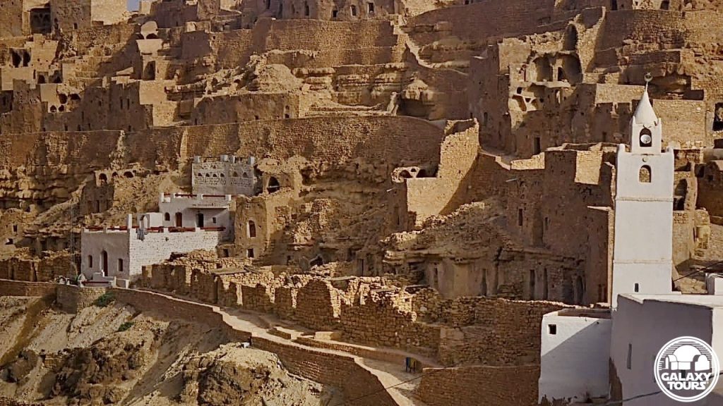
Modern Midès is a sparsely populated mountain oasis village located in the Tozeur Governorate less than 1 km from the Algerian border to the north and 3 km from Tamerza (alternately: Tamaghza), an important regional tourism center, across the Horchane wadi to the south. The modern village, easily accessible via R201 from the P16/C201 junction, was established in the aftermath of intense flooding in 1969 caused by 22 days of torrential rainfall throughout southern Tunisia. The catastrophic weather event, which reportedly killed more than 500 people, overflowed wadis in the region, forcing extensive property damage. Many settlements were left abandoned, to include ancient Midès. A concentration of plain-clothes police officers patrol the area to thwart any nefarious actors seeking to cross into Tunisia from Algeria.
SITE
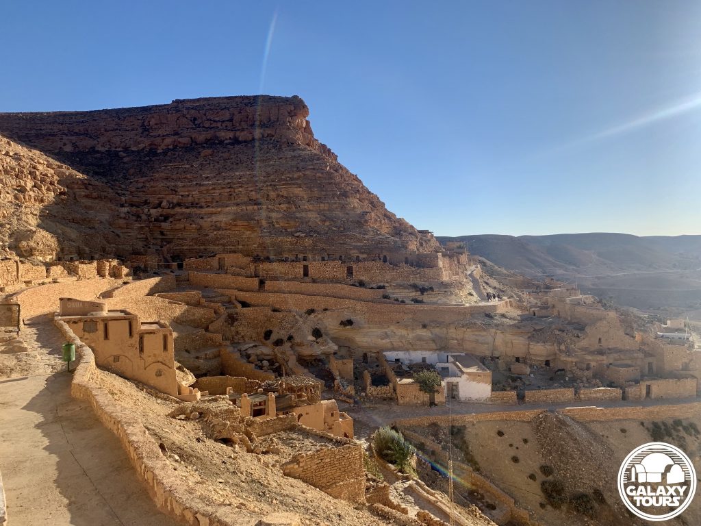
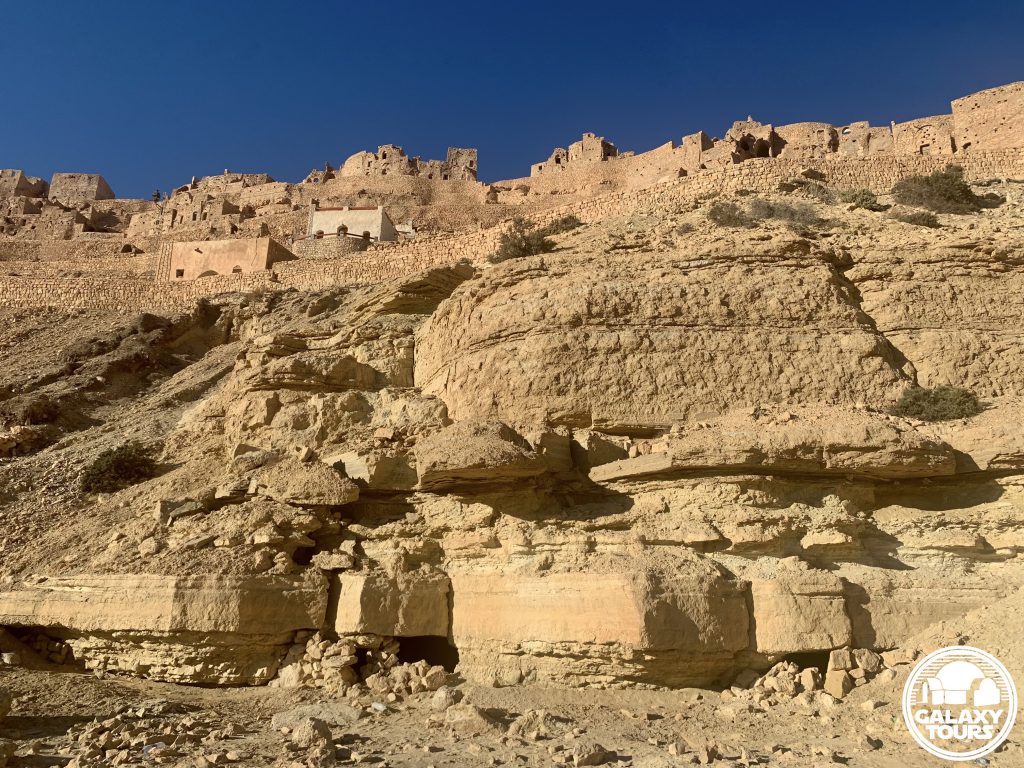
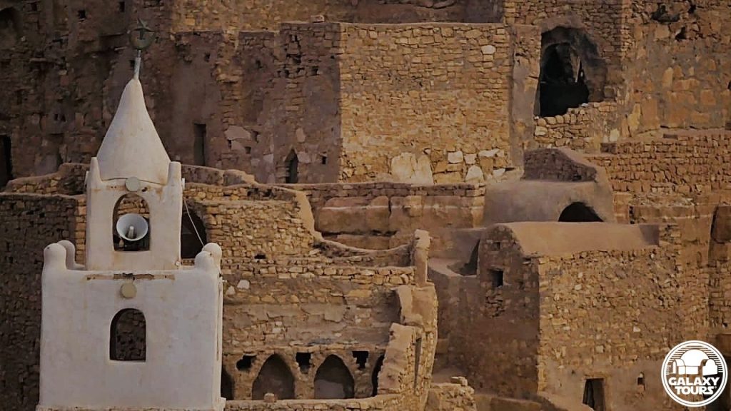
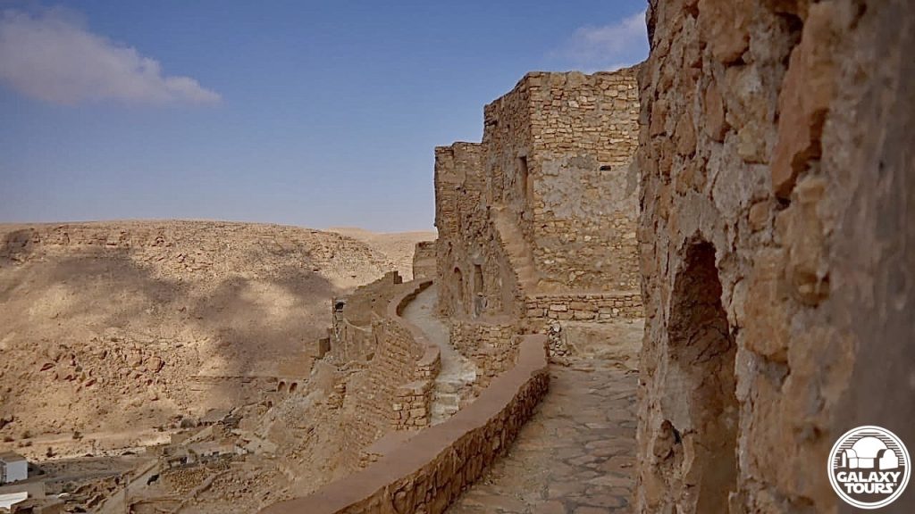
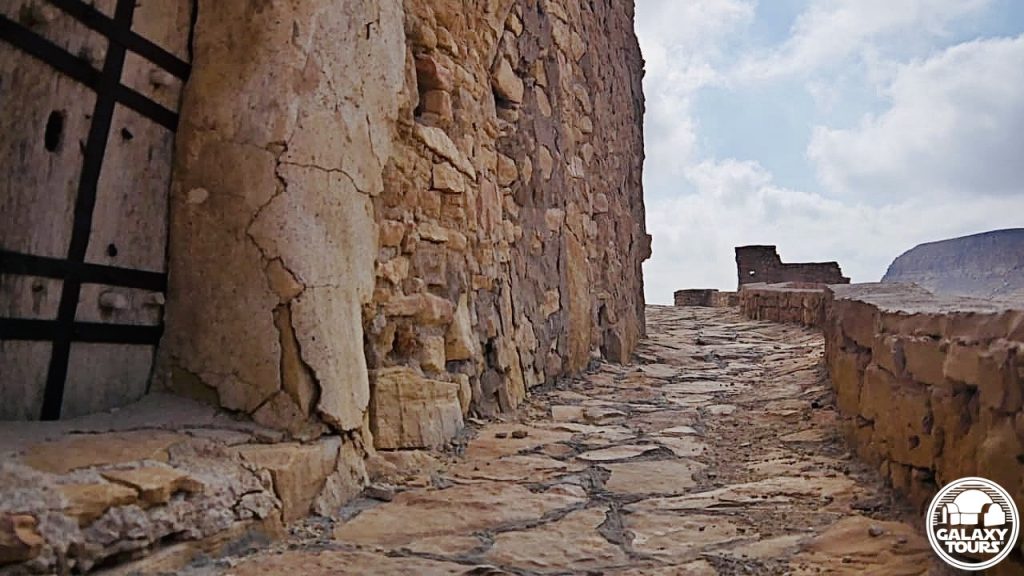
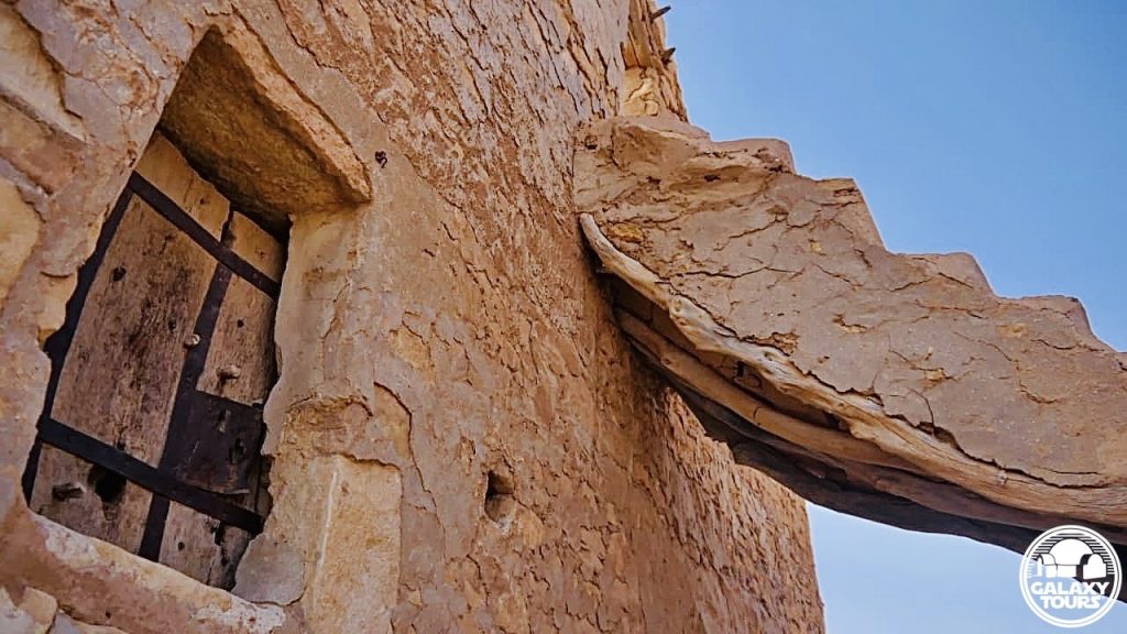
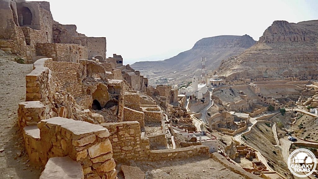
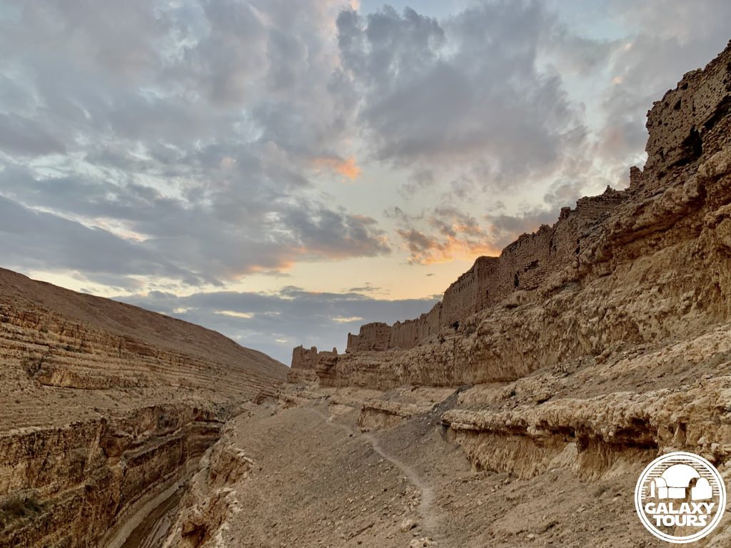
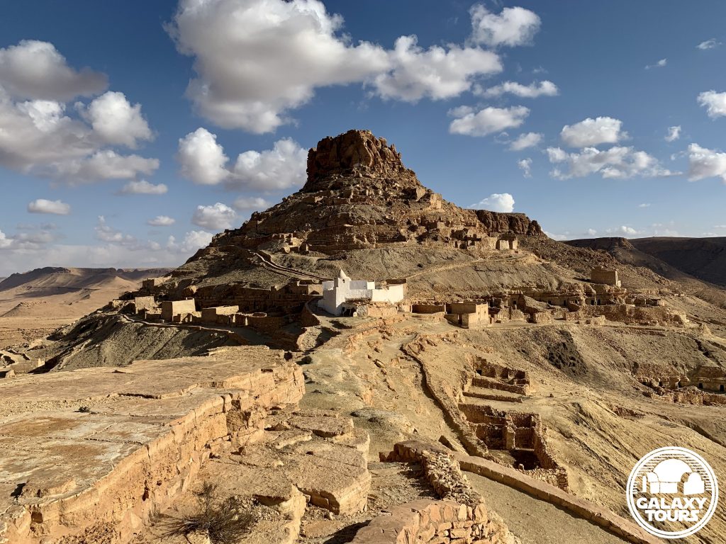
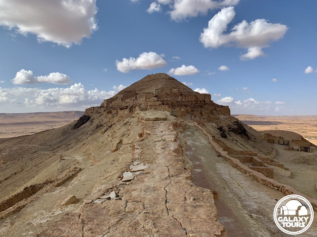
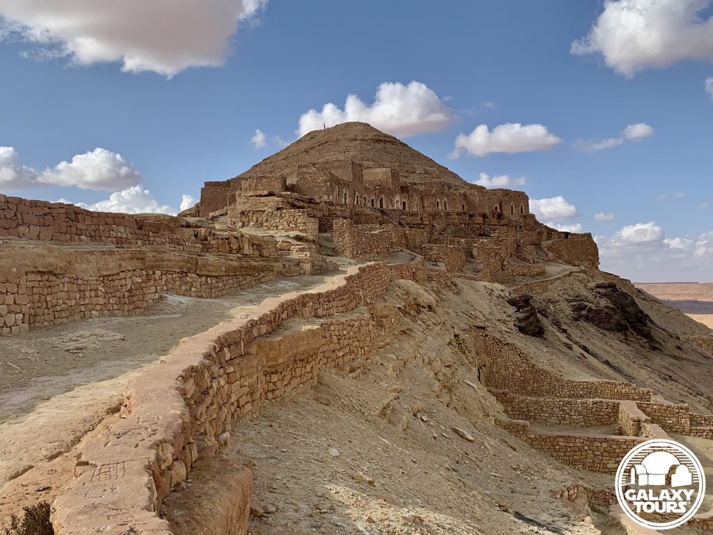
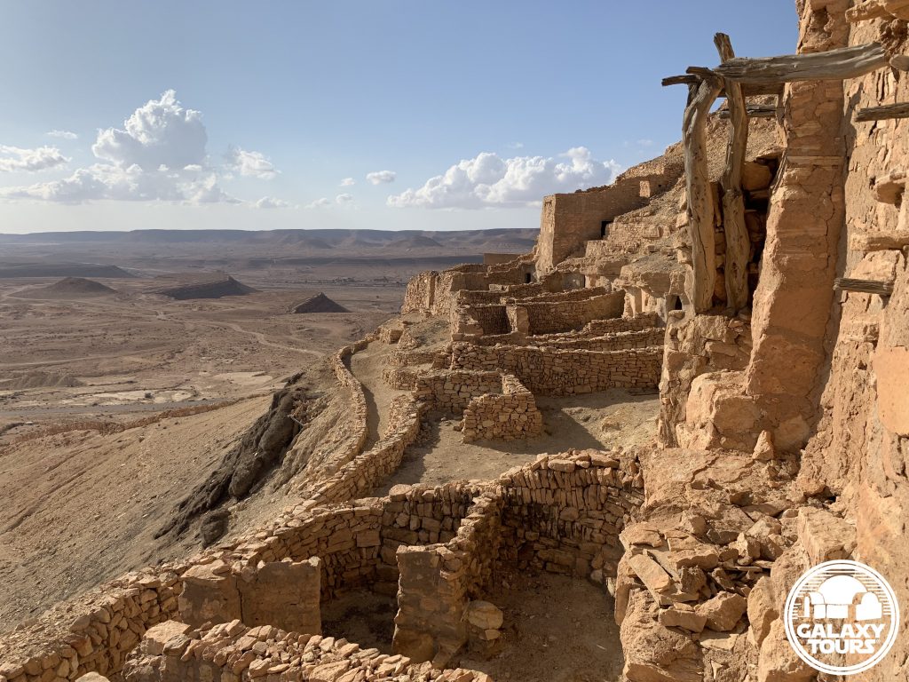
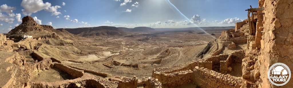
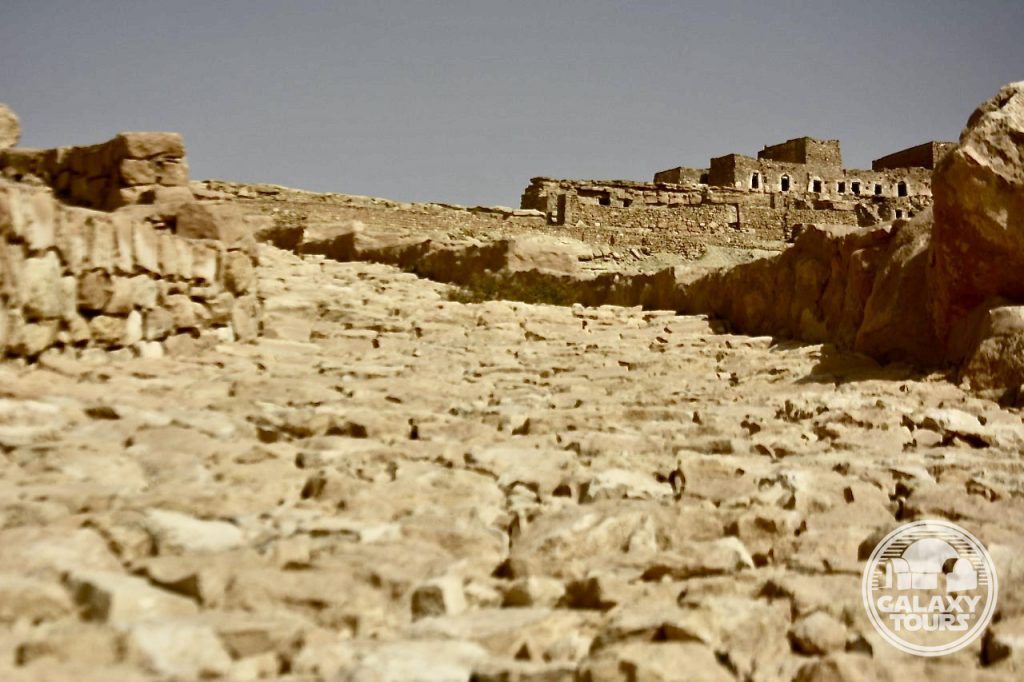
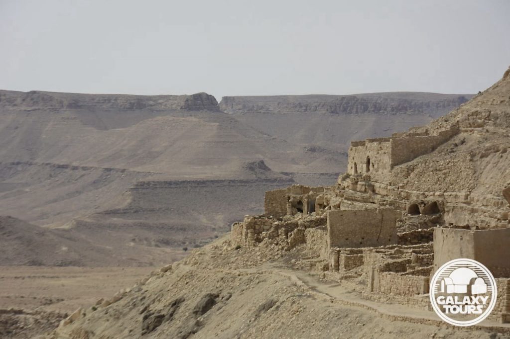
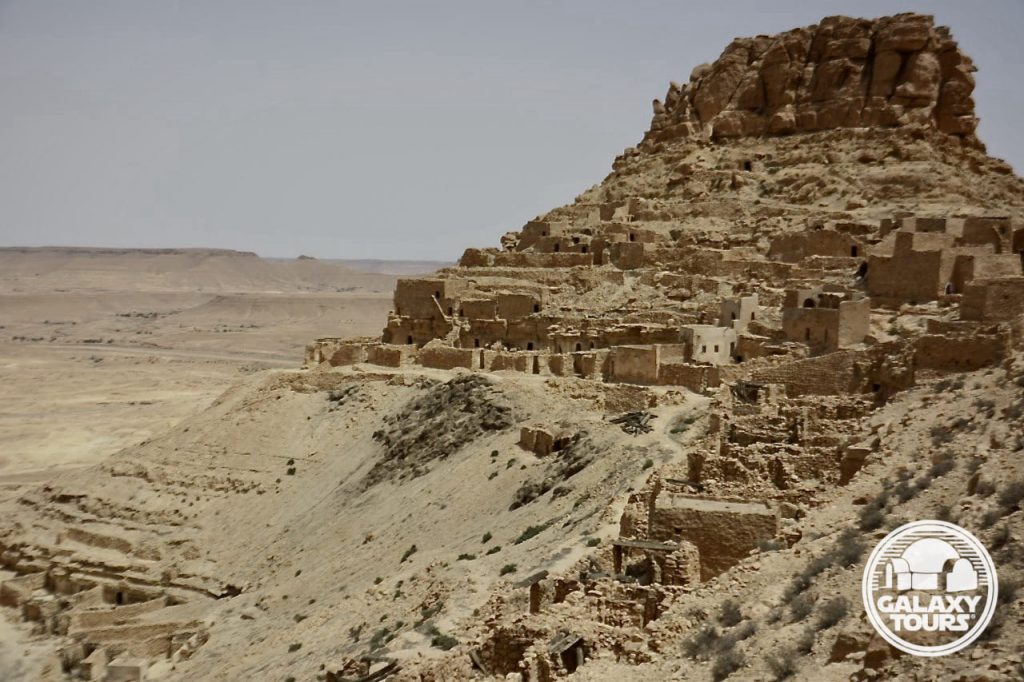
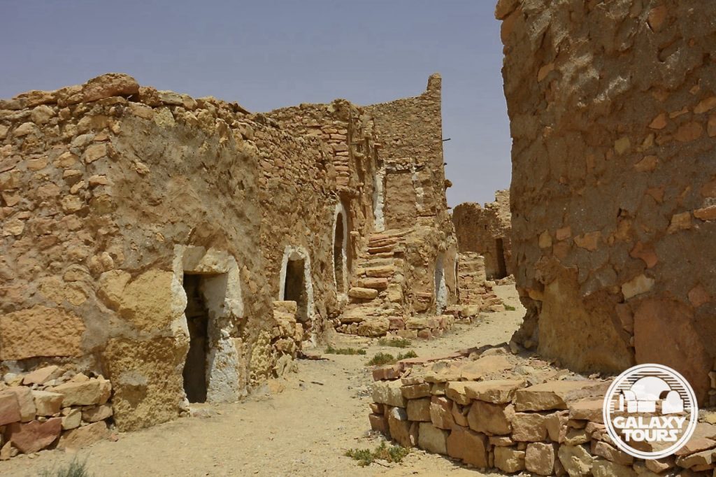
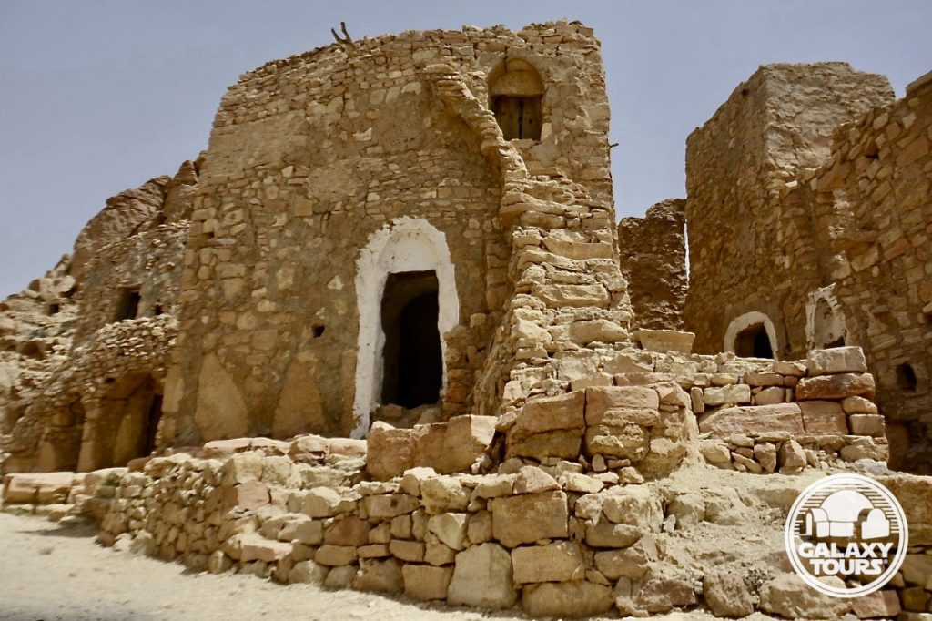
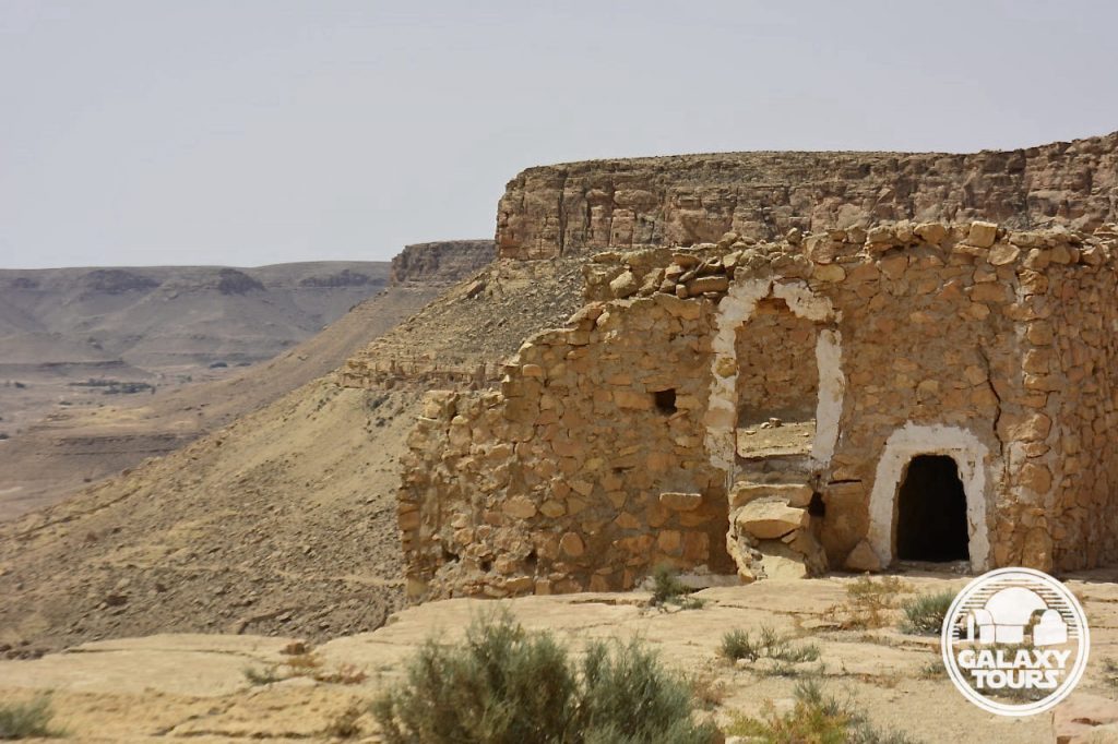
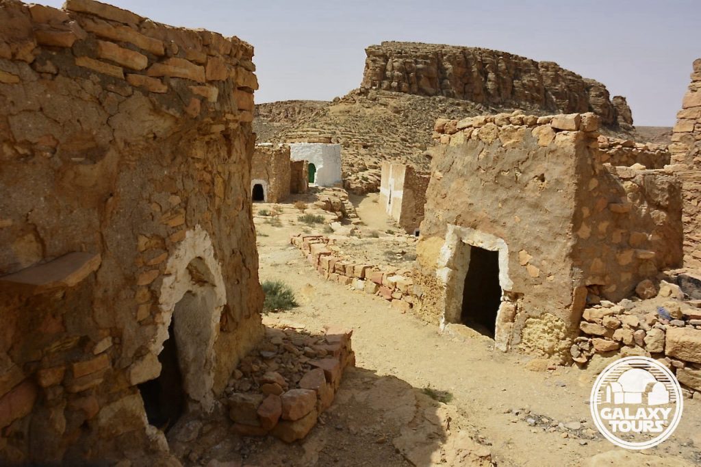
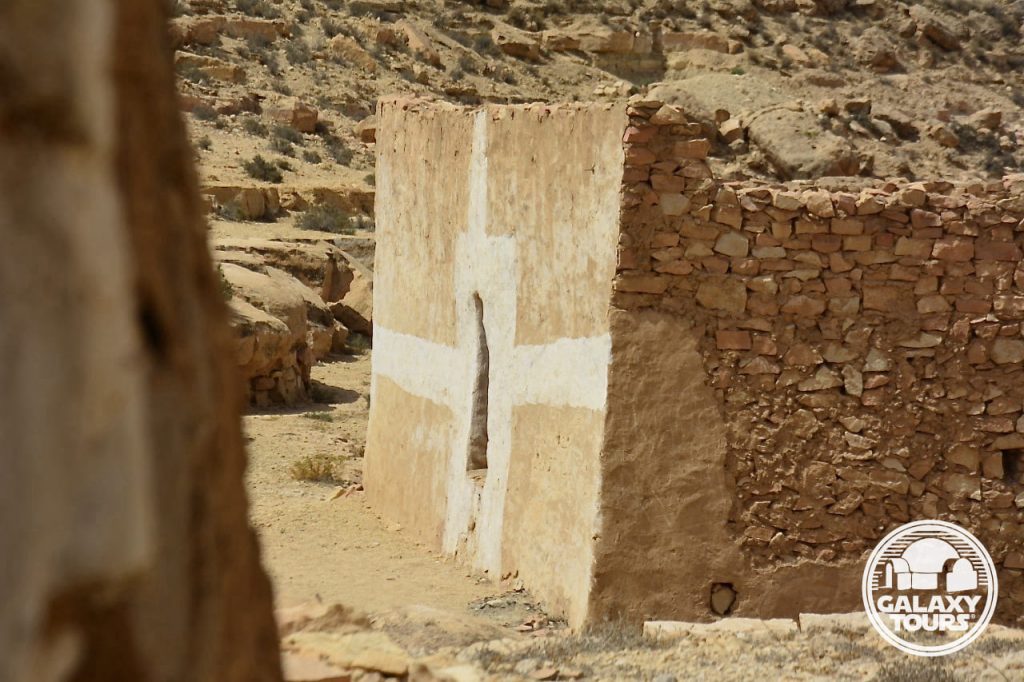
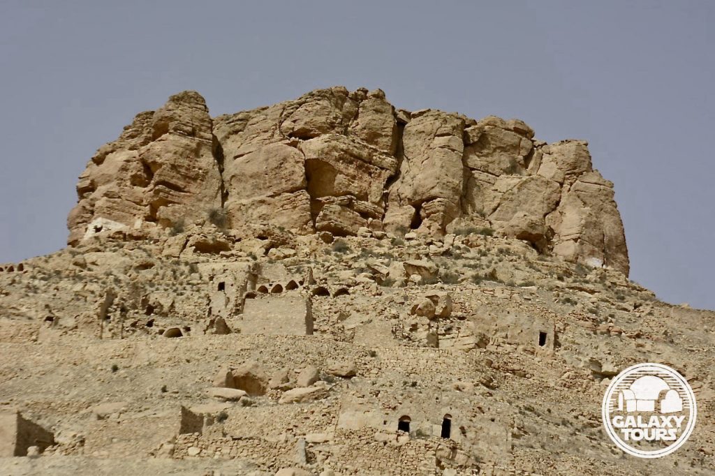
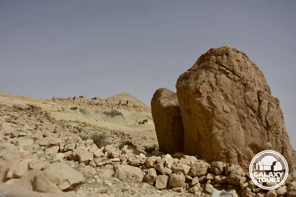
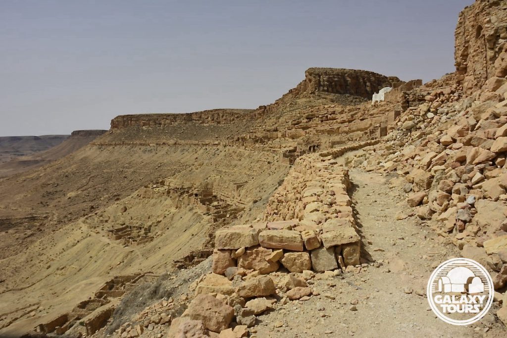
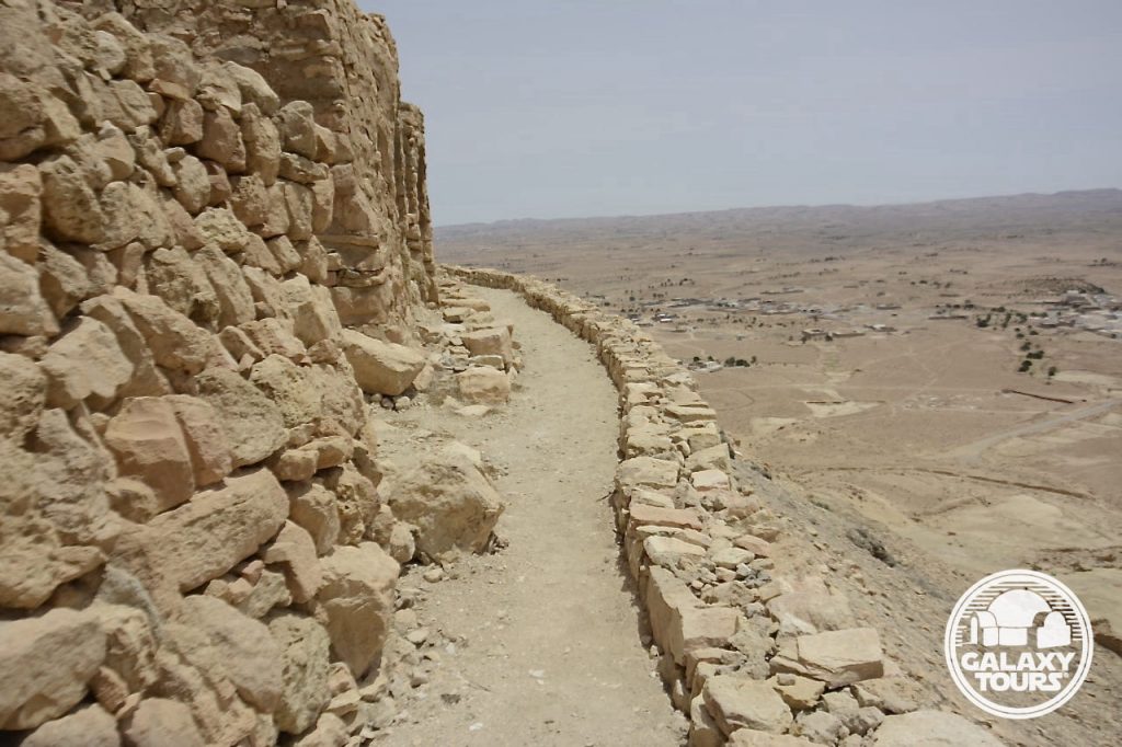
Ancient Midès (identified as Madés by the Romans)—strategically situated about 1 km southwest of the modern village between a dense date palm grove and a steep ravine drop-off (50-60 meters high)—functioned as an Amazigh stronghold in the mountains of the arid Djerid region. Remnants of narrow streets and mudbrick structures are on display among the ancient ruins. The most impressive feature at the site is the impassable cliffside south wall: a row of fortified structures clinging to the sheer rock face of the ravine for a span of some 300 meters. The narrow ravine below, populated with unique natural monuments, contrasting colors, and dynamic shapes sculpted out of rock by river torrents of former ages, stretches for 3 km around the village as a natural defensive barrier.
IDENTIFICATION
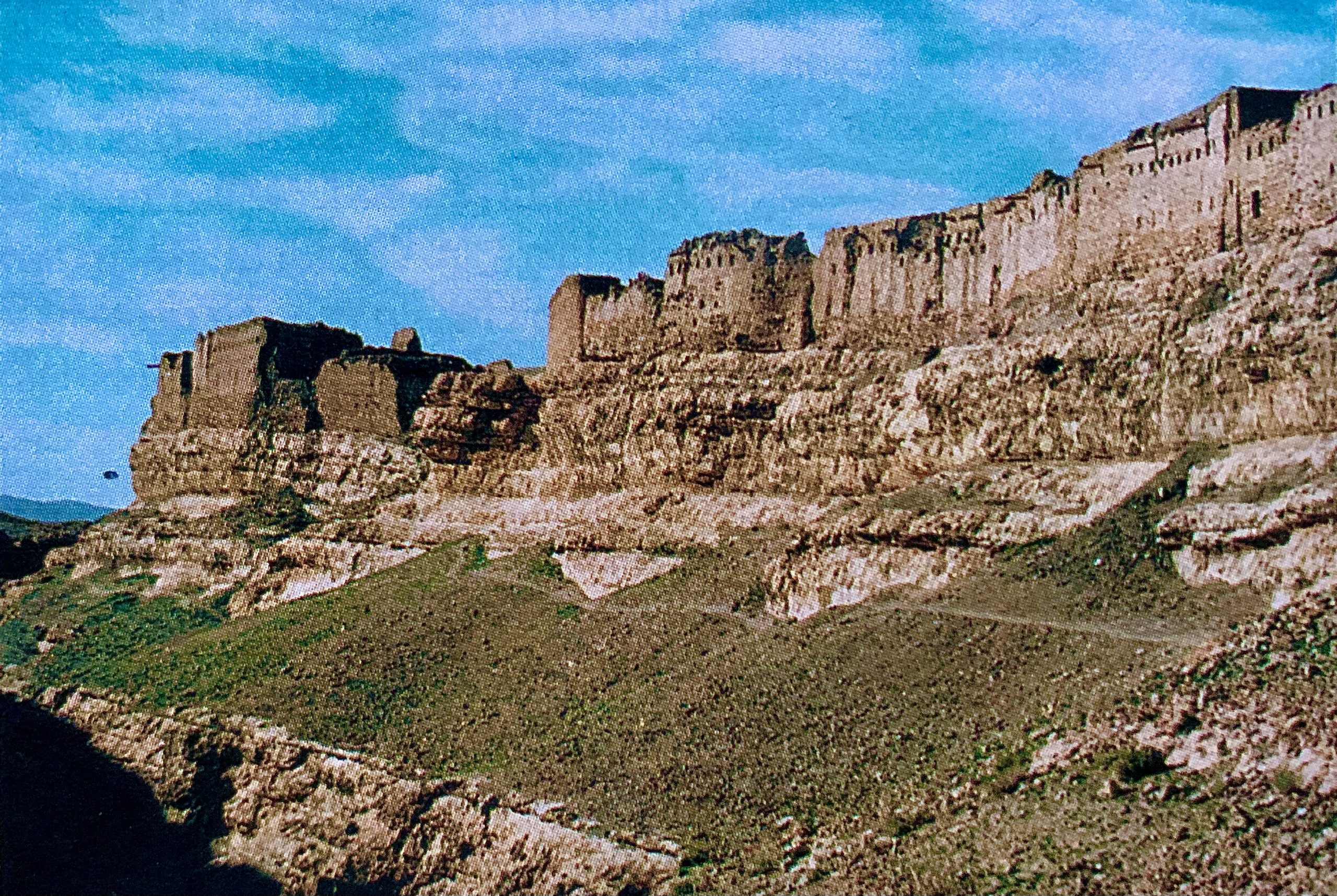
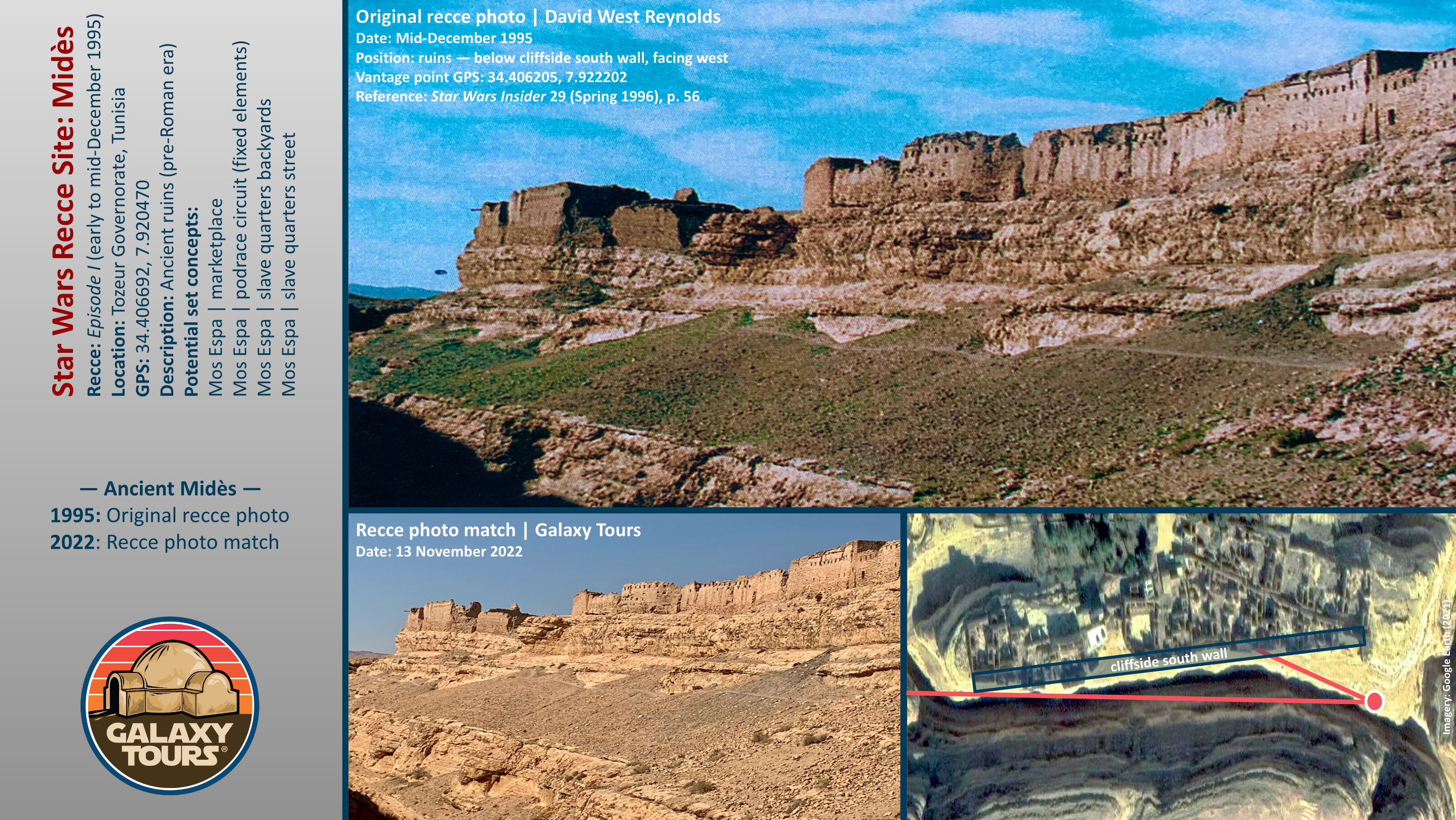
Jon Bradley Snyder (author/editor) reported on the principal Episode I recce to Tunisia (early to mid-December 1995) in Star Wars Insider 29 (Spring 1996). In his article (“On-Location: Tatooine”) Snyder published photos (taken by David West Reynolds) with generic captions for several of the Tunisian sites visited during the recce. No names or clear identifications were provided for any of the visually documented sites. Multi-faceted research confirms that one of the recce photos in the article (page 56; top row, right-hand side) displays a wide shot capturing the majority of the ancient Midès cliffside south wall. Reynolds took the recce photo from a vantage point approximately 45 meters southeast of the ruins along the edge of the sloping bank directly next to the ravine. The caption associated with the photo reads: “High above a chasm, this eerie abandoned city still keeps watch over the remote mountain passes near Algeria.” Snyder added that the team “surveyed many long-abandoned cities” in the “mountains near Algeria.”
Midès’ remote mountainous setting less than 1 km from the Algerian border seemingly presented too many logistical challenges, likely resulting in only minimal consideration to transform the hillside ruins into fictional Mos Espa. Tunisian tourism circles frequently identify the canyon below ancient Midès as “Star Wars Canyon,” inaccurately confusing this unique landscape with Maguer Gorge (Jebel Sidi Bouhlel). This misinformation is likely tethered to the popular claim that the Midès area served as inspiration for various Mos Espa podrace canyonland CGI elements. Despite no enduring effort to preserve the ruins, views of the cliffside south wall at the site remain more or less unchanged since the 1995 recce.


Ksar Ouled Soltane
OVERVIEW
Site: Ksar Ouled Soltane
GPS: 32.788346, 10.514549
Location: Ksar Ouled Soltane village, Tataouine Governorate (southeast Tunisia)
Description: Amazigh fortified granary (late 17th century CE)
Star Wars recce:
Episode I – Tunisia (December 1995)*
Source: Correspondence with Philip Vanni (Star Wars tourism pioneer)
Star Wars scouted set concept:
Mos Espa | slave quarters
Pending: Although final confirmation is still pending, layered first- and second-hand verbal evidence suggests that Ksar Ouled Soltane—one of the most popular Tunisian ksour—was probably scouted in December 1995 or possibly during a subsequent pre-production recce in 1996. Located deep in the Tataouine region far from all major roads, the extreme remote position of the site likely resulted in only minimal consideration for Episode I production.
Correction: Despite consistently circulated misinformation dating back to 1999, Ksar Ouled Soltane is not a Star Wars film site.
Accessibility: Very easy; foothills terrain; paved roads; parking area (32.788436, 10.515403) directly at the site entrance.
*Visual confirmation pending. No recce photographs or sketches from Ksar Ouled Soltane are known to exist.
SITE
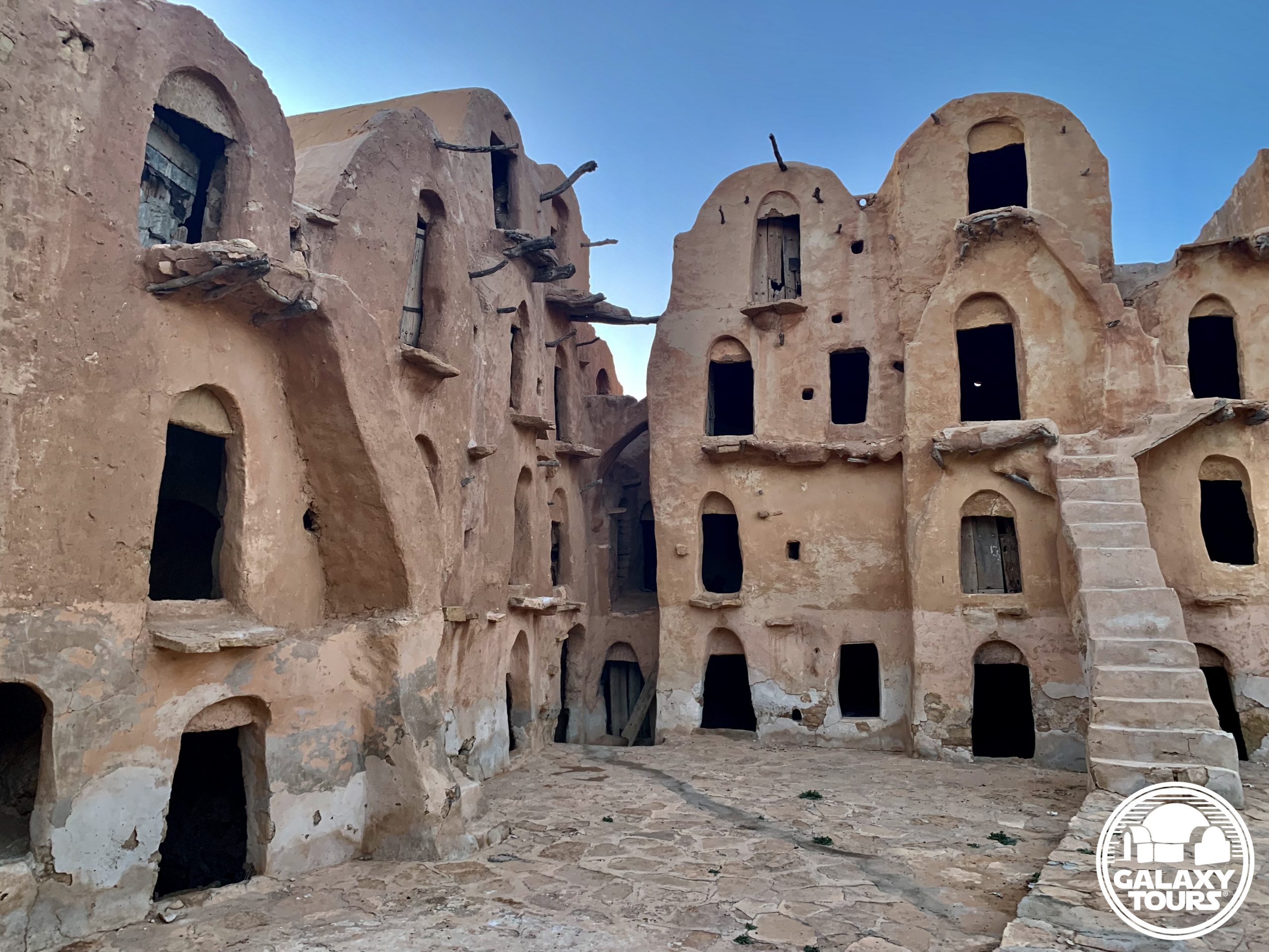
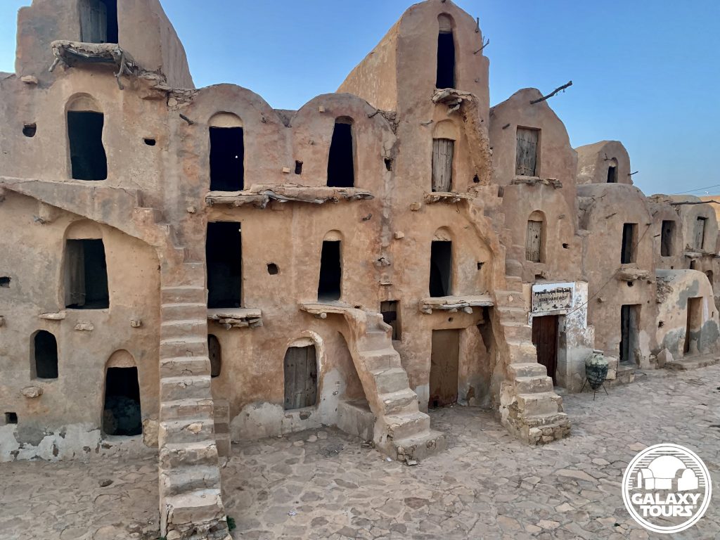
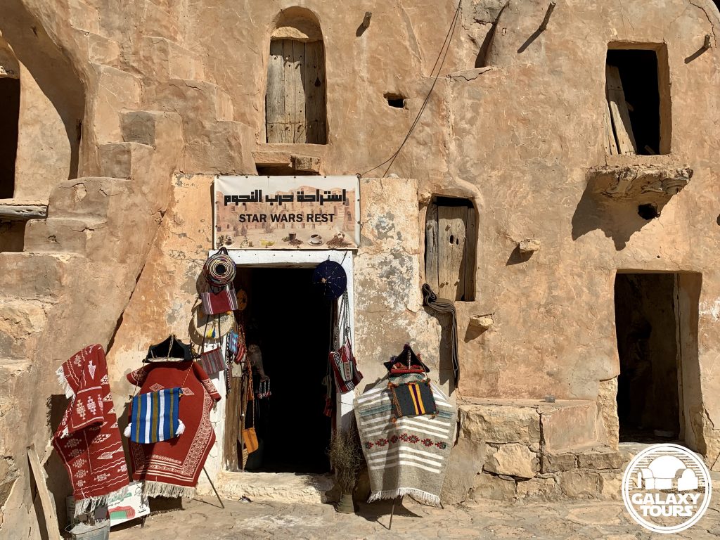
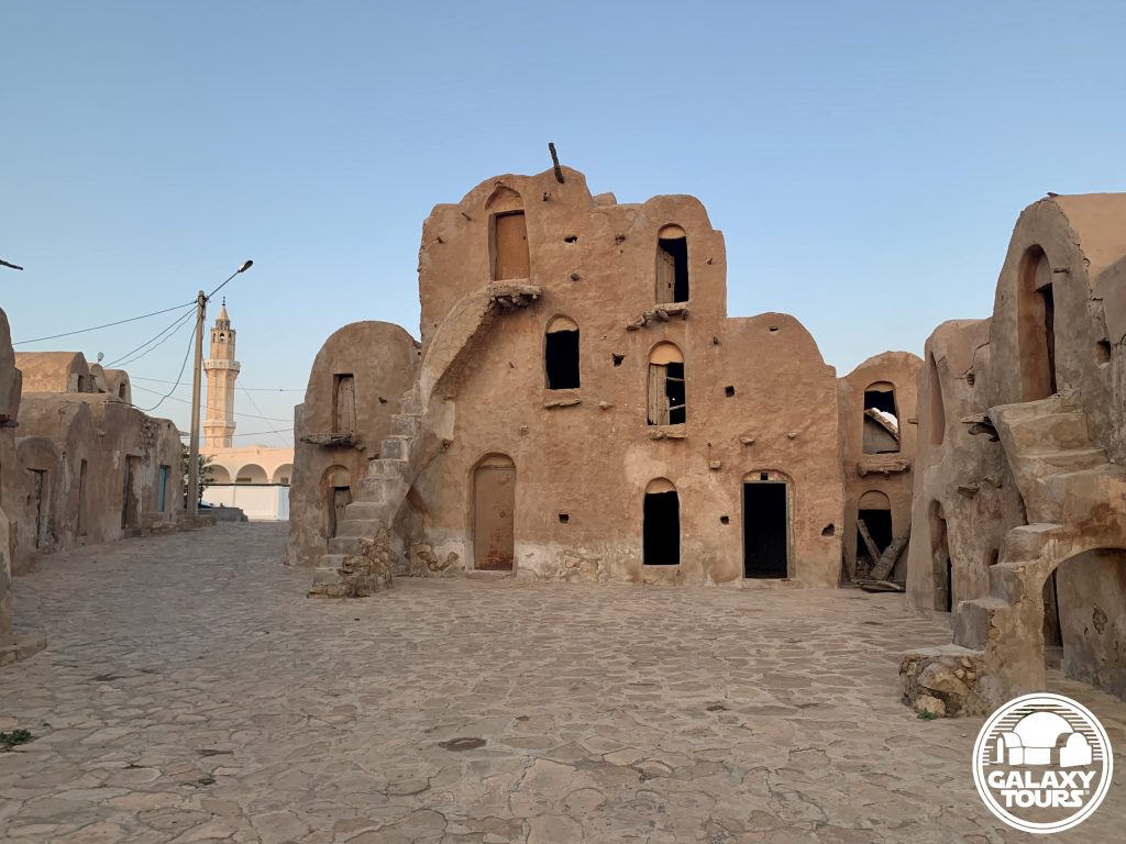
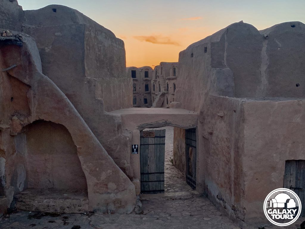
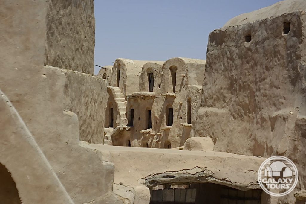
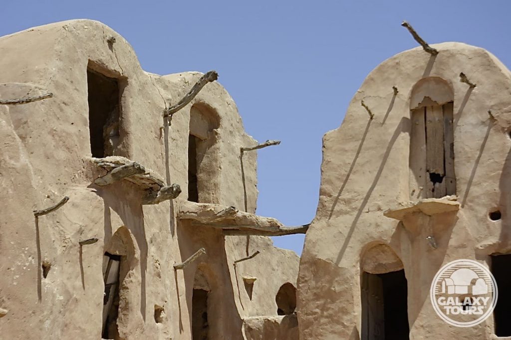
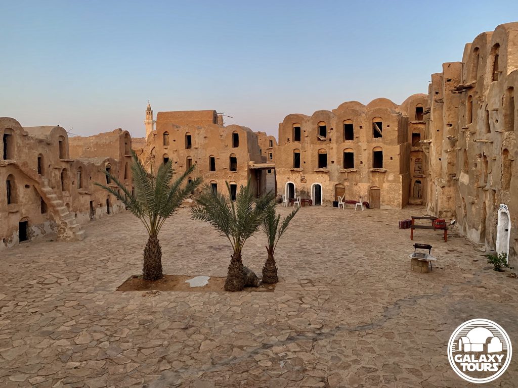
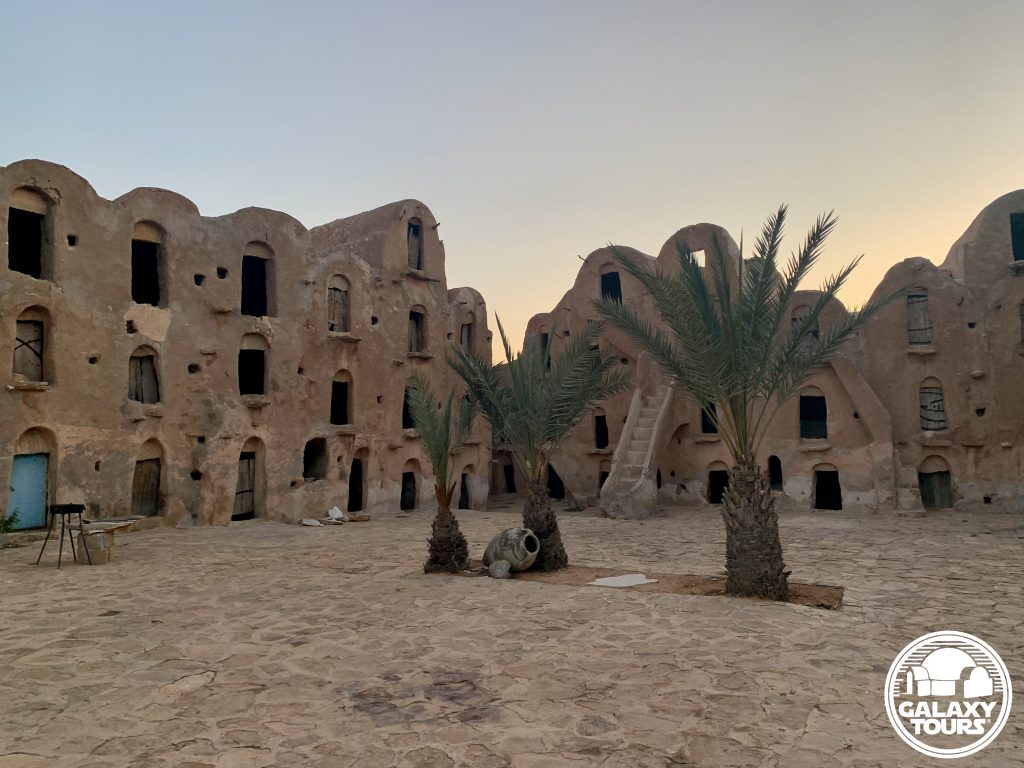
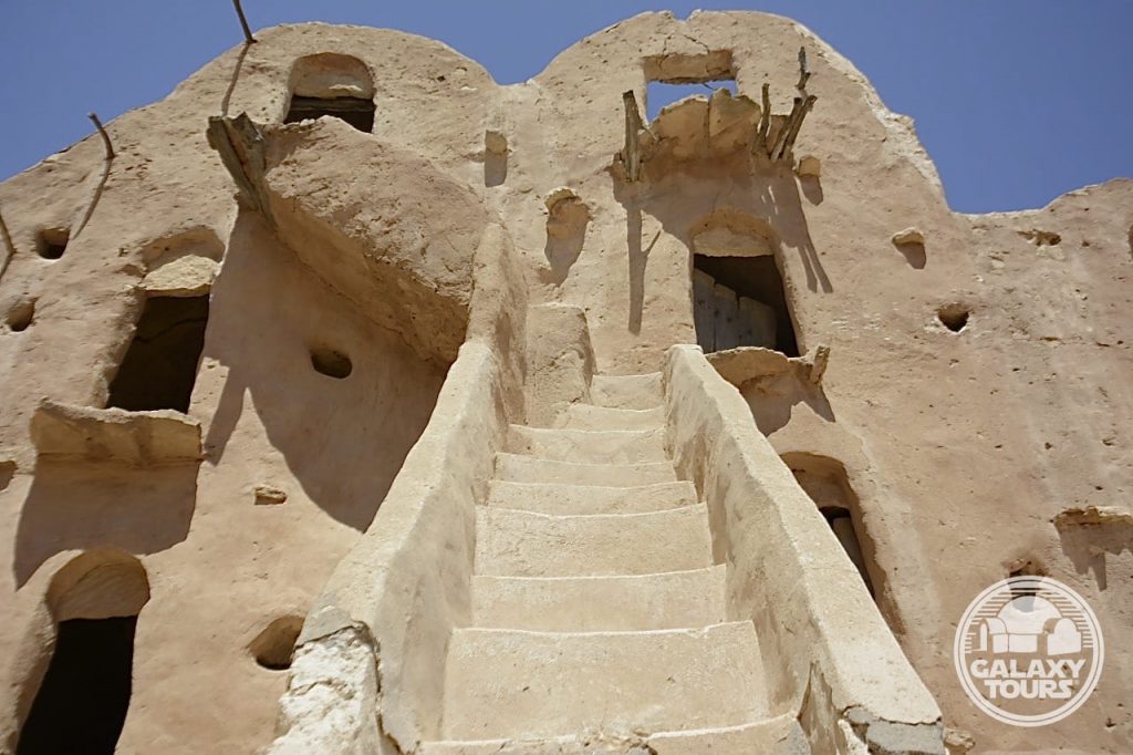
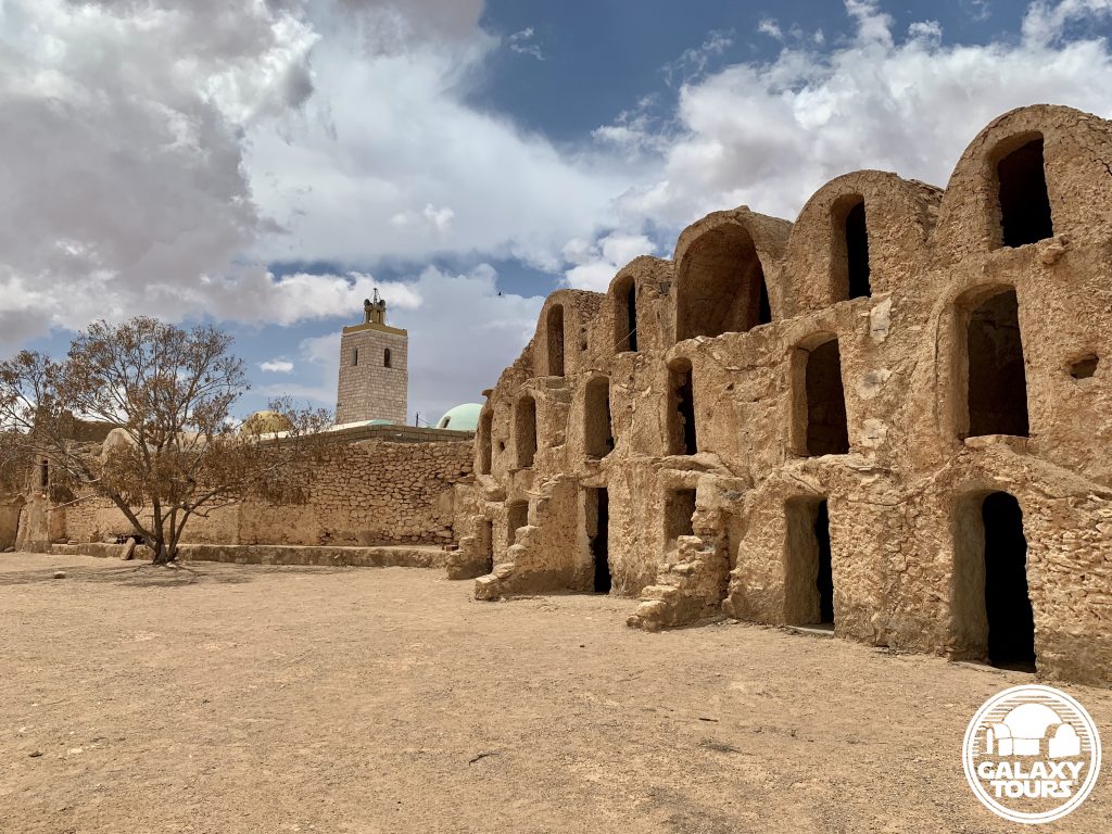
Named after the Ouled Soltane tribe (descendants of the Ouled Chehida), Ksar Ouled Soltane is one of the most picturesque and widely promoted Tunisian ksour with 287 well-preserved ghorfas, numerous steep stone staircases scaling four stories high (the fifth story no longer exists), and a large assortment of mounted wooden hooks used to hoist bags of agrarian goods to/from the ghorfas. The original (west) rectangular courtyard (60 x 40 meters) was constructed in approximately 1699. The outer (east) courtyard was added in the mid-19th century CE with the unenclosed east end of the space functioning as the single exterior entrance into the ksar. Both courtyards continue to serve as a central gathering point for the local community, offering only very rudimentary tourist options. The entire complex was fully restored in 1993 and enjoys wide-scale popularity as a top-ranked tourism destination in southern Tunisia.
SITE
Named after the Ouled Soltane tribe (descendants of the Ouled Chehida), Ksar Ouled Soltane is one of the most picturesque and widely promoted Tunisian ksour with 287 well-preserved ghorfas, numerous steep stone staircases scaling four stories high (the fifth story no longer exists), and a large assortment of mounted wooden hooks used to hoist bags of agrarian goods to/from the ghorfas. The original (west) rectangular courtyard (60 x 40 meters) was constructed in approximately 1699. The outer (east) courtyard was added in the mid-19th century CE with the unenclosed east end of the space functioning as the single exterior entrance into the ksar. Both courtyards continue to serve as a central gathering point for the local community, offering only very rudimentary tourist options. The entire complex was fully restored in 1993 and enjoys wide-scale popularity as a top-ranked tourism destination in southern Tunisia.
IDENTIFICATION
Philip Vanni, the original Tunisia Star Wars film site explorer/preservationist, spent weeks/months in Tunisia each year from 1993-2002. In personal correspondence with Galaxy Tours in mid-February 2021, Vanni disclosed that he had met with Rick McCallum (prequels producer) along with members of the Episode I pre-production location crew in 1996 at Hotel Sidi Idriss in Matmata al-Qadimal. (Vanni consistently used the Star Wars film site hotel as his base location during his trips to Tunisia). McCallum reportedly disclosed during this meeting that Ksar Ouled Soltane was being considered as a potential Episode I film site due to its size, well-preserved condition, and remote setting, which meant a reduced number of tourists. Although not direct confirmation, this information suggests that Ksar Ouled Soltane was probably scouted either as part of the principal Episode I recce to Tunisia in December 1995 or that of a possible subsequent pre-production recce in 1996.
Congruently, in his Star Wars Insider 29 (Spring 1996) article (“On-Location: Tatooine”) summarizing the December 1995 Lucasfilm recce to Tunisia, Jon Bradley Snyder (author/editor) cited insight shared by Gavin Bocquet (prequels production designer) regarding locations visited during the recce that were too isolated to be “accessible” for Episode IV filming 20 years prior. This group of remote sites specifically included ksour with vaulted grain storage ghorfas “stacked up to five stories high.” Only a few ksour in southern Tunisia were built with five-story high walls. Ksar Ouled Soltane is the most famous in this category and debatably the most isolated. Although fifth-level ghorfas have not survived at Ksar Ouled Soltane, Bocquet’s statement, particularly when viewed in the context of McCallum’s comments to Vanni in 1996, adds a layer of evidence to strengthen the identification of Ksar Ouled Soltane as a probable Star Wars recce site.
Located deep in the Tataouine region far from all major roads, the extreme remote position of Ksar Ouled Soltane—one of the points of appeal for McCallum—likely resulted in only minimal consideration for Episode I production when weighed against the spectrum of logistical challenges of filming at the site.


Ksar Ouled Abdallah
OVERVIEW
Site: Ksar Ouled Abdallah
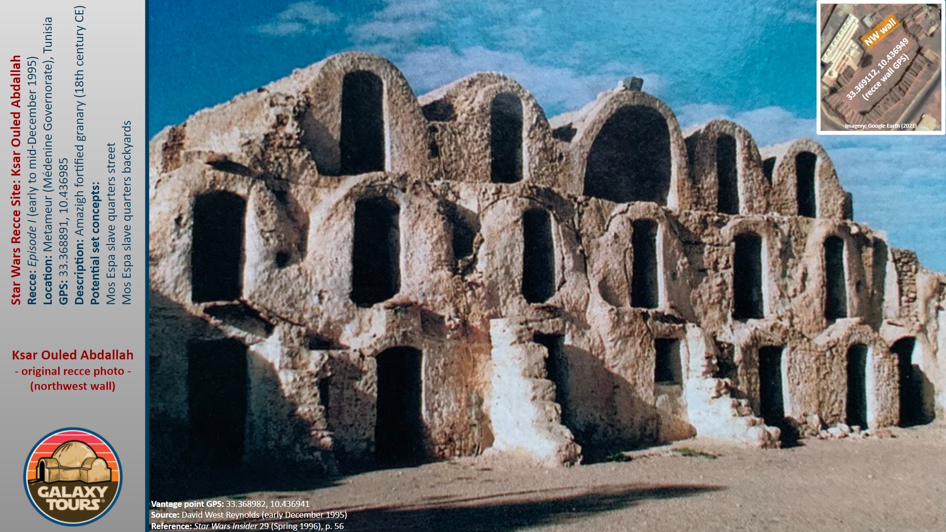
GPS: 33.368891, 10.436985
Location: Metameur, Médenine Governorate (southeast Tunisia)
Description: Amazigh fortified granary (18th century CE)
Star Wars recce:
Episode I – Tunisia (December 1995)
Source: Original recce photograph
Star Wars scouted set concept:
Mos Espa | slave quarters
Star Wars connection discovery:
Galaxy Tours (9 December 2020)
Courtyard: The ksar boasts one of the largest courtyards among all surviving Tunisian ksour. This defining characteristic, although impressive, likely drove the decision not to film at Ksar Ouled Abdallah in preference to the more compact, visually appealing, production-friendly layout offered at nearby Ksar Ommarsia (Médenine city), the site eventually chosen for Mos Espa slave quarters street scenes.
Accessibility: Very easy; flat terrain; paved roads; parking area (33.369041, 10.437368) directly at the site entrance.
SITE
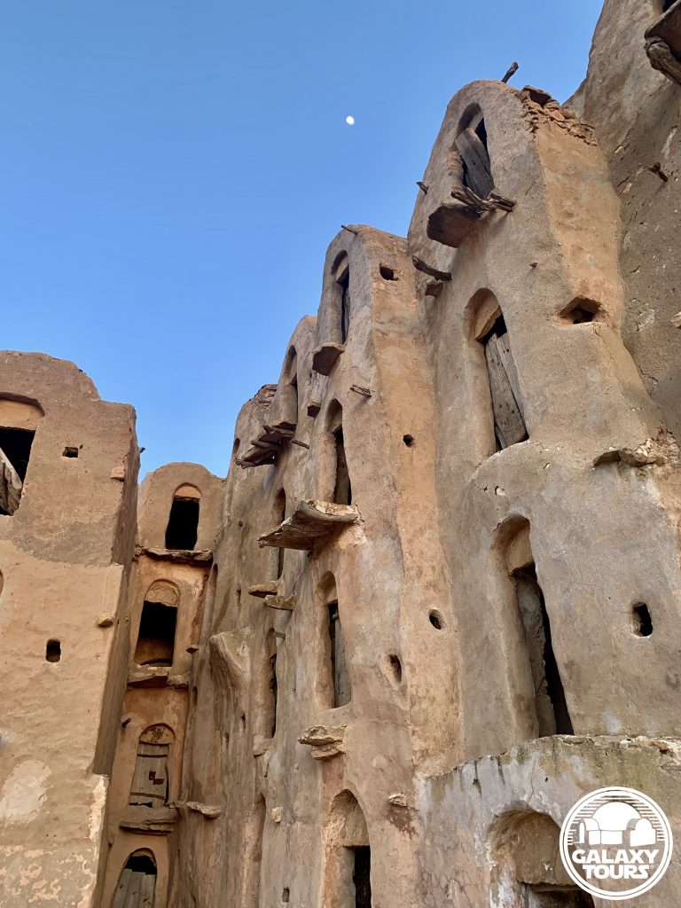
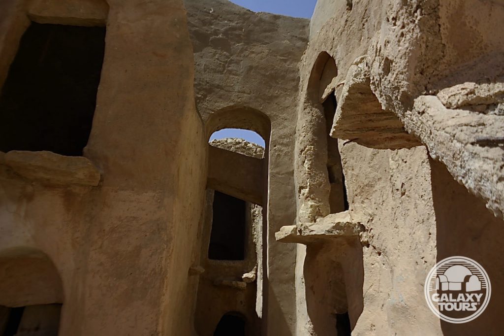
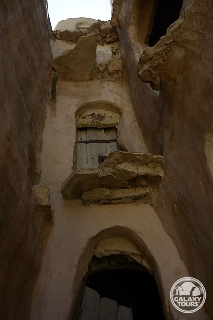
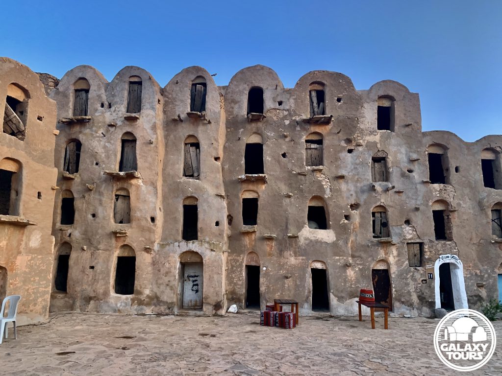
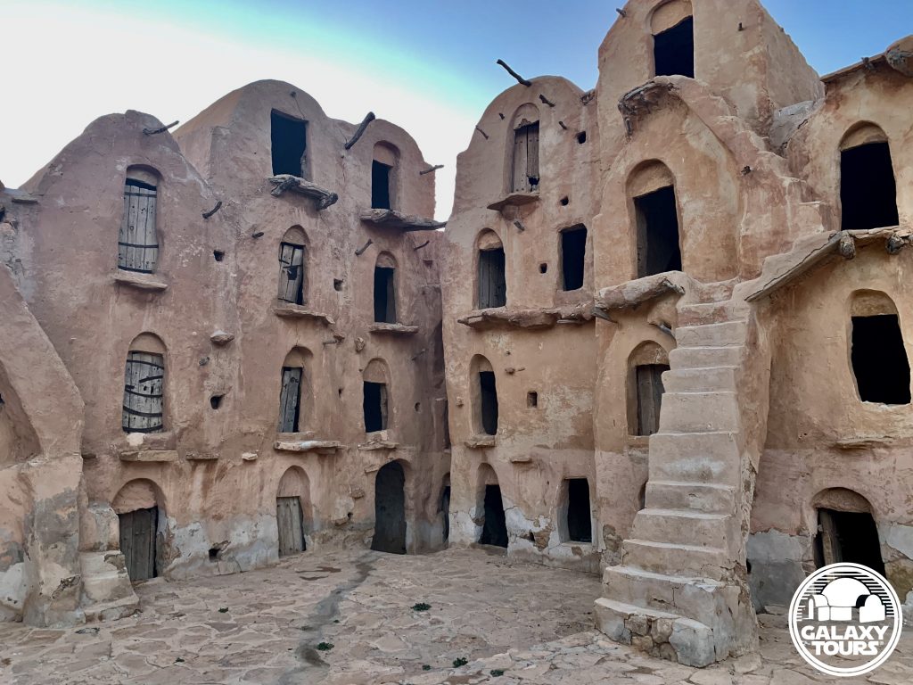
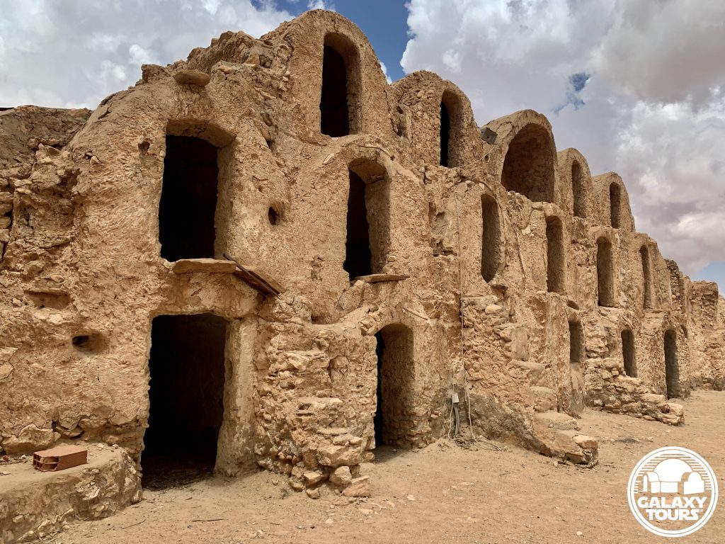
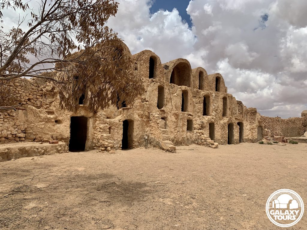
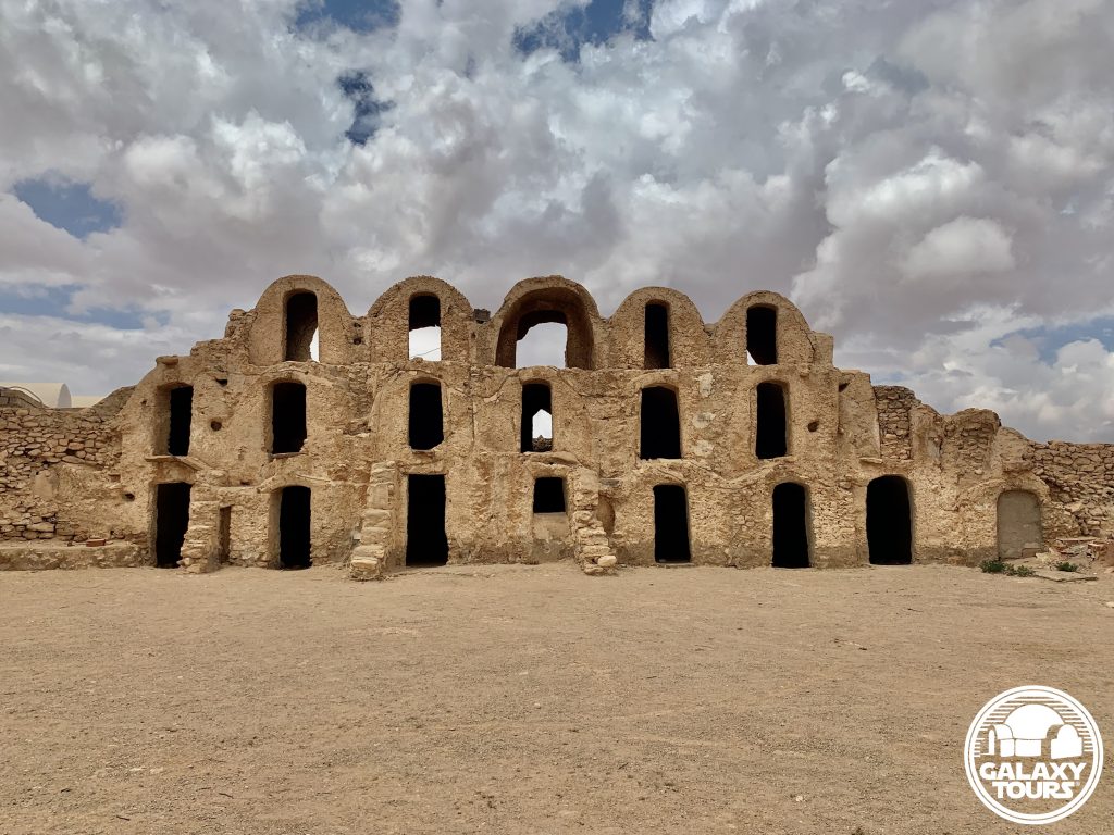
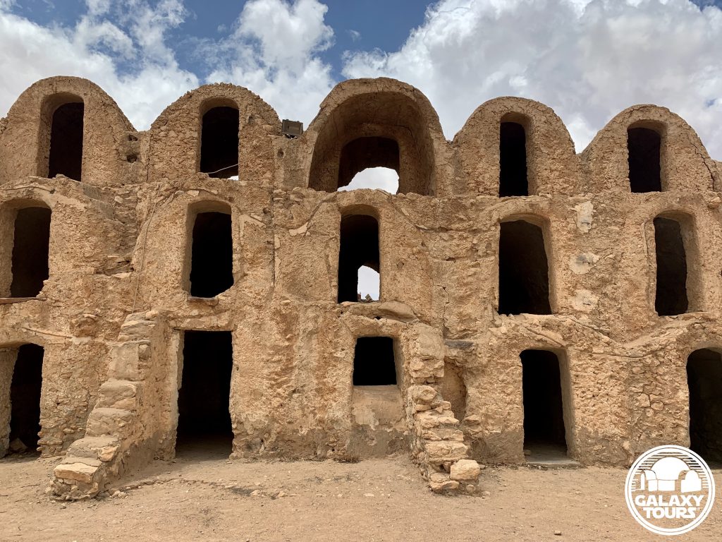
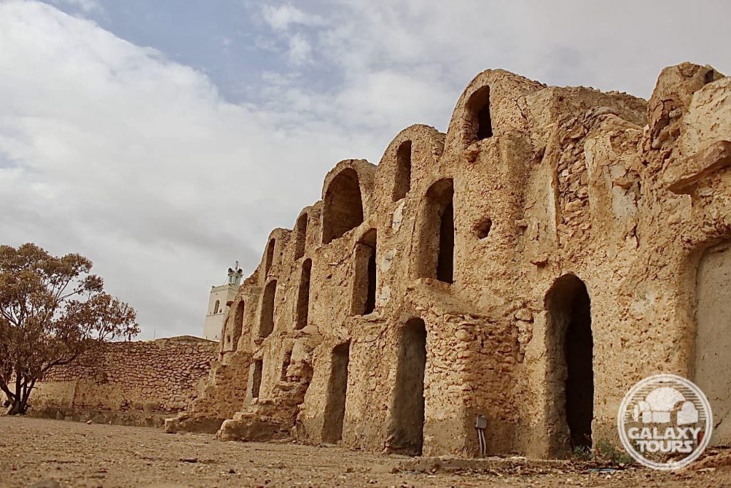
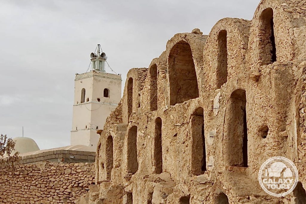
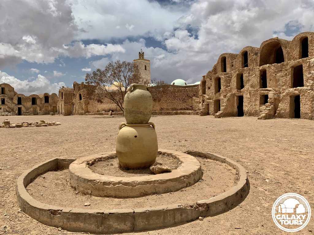
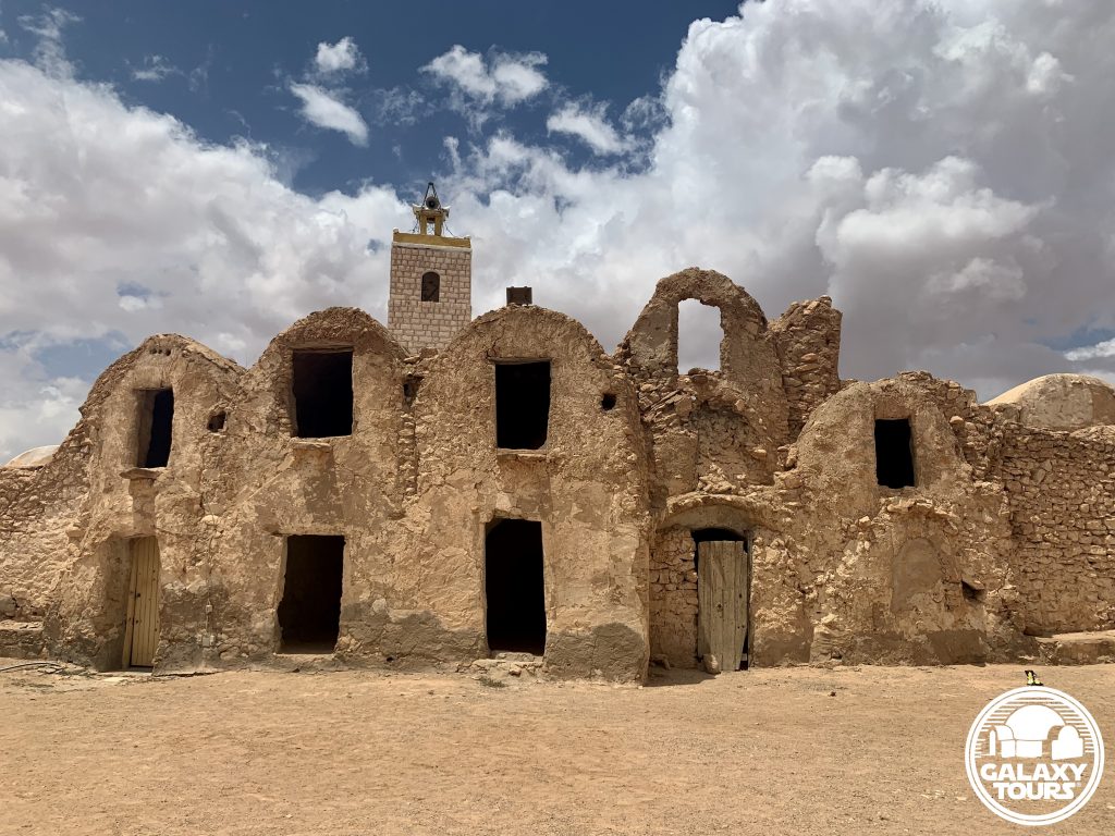
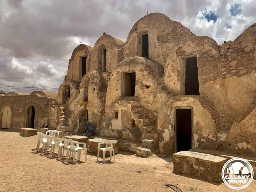
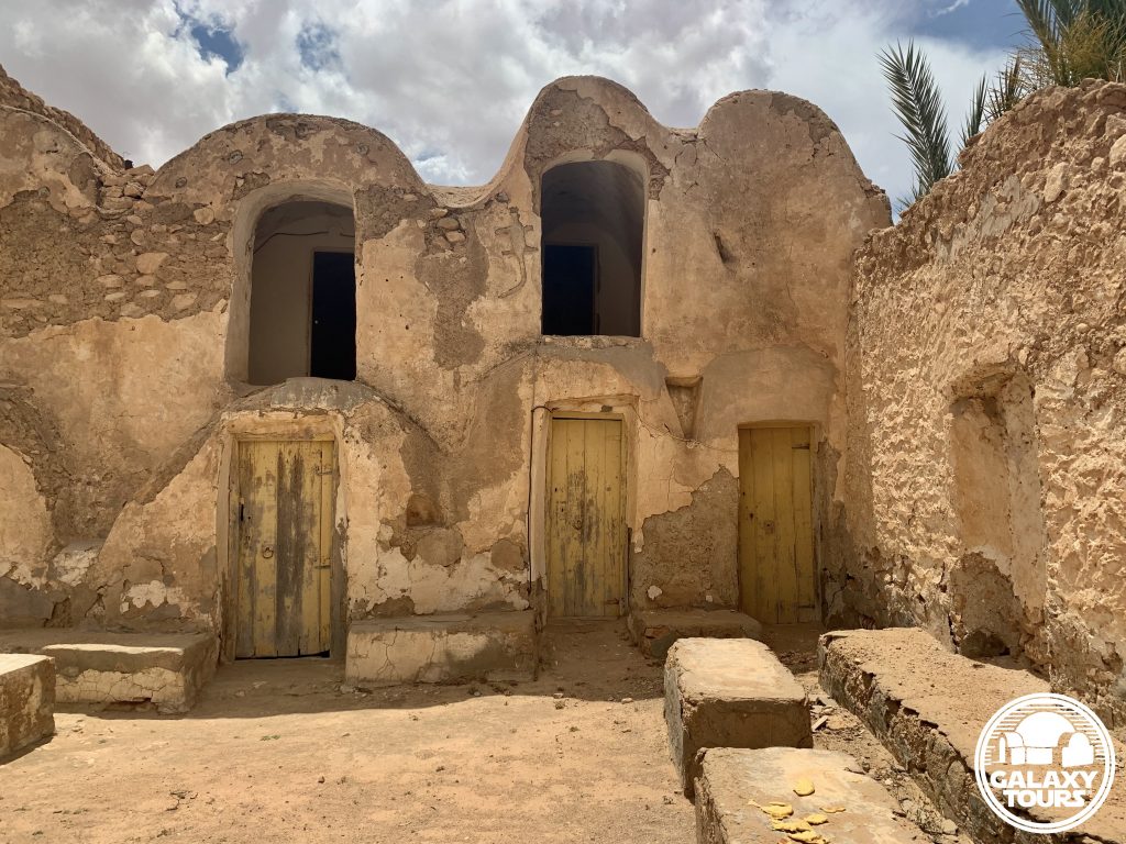
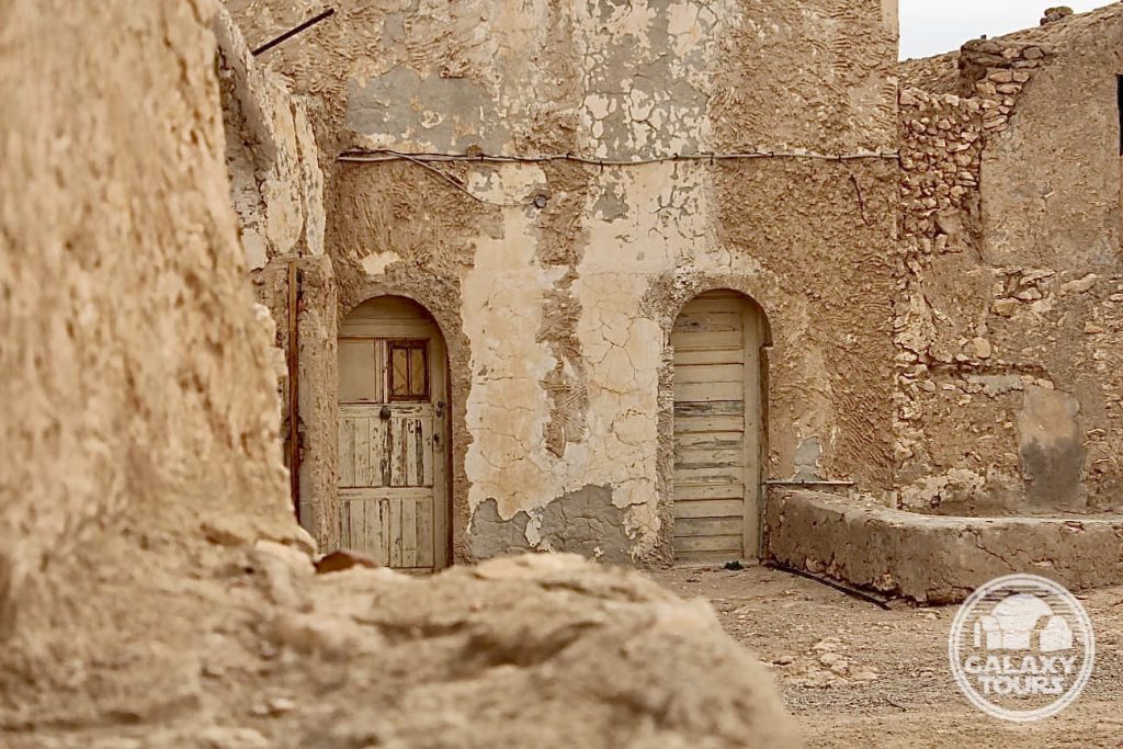
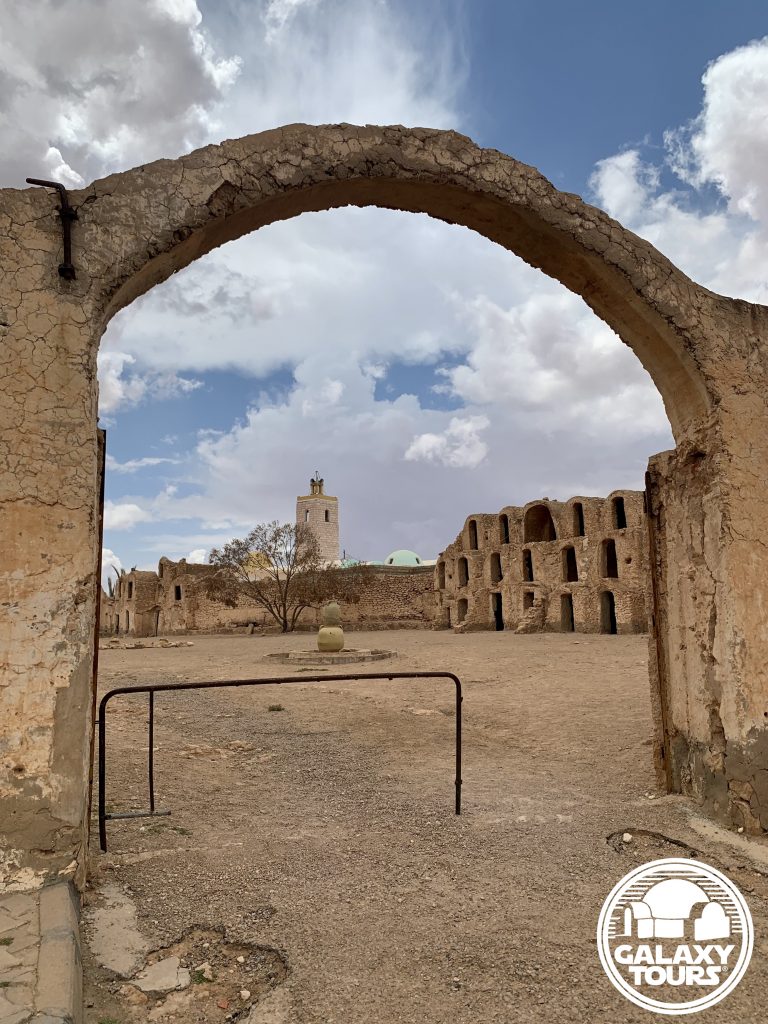
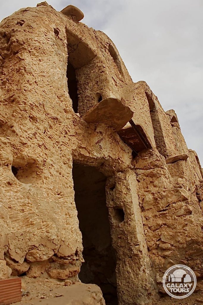
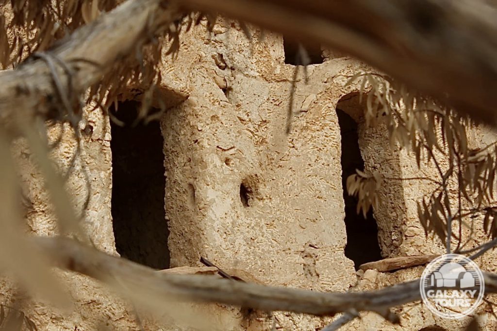
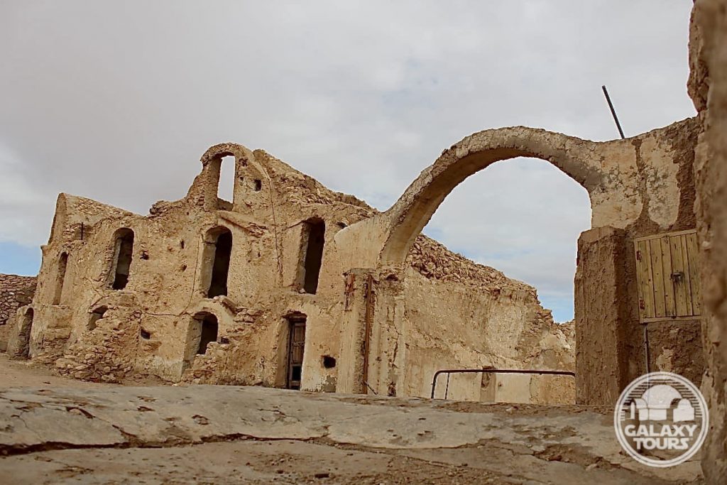
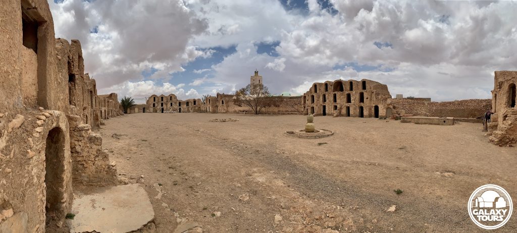
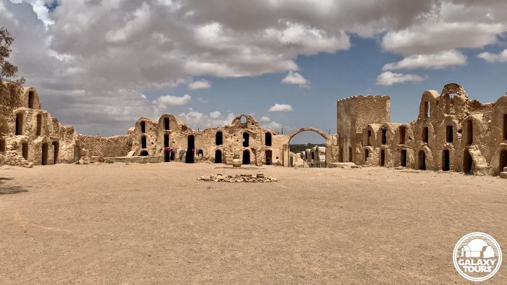
Ksar Ouled Abdallah (alternately: Ksar Gueblaoui), named after the Ouled Abdallah band of the Hrarza tribe, is the largest and most important among the cluster of five historic ksour remaining in Metameur, situated in the southwest section of the modern village. (The other four ksour in Metameur are named: Ksar El Khoukha, Ksar Essouk, Ksar El Ghoula, and Ksar Ouled Meftah). Built in the 18th century CE, the west corner of the rectangular Ksar Ouled Abdallah (ca. 100 x 50 meters) is adjacent to the Sidi Ahmed Lahjel Mosque complex, which contains a domed marabout dedicated to the enshrined village founder.
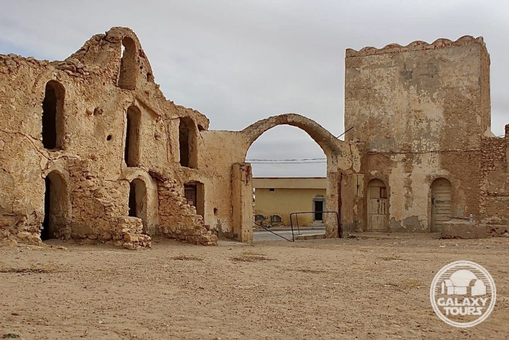
The ksar has one exterior entrance (east corner), marked by a concrete arch, and 108 ghorfas (ca. 50 in ruins) stacked primarily two stories high (three stories in some areas) with all original access doors removed. Some 50 ghorfas along the southeast and southwest walls have been restored. In particular, the southwest wall has been converted into a low-budget inn for tourists called Hôtel les Ghorfas (alternately: Ghorfa Hotel, Hotel el-Ghorfa), offering very basic accommodations in a dozen ghorfas (with installed wooden doors) and a souvenir shop. Reportedly established in 1986, Hôtel les Ghorfas is not officially closed despite the fact that it is barely operational, lacks consistent business hours, maintains no advertising, and attracts little to no clientele.
SITE
Ksar Ouled Abdallah (alternately: Ksar Gueblaoui), named after the Ouled Abdallah band of the Hrarza tribe, is the largest and most important among the cluster of five historic ksour remaining in Metameur, situated in the southwest section of the modern village. (The other four ksour in Metameur are named: Ksar El Khoukha, Ksar Essouk, Ksar El Ghoula, and Ksar Ouled Meftah). Built in the 18th century CE, the west corner of the rectangular Ksar Ouled Abdallah (ca. 100 x 50 meters) is adjacent to the Sidi Ahmed Lahjel Mosque complex, which contains a domed marabout dedicated to the enshrined village founder.
The ksar has one exterior entrance (east corner), marked by a concrete arch, and 108 ghorfas (ca. 50 in ruins) stacked primarily two stories high (three stories in some areas) with all original access doors removed. Some 50 ghorfas along the southeast and southwest walls have been restored. In particular, the southwest wall has been converted into a low-budget inn for tourists called Hôtel les Ghorfas (alternately: Ghorfa Hotel, Hotel el-Ghorfa), offering very basic accommodations in a dozen ghorfas (with installed wooden doors) and a souvenir shop. Reportedly established in 1986, Hôtel les Ghorfas is not officially closed despite the fact that it is barely operational, lacks consistent business hours, maintains no advertising, and attracts little to no clientele.
IDENTIFICATION
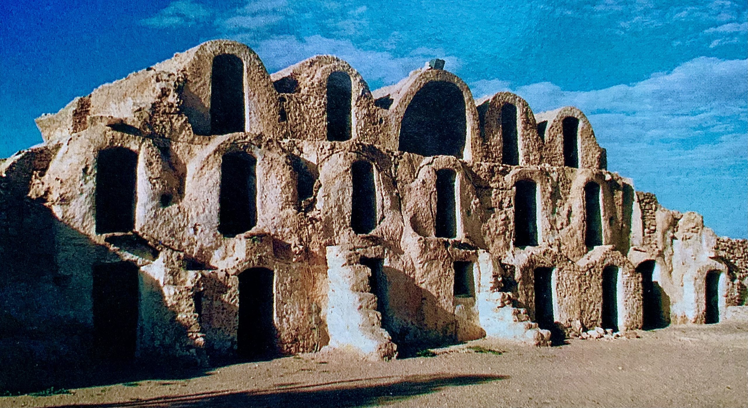
Jon Bradley Snyder (author/editor) reported on the principal Episode I recce to Tunisia (early to mid-December 1995) in Star Wars Insider 29 (Spring 1996). In his article (“On-Location: Tatooine”) Snyder published photos (taken by David West Reynolds) with generic captions for several of the Tunisian sites visited during the recce. No names or clear identifications were provided for any of the visually documented sites. Multi-faceted research confirms that one of the recce photos in the article (page 56; center row, left-hand side) displays the distinct northwest wall of Ksar Ouled Abdallah, characterized by five columns of ghorfas stacked three stories high with a uniquely shaped wide-entrance ghorfa in the center of the top row. Reynolds stood north of center in the courtyard just east of the lone tree at the site to take the recce photo. The last part of the caption associated with the photo reads: “This kind of architecture will be part of the look of Tatooine in the prequels.”
The ksar boasts one of the largest courtyards among all surviving Tunisian ksour. This defining characteristic, although impressive, likely drove the decision not to film at Ksar Ouled Abdallah in preference to the more compact, visually appealing, production-friendly layout offered at nearby Ksar Ommarsia (Médenine city center), the site eventually chosen for Mos Espa slave quarters street scenes. Interestingly, both ksour are situated along the major east-west access route in the heart of the Médenine region and Ksar Ouled Abdallah receives drastically less foot traffic, reinforcing the notion that courtyard size, shape, and style were the decisive factors.
The beam light featured in Reynolds’ photo above the wide-entrance top row ghorfa has been replaced/moved to the side of the same ghorfa. With the exception of this small detail, the ksar northwest wall (despite the lack of any real effort to preserve the site) remains more or less unchanged since the 1995 recce.
Kala’a Guermessa
OVERVIEW
Site: Kala’a Guermessa
GPS: 32.986201, 10.251390
Location: Guermessa, Tataouine Governorate (southeast Tunisia)
Description: Amazigh mountain citadel (7th century CE)
Star Wars recce:
Episode I – Tunisia (December 1995)
Source: Original recce photograph
Star Wars scouted set concept:
Mos Espa spaceport | various elements
Star Wars connection discovery:
Galaxy Tours (10 February 2021)
Isolation: Although arguably more impressive than Kala’a Chenini, Kala’a Guermessa receives comparatively very few visitors, creating a palpable sense of remote isolation framed by its two peaks of assorted ruins engulfing the stand-alone Sidi Hamza Marabout.
Challenges: The remote location of the site paired with the relatively steep ascent to access the ruins on both peaks likely resulted in only minimal consideration to transform Kala’a Guermessa into fictional Mos Espa.
Canon reference: The name Guermessa is associated (since 2015) with one of the three moons of fictional Tatooine. Nearby Chenini and Ghomrassen represent the names of the other two moons. All three locales “orbit” around Tataouine city.
Accessibility: Easy; foothills terrain; paved roads; parking area (32.986875, 10.252415) in close proximity; low-impact uphill hike (ca. 250 meters) on marked path to central area of the site.
SITE
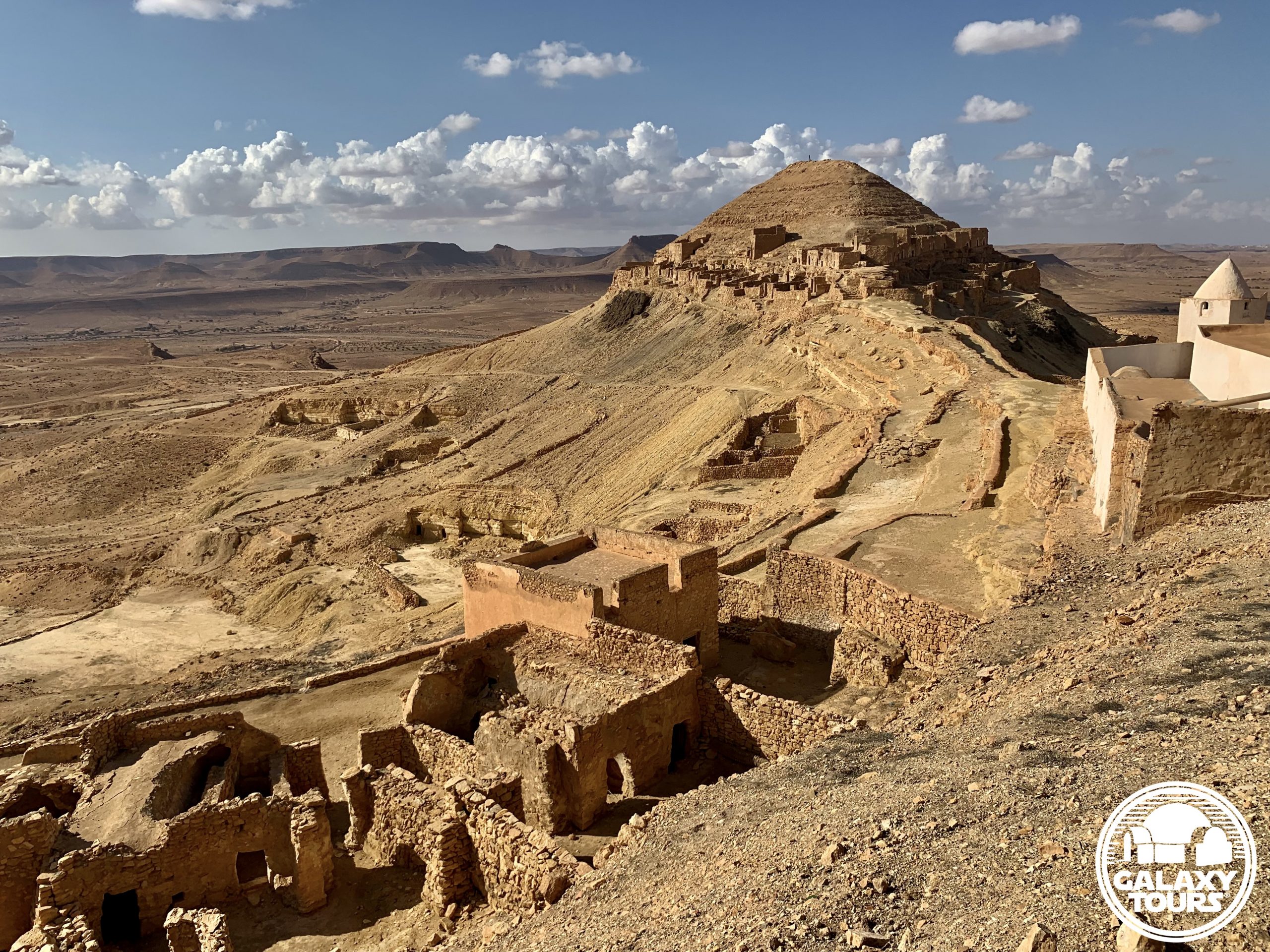
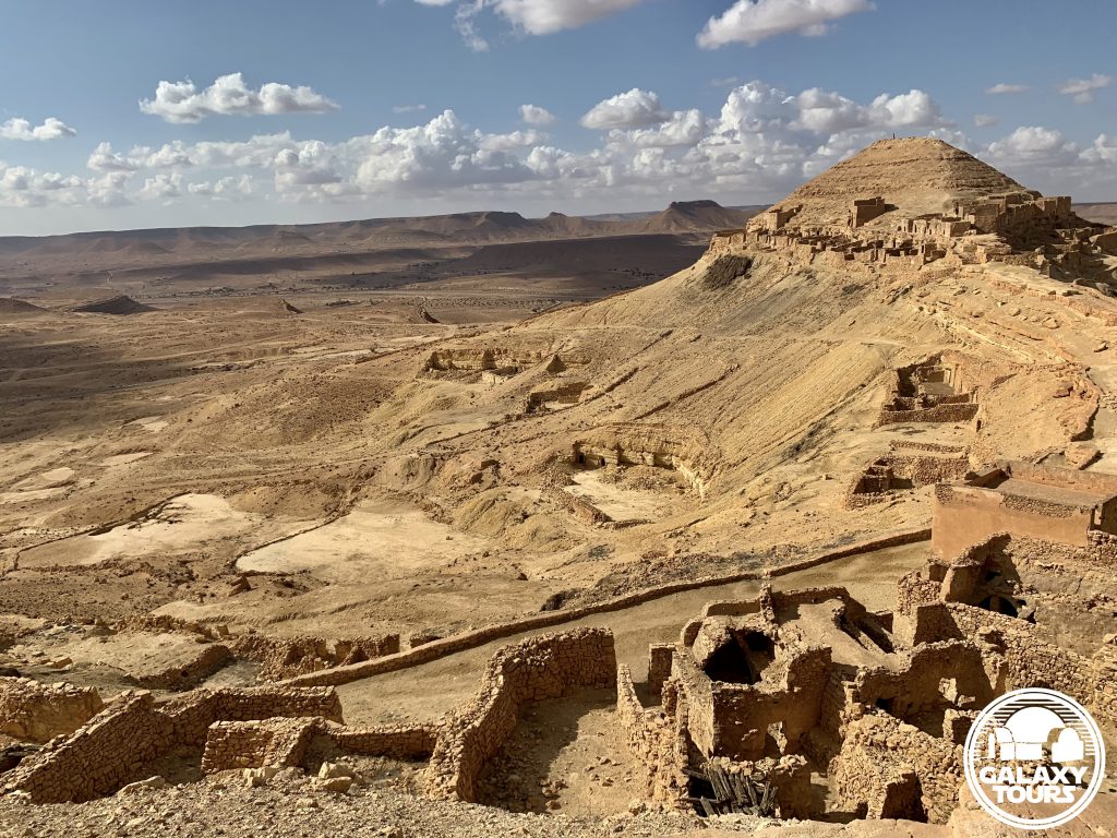
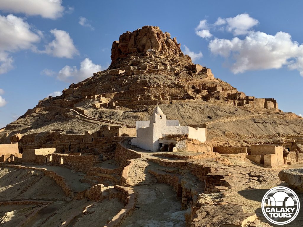
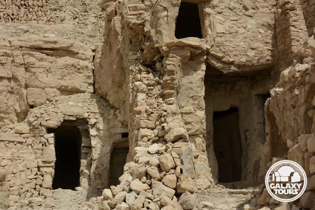
The Guermessi tribe erected the ancient mountain village in the 7th or 8th century CE as a defensive kala’a (Arabic: “citadel” or “fortress”), digging multiple layers of fortified subterranean (troglodyte) structures into the sloping strata (limestone, clay, marl, and dolomite) of two adjacent peaks (ca. 355 meters apart) strategically located on the northern end of the Jebel El Hadada mountain range (elevation: 548 meters) high above the surrounding Ferch plain. The founding of Kala’a Guermessa is traditionally linked to a miracle of much-needed rainfall at the arrival of two marabouts to the region from Kairouan (Tunisia): Sidi Ibrahim and his servant Sidi Bando. The whitewashed Sidi Hamza Marabout (dedicated to the son of Sidi Ibrahim) functions as the center point of the ancient ruins between the two peaks.
As peaceful relations developed between the local Amazigh and nomadic Arab tribes, the horizontally terraced kala’a fortifications on the slopes of Ras Oum Moutmana (alternately: Ras El Metmana)—the flat-topped south peak at the site—were expanded to include family-specific ghorfa chambers built in front of the fortified structures, forming a collective cliffside ksar complex for crops storage. Only the east and south sections of Ksar Guermessa have survived with some pockets of the south section partially restored. The north peak at the site is home to layers of lateral subterranean ruins.
SITE
The Guermessi tribe erected the ancient mountain village in the 7th or 8th century CE as a defensive kala’a (Arabic: “citadel” or “fortress”), digging multiple layers of fortified subterranean (troglodyte) structures into the sloping strata (limestone, clay, marl, and dolomite) of two adjacent peaks (ca. 355 meters apart) strategically located on the northern end of the Jebel El Hadada mountain range (elevation: 548 meters) high above the surrounding Ferch plain. The founding of Kala’a Guermessa is traditionally linked to a miracle of much-needed rainfall at the arrival of two marabouts to the region from Kairouan (Tunisia): Sidi Ibrahim and his servant Sidi Bando. The whitewashed Sidi Hamza Marabout (dedicated to the son of Sidi Ibrahim) functions as the center point of the ancient ruins between the two peaks.
As peaceful relations developed between the local Amazigh and nomadic Arab tribes, the horizontally terraced kala’a fortifications on the slopes of Ras Oum Moutmana (alternately: Ras El Metmana)—the flat-topped south peak at the site—were expanded to include family-specific ghorfa chambers built in front of the fortified structures, forming a collective cliffside ksar complex for crops storage. Only the east and south sections of Ksar Guermessa have survived with some pockets of the south section partially restored. The north peak at the site is home to layers of lateral subterranean ruins.
IDENTIFICATION
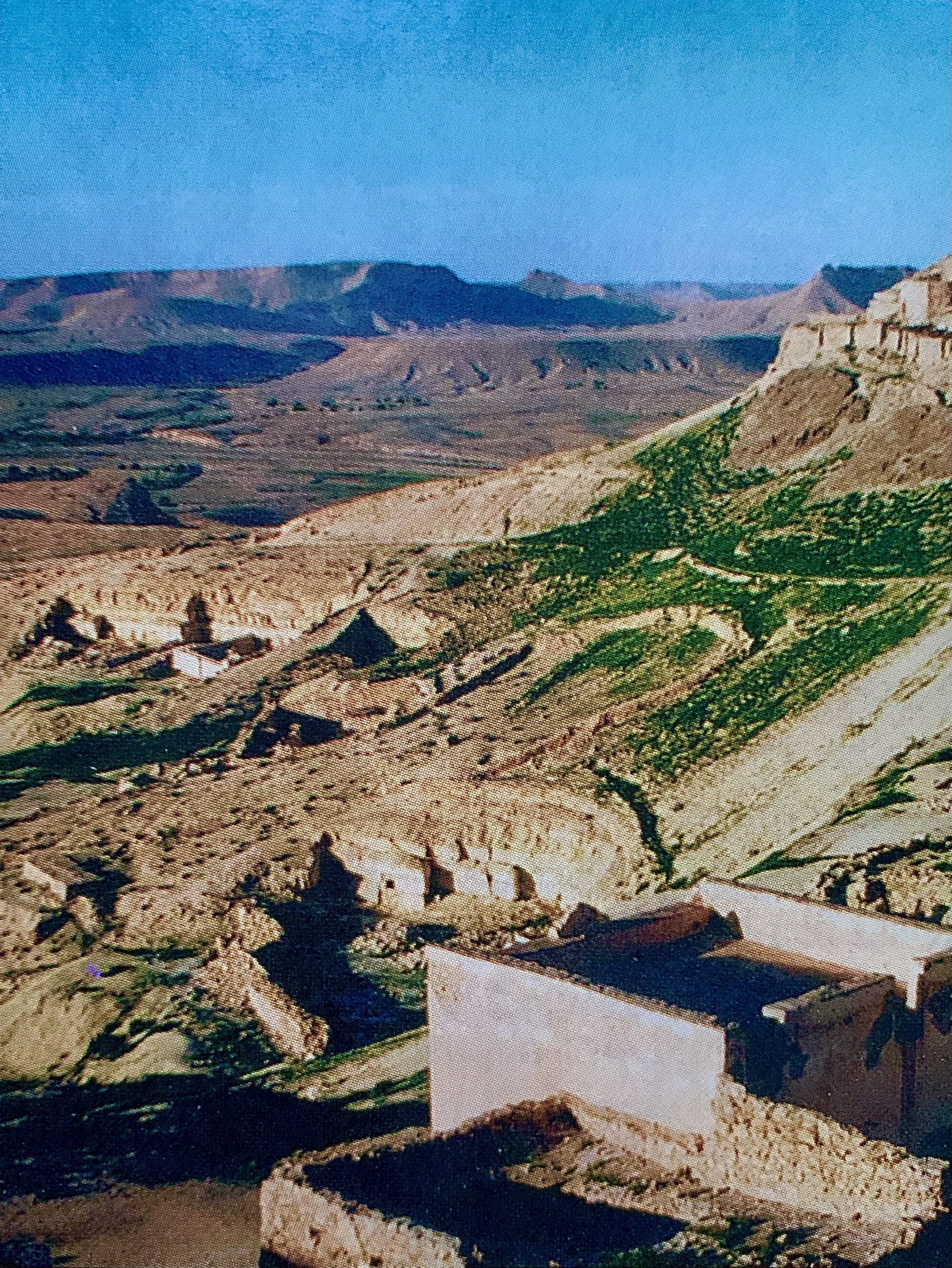
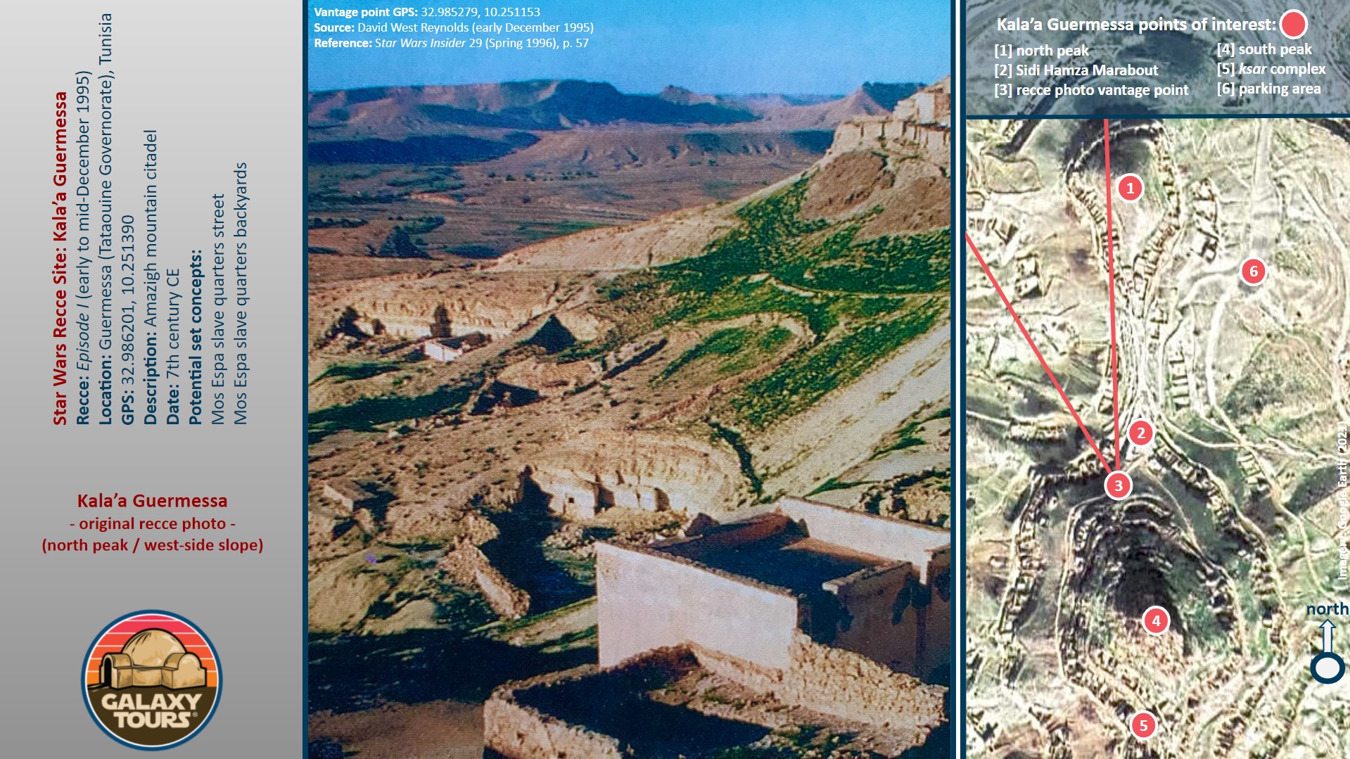
Jon Bradley Snyder (author/editor) reported on the principal Episode I recce to Tunisia (early to mid-December 1995) in Star Wars Insider 29 (Spring 1996). In his article (“On-Location: Tatooine”) Snyder published photos (taken by David West Reynolds) with generic captions for several of the Tunisian sites visited during the recce. No names or clear identifications were provided for any of the visually documented sites. Multi-faceted research confirms that one of the recce photos in the article (page 57; top row, right-hand side) captures a panoramic view of the Kala’a Guermessa north peak with its unique arrangement of subterranean ruins compacted near the top of the peak and interspersed intermittently down the face of the west-side slope. Reynolds stood along the footpath on the north side of Ras Oum Moutmana approximately 30 meters southwest of the Sidi Hamza Marabout to frame the recce photo. The caption associated with the photo reads: “Though it looks like a matte painting, this mountain city is real, standing deep in the remote wastes of southern Tunisia.”
The remote location of the site deep in the Tataouine region paired with the relatively steep ascent to access the ruins on both peaks likely resulted in only minimal consideration (at best) to transform Kala’a Guermessa into fictional Mos Espa. Despite no enduring effort to preserve the ruins, views of the north peak west-side slope at the site remain more or less unchanged since the 1995 recce.


Kala’a Chenini
OVERVIEW
Site: Kala’a Chenini
GPS: 32.912024, 10.263603
Location: Chenini, Tataouine Governorate (southeast Tunisia)
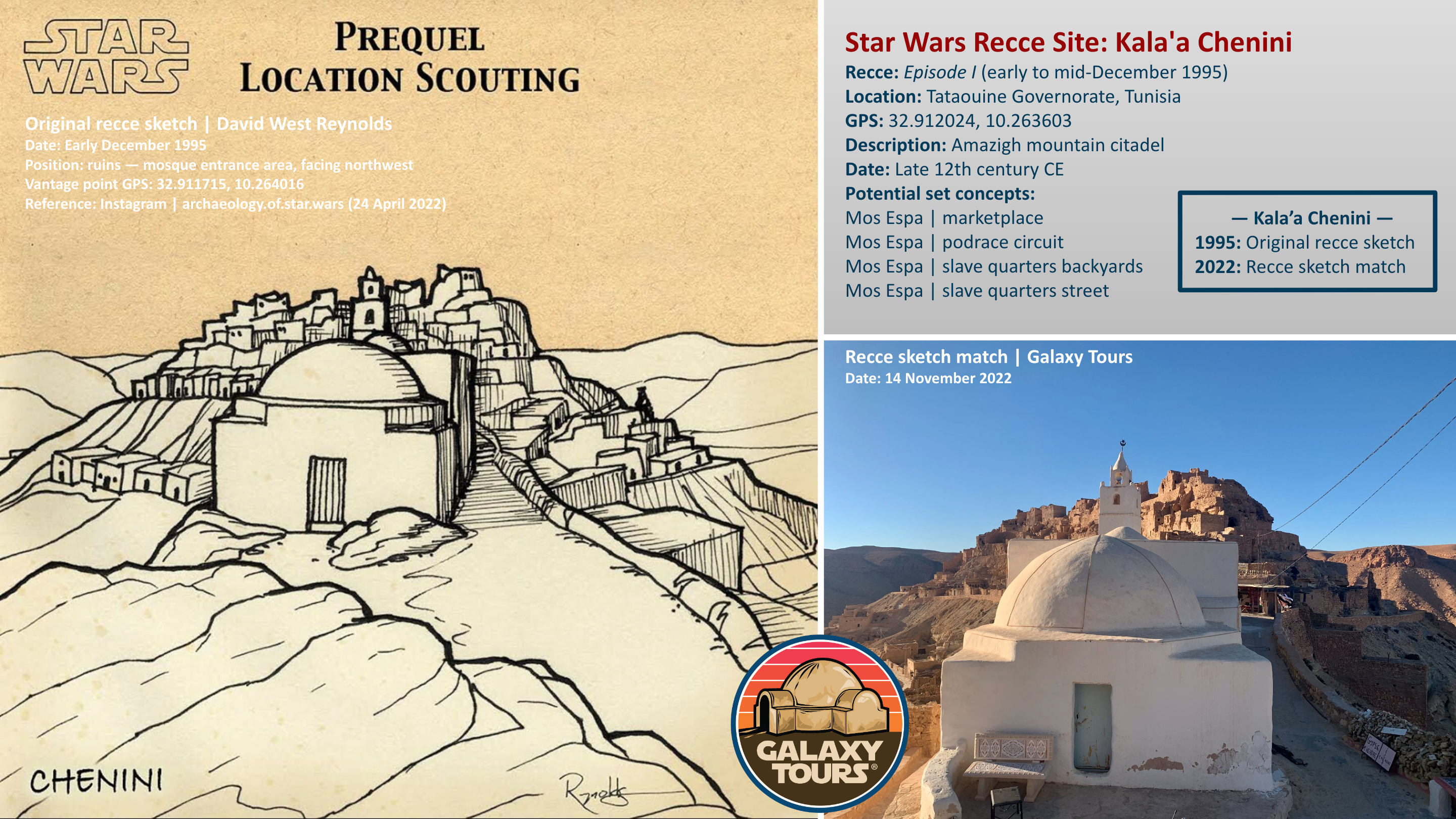
Description: Amazigh mountain citadel (late 12th century CE)
Star Wars recce:
Episode I – Tunisia (December 1995)
Source: Original recce sketch
Star Wars scouted set concept:
Mos Espa spaceport | various elements
Star Wars connection confirmation:
Galaxy Tours (5 August 2022)
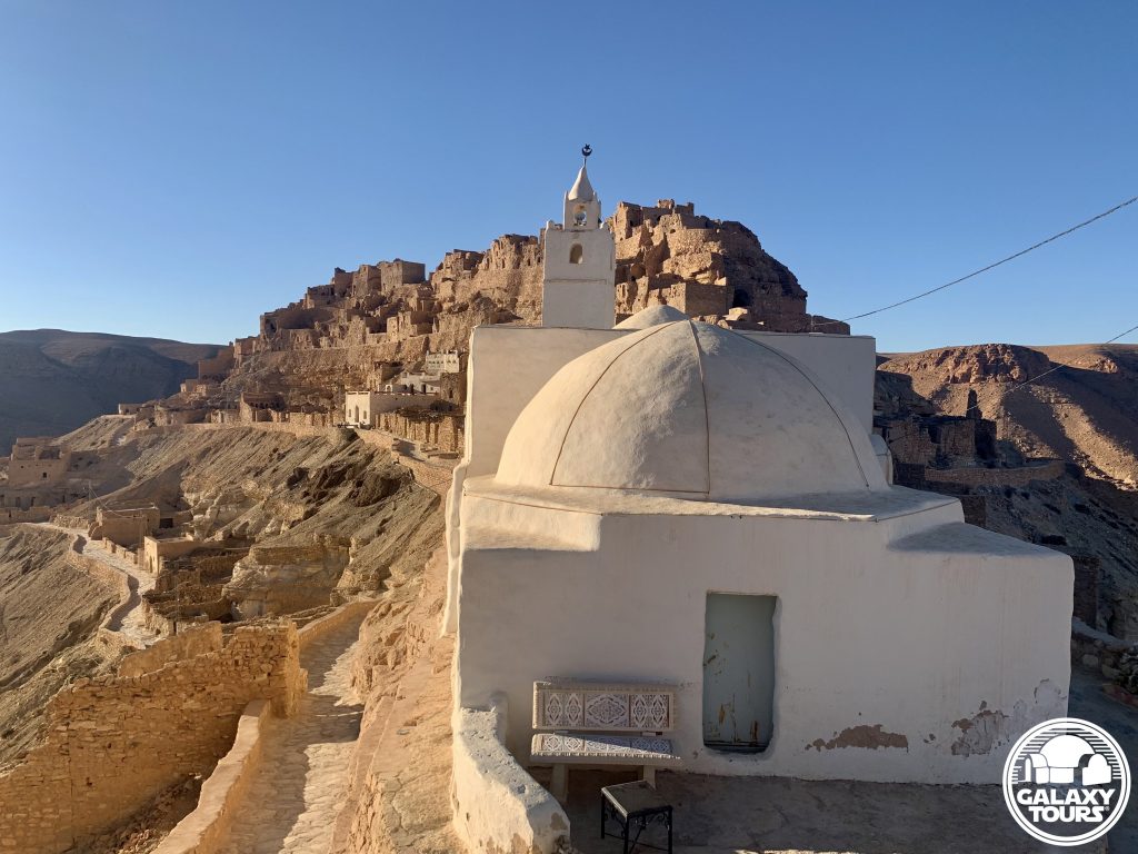
Tourist attraction: Kala’a Chenini, marked by the whitewashed Al-Farajeen Mosque as the distantly visible landmark for the bustling ancient mountain village, remains one of the most visited sites on the tourism circuit in southern Tunisia.
Challenges: The popularity of the site coupled with its remote location and the relatively steep ascent to access the ruins likely resulted in only minimal consideration to transform Kala’a Chenini into fictional Mos Espa.
Canon reference: The name Chenini is associated (since 2015) with one of the three moons of fictional Tatooine. Nearby Guermessa and Ghomrassen represent the names of the other two moons. All three locales “orbit” around Tataouine city.
Accessibility: Easy; foothills terrain; paved roads; parking area (32.911507, 10.263003) in close proximity; low-impact uphill hike (ca. 215 meters) on marked path to central area of the site.
SITE
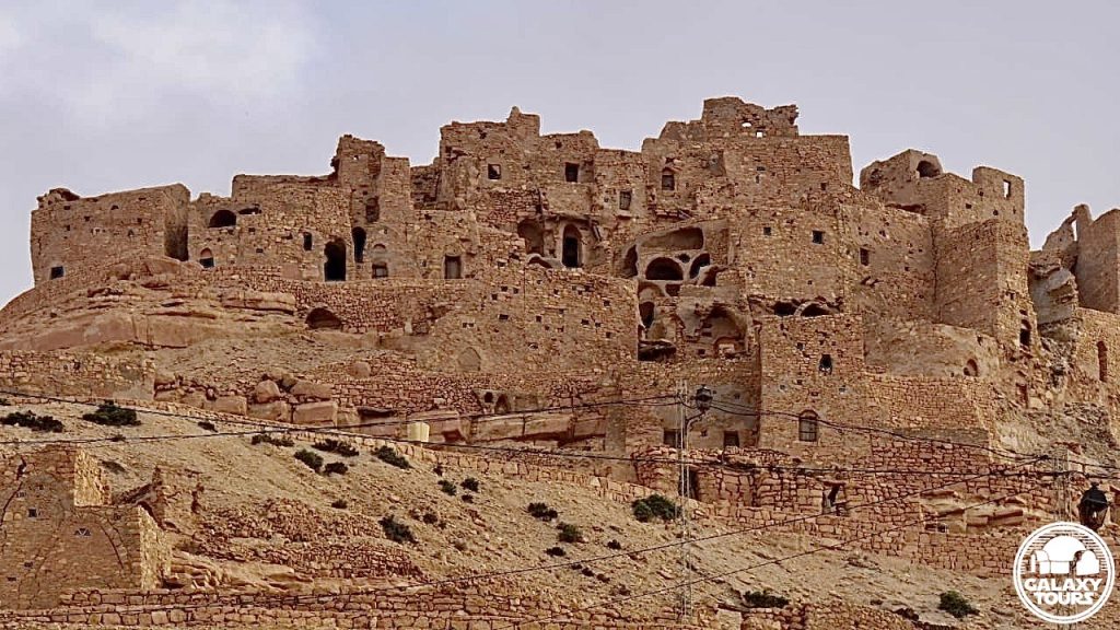
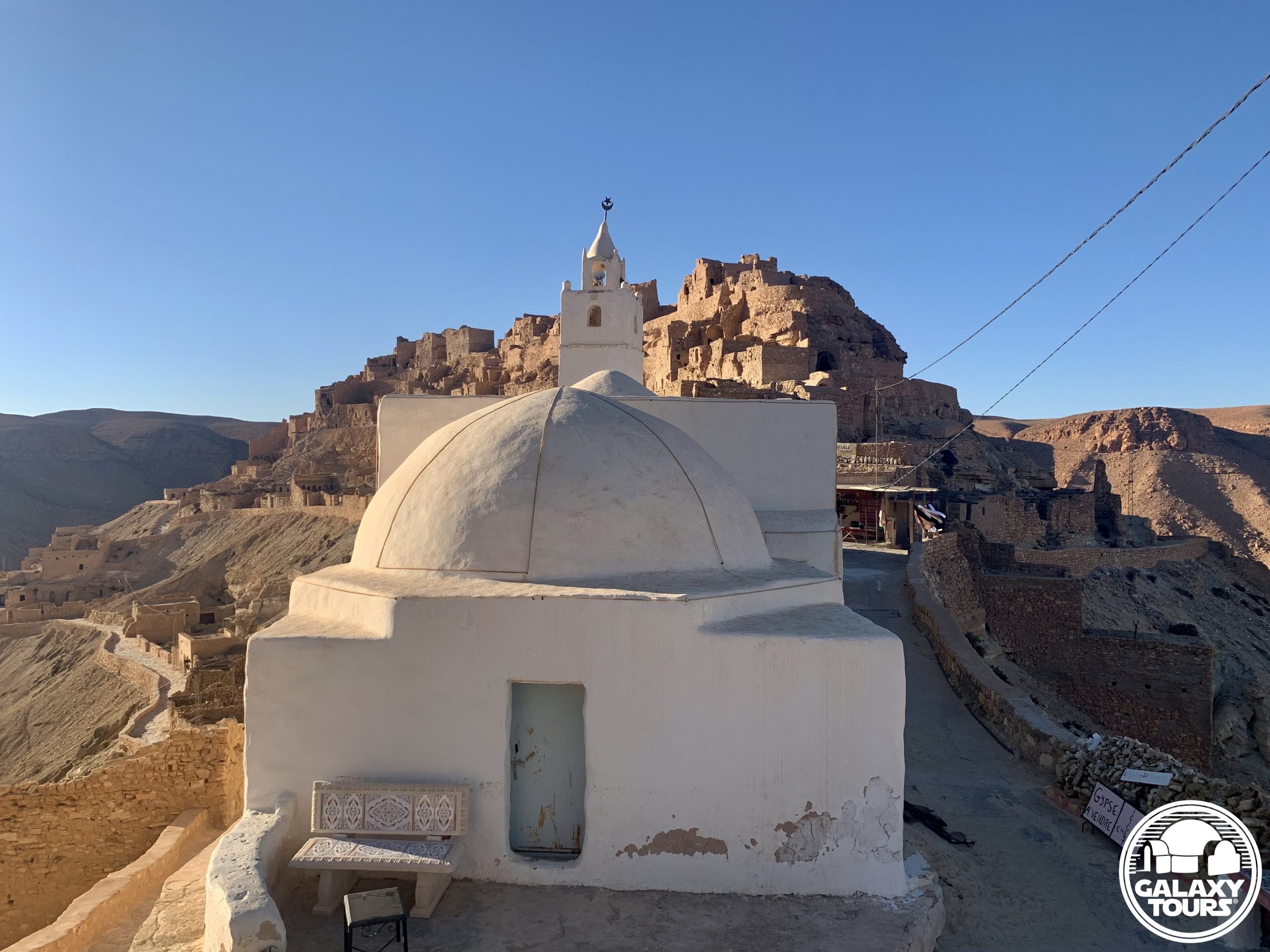
Seeking refuge from the dominate Arab Hilalian tribes, the Zenata tribe erected in the late 12th century CE the ancient mountain village as a defensive kala’a (Arabic: “citadel” or “fortress”), digging multiple layers of fortified subterranean (troglodyte) structures into the sloping strata (limestone, clay, marl, and dolomite) of an isolated curved peak (ca. 830 meters long) that extends from the northwest side of Jebel Charenn (elevation: 644 meters), the second tallest mountain range in the Tataouine region. Family-specific ghorfa chambers, forming a cliffside ksar complex for crops storage, represent the oldest fortifications at Kala’a Chenini. An excavated inscription dates one of the ghorfas to 590 AH (1193/1194 CE); the first ksar structures were certainly built years/decades earlier. Although the fortified dwellings at Kala’a Chenini have not been inhabited for centuries, some of the ancient ghorfas continue to be used as grain storage depots by Zenata families.
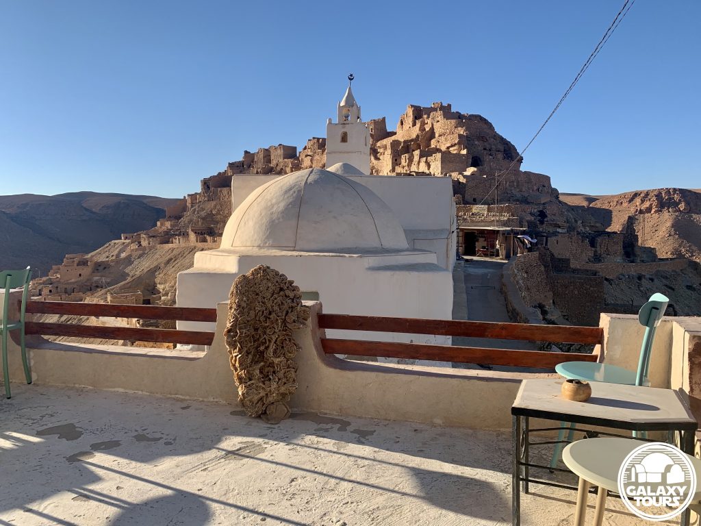
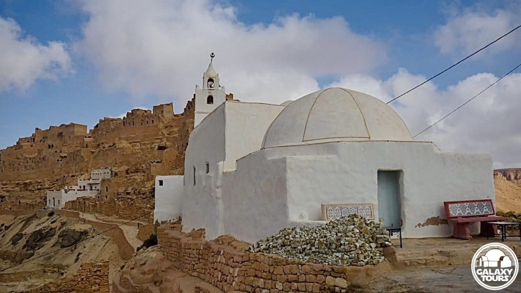
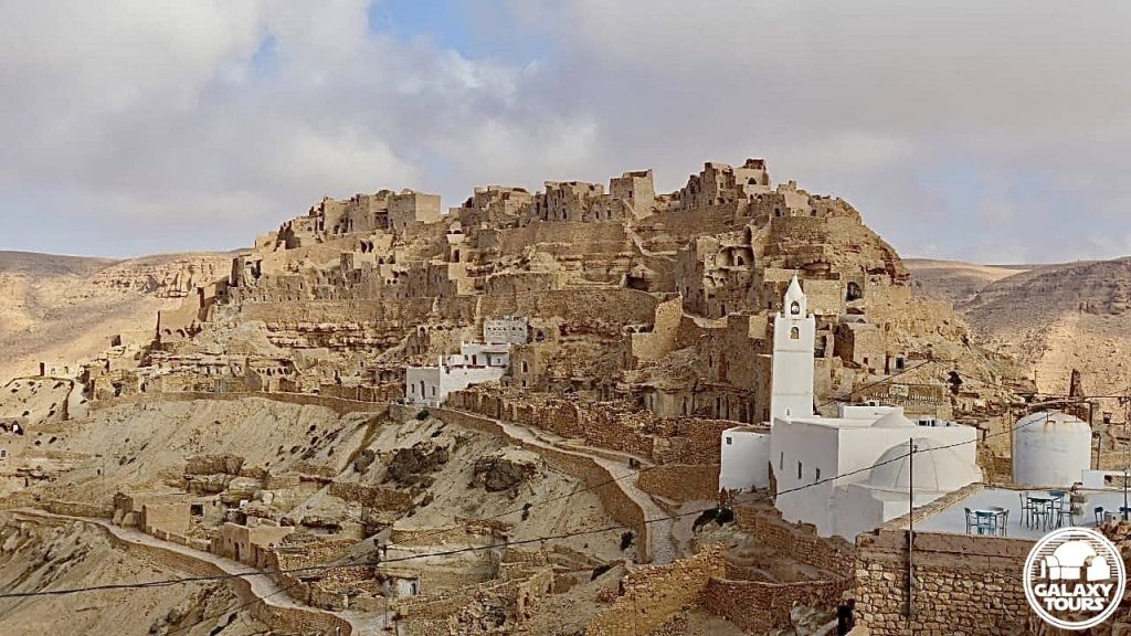
Kala’a Chenini is one of the most popular sites on the tourism circuit in southern Tunisia. Al-Farajeen Mosque, a compact whitewashed structure placed prominently in the approximate center of the curved Kala’a Chenini peak, functions as the distantly visible landmark for the ancient mountain village. The steady mix of local and touristic activity at the two-storey Café Haute Chenini, situated just southeast of the mosque, injects a relaxed yet pulsating energy into the surrounding cliffside subterranean ruins. This unique atmosphere starkly contrasts the abandoned silence that prevails at Kala’a Guermessa, located roughly 8.5 km to the northwest.
SITE
Seeking refuge from the dominate Arab Hilalian tribes, the Zenata tribe erected in the late 12th century CE the ancient mountain village as a defensive kala’a (Arabic: “citadel” or “fortress”), digging multiple layers of fortified subterranean (troglodyte) structures into the sloping strata (limestone, clay, marl, and dolomite) of an isolated curved peak (ca. 830 meters long) that extends from the northwest side of Jebel Charenn (elevation: 644 meters), the second tallest mountain range in the Tataouine region. Family-specific ghorfa chambers, forming a cliffside ksar complex for crops storage, represent the oldest fortifications at Kala’a Chenini. An excavated inscription dates one of the ghorfas to 590 AH (1193/1194 CE); the first ksar structures were certainly built years/decades earlier. Although the fortified dwellings at Kala’a Chenini have not been inhabited for centuries, some of the ancient ghorfas continue to be used as grain storage depots by Zenata families.
Kala’a Chenini is one of the most popular sites on the tourism circuit in southern Tunisia. Al-Farajeen Mosque, a compact whitewashed structure placed prominently in the approximate center of the curved Kala’a Chenini peak, functions as the distantly visible landmark for the ancient mountain village. The steady mix of local and touristic activity at the two-storey Café Haute Chenini, situated just southeast of the mosque, injects a relaxed yet pulsating energy into the surrounding cliffside subterranean ruins. This unique atmosphere starkly contrasts the abandoned silence that prevails at Kala’a Guermessa, located roughly 8.5 km to the northwest.
IDENTIFICATION
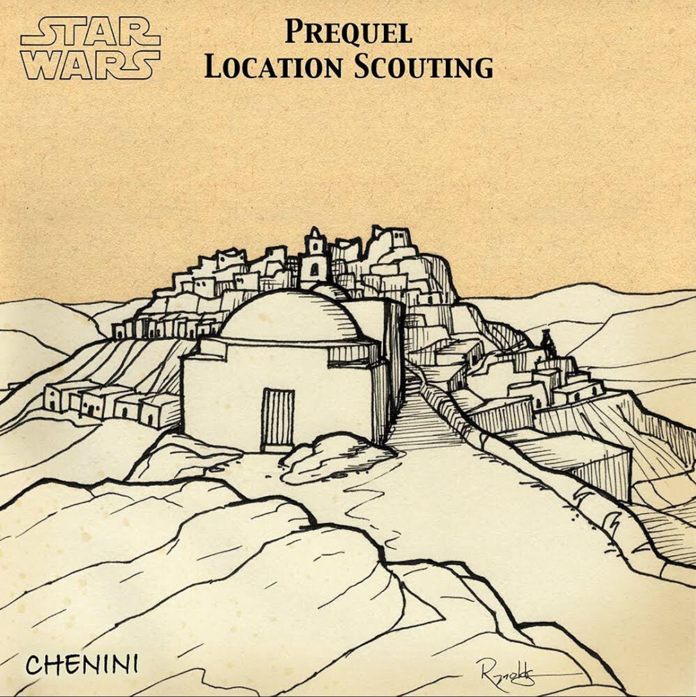
Archaeologist David West Reynolds, serving as the Star Wars locations specialist during the principal Episode I recce to Tunisia (early to mid-December 1995), documented the scouted sites with photographs and sketches. Reynolds released six recce photographs to Jon Bradley Snyder (author/editor) for publication in Star Wars Insider 29 (Spring 1996), leaving the remaining photos and all sketches concealed from public view. Although Reynolds assumed for decades that the unpublished recce visuals were locked away in Skywalker Ranch files as part of an Episode I “Tunisia reference kit” he had prepared for George Lucas (writer/director) and Rick McCallum (producer), a targeted search more than 25 years later through his personal archives uncovered a small cache of Episode I documents, to include his original recce sketch drawn at Kala’a Chenini in early December 1995.
Reynolds posted the “Prequel Location Scouting” sketch, clearly labeled as “Chenini,” on 24 April 2022 via Instagram (account: archaeology.of.star.wars). The sketch depicts the front and northeast side of Al-Farajeen Mosque folded into a picturesque display of background hilltop ruins. Reynolds stood approximately 15 meters southeast of the mosque entrance to frame the drawing. Replicating this exact positioning is no longer possible due to the post-1995 construction of a large elevated platform upon which rests the café, outdoor sitting areas, a cell tower, and a water storage tank.
The popularity of the site as a high-traffic tourist destination coupled with its remote location deep in the Tataouine region and the relatively steep ascent to access the ruins likely resulted in only minimal consideration (at best) to transform Kala’a Chenini into fictional Mos Espa. Despite no systematic effort to preserve the ruins, views of the mosque and surrounding ancient structures remain more or less unchanged since the 1995 recce.