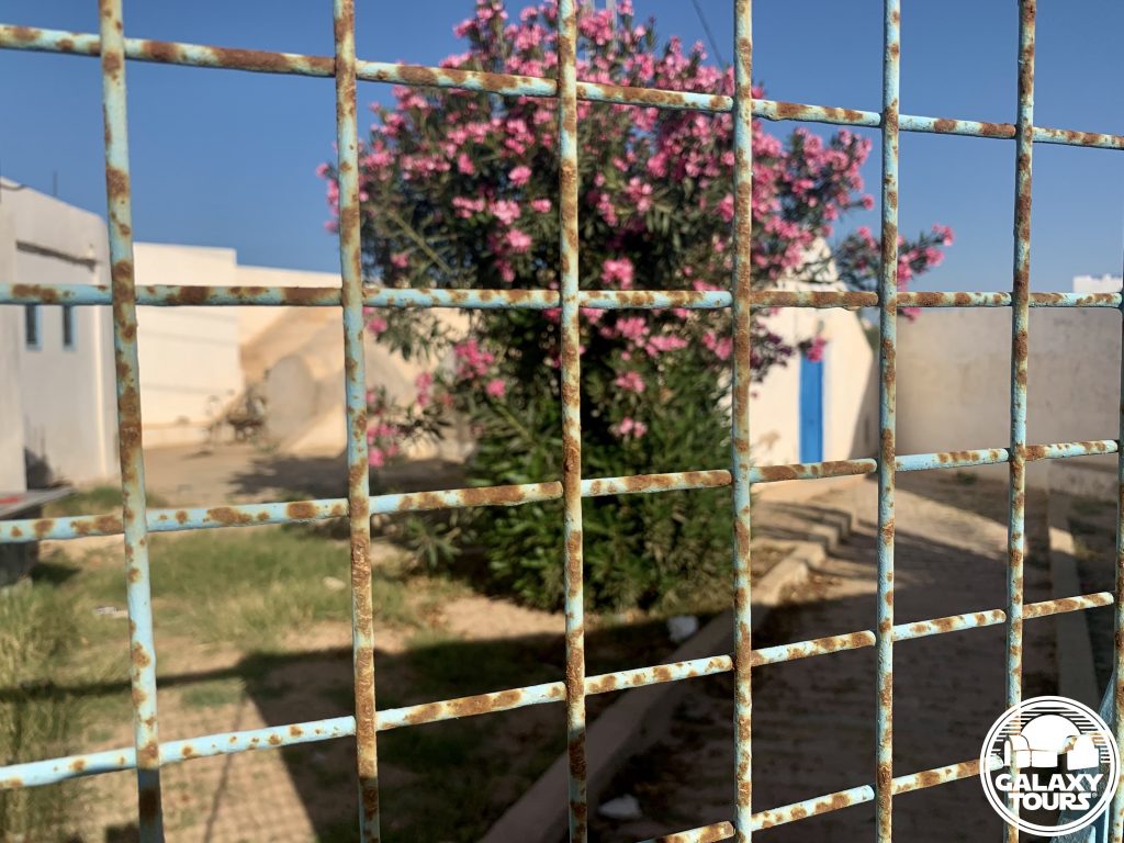
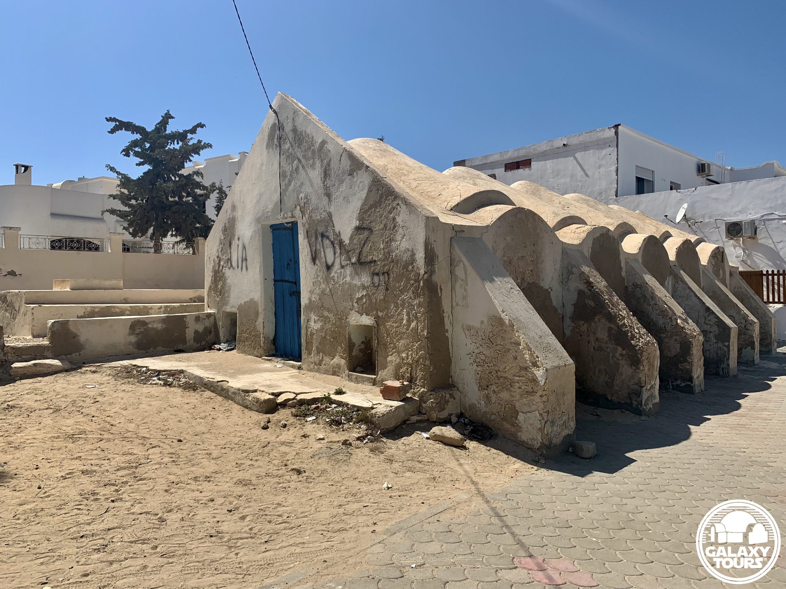
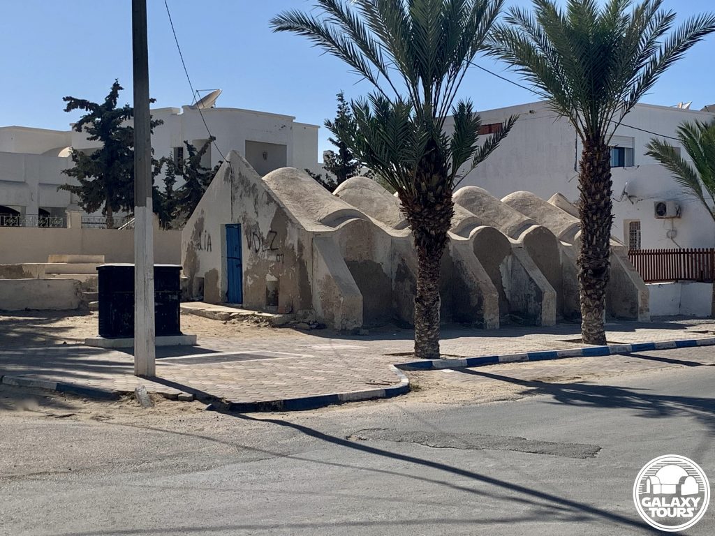
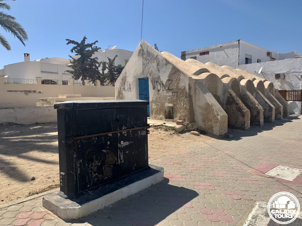
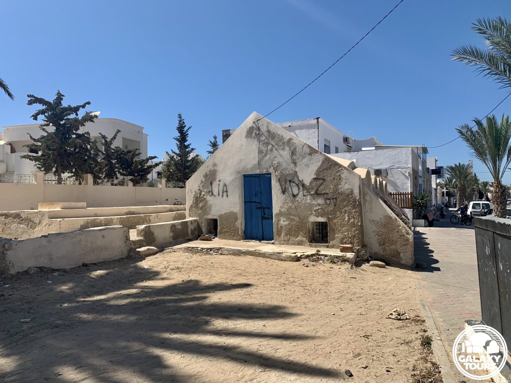
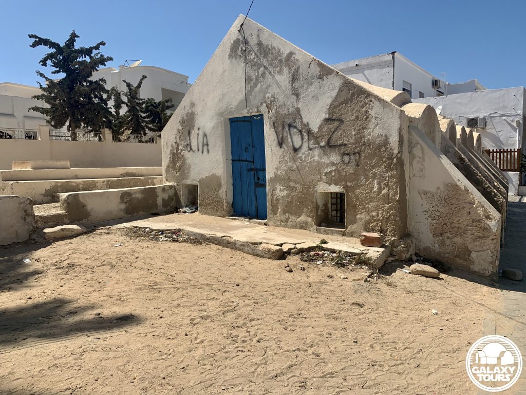
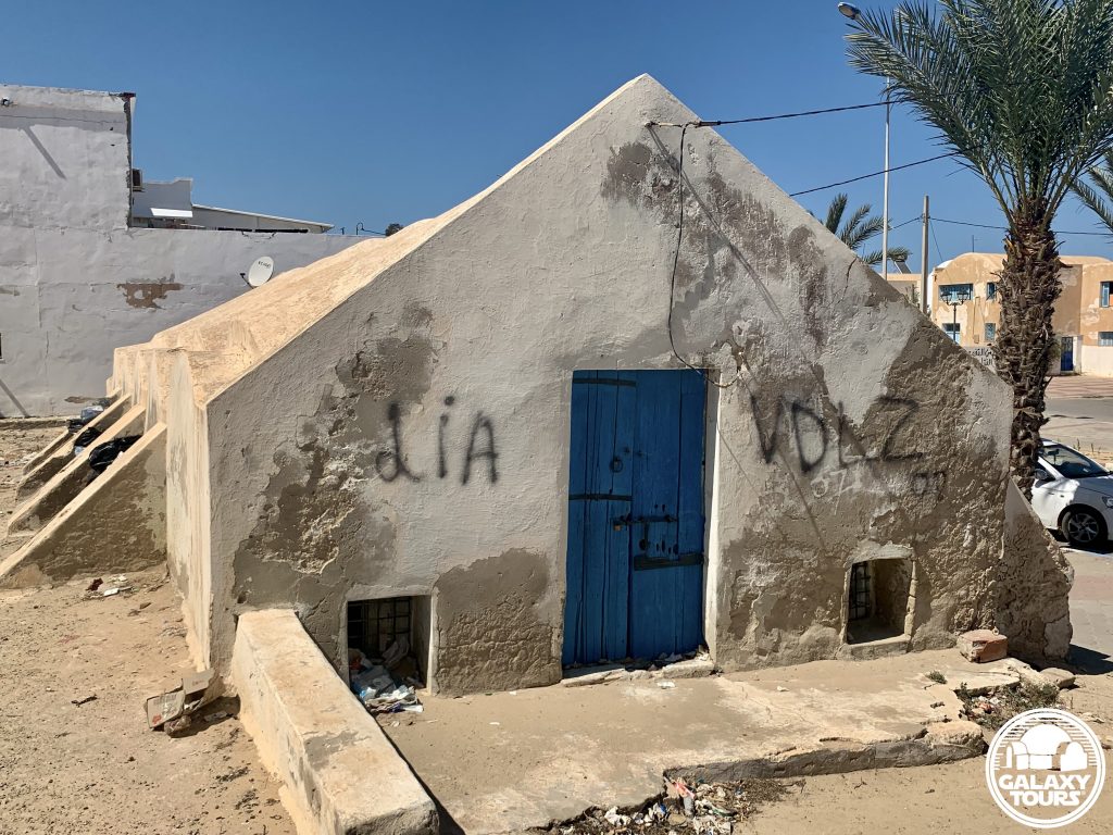
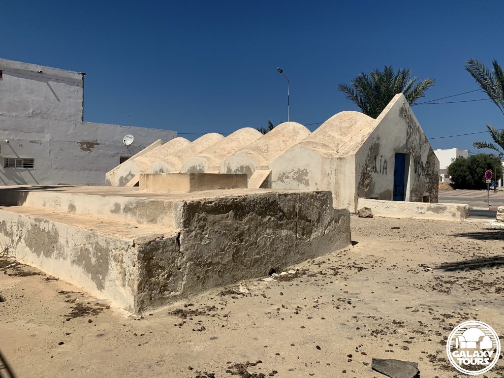
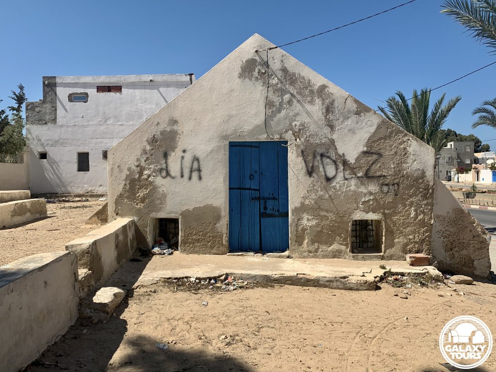
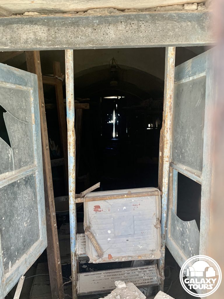
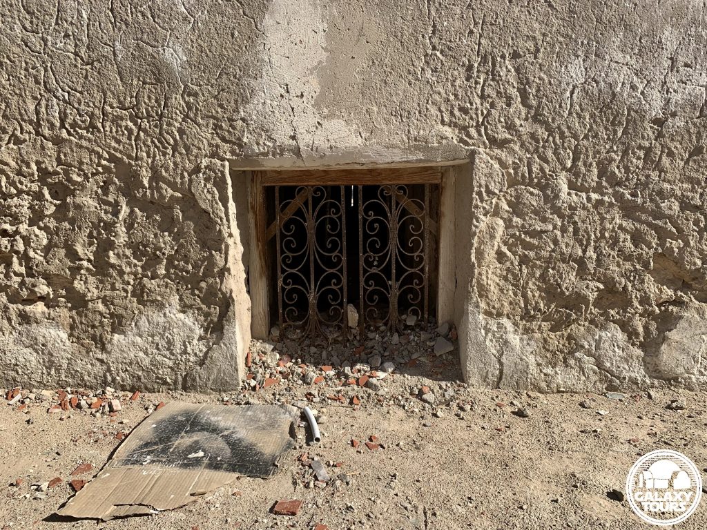
All recce sites img

Hanout el-Aouina

OVERVIEW

Site: Hanout el-Aouina workshop

GPS: 33.882018, 10.855994

Location: Houmt Souk, Médenine Governorate, Djerba island (Tunisia)

Description: Djerban wool weaving workshop (abandoned) (18th century CE)

Star Wars recce:
Episode IV Tunisia (November 1975)

Source: Original recce photograph

Star Wars scouted set concept:
Mos Eisley | Cantina (exterior)

Star Wars connection discovery:
Galaxy Tours (13 May 2022)

Name: Built in the 18th century CE by the Seoud family, the name Hanout el-Aouina in Tunisian Arabic means “the plum workshop,” suggesting the presence of a prominent plum tree in the immediate vicinity in former times.

Limited space: Situated in a compact area along the busy Avenue Habib Bourguiba near the Houmt Souk city center, securing adequate production space at Hanout el-Aouina would have been highly problematic, suggesting that likely only minimal consideration was given to transform the workshop into the Cantina.

Houmt Souk: Although unconfirmed, several unidentified recce photos from John Barry’s collection might possibly conclude that the Episode IV recce team also scouted various market streets inside the Houmt Souk city center in the general vicinity of Hanout el-Aouina.
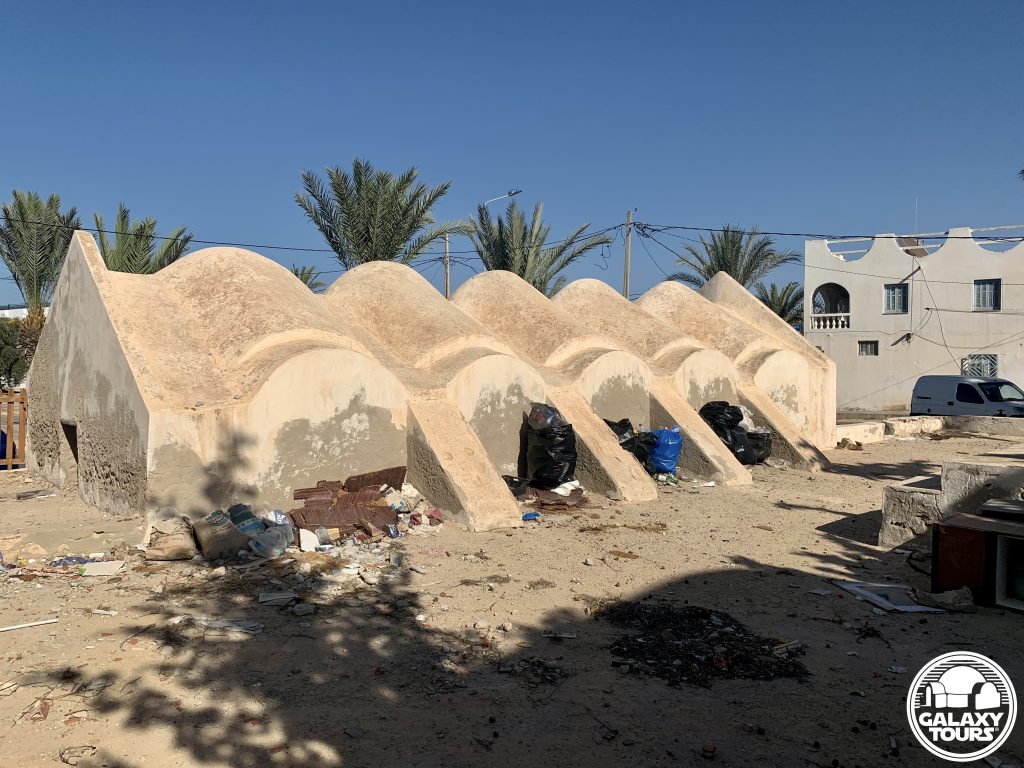
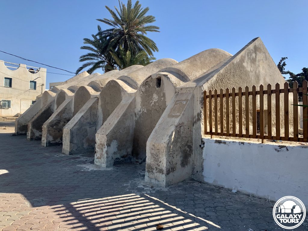
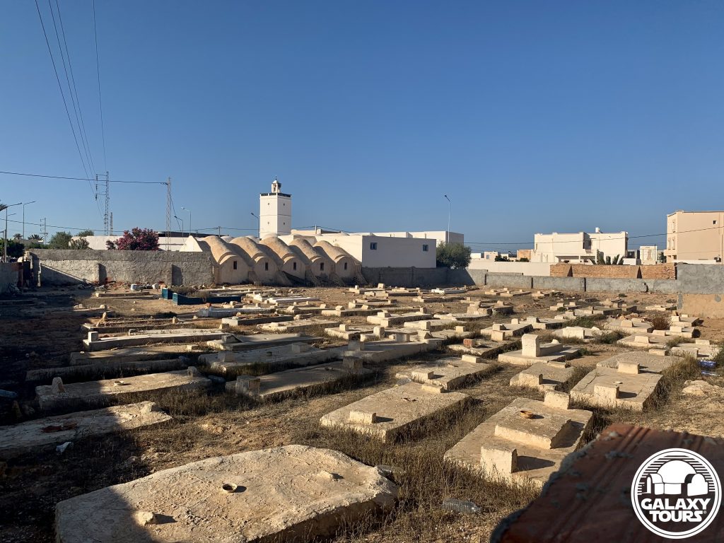
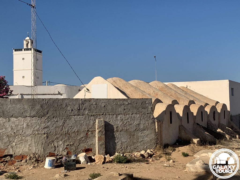
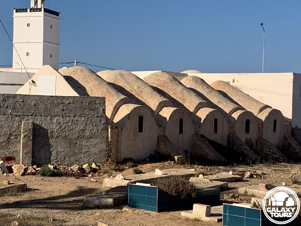
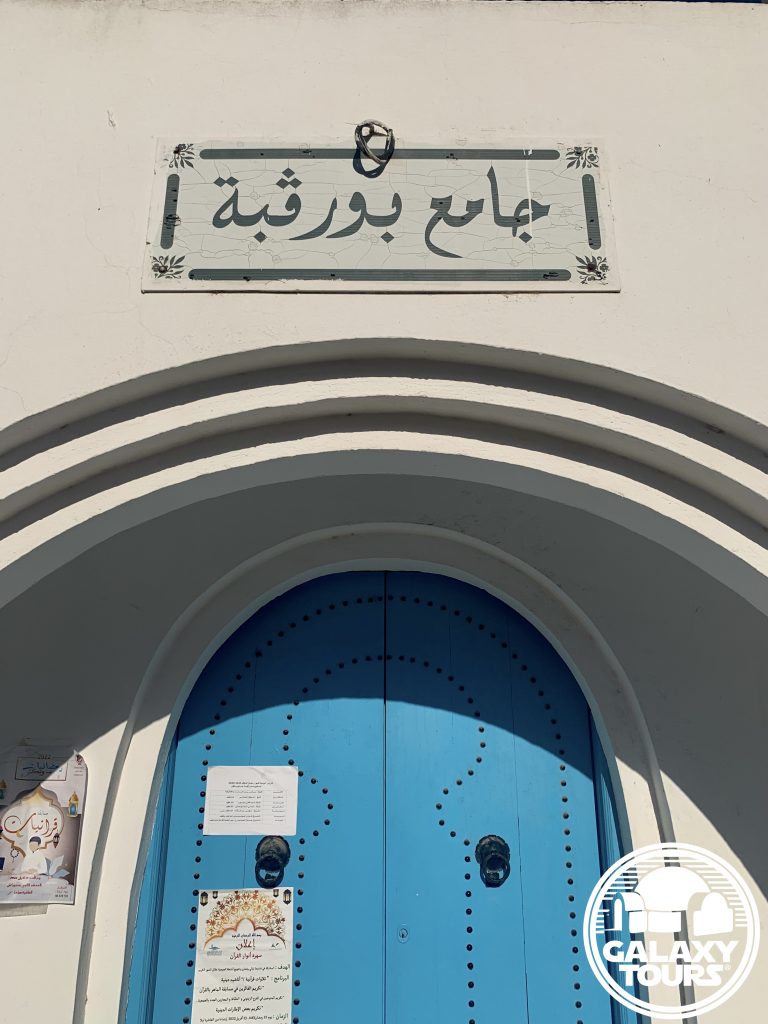
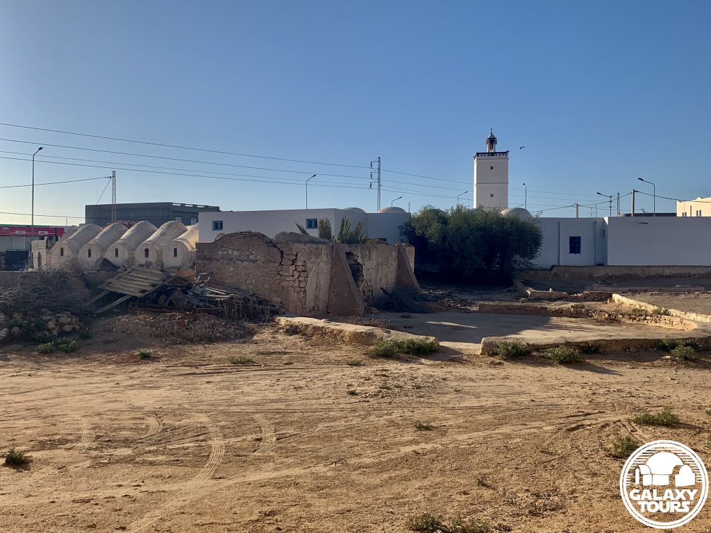
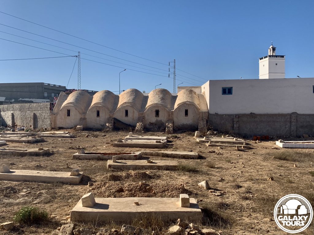
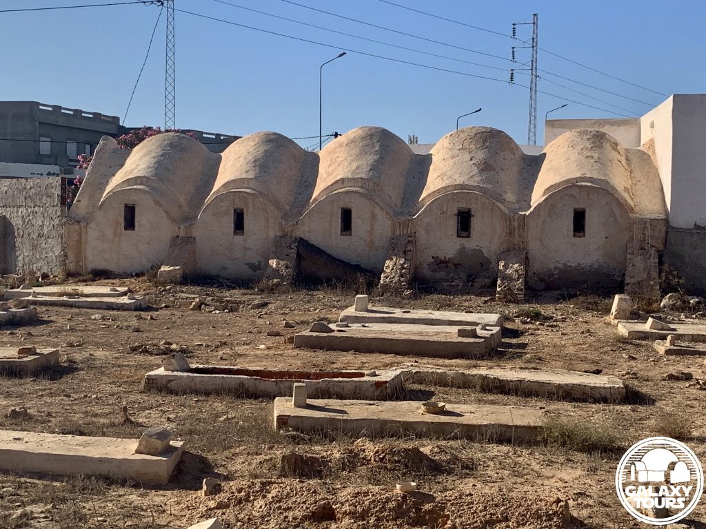
Accessibility: Very easy; city location; paved roads; street parking (33.882034, 10.856110) in close proximity to the site along C117 (main north-south access road in center Djerba); interior not accessible.

LOCATION

Houmt Souk (Arabic: “market neighborhood”), the Djerban capital, is located in the northwest sector of the island approximately 7.5 km east of Djerba-Zarzis Airport. Historically tethered to a Roman settlement called Gerba (alternately: Griba), Houmt Souk was founded as the island’s commercial market and remains Djerba’s lively commercial hub. At the city center is the souk with two qaysarriya (roofed bazaars) reserved for the most expensive goods and several key historical landmarks, to include Sidi Brahim Jomni Mosque, Al-Ghorba Mosque, the Mosque of the Turks, and the Mausoleum of Sidi Abdelkader, which couples as the office for the Association pour la Sauvegarde de l’Ile de Djerba (ASSIDJE). The city is divided into four districts: Taourit and Essouani in the north; Boumellel and Ejjouamaâ in the south.

Borj El Kebir (alternately: Borj El Ghazi Mustapha), the coastal Houmt Souk fort constructed in 1289 by Roger de Lauria (Aragonese king of Sicily), is linked to Ottoman naval dominance at the Battle of Djerba. In a matter of hours on 11 May 1560, the Ottoman admiral Piyale Pasha handed a crushing defeat to a Spanish Armada coalition positioned along the northern Djerban coastline. A significant grouping of Spaniards (accounts range from 500 to 5,000 sailors) retreated to Borj El Kebir and were reportedly massacred inside the fort. The Ottomans reportedly erected a pyramid of Spanish skulls at the fort to commemorate the victory. The skulls stood in place until the governing Turkish Bey, seeking to appease European diplomats, buried the mound in 1848.

SITE

The Hanout el-Aouina workshop with a small west-side adjoining courtyard is located less than 1 km northwest of the city center souk along the busy Avenue Habib Bourguiba (part of the C117 access road) in northern Houmt Souk. Built in the 18th century CE by the Seoud family, the name Hanout el-Aouina in Tunisian Arabic means “the plum workshop,” suggesting the presence of a prominent plum tree in the immediate vicinity at the time of construction. The Seoud family owned and operated the wool weaving workshop up until at least the late 20th century CE. The historical value of the now-abandoned workshop is easy to overlook amidst the surrounding modern apartments, shops, restaurants, and administrative buildings.

Expertise in wool weaving as a defining Djerban handicraft dates back to the Middle Ages. Traditional wool weaving workshops—whether stand-alone or connected to menzel and/or mosque complexes—are numerous on the island. The unique Djerban weaving workshop design typically consists of (1) matching front and rear pentagon-shaped facades with parallel vertical walls, (2) one entrance access (front facade), (3) a vaulted concave roof often lined with five ghorfa-like vaults on each side, and (4) five external buttresses paired with window openings on each side wall. The architectural composition of Hanout el-Aouina incorporates all elements of this typical Djerban design.

IDENTIFICATION

John Barry (production designer) used Kodak Tri-X panchromatic photographs and hand-drawn sketches to document the various locations scouted during the principal Episode IV pre-production recce to Tunisia in mid-November 1975. Over 30 negatives from Barry’s collection of recce photos have been released via official publications or Star Wars community online platforms. No names or specific identifications are associated with any of the negatives.

Multi-faceted research confirms that one of Barry’s recce photos depicts the Hanout el-Aouina workshop from a vantage point close to Avenue Habib Bourguiba approximately 10 meters southeast of the building entrance. Visible in the recce photo is the workshop front facade, eastern side wall, west-side courtyard, and an assortment of wool materials placed outside in the entrance area, likely as part of the production process. (The outdoor activity exhibited in the photo confirms that the workshop was operational up through 1975).

The deliberate stop at Hanout el-Aouina mirrors the interest given to the Bouregba Mosque complex weaving workshop in Sedouikech during the same recce. Occupying only limited property area amidst neighboring structures and high-traffic roads, blocking off adequate production space at Hanout el-Aouina would have been highly problematic. This suggests that likely only minimal consideration was given to use the workshop as the Cantina filming location.

Hanout el-Aouina, the first Star Wars recce site identified in Houmt Souk, remains readily recognizable, more or less unchanged since 1975 with the minor exception of a raised cement platform along the front facade. Replicating the exact angle of the recce photo is obstructed by the post-1975 placement of a large utility panel in the direct area outside the workshop used by Barry to frame the photo. Although unconfirmed, several yet-to-be-identified recce photos from Barry’s collection might possibly conclude that the Episode IV recce team also scouted various market streets inside the Houmt Souk city center.

All recce sites img

Chebika

OVERVIEW

Site: Ancient Chebika

GPS: 34.321577, 7.938975

Location: Tozeur Governorate, southwest Tunisia

Description: Ruins (Roman era)

Star Wars recce:
Episode IV Tunisia (November 1975)

Source: Original recce sketch

Star Wars scouted set concept:
Mos Eisley spaceport | various elements

Star Wars connection confirmation:
Galaxy Tours (8 July 2021)

Key factors: Although scouted as a potential alternative to Ajim, Chebika was likely never considered a true viable option to represent Mos Eisley for several key reasons: (1) Chebika’s remote mountainous setting seemingly presented steep logistical challenges, (2) budget constraints rendered the task of dressing an entire ruins area with set decor as highly unrealistic, and (3) Ajim proved to be more practical, economical, and accessible for production.

Screenplay setting: The rugged mountainous landscape surrounding Chebika (unlike Ajim) matched the screenplay concept for a “bluff overlooking Mos Eisley spaceport,” initially introduced in the third draft (1 August 1975).

Accessibility: Very easy; highland terrain; paved roads; parking area (34.320475, 7.939072) directly at the site.

LOCATION

Modern Chebika (alternately: Sebikha, Shabikah, As-Sabikah) is a sparsely populated mountain oasis village located in the Tozeur Governorate directly along the P16 highway approximately 53 km northwest of Tozeur city, the provincial capital. The modern village, engulfed by a large palmeraie to the east, was established in the aftermath of intense flooding in 1969 caused by 22 days of torrential rainfall throughout southern Tunisia. The catastrophic weather event, which reportedly killed more than 500 people, overflowed wadis in the region, forcing extensive property damage. Many settlements were left abandoned, to include ancient Chebika.

SITE

Fortified as the Roman outpost Ad Speculum (Latin: “from the mirror”), ancient Chebika, perched on a rock platform at the foot of Jebel el-Negueb less than 500 meters northeast of the modern village, was utilized as a mountain stronghold in the arid Djerid region from which to send signals by mirror to track caravans traveling to/from Tozeur. In the post-Roman era, the settlement was converted into an Amazigh mountain refuge alternately known as Ksar el-Shams (Arabic: “castle of the sun”) due to its openly exposed position. Remains of narrow streets and brick and mud structures blend the ancient village into the surrounding jagged peaks on all sides (except to the south). A steep ravine filled with date palms injects contrasting greenery to the east/southeast.

The elevated position of ancient Chebika offers sweeping views of the Chott el-Gharsa salt flats, located some 20 km to the south. A marked trail, running along the tiered retaining wall built on the eastern perimeter of the site, leads to a small waterfall tucked inside the canyon to the northeast. The 40-minute walk to the waterfall following a spring-fed stream with several pools of clear blue water is a popular tourist attraction, especially during the winter months when the spring is most active. According to tradition, the spring was formed at the point where a wandering camel carrying the body of a marabout named Sidi Sultan came to a halt. Sidi Sultan Marabout, located near the ravine, enshrines the tomb of the Muslim holy man.

IDENTIFICATION

In his monumental work The Making of Star Wars: The Definitive Story Behind the Original Film (2007), J.W. Rinzler published several original concept sketches drawn by John Barry (production designer) from late 1975 to early 1976 in conjunction with the principal Episode IV pre-production recce to Tunisia in mid-November 1975. One of the sketches contains a detailed caption that clearly identifies Chebika as the illustrated location: “CHEBIKA – in mountains near TOZEUR. Alternative town to AJIM – near salt flat location.”

Barry likely relied on at least two vantage points—southeast and southwest of the ancient village—to draw the sketch. The distinctive multi-level mudbrick reinforcement wall located on the east edge of the Chebika ruins paired with identifiable elements of the buildings above the tiered wall are unmistakingly featured in the drawing. The mountains in the sketch seem to resemble a conflated perspective of real-world peaks situated both north and east of the ruins. Barry added landspeeders, villagers, rooftop small domes, and futuristic antennas to complete the fictional Tatooine cityscape, mirroring the unique Ibadi/Amazigh architecture ubiquitously present on Djerba island. Post-1975 tourism developments on the south side of the ruins (viewing platform, cafe, shops) restrict the ability to exactly match Barry’s original sketch position(s) at the site.

Barry’s identification of Chebika as an alternate to Ajim indicates that the site was under consideration as a possible location for the Episode IV Mos Eisley city center scenes involving the stormtrooper security checkpoint and cantina exterior. Several geographic factors bolstered the case for Chebika. For example, Chebika’s relative proximity to the three Episode IV film sites in the Tozeur GovernorateChott el-Djerid, Gour Beni Mzab, and Maguer Gorge—offered the possibility of centralizing almost all filming activity in the same general region. Moreover, the rugged mountainous landscape surrounding Chebika (unlike Ajim) matched the screenplay concept for a “bluff overlooking Mos Eisley spaceport,” initially introduced in the third draft (1 August 1975). Lastly, the compact size and post-1969 abandoned state of the Chebika ruins created the potential for enhanced flexibility to film both landscape-enriched wide shots and street-level close-ups. In the end, Chebika’s remote mountainous setting seemingly presented more logistical challenges than advantages and budget constraints rendered the option of dressing an entire ruins area with set decor as highly unrealistic. The decision to film Episode IV Mos Eisley scenes in Ajim (rather than Chebika) proved to be more practical and economical, shaped in part by Djerba’s position as the primary travel hub to/from southern Tunisia.

All recce sites img

Bouregba Mosque

OVERVIEW

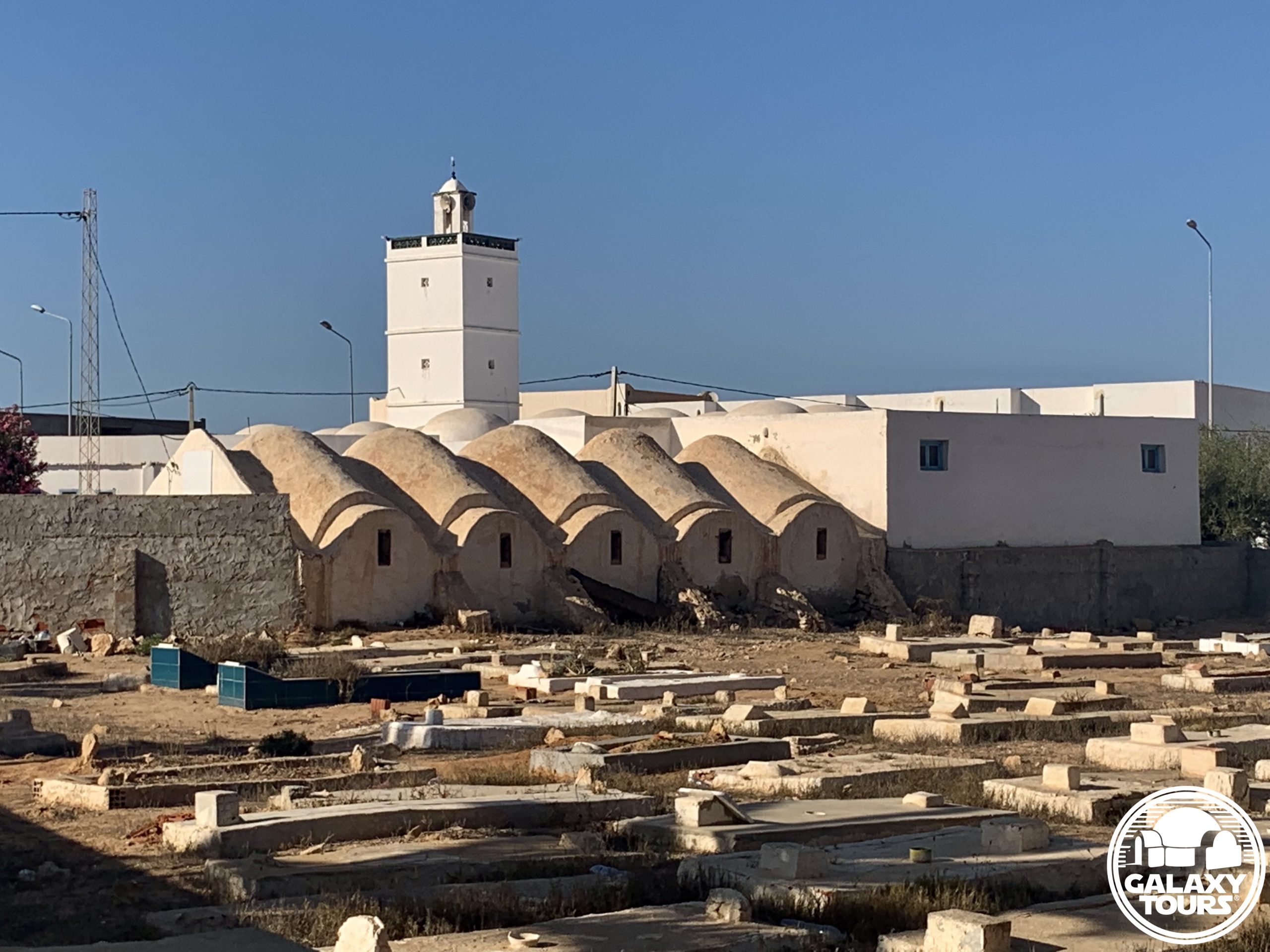
Site: Bouregba Mosque complex

GPS: 33.746187, 10.920452

Location: Sedouikech, Médenine Governorate, Djerba island (Tunisia)

Description: Ibadi complex (late 19th century CE)

Star Wars recce:
Episode IV Tunisia (November 1975)

Source: Original recce photograph

Star Wars scouted set concept:
Mos Eisley | Cantina (exterior)

Star Wars connection discovery:
Galaxy Tours (13 May 2022)

Drive-by: Bouregba Mosque complex includes a mosque, wool weaving workshop, and cemetery. The focal point of the quick drive-by recce visit was certainly the weaving workshop. The close proximity of the cemetery to the workshop likely designated the site unsuitable for filming from the start.

Accessibility: Very easy; flat terrain; paved roads; street parking (33.745817, 10.920226) in close proximity to the site along C117 (main north-south access road in center Djerba); stone wall surrounds the complex; not open to visitors.

LOCATION

Sedouikech (alternately: Seduiksh, Sadouikch, Sedouikch, Sedouikeche), located on a small plateau in the southeast sector of Djerba, is a town spanning approximately 13 km² in total area. Stemming from the medieval-era network of densely packed rural Djerban settlements, Sedouikech is defined by its menzel complexes, fish market, and wool weaving workshops. The town “center” is more or less divided in half by the C117 access road that connects Houmt Souk (roughly 16 km to the northwest) southward to the Roman-era viaduct, the only land route between Djerba and the Tunisian mainland. In conjunction with Ouirsighen, Guellala, and Ajim to the west, Sedouikech is distinguished as one of the few remaining locations on the island in which the Amazigh (Berber) language is spoken on a daily basis.

SITE

The Bouregba Mosque complex serves as the defining landmark in the Sedouikech center area. Resting on the highest point on the island, Ibadi authorities constructed the mosque and adjoining minaret in the late 19th century CE to serve both as a place of worship and a defensive vantage point for inland Djerba. The wool weaving workshop and cemetery were added to the Ibadi complex likely in the early 20th century CE.

Establishing weaving workshops next to mosques was a common practice for historic Djerba. The unique Djerban weaving workshop design typically consists of (1) matching front and rear pentagon-shaped facades with parallel vertical walls, (2) one entrance access (front facade), (3) a vaulted concave roof often lined with five ghorfa-like vaults on each side, and (4) five external buttresses paired with window openings on each side wall.

IDENTIFICATION

John Barry (production designer) used Kodak Tri-X panchromatic photographs and hand-drawn sketches to document the various locations scouted during the principal Episode IV pre-production recce to Tunisia in mid-November 1975. Over 30 negatives from Barry’s collection of recce photos have been released via official publications or Star Wars community online platforms. No names or specific identifications are associated with any of the negatives.

Multi-faceted research confirms that one of Barry’s recce photos depicts the Bouregba Mosque from the vantage point of the C117 access road overlooking the southwest corner of the complex. Barry appears to have taken the photo from inside a vehicle, suggesting only a quick pass-by stop at the complex. The focal point of the photo seems to be the weaving workshop situated between the mosque minaret and cemetery, mirroring the interest given to the Hanout el-Aouina workshop in Houmt Souk during the same recce. The close proximity of the cemetery to the weaving workshop likely designated Bouregba Mosque unsuitable for filming from the start.

As the easternmost Star Wars recce site on Djerba island, Bouregba Mosque represents the scouted location nearest to the lodging accommodations used by the Episode IV recce team in likely the Midoun Zone Touristique. Despite various structural changes/additions that have taken place at the complex since the 1975 recce, the Bouregba Mosque minaret, weaving workshop, and cemetery remain overtly recognizable, particularly when viewed over the southwest section of the post-1975 perimeter stone wall that surrounds the complex.