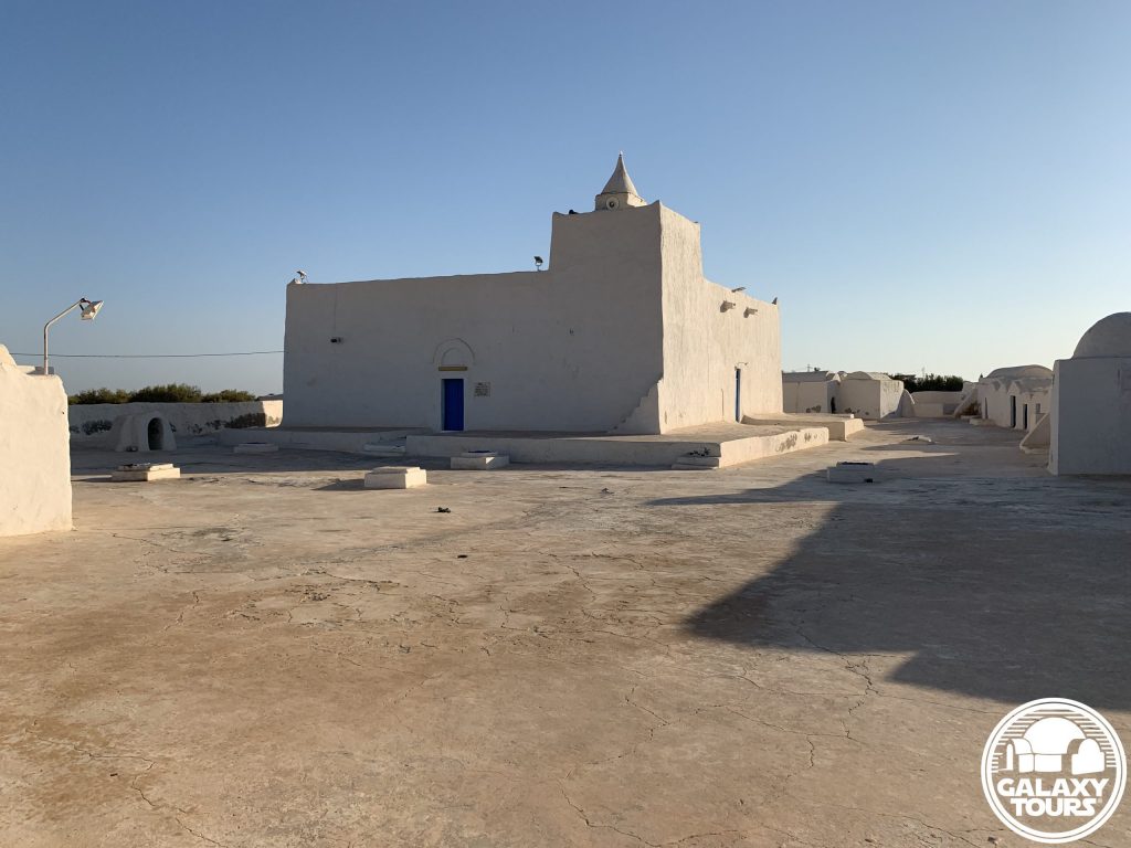
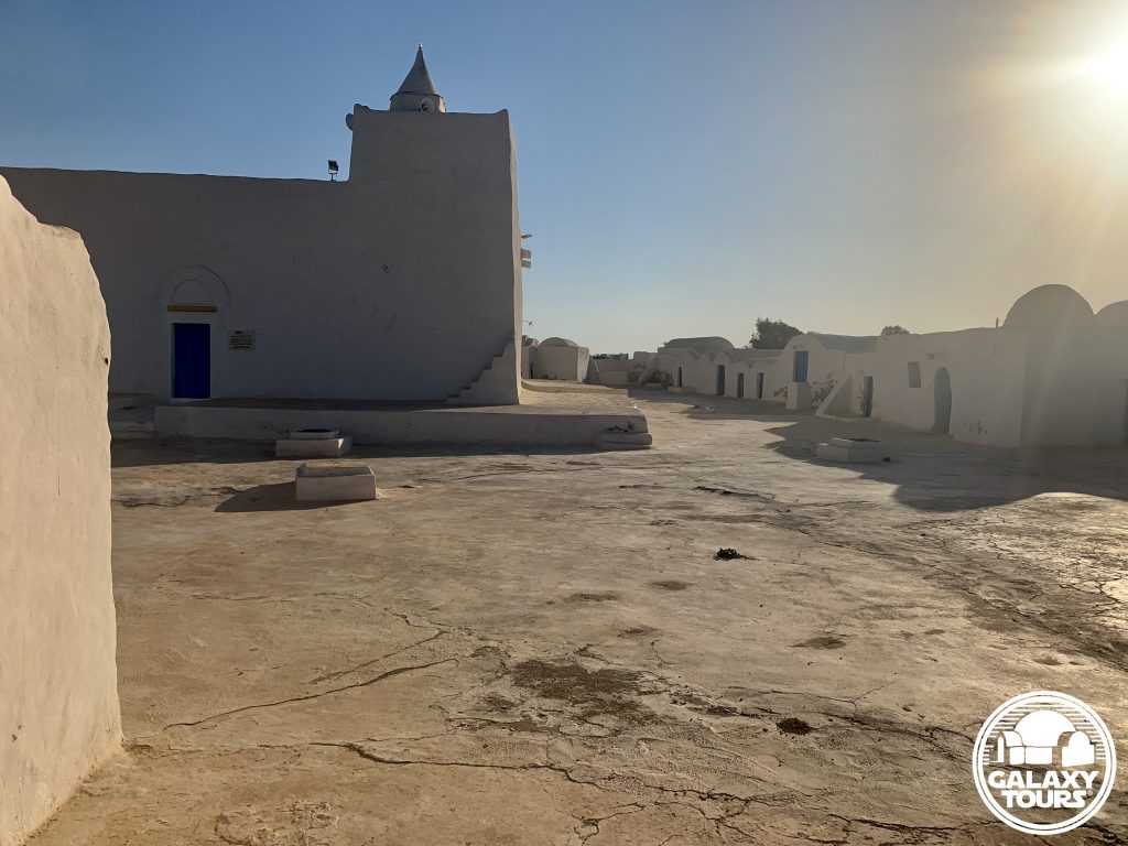
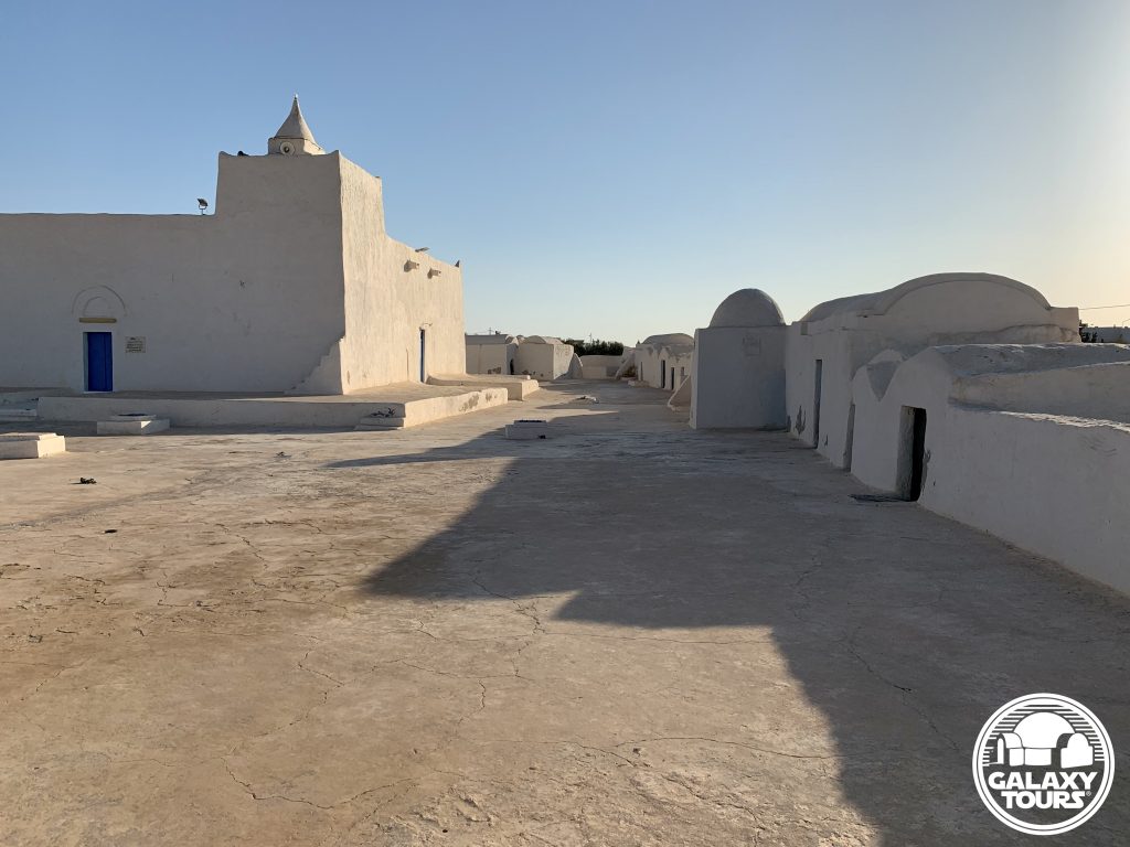
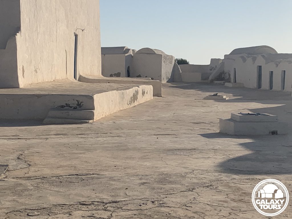
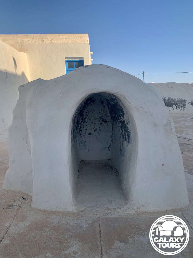
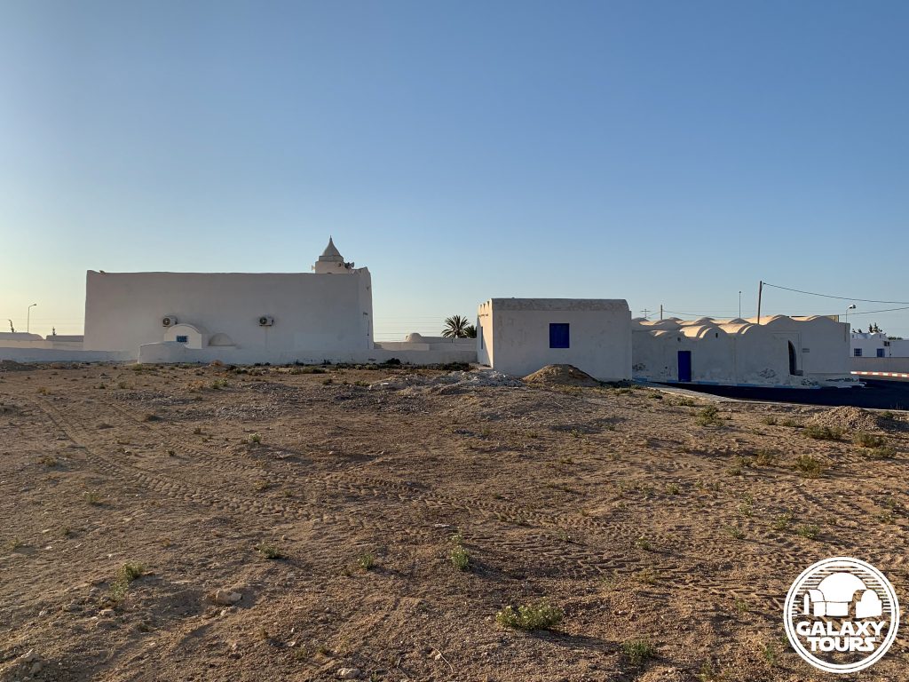
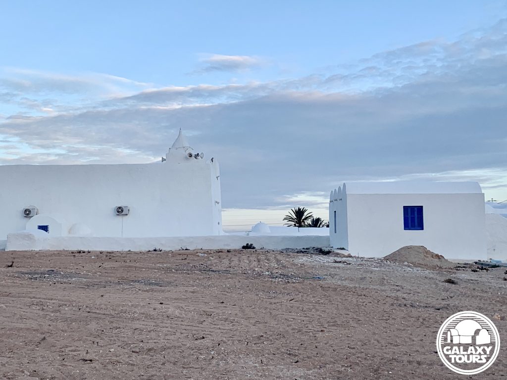
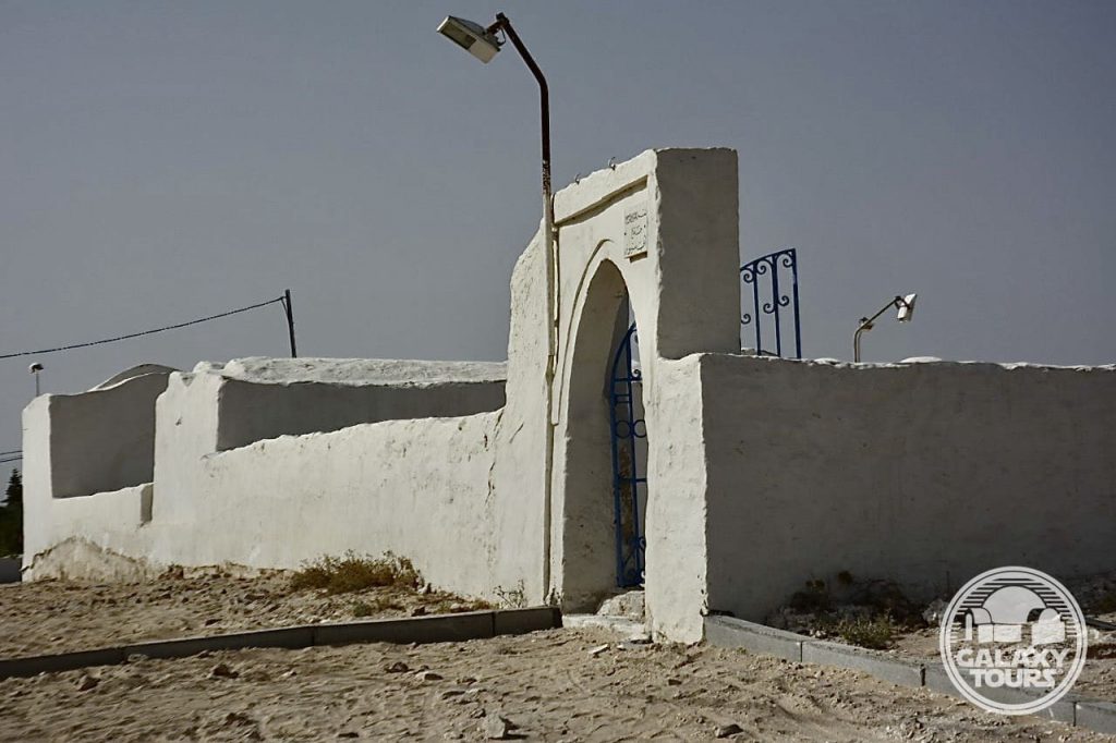
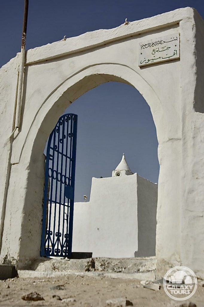
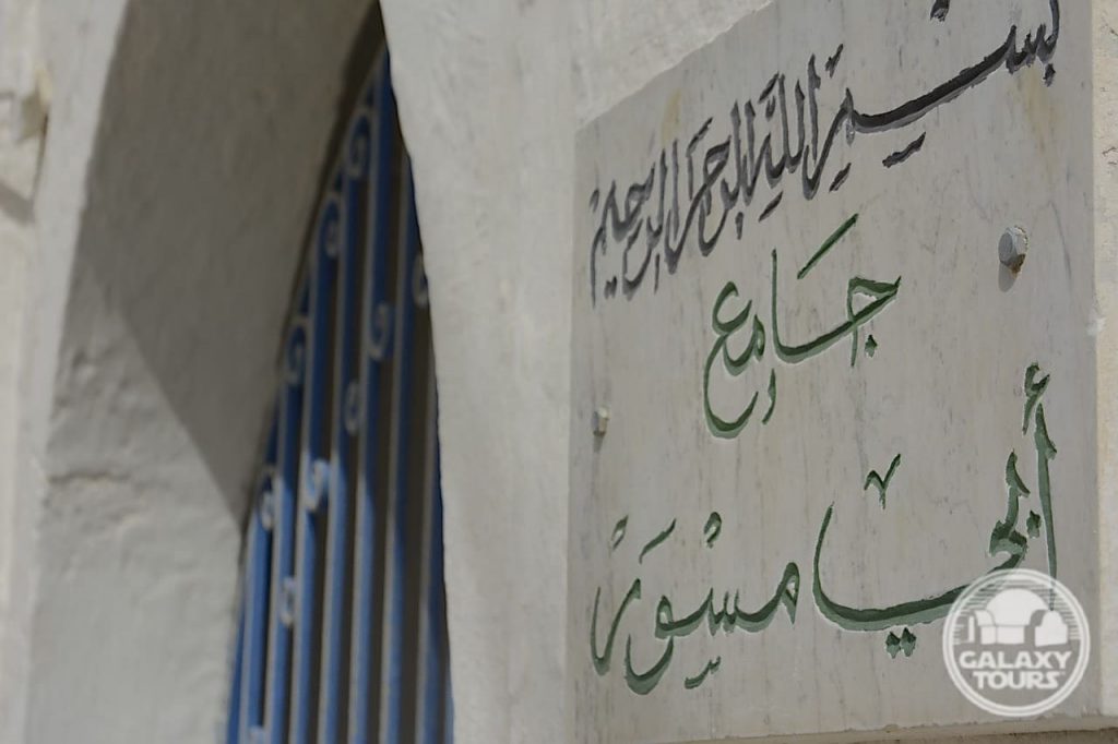
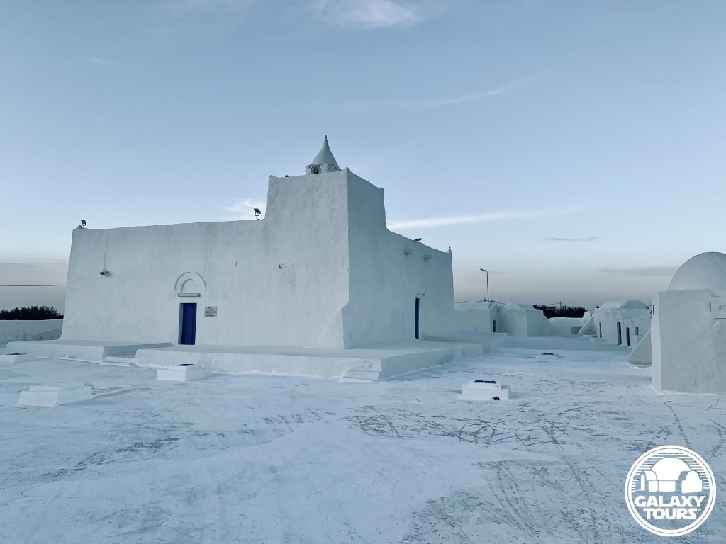
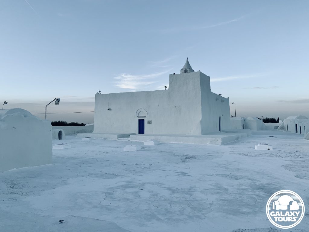
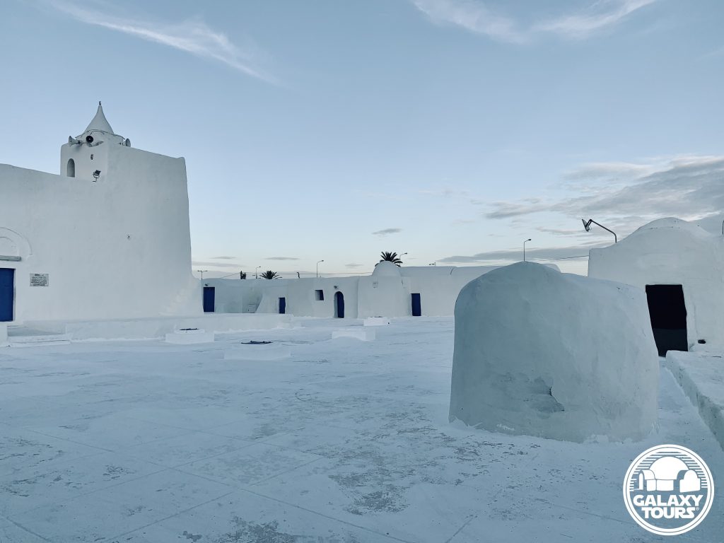
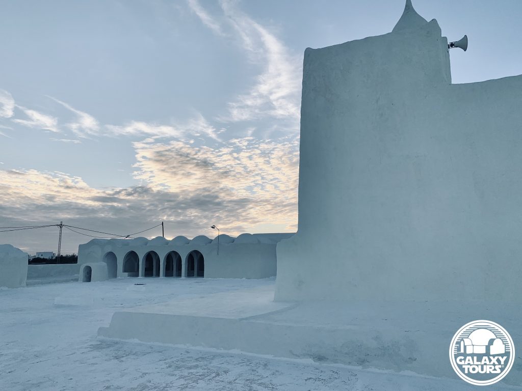
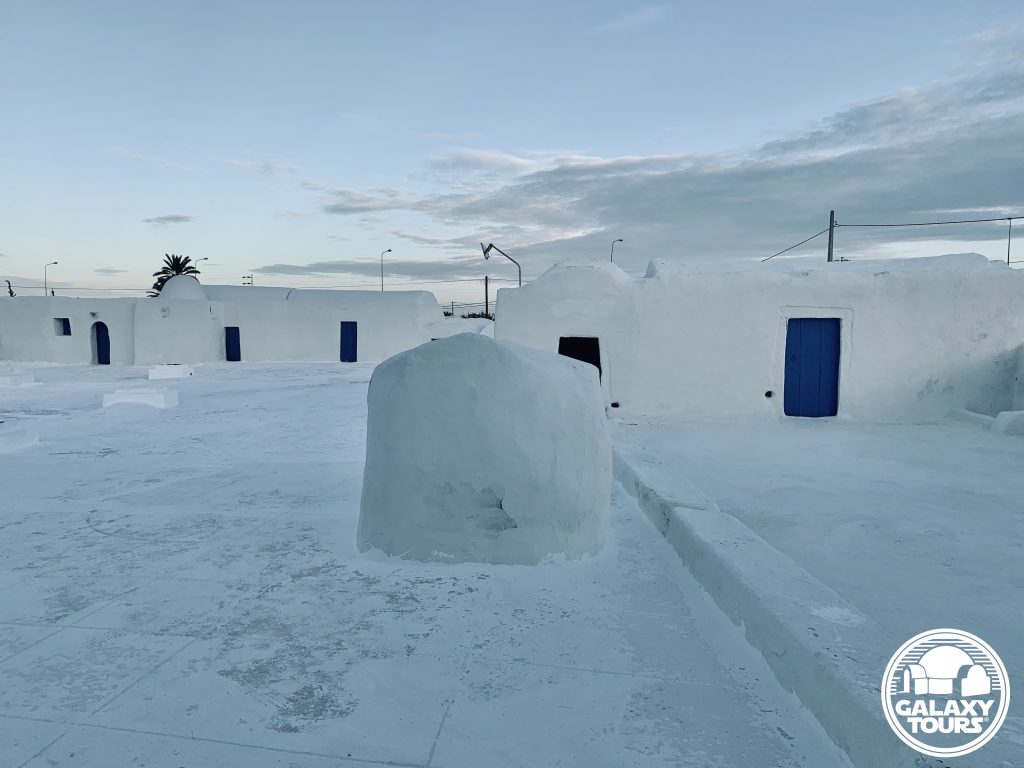
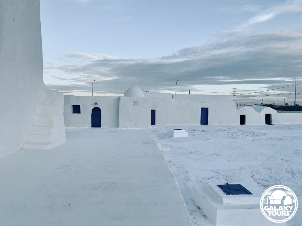
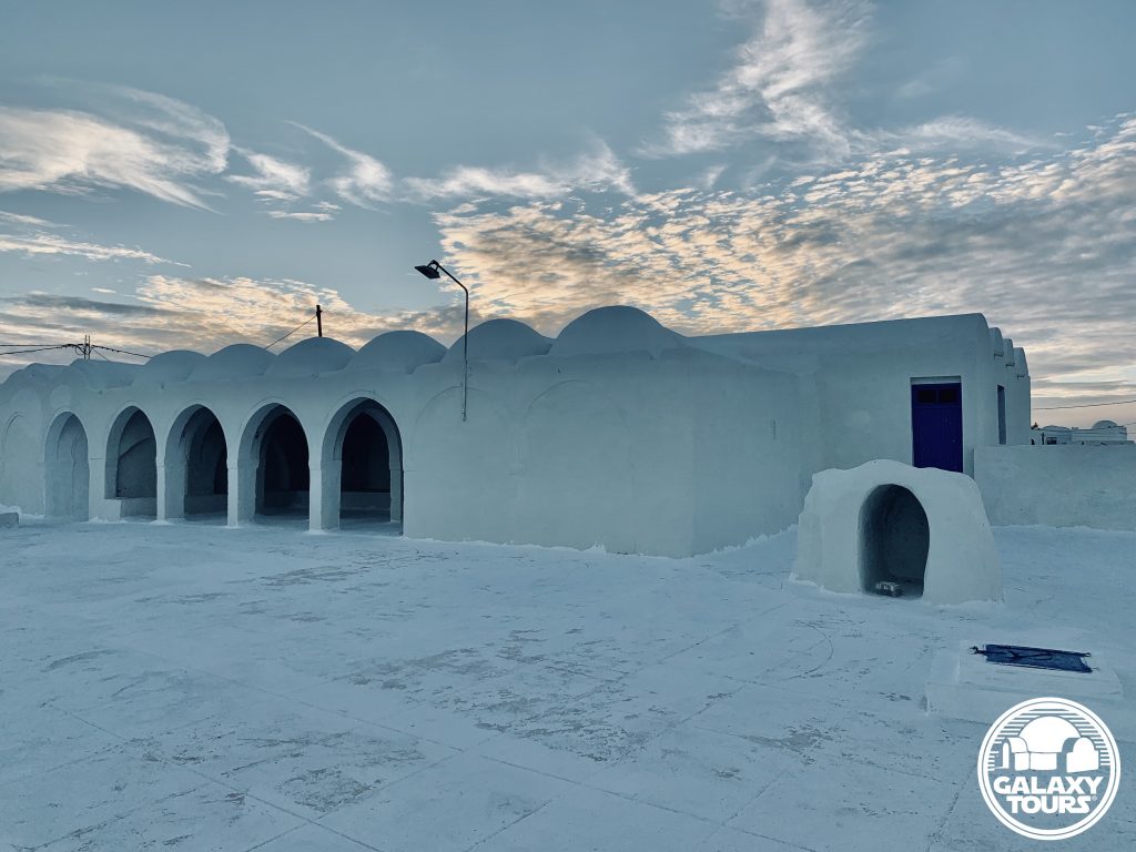
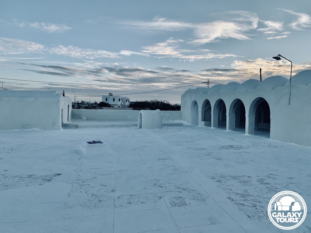
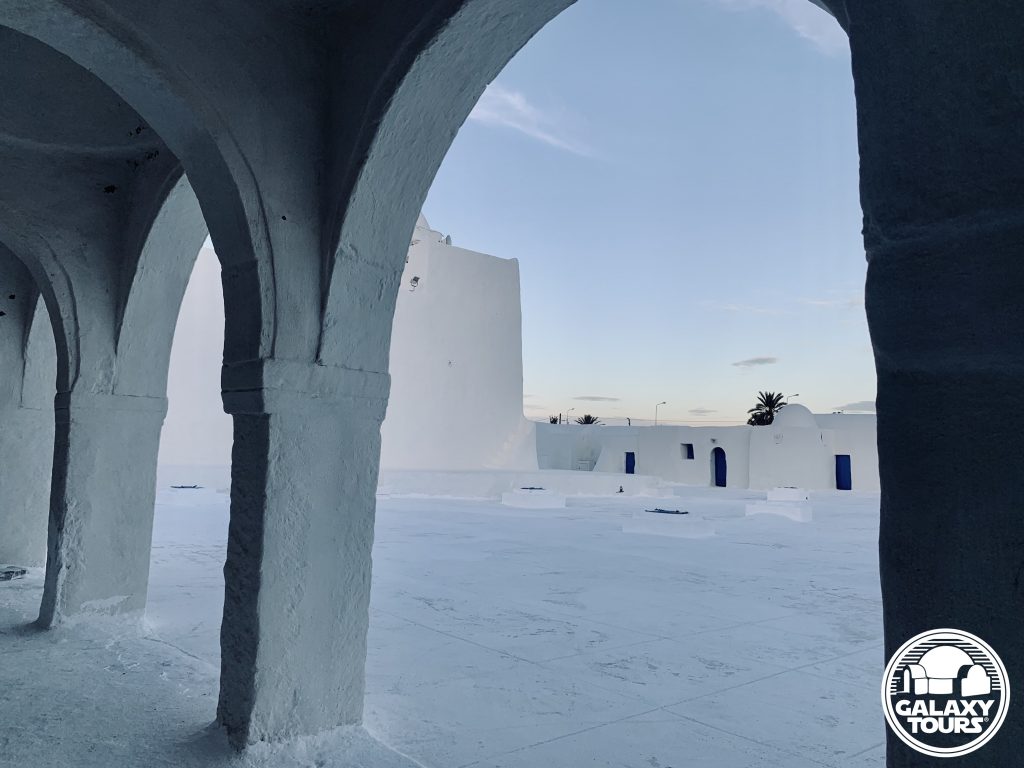
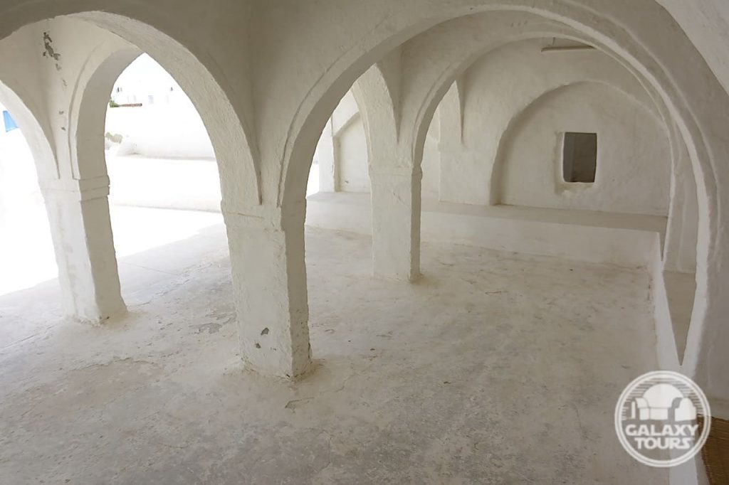
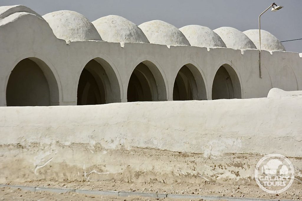
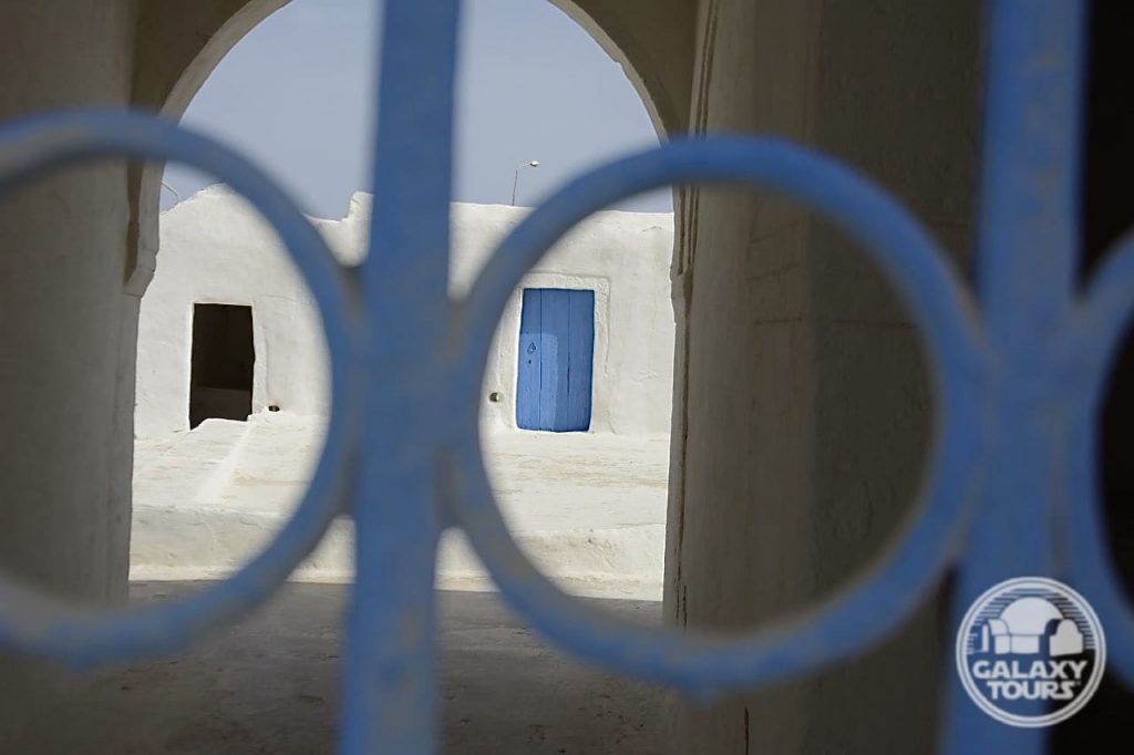
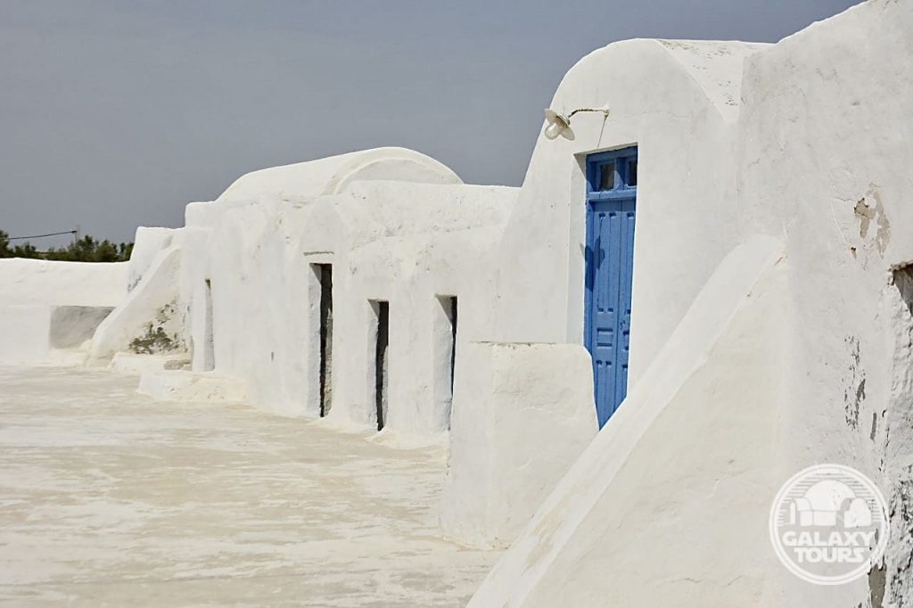
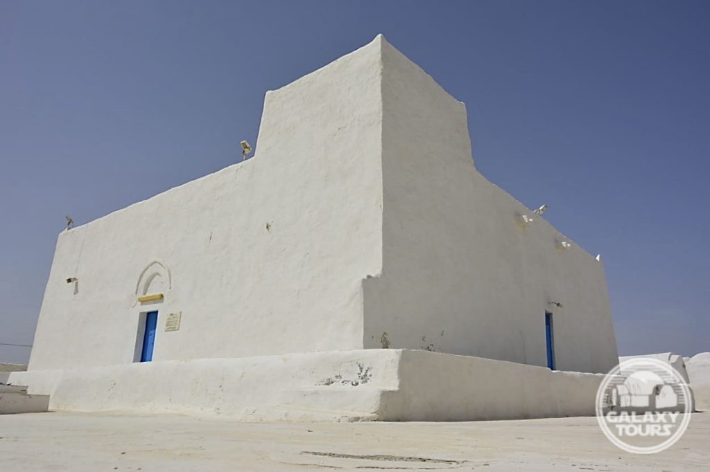
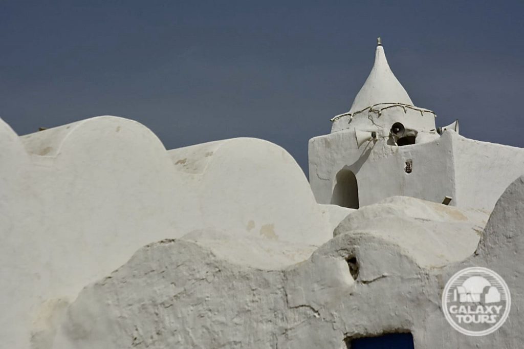
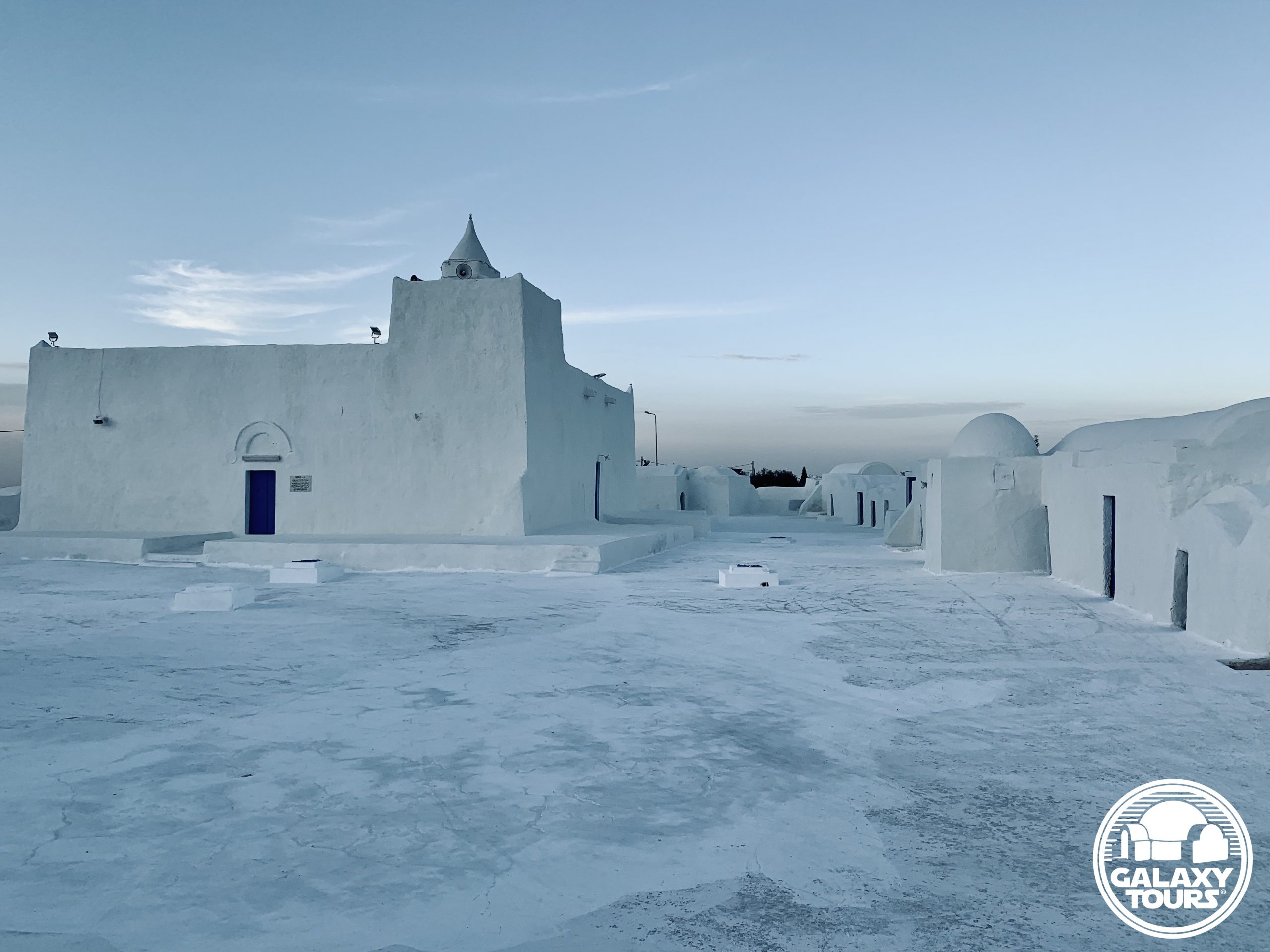
Hanout el-Aouina
OVERVIEW
Site: Hanout el-Aouina workshop
Location: Houmt Souk (Médenine Governorate) / Djerba island (Tunisia)
GPS: 33.882018, 10.855994
Description: Djerban wool weaving workshop (abandoned) (18th century CE)
Star Wars recce: Episode IV – Tunisia (1975)
Source: Original recce photograph
Potential Star Wars set concepts:
Anchorhead | Tosche Station (exterior)
Mos Eisley | Cantina (exterior)
Accessibility: Very easy; city location; paved roads; street parking (33.882034, 10.856110) in close proximity to the site along C117 (main north-south access road in center Djerba); interior not accessible.
LOCATION
Houmt Souk (Arabic: “market neighborhood”), the Djerban capital, is located in the northwest sector of the island approximately 7.5 km east of Djerba-Zarzis Airport. Historically tethered to a Roman settlement called Gerba (alternately: Griba), Houmt Souk was founded as the island’s commercial market and remains Djerba’s lively commercial hub. At the city center is the souk with two qaysarriya (roofed bazaars) reserved for the most expensive goods and several key historical landmarks, to include Sidi Brahim Jomni Mosque, Al-Ghorba Mosque, the Mosque of the Turks, and the Mausoleum of Sidi Abdelkader, which couples as the office for the Association pour la Sauvegarde de l’Ile de Djerba (ASSIDJE). The city is divided into four districts: Taourit and Essouani in the north; Boumellel and Ejjouamaâ in the south.
Borj El Kebir (alternately: Borj El Ghazi Mustapha), the coastal Houmt Souk fort constructed in 1289 by Roger de Lauria (Aragonese king of Sicily), is linked to Ottoman naval dominance at the Battle of Djerba. In a matter of hours on 11 May 1560, the Ottoman admiral Piyale Pasha handed a crushing defeat to a Spanish Armada coalition positioned along the northern Djerban coastline. A significant grouping of Spaniards (accounts range from 500 to 5,000 sailors) retreated to Borj El Kebir and were reportedly massacred inside the fort. The Ottomans reportedly erected a pyramid of Spanish skulls at the fort to commemorate the victory. The skulls stood in place until the governing Turkish Bey, seeking to appease European diplomats, buried the mound in 1848.
SITE
The Hanout el-Aouina workshop with a small west-side adjoining courtyard is located less than 1 km northwest of the city center souk along the busy Avenue Habib Bourguiba (part of the C117 access road) in northern Houmt Souk. Built in the 18th century CE by the Seoud family, the name Hanout el-Aouina in Tunisian Arabic means “the plum workshop,” suggesting the presence of a prominent plum tree in the immediate vicinity at the time of construction. The Seoud family owned and operated the wool weaving workshop up until at least the late 20th century CE. The historical value of the now-abandoned workshop is easy to overlook amidst the surrounding modern apartments, shops, restaurants, and administrative buildings.
Expertise in wool weaving as a defining Djerban handicraft dates back to the Middle Ages. Traditional wool weaving workshops—whether stand-alone or connected to menzel and/or mosque complexes—are numerous on the island. The unique Djerban weaving workshop design typically consists of (1) matching front and rear pentagon-shaped facades with parallel vertical walls, (2) one entrance access (front facade), (3) a vaulted concave roof often lined with five ghorfa-like vaults on each side, and (4) five external buttresses paired with window openings on each side wall. The architectural composition of Hanout el-Aouina incorporates all elements of this typical Djerban design.
IDENTIFICATION
John Barry (production designer) used Kodak Tri-X panchromatic photographs and hand-drawn sketches to document the various locations scouted during the principal Episode IV pre-production recce to Tunisia in mid-November 1975. Over 30 negatives from Barry’s collection of recce photos have been released via official publications or Star Wars community online platforms. No names or specific identifications are associated with any of the negatives.
Multi-faceted research confirms that one of Barry’s recce photos depicts the Hanout el-Aouina workshop from a vantage point close to Avenue Habib Bourguiba approximately 10 meters southeast of the building entrance. Visible in the recce photo is the workshop front facade, eastern side wall, west-side courtyard, and an assortment of wool materials placed outside in the entrance area, likely as part of the production process. (The outdoor activity exhibited in the photo confirms that the workshop was operational up through 1975). The deliberate stop at Hanout el-Aouina mirrors the interest given to the Bouregba Mosque complex weaving workshop in Sedouikech during the same recce.
Hanout el-Aouina, the first Star Wars recce site identified in Houmt Souk, remains readily recognizable, more or less unchanged since 1975 with the minor exception of a raised cement platform along the front facade. Replicating the exact angle of the recce photo is obstructed by the post-1975 placement of a large utility panel in the direct area outside the workshop used by Barry to frame the photo. Although unconfirmed, several yet-to-be-identified recce photos from Barry’s collection might possibly conclude that the Episode IV recce team also scouted various market streets inside the Houmt Souk city center.

Bouregba Mosque
OVERVIEW
Site: Bouregba Mosque complex
Location: Sedouikech (Médenine Governorate) / Djerba island (Tunisia)
GPS: 33.746187, 10.920452
Description: Ibadi complex (late 19th century CE)
Star Wars recce: Episode IV – Tunisia (1975)
Source: Original recce photograph
Potential Star Wars set concepts:
Anchorhead | Tosche Station (exterior)
Mos Eisley | Cantina (exterior)
Accessibility: Very easy; flat terrain; paved roads; street parking (33.745817, 10.920226) in close proximity to the site along C117 (main north-south access road in center Djerba); stone wall surrounds the complex; not open to visitors.
LOCATION
Sedouikech (alternately: Seduiksh, Sadouikch, Sedouikch, Sedouikeche), located on a small plateau in the southeast sector of Djerba, is a town spanning approximately 13 km² in total area. Stemming from the medieval-era network of densely packed rural Djerban settlements, Sedouikech is defined by its menzel complexes, fish market, and wool weaving workshops. The town “center” is more or less divided in half by the C117 access road that connects Houmt Souk (roughly 16 km to the northwest) southward to the Roman-era viaduct, the only land route between Djerba and the Tunisian mainland. In conjunction with Ouirsighen, Guellala, and Ajim to the west, Sedouikech is distinguished as one of the few remaining locations on the island in which the Amazigh (Berber) language is spoken on a daily basis.
SITE
The Bouregba Mosque complex serves as the defining landmark in the Sedouikech center area. Resting on the highest point on the island, Ibadi authorities constructed the mosque and adjoining minaret in the late 19th century CE to serve both as a place of worship and a defensive vantage point for inland Djerba. The wool weaving workshop and cemetery were added to the Ibadi complex likely in the early 20th century CE.
Establishing weaving workshops next to mosques was a common practice for historic Djerba. The unique Djerban weaving workshop design typically consists of (1) matching front and rear pentagon-shaped facades with parallel vertical walls, (2) one entrance access (front facade), (3) a vaulted concave roof often lined with five ghorfa-like vaults on each side, and (4) five external buttresses paired with window openings on each side wall.
IDENTIFICATION
John Barry (production designer) used Kodak Tri-X panchromatic photographs and hand-drawn sketches to document the various locations scouted during the principal Episode IV pre-production recce to Tunisia in mid-November 1975. Over 30 negatives from Barry’s collection of recce photos have been released via official publications or Star Wars community online platforms. No names or specific identifications are associated with any of the negatives.
Multi-faceted research confirms that one of Barry’s recce photos depicts the Bouregba Mosque from the vantage point of the C117 access road overlooking the southwest corner of the complex. Barry appears to have taken the photo from inside a vehicle, suggesting only a pass-by stop at the complex. The focal point of the photo seems to be the weaving workshop situated between the mosque minaret and cemetery, mirroring the interest given to the Hanout el-Aouina workshop in Houmt Souk during the same recce.
As the easternmost Star Wars recce site on Djerba island, Bouregba Mosque represents the scouted location nearest to the lodging accommodations used by the Episode IV recce team in likely the Midoun Zone Touristique. Despite various structural changes/additions that have taken place at the complex since the 1975 recce, the Bouregba Mosque minaret, weaving workshop, and cemetery remain overtly recognizable, particularly when viewed over the southwest section of the post-1975 perimeter stone wall that surrounds the complex.

Abu Miswar Mosque
OVERVIEW
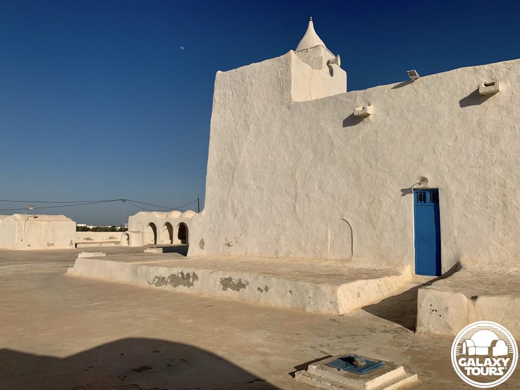
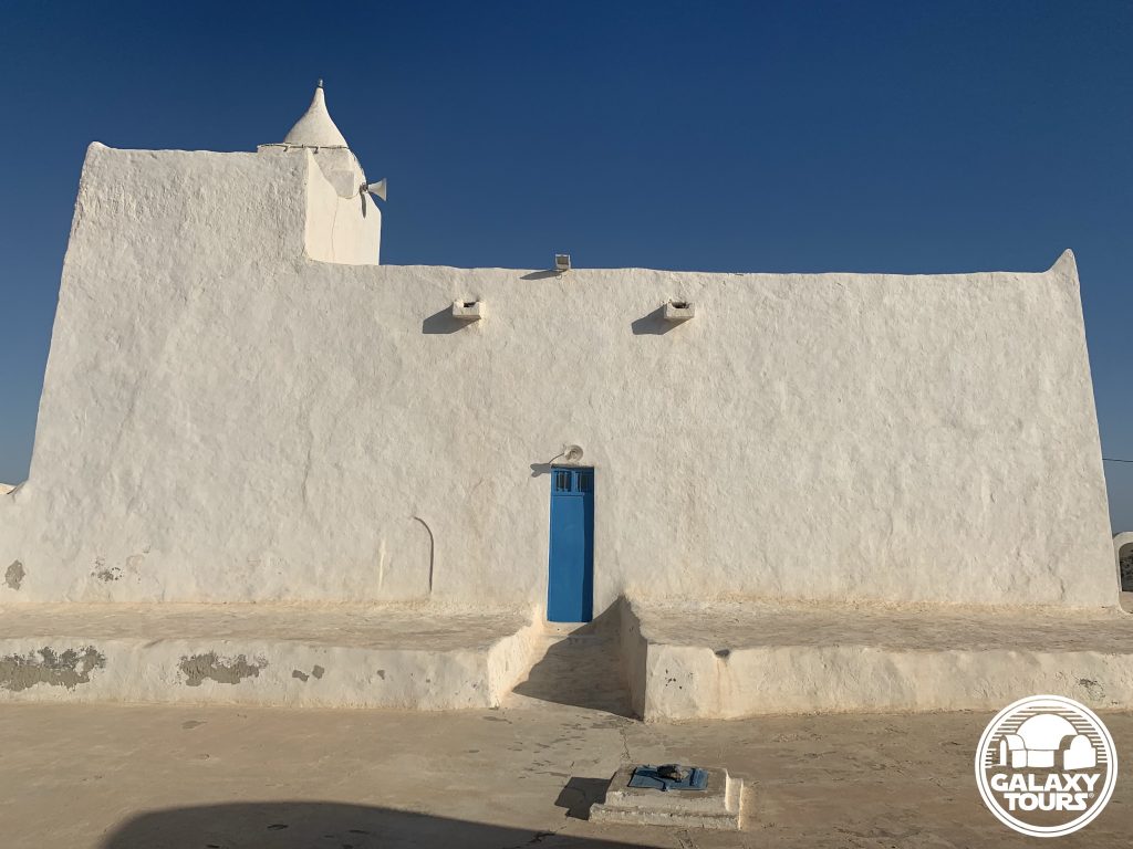
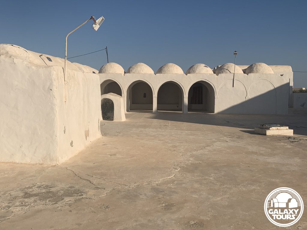
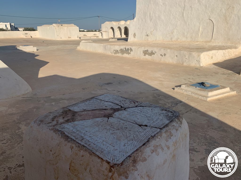
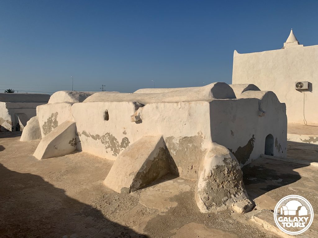
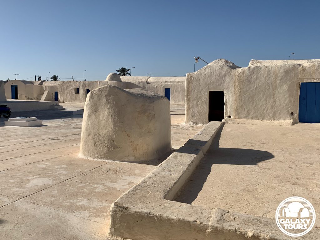
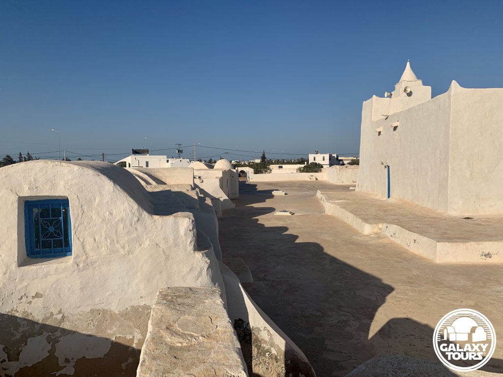
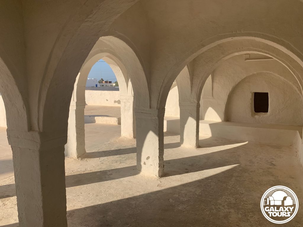
Site: Abu Miswar Mosque complex
Location: Hachan outskirts (Médenine Governorate) / Djerba island (Tunisia)
GPS:33.862203, 10.821254
Description: Ibadi complex (late 9th century CE)
Star Wars recce: Episode IV – Tunisia (1975)
Source: Original recce photographs
Potential Star Wars set concepts:
Anchorhead | main road
Anchorhead | Tosche Station (exterior)
Accessibility: Very easy; flat terrain; paved roads; close proximity to airport; parking area (33.862514, 10.821451) directly at the site entrance; courtyard open to visitors.
LOCATION
Hachan (alternately: Hachene, Hashan), located in the northwest sector of Djerba island, is a small village spanning roughly 6.25 km² in total area. Part of the medieval-era network of densely packed rural Djerban settlements, the village is populated predominantly with historic menzel complexes, some of the oldest on the island. The “center” of the village is situated some 3 km southwest of Houmt Souk. The main access road (C116) that connects Houmt Souk to Ajim divides Hachan more or less in half.
SITE
Located along the Hachan northwest perimeter less than 100 meters south of Rue Boumessouer/Airport Road (C116E) and roughly 500 meters east of neighboring Mellita, the Abu Miswar Mosque complex (alternately: The Great Mosque, El Kebir Mosque, Miswariyya, Abi Maswar/Abu Masour/Aboumessouer Mosque) marks the approximate midpoint between Djerba-Zarzis Airport (5 km to the west) and Houmt Souk (4 km to the northeast). Documented as Djerba’s oldest mosque, the Ibadi place of worship was founded in the late 9th century CE by the charismatic Muslim teacher Abu Miswar Yasja, who migrated to Djerba from the Jebel Nafusa mountains in neighboring Libya. Abu Miswar solidified Djerba’s status as the uncontested center of Ibadi learning during the 10th century CE, a tradition continued by his son Abu Zakaria Fasil, who is credited with completing construction on the mosque. Despite the attributed name “Great Mosque,” the Amazigh structure, categorized as one of the inland fortified mosques on the island, is no bigger than any other Djerban mosque (ca. 18 x 17 meters) and typical in appearance with windowless whitewashed walls, a protruding box-shaped mihrab niche (southeast wall), and a fort-like mini-minaret. A historic sundial in the courtyard was used to determine daily prayer times. A series of small rooms were used to house Ibadi students studying at the mosque.
IDENTIFICATION
In his monumental work The Making of Star Wars: The Definitive Story Behind the Original Film (2007), J.W. Rinzler published a behind-the-scenes-photograph of George Lucas (writer/director) and John Barry (production designer), presumably at EMI-Elstree Studios (Borehamwood, England), reviewing in late 1975/early 1976 the makeshift studio recce wall, composed of an an assortment of unannotated pinned photos (organized by location) taken by Barry during the principal Episode IV pre-production recce to Tunisia in mid-November 1975. Multi-faceted research confirms that three recce photos grouped together on the wall (second column from the left, lower panel, top left-hand corner) depict the Abu Miswar Mosque complex from three different camera angles: two from the northeast section of the mosque courtyard (near the gated main entrance) and one from a vantage point some 50 meters southeast of the complex. The mosque is visible in two of the three camera angles.
Three additional Kodak Tri-X panchromatic photographs from Barry’s recce archives further verify the identification of the Abu Miswar Mosque complex as an Episode IV recce site. Released via Star Wars community online platforms void of any locational attribution (like all of Barry’s recce negatives), on-site visual comparisons confirm that Barry shot all three photos in the mosque courtyard. Two of the photos were taken from a vantage point approximately 15 meters northeast of the mosque: the first depicting Gary Kurtz (producer) making measurements between the northeast corner of the elevated mosque platform and a nearby cistern cover; the second focused on the domed arches of the shaded sitting area attached to the secondary entrance at the southeast corner of the complex. The remaining photo is a close-up featuring one of the various cistern covers plotted around the courtyard on all but the south side of the mosque.
Djerban authorities have designated Abu Miswar Mosque as an essential cultural heritage landmark with funds appropriated to ensure periodic upkeep. Although restoration works at the complex have introduced some structural changes (particularly the expansion of the secondary entrance area) since the 1975 recce, the entire complex remains distinctly recognizable, offering clear reference points to line up Barry’s complete set of six preserved recce photos.