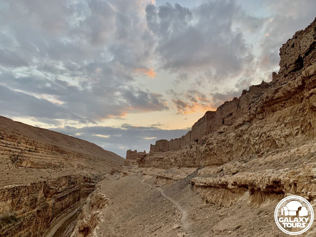
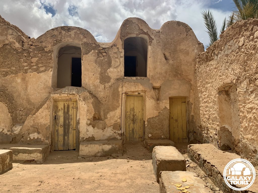
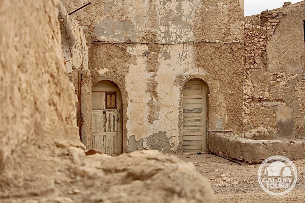
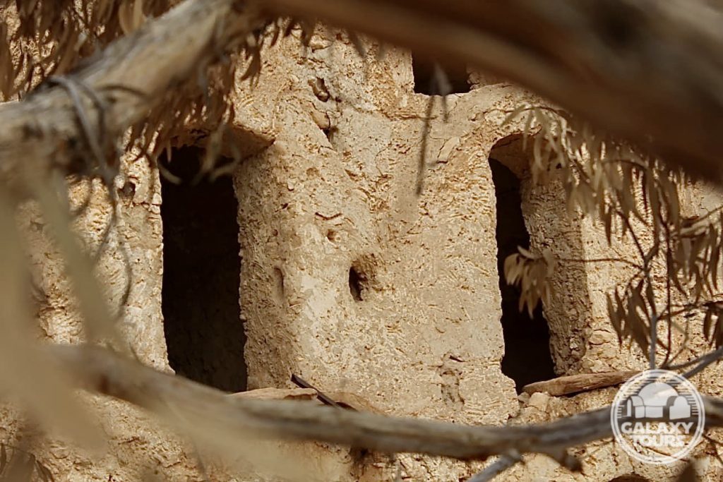
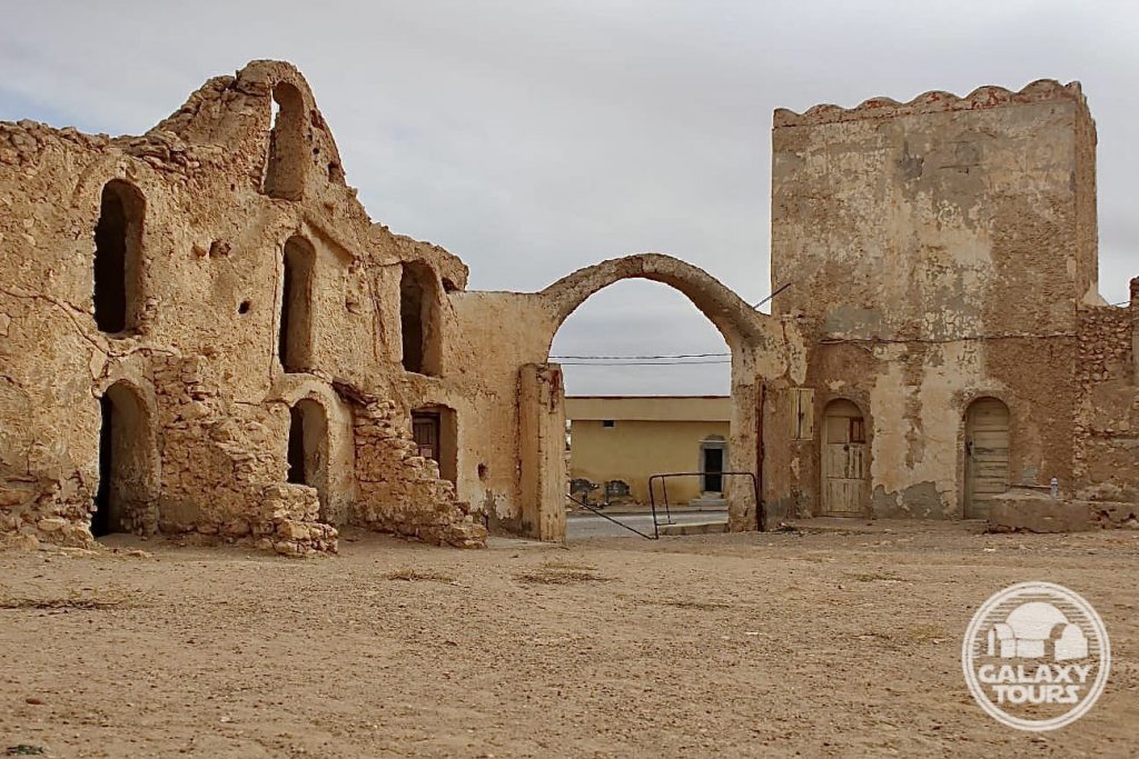
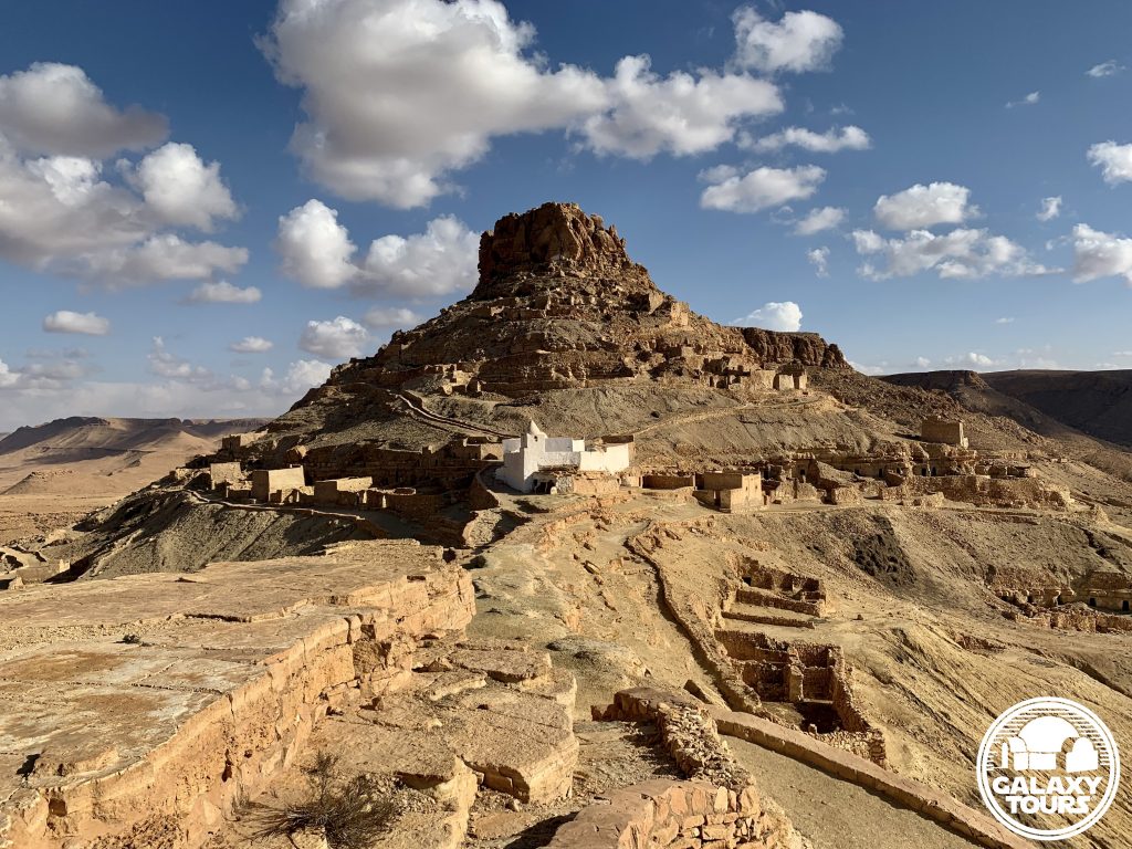
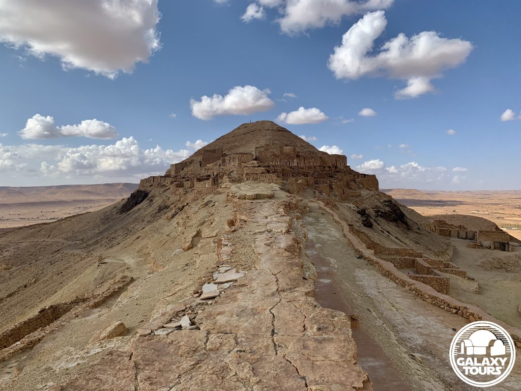
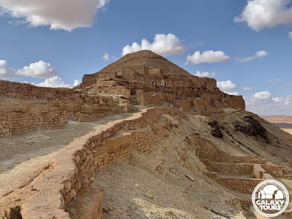
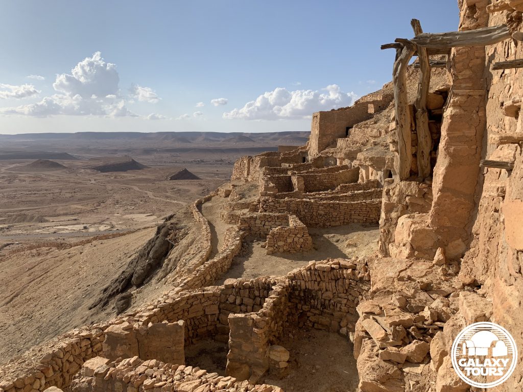
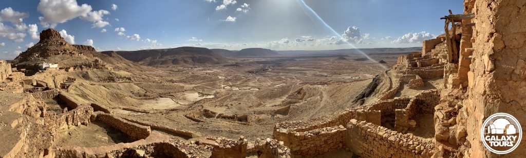
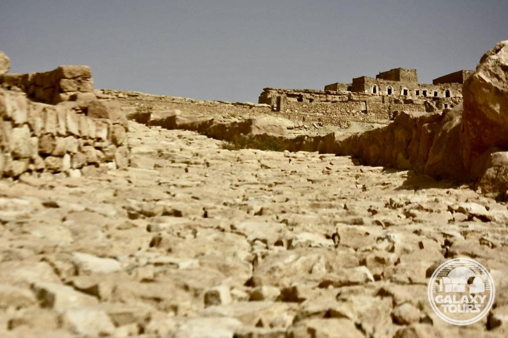
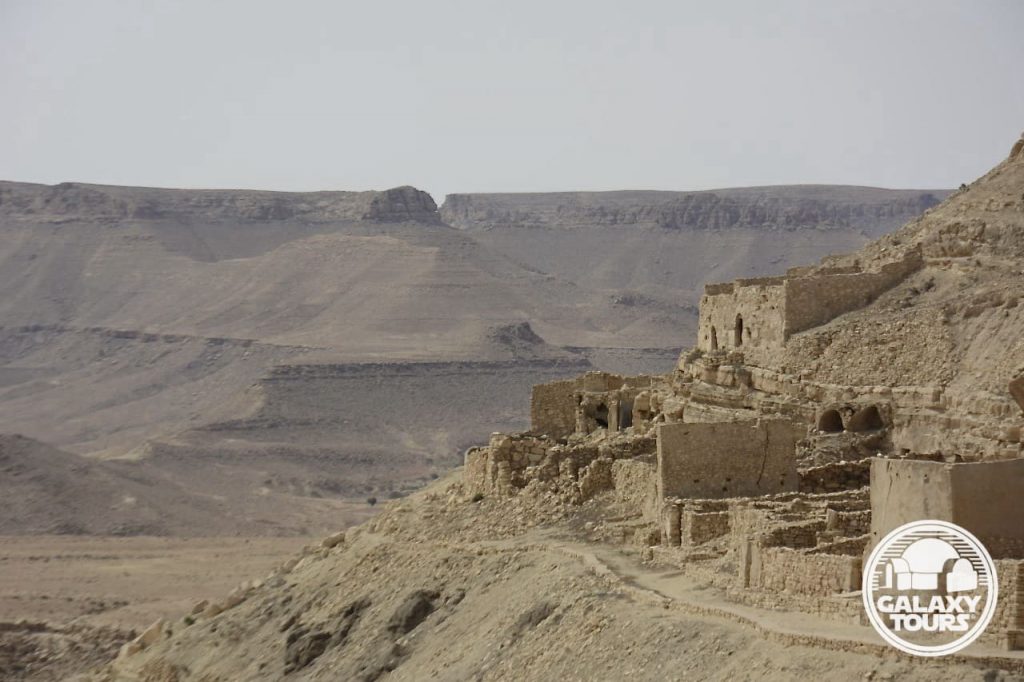
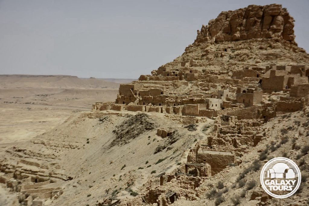
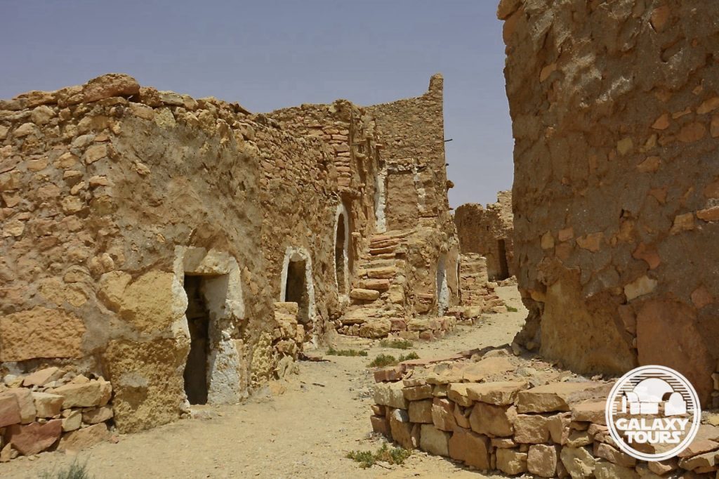
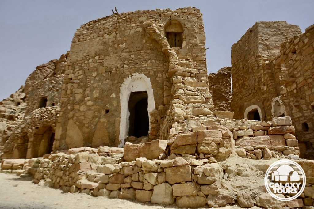
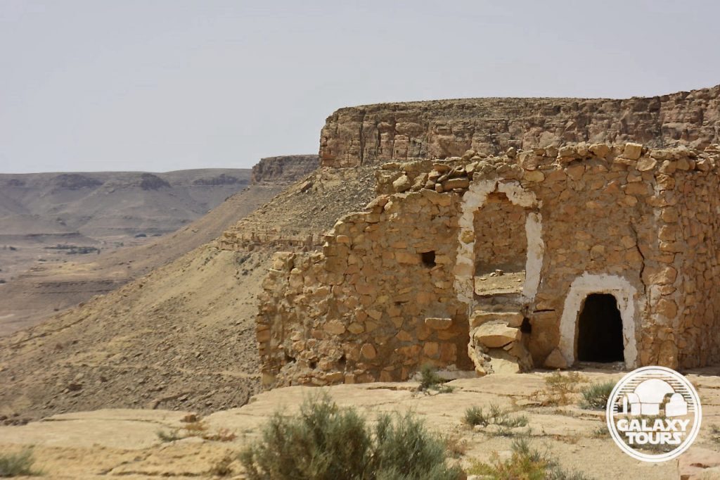
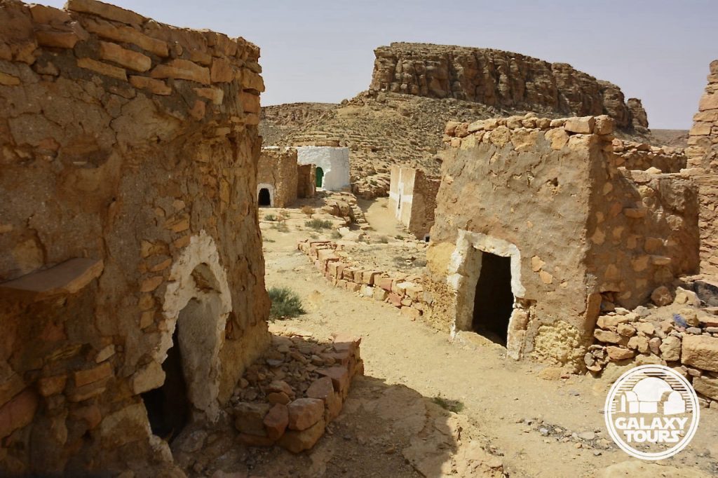
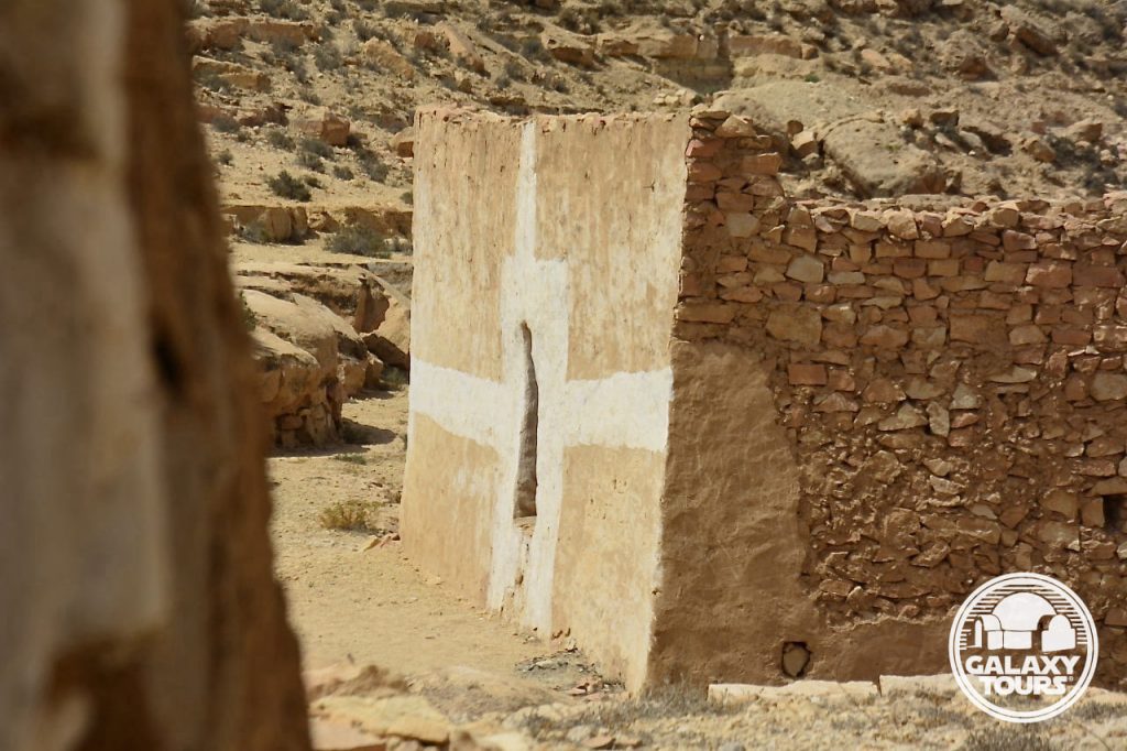
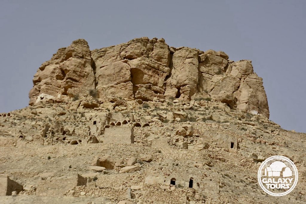
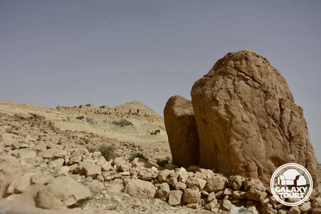
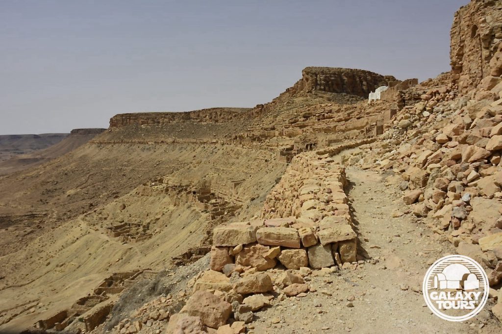
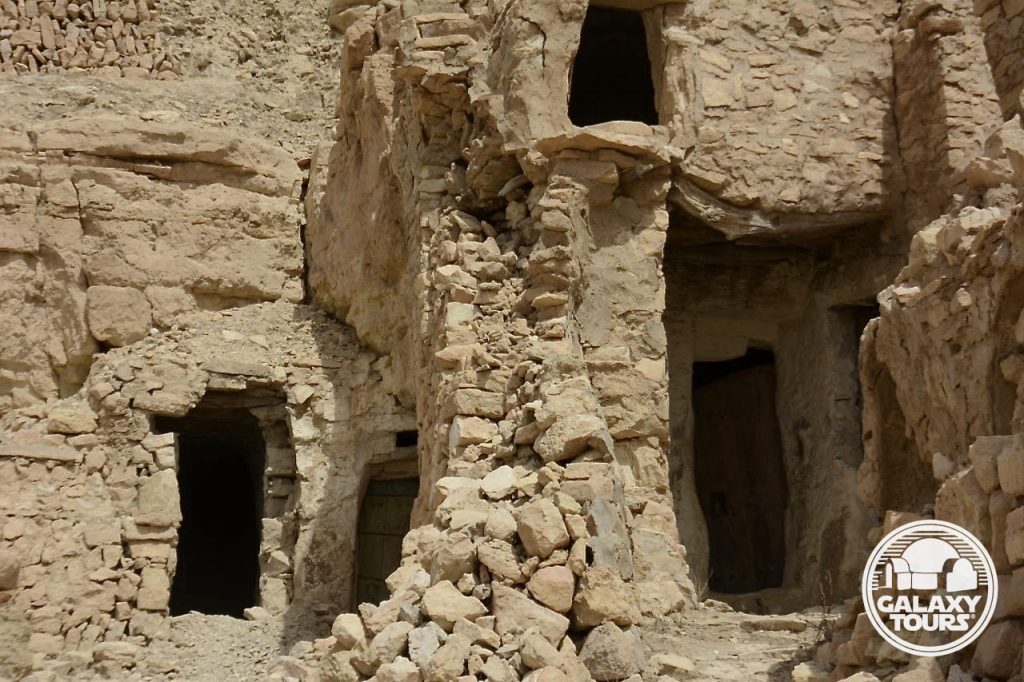
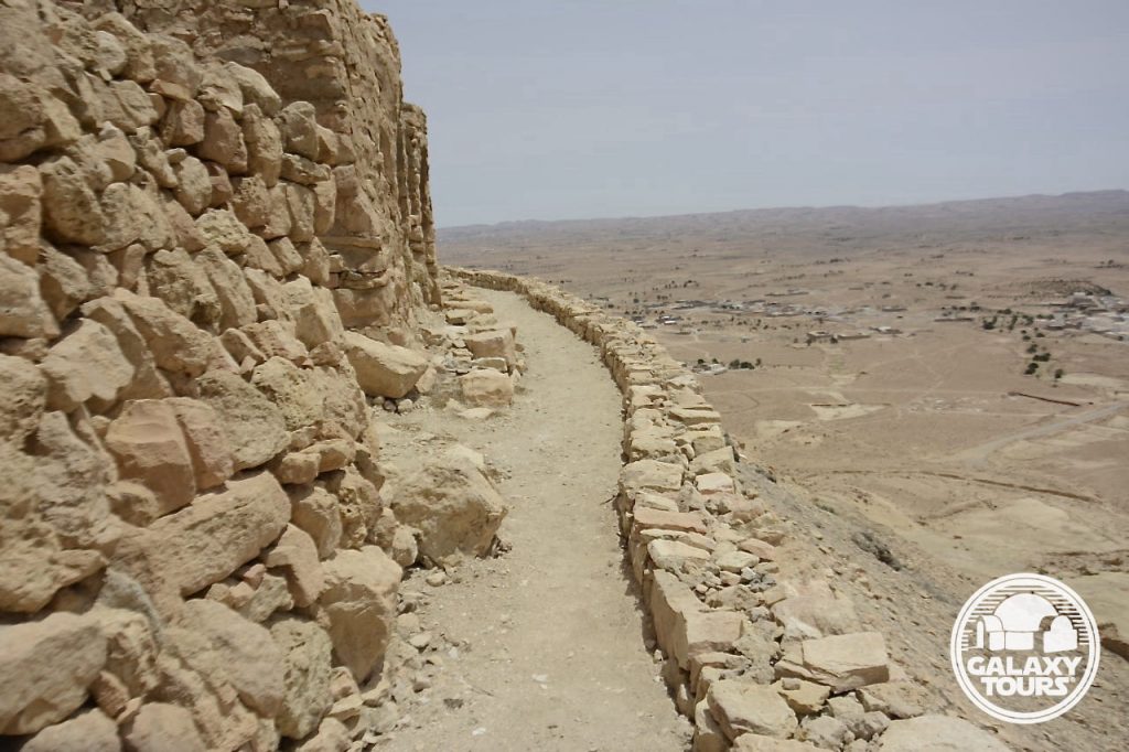
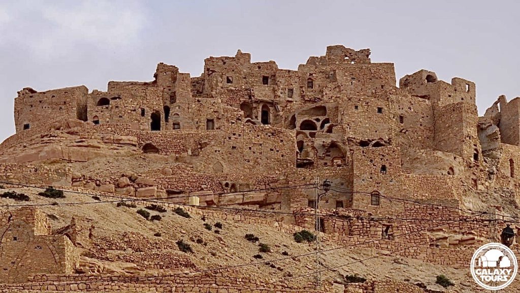
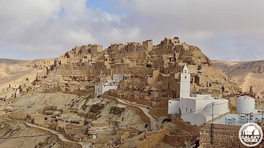
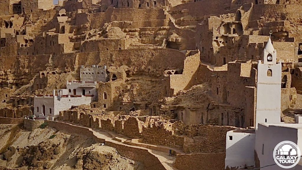
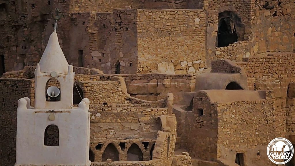
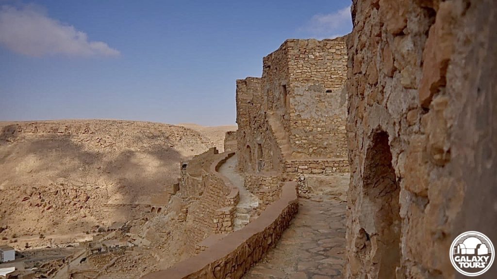
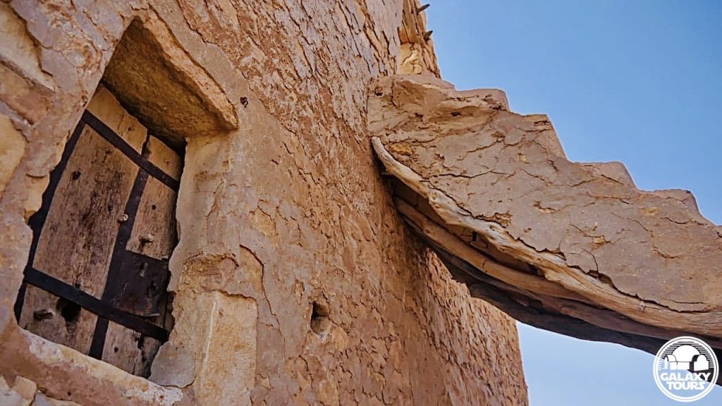
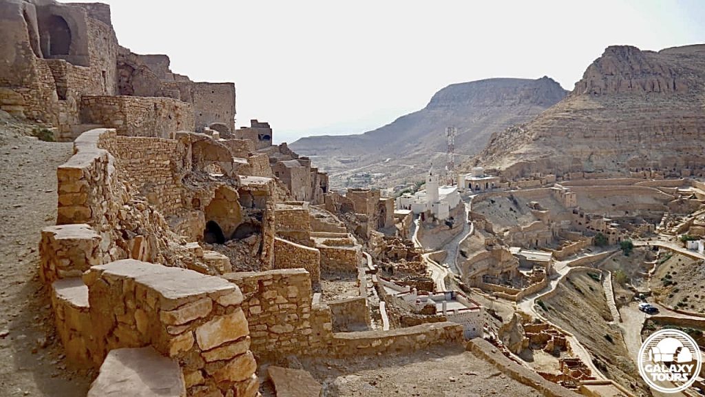
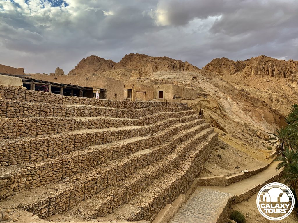
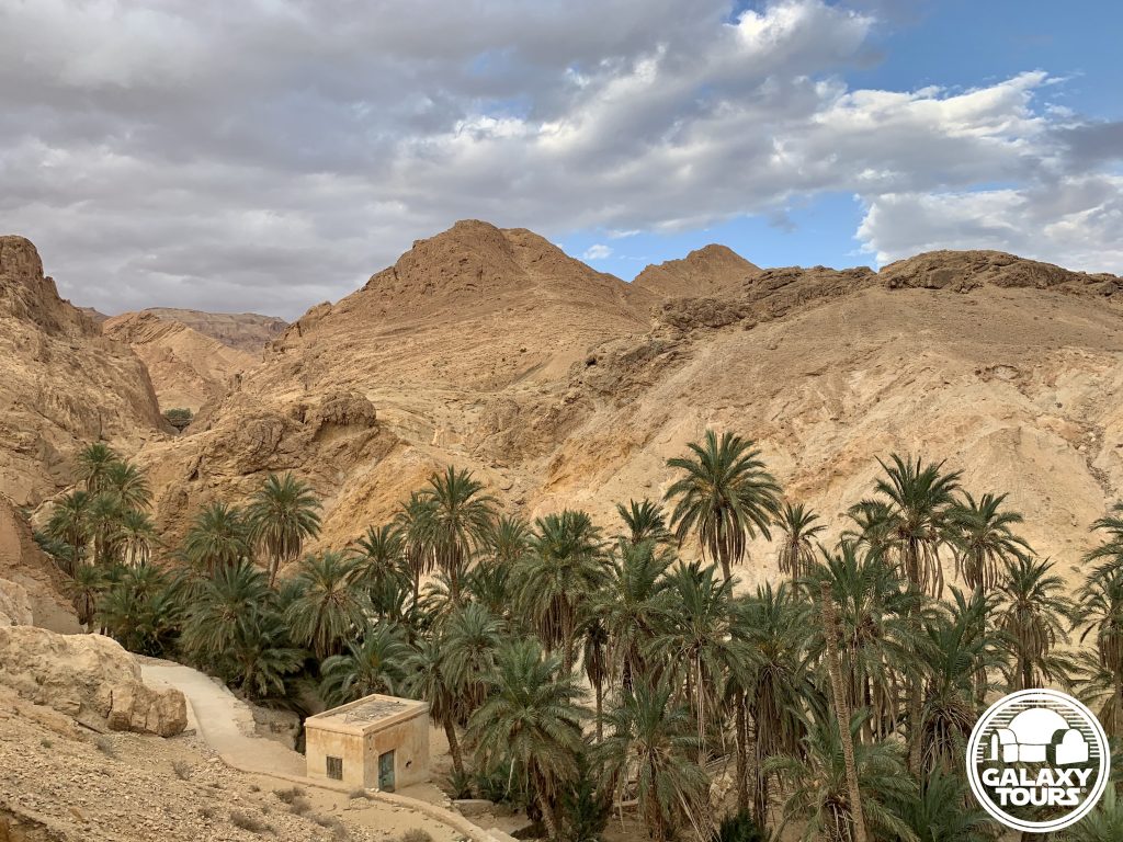
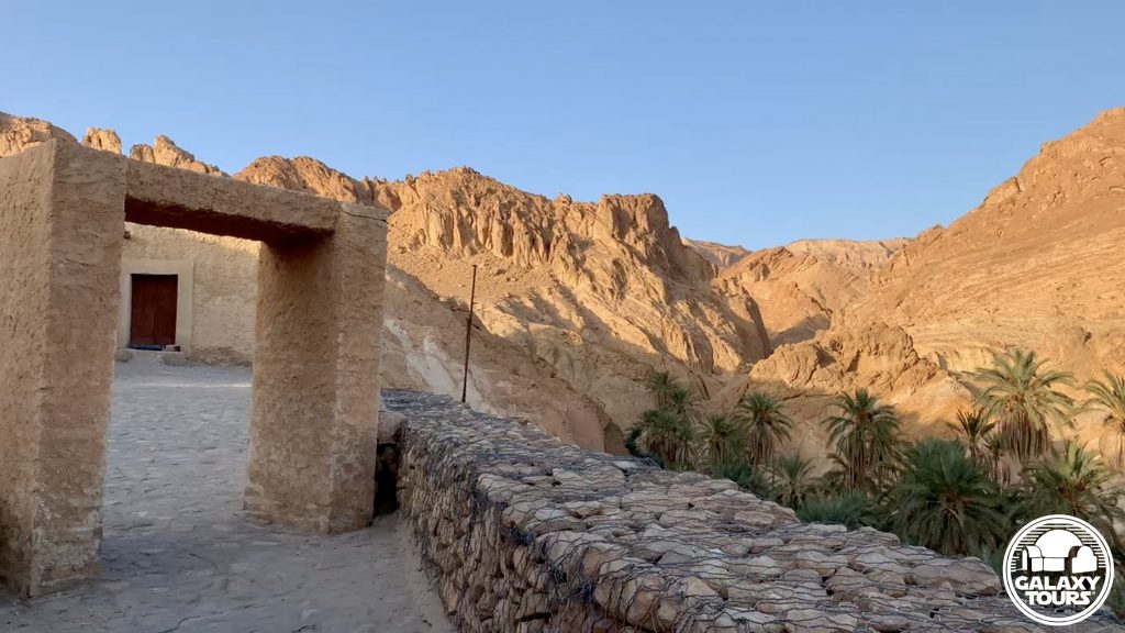
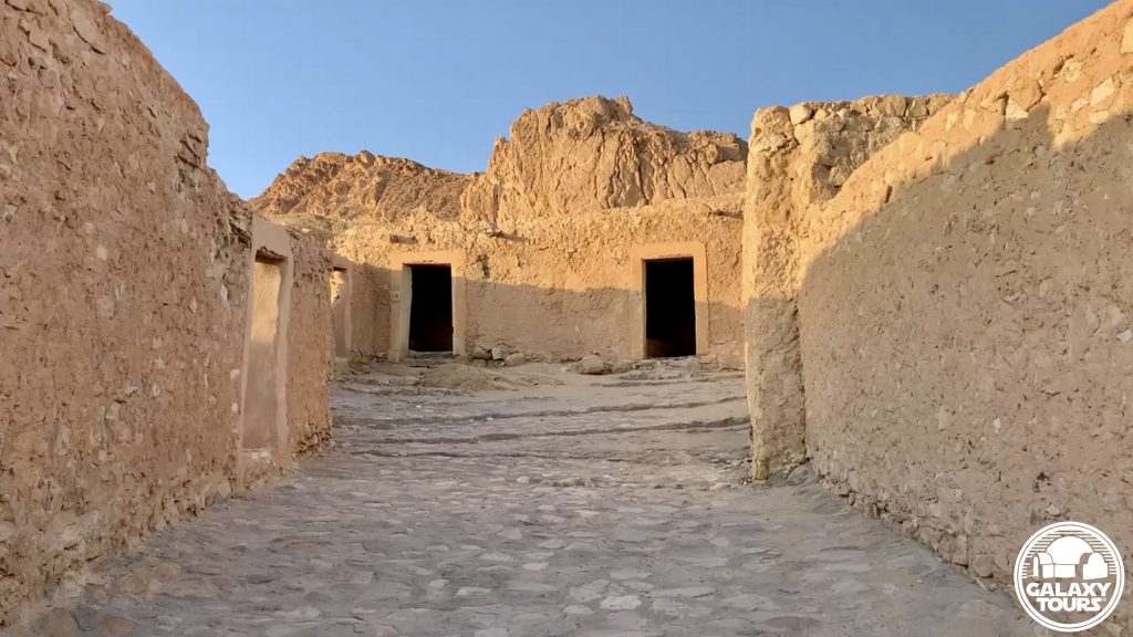
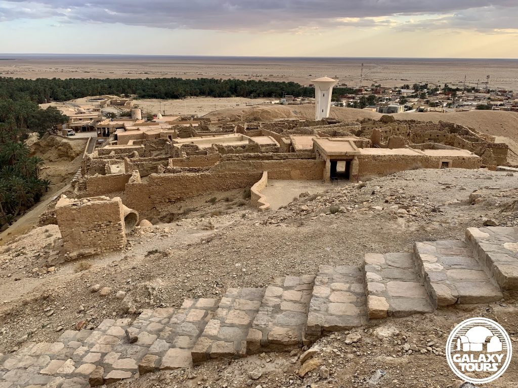
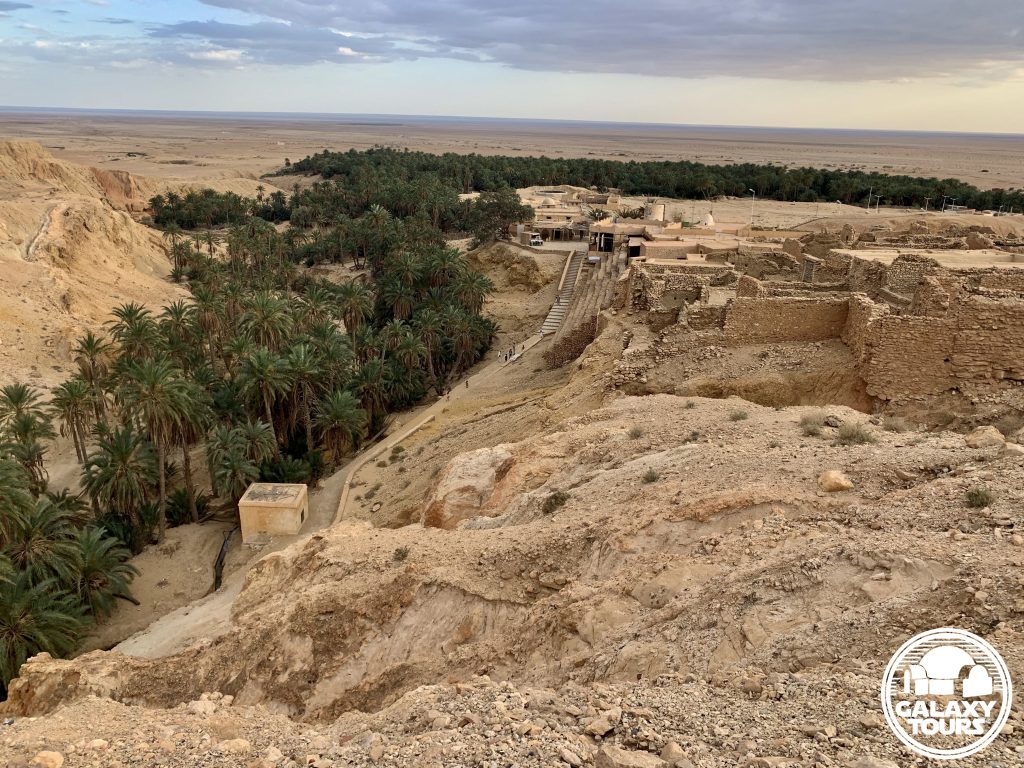
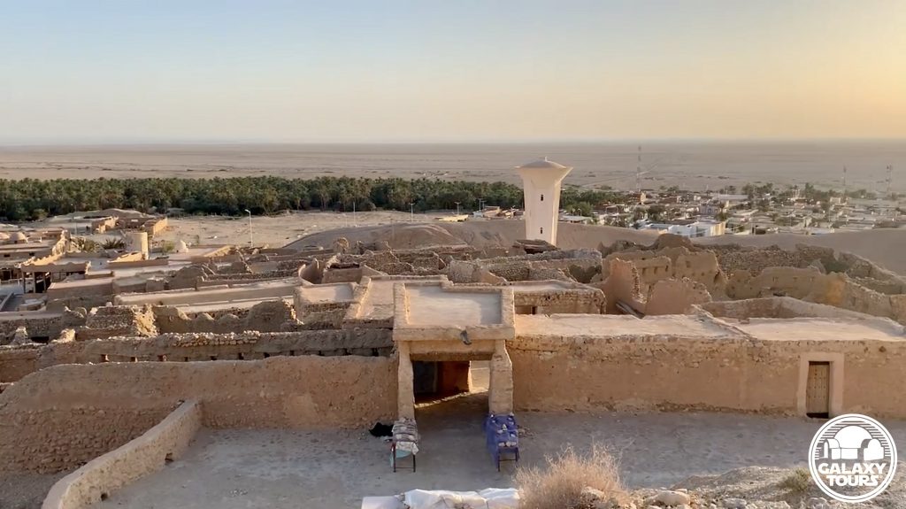
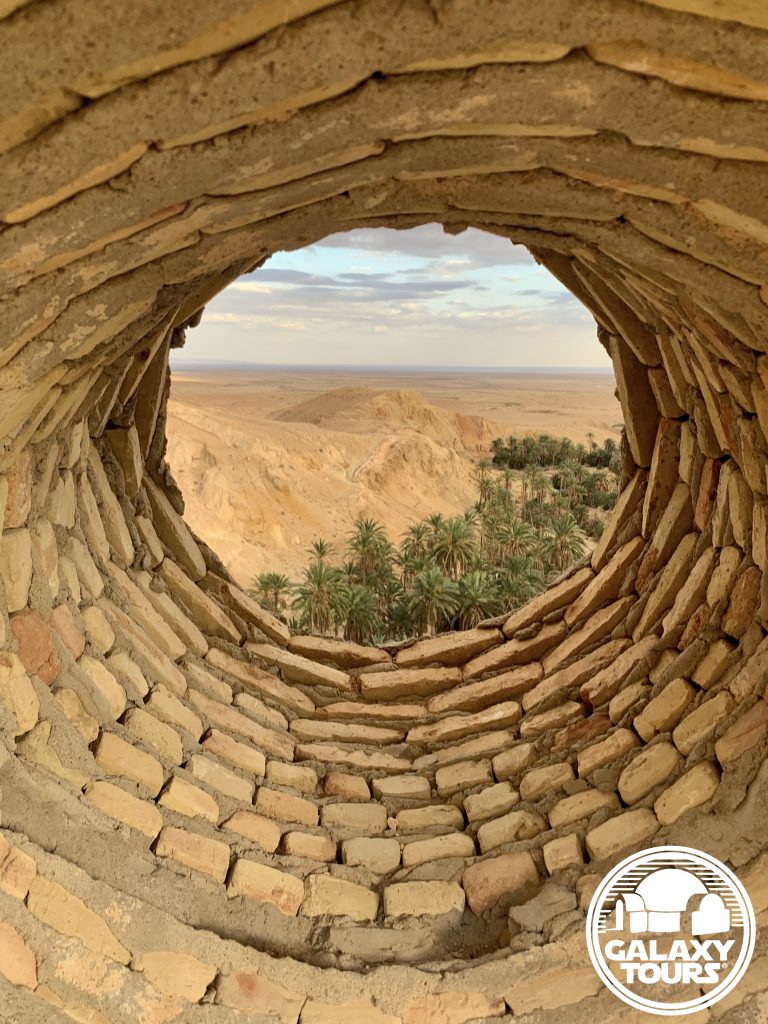
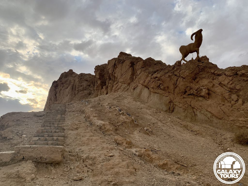
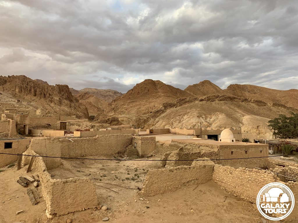
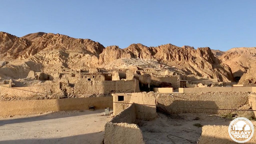
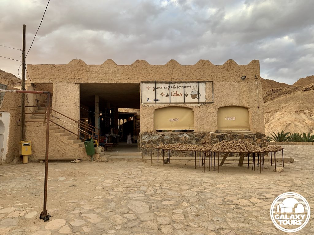
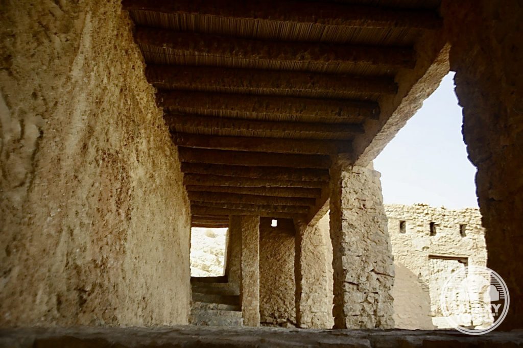
Midès
OVERVIEW
Site: Ancient Midès
GPS: 34.406692, 7.920470
Location: Tozeur Governorate, southwest Tunisia
Description: Ruins (pre-Roman era)
Star Wars recce:
Episode I – Tunisia (December 1995)
Source: Original recce photograph (Reynolds)
Star Wars scouted set concept:
Mos Espa spaceport | various elements
Star Wars connection discovery:
Galaxy Tours (22 November 2020)
Challenges: Midès’ remote mountainous setting less than 1 km from the Algerian border seemingly presented too many logistical challenges, likely resulting in only minimal consideration to transform the hillside ruins into fictional Mos Espa.
Canyon: Tunisian tourism circles frequently identify the canyon below ancient Midès as “Star Wars Canyon,” inaccurately confusing this unique landscape with Maguer Gorge (Jebel Sidi Bouhlel). This misinformation is likely tethered to the popular (but unfounded) claim that the Midès area served as inspiration for various Mos Espa podrace canyonland CGI elements.


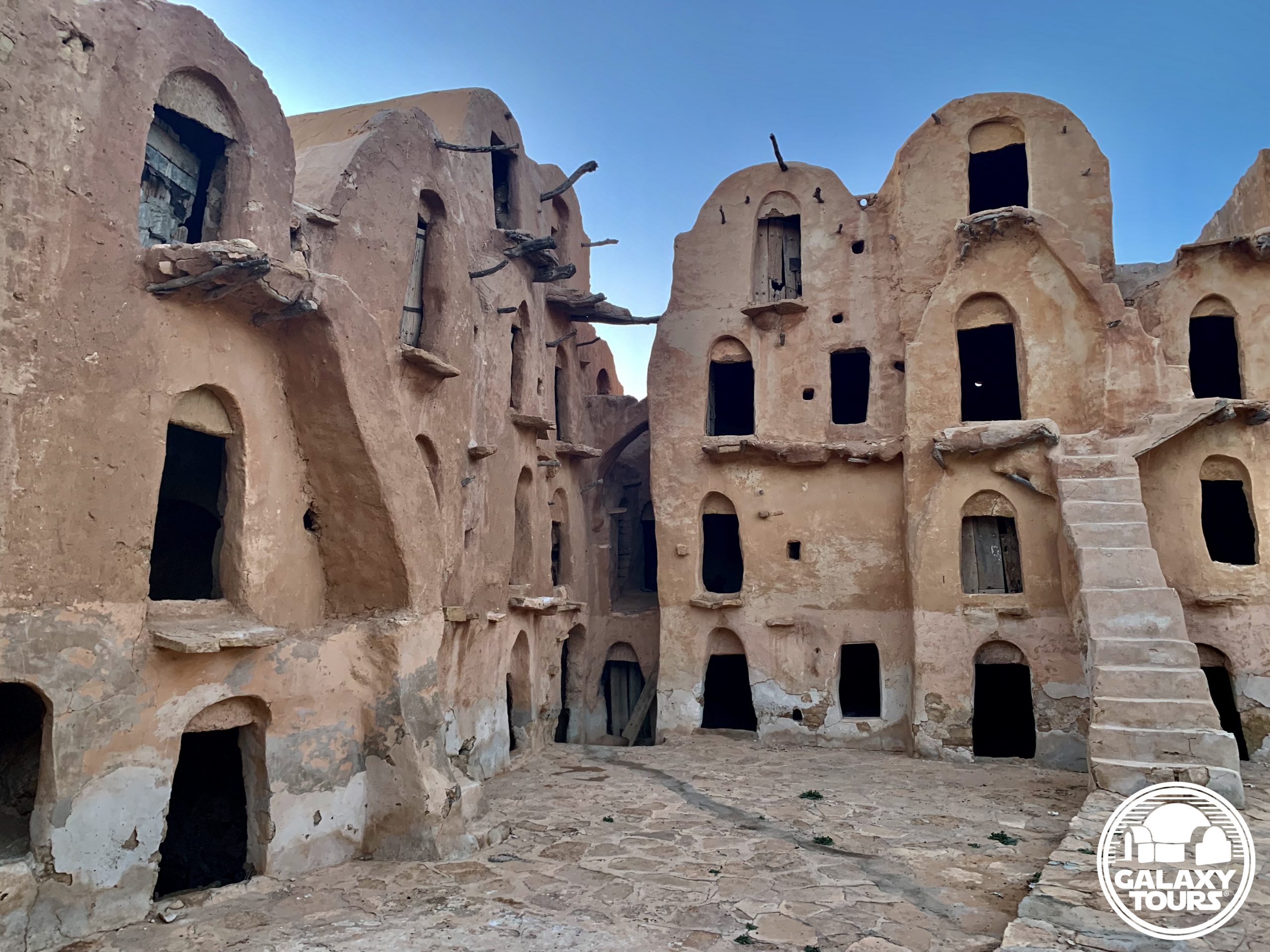
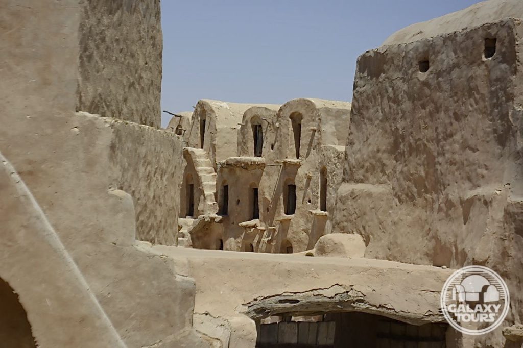
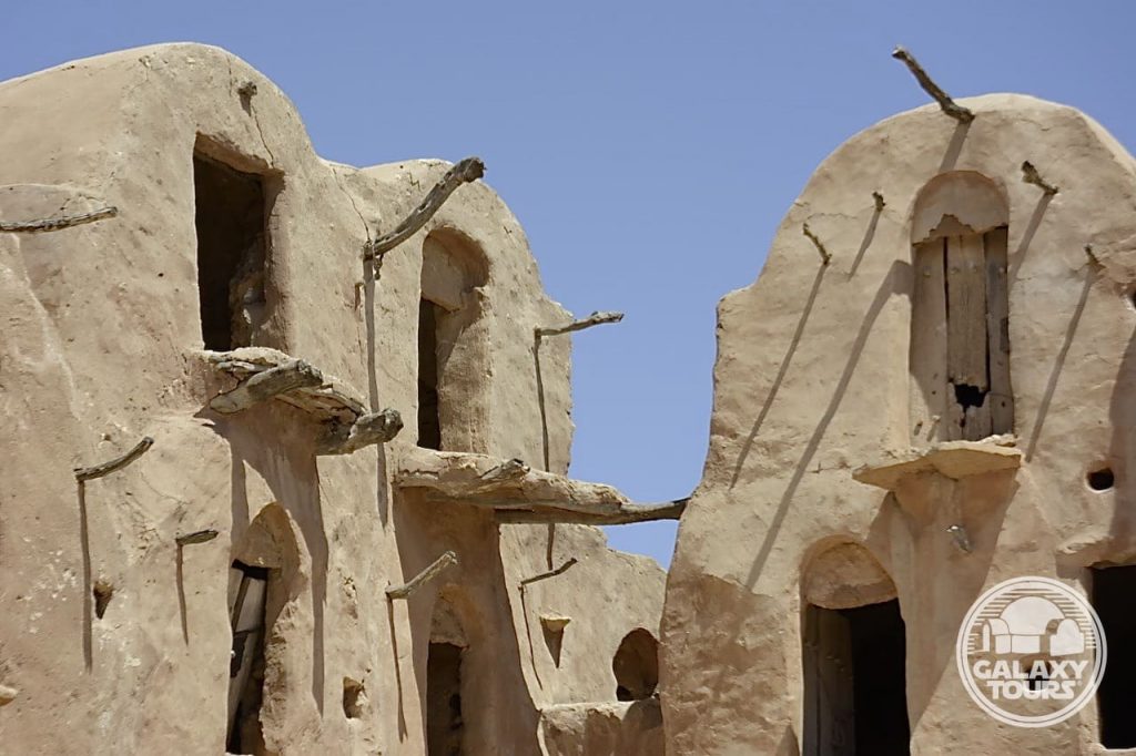
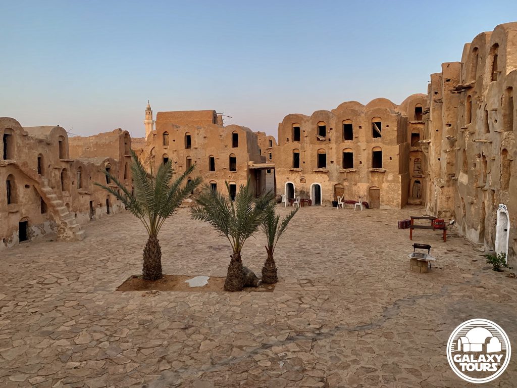
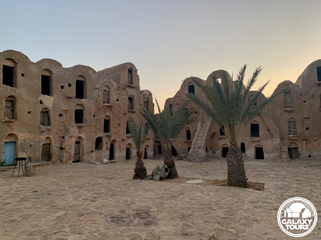
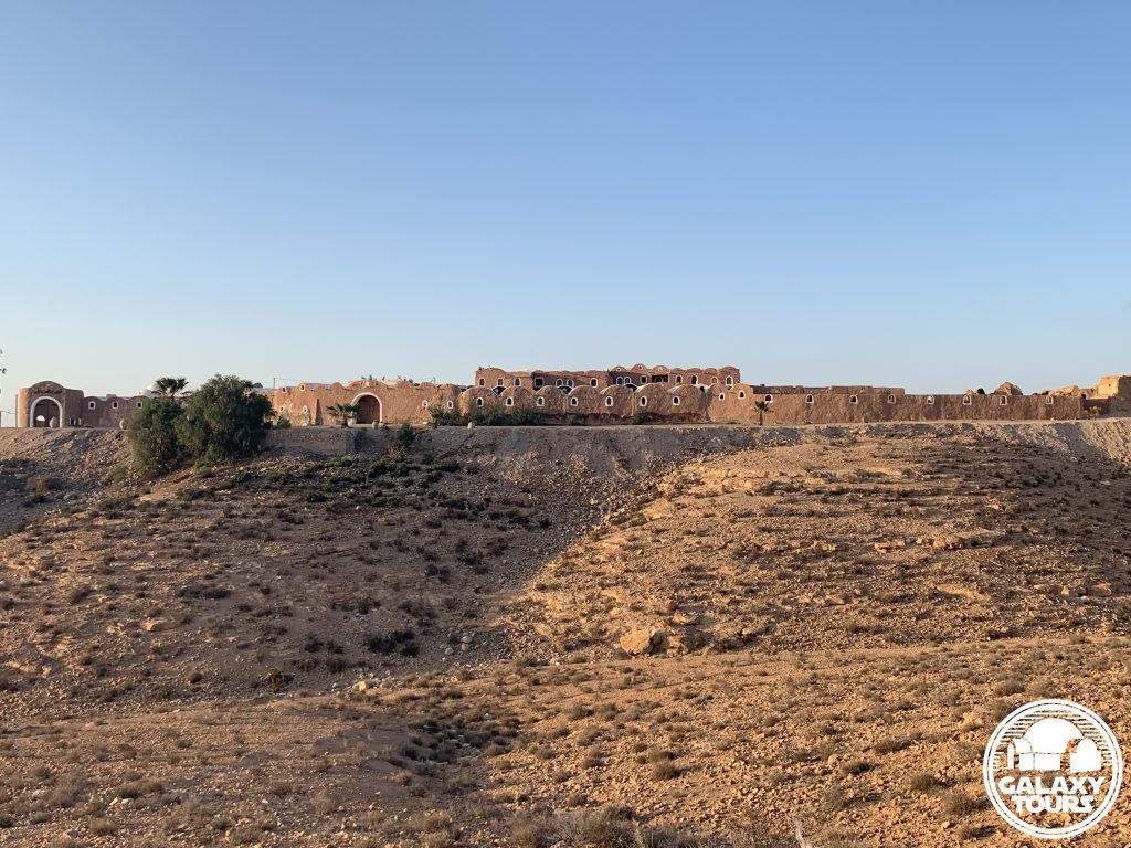
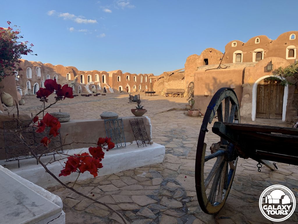
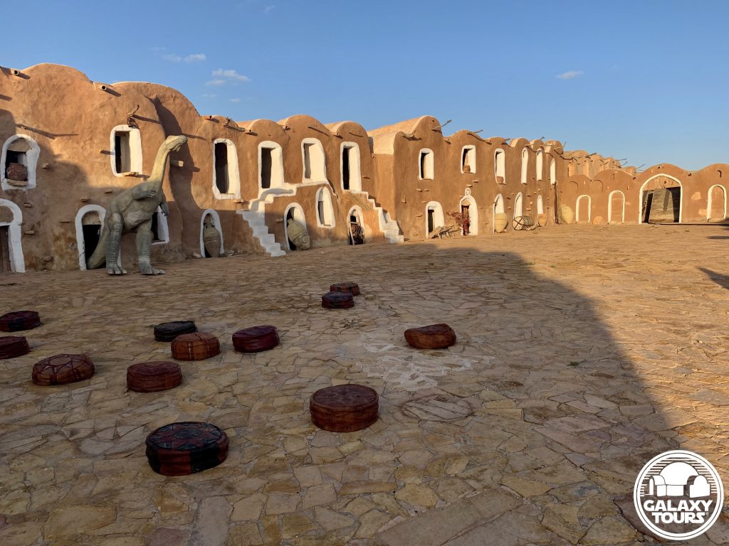
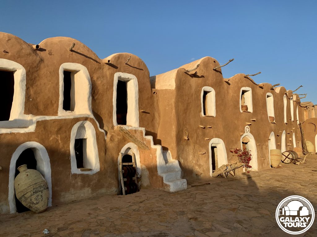
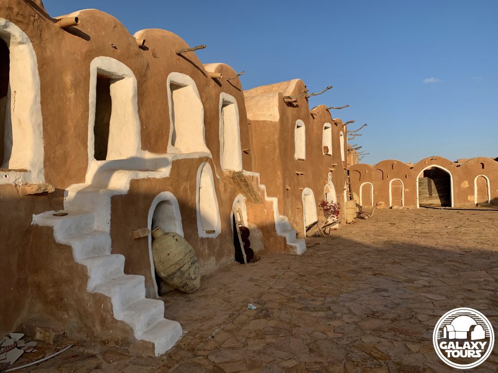
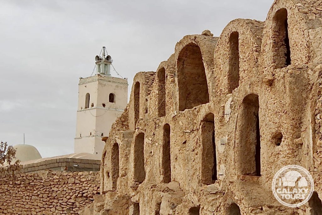
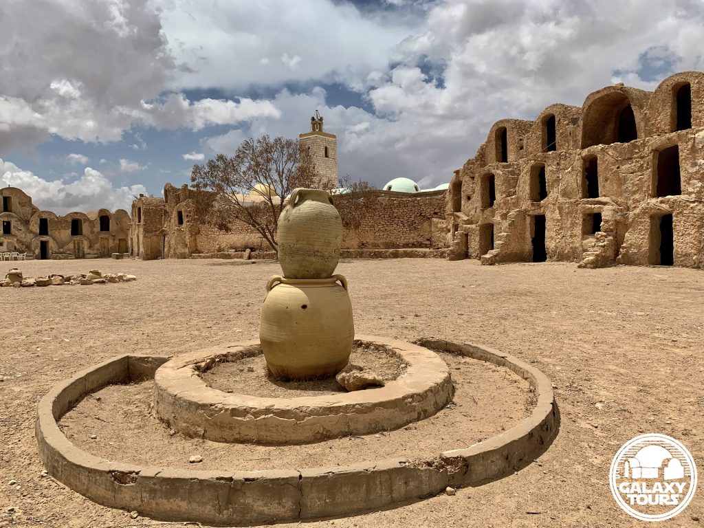
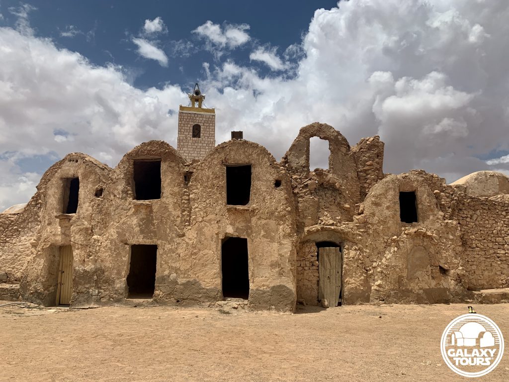
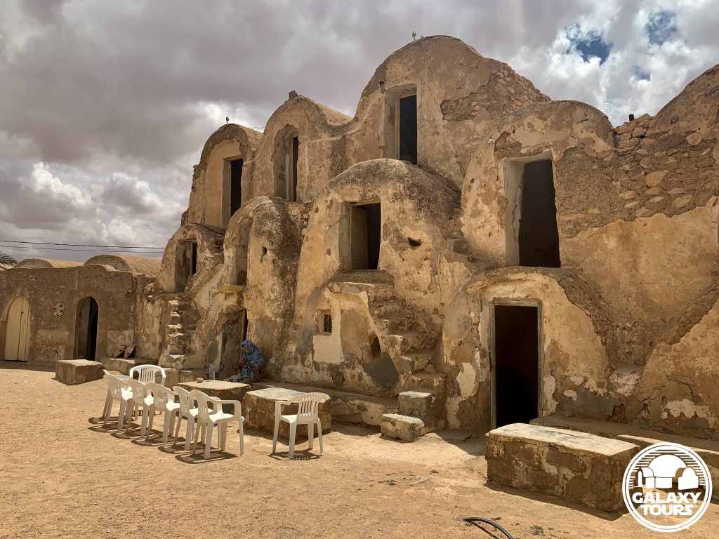
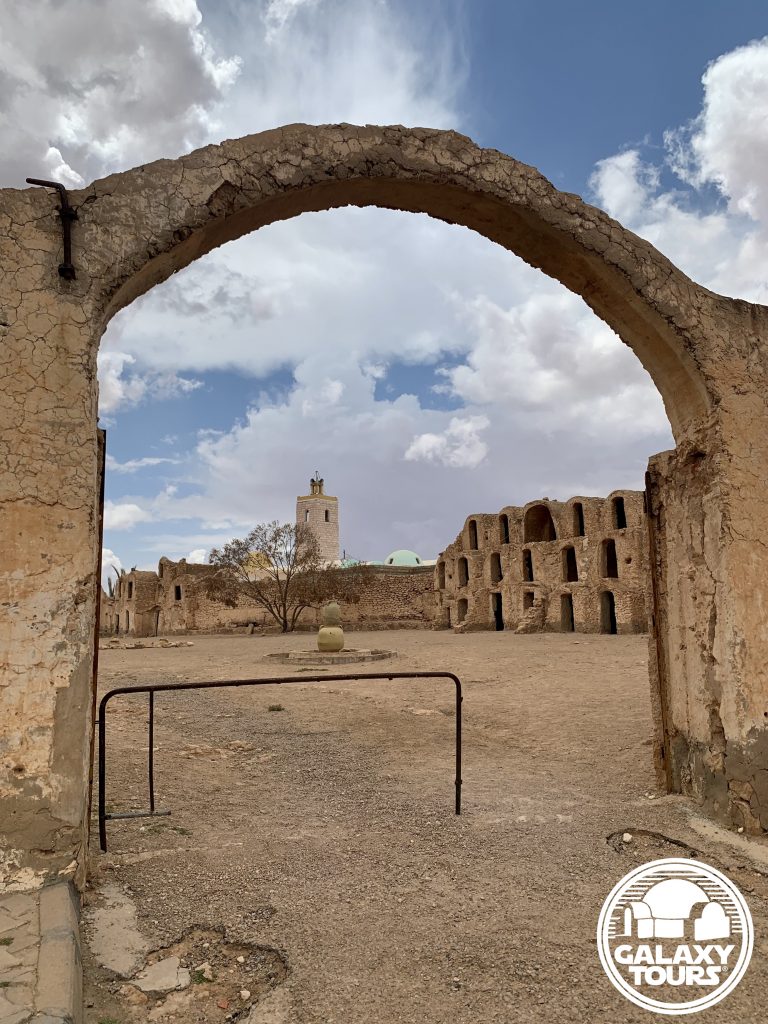
Ksar Ouled Soltane
OVERVIEW
Site: Ksar Ouled Soltane
GPS: 32.788346, 10.514549
Location: Ksar Ouled Soltane village, Tataouine Governorate, southeast Tunisia
Description: Amazigh fortified granary (late 17th century CE)
Star Wars recce:
Episode I – Tunisia (December 1995)*
Source: Correspondence with Philip Vanni (Star Wars tourism pioneer)
Star Wars scouted set concept:
Mos Espa | slave quarters
Pending: Although final confirmation is still pending, layered first- and second-hand verbal evidence suggests that Ksar Ouled Soltane—one of the most popular Tunisian ksour—was probably scouted in December 1995 or possibly during a subsequent pre-production recce in 1996. Located deep in the Tataouine region far from all major roads, the extreme remote position of the site likely resulted in only minimal consideration for Episode I production.
Correction: Despite consistently circulated misinformation dating back to 1999, Ksar Ouled Soltane is not a Star Wars film site.
*Visual confirmation pending. No recce photographs or sketches from Ksar Ouled Soltane are known to exist.

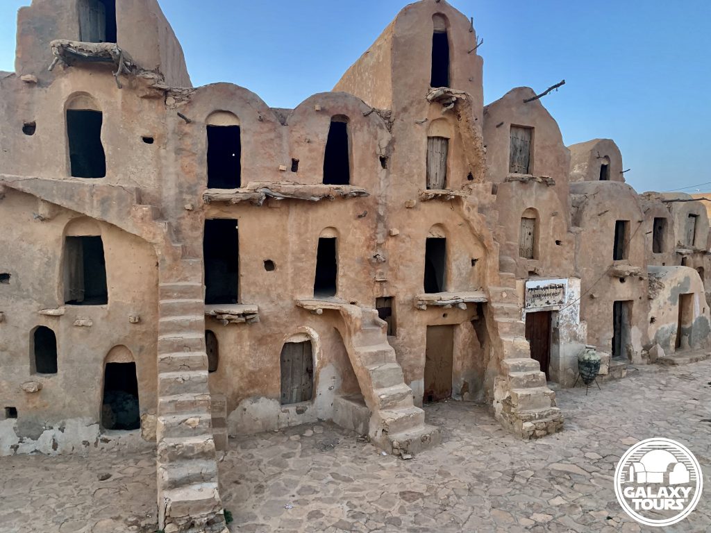
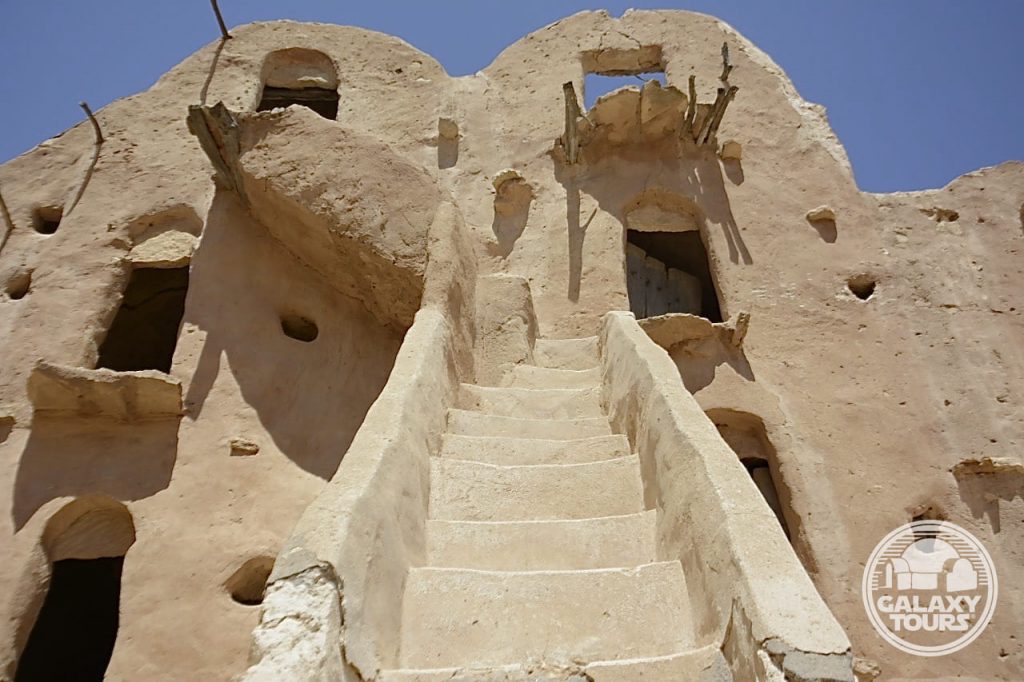
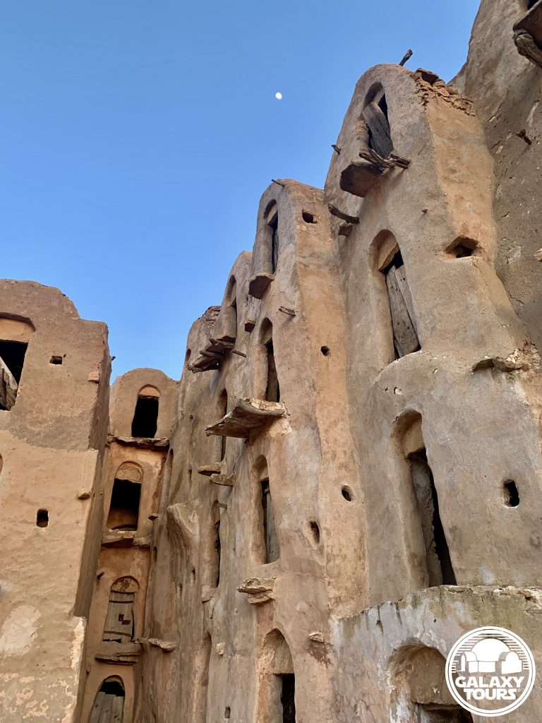
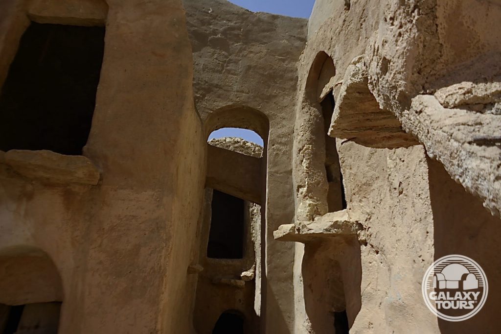
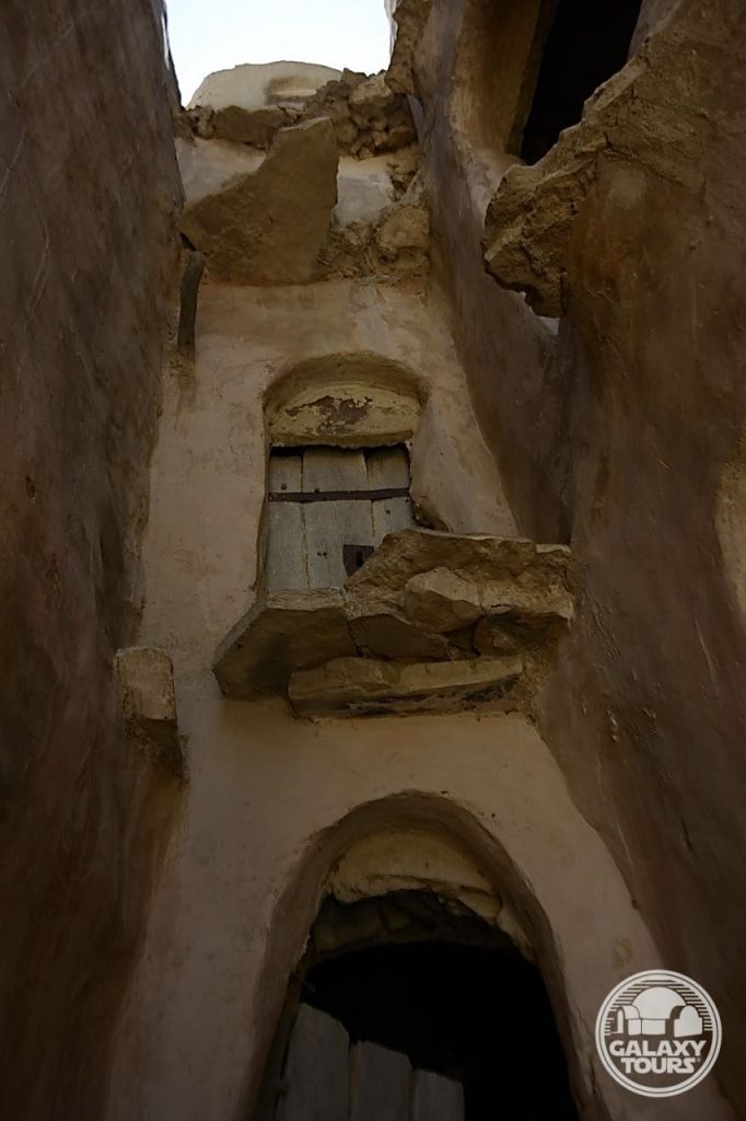

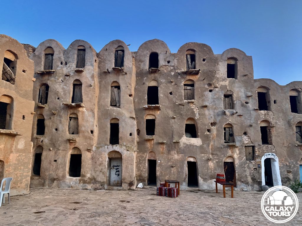
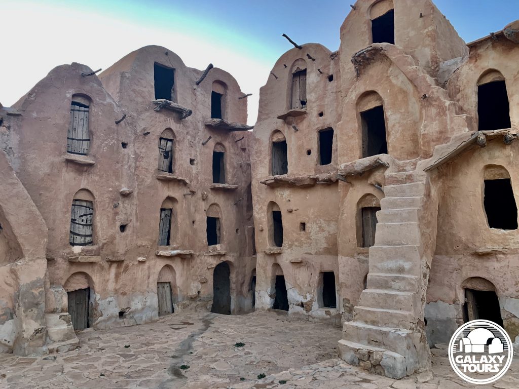


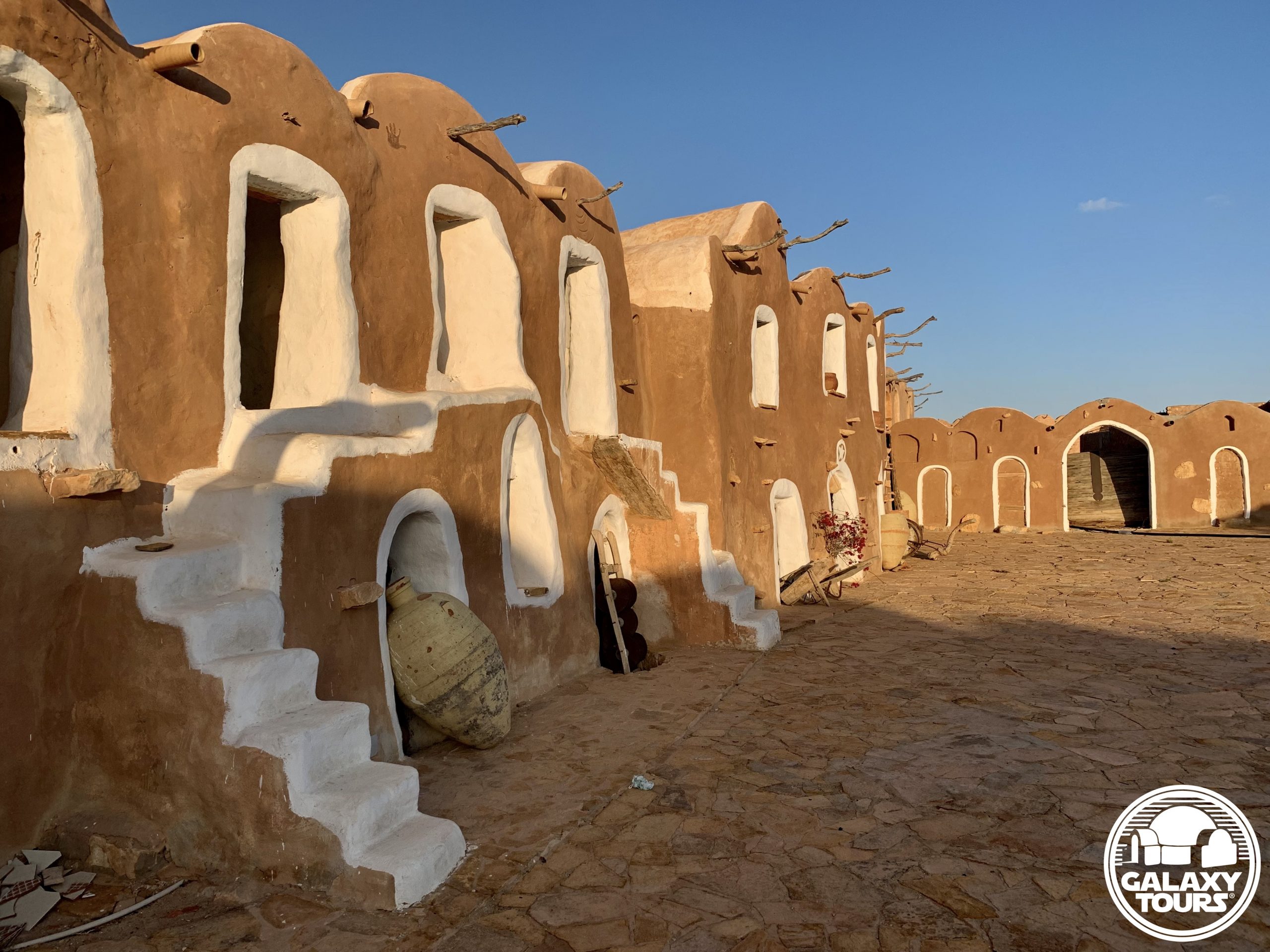
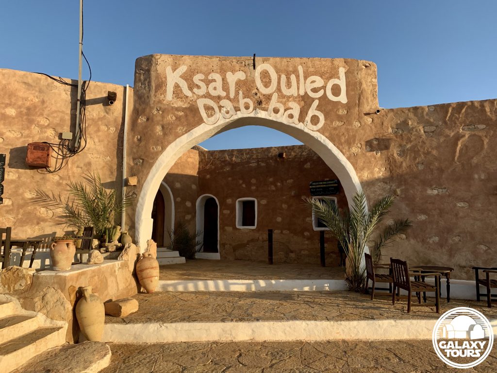
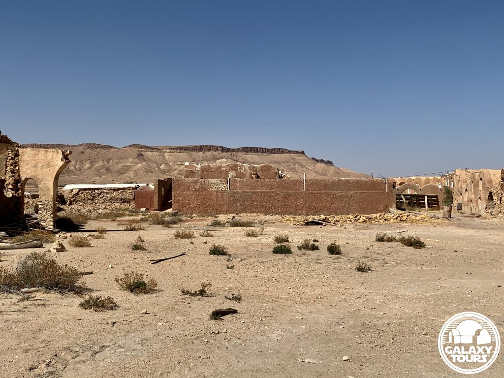
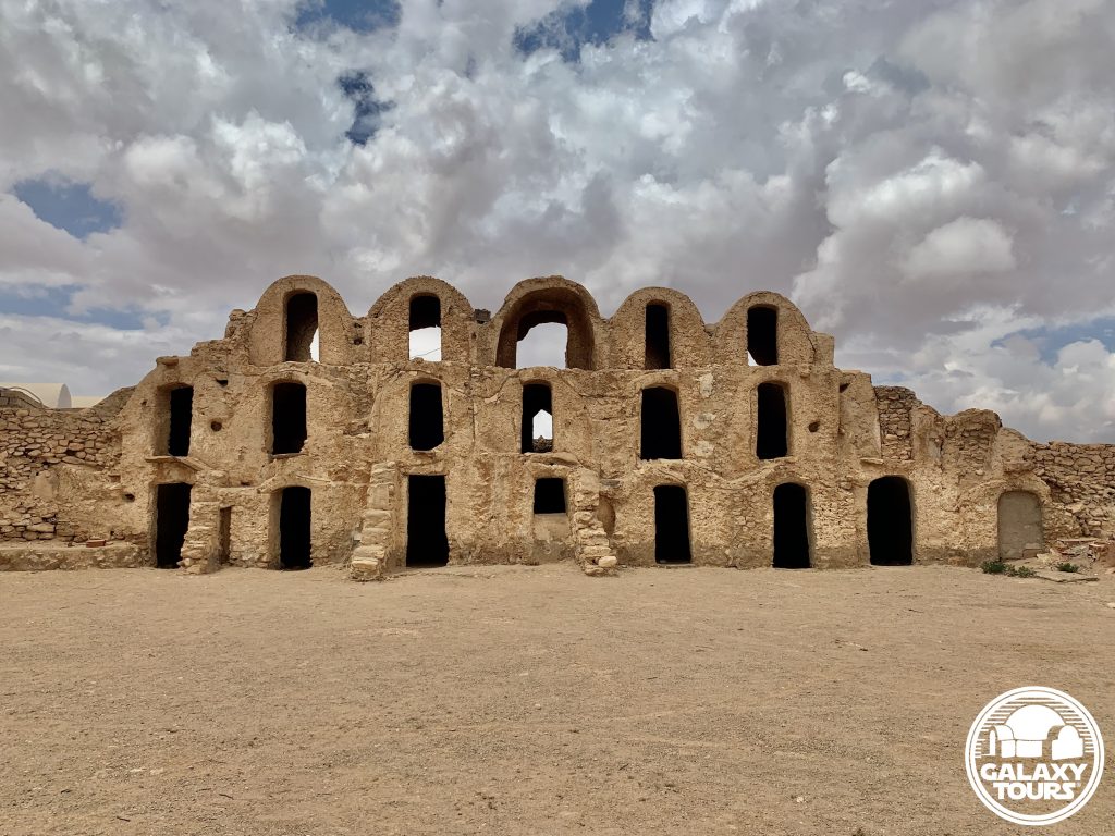
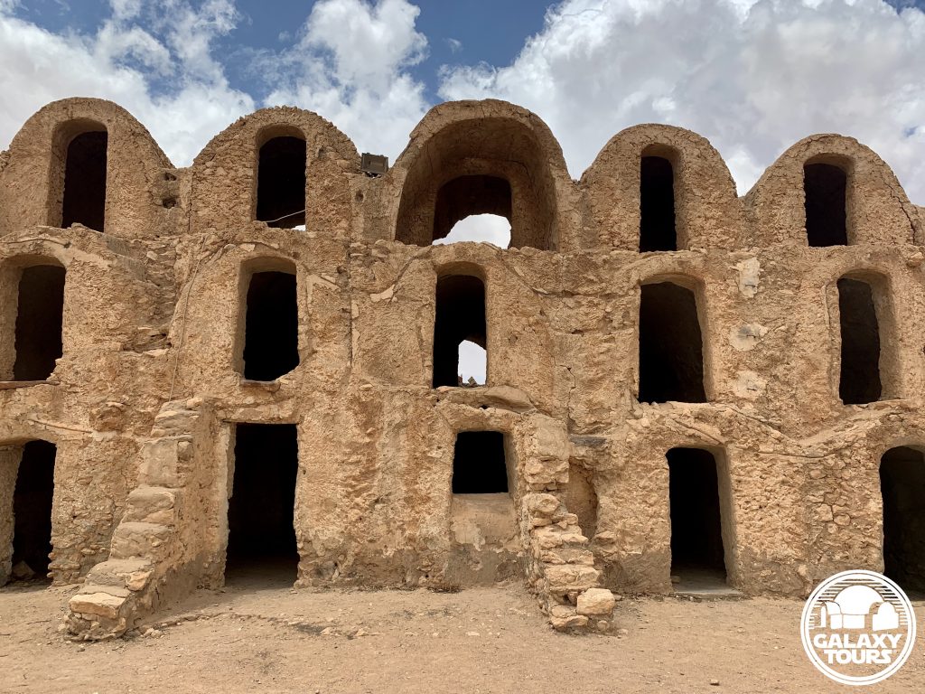
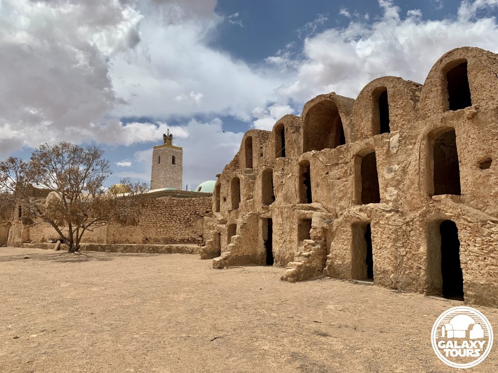
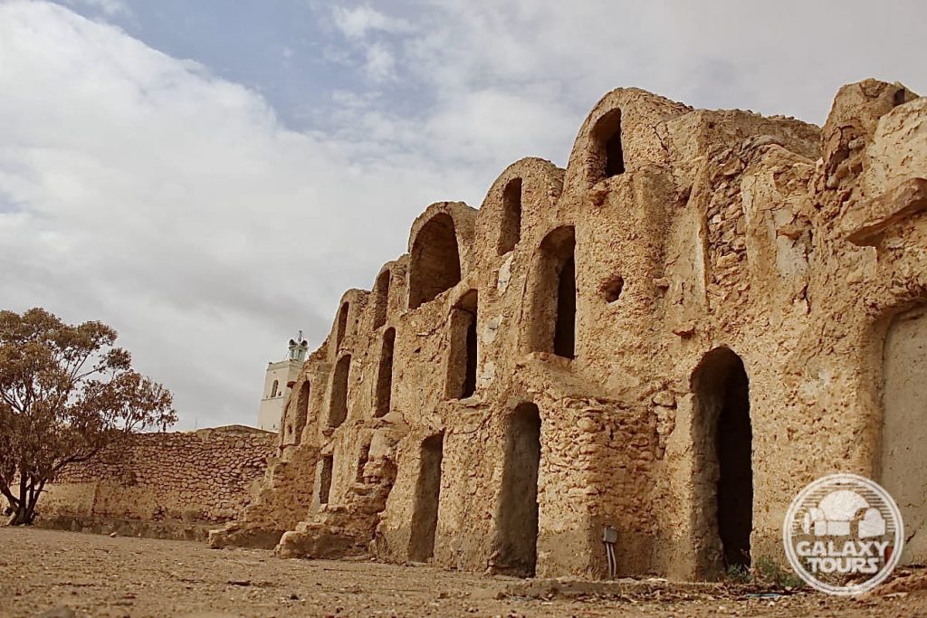
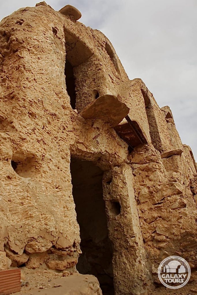
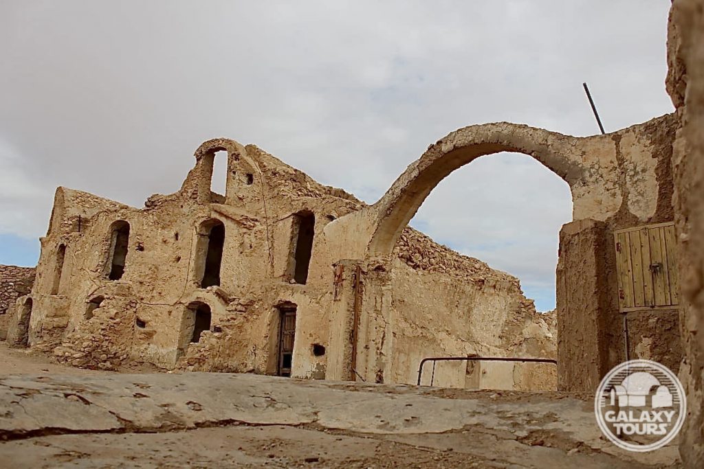
Ksar Ouled Debbab
OVERVIEW
Site: Ksar Ouled Debbab
GPS: 32.869731, 10.381757
Location: Ksar Ouled Debbab village, Tataouine Governorate, southeast Tunisia
Description: Amazigh fortified granary (mid-18th century CE)
Star Wars recce:
Episode IV – Tunisia (November 1975)
Source: Original recce photographs & recce sketch (Barry)
Star Wars scouted set concept:
Mos Eisley | slums street
Star Wars screenplay change | Cut location confirmation:
Fourth draft (1 January 1976) | Head of Departments Meeting (23 January 1976)
Star Wars connection discovery & follow-up:
Galaxy Tours (5 March 2021 & 29 May 2022)
More Mos Eisley (almost): For roughly a six-week period (mid-November 1975 to early January 1976), Ksar Ouled Debbab was locked in as a second fictional Mos Eisley location in Tunisia (paired with Ajim). Due to budget constraints and logistical hurdles associated with filming at a site located so far south in the Tataouine region, the Mos Eisley slums street scene envisioned for Ksar Ouled Debbab was replaced in the fourth draft (1 January 1976) with scene 48 [Ben: “These are not the droids you’re looking for”] to be shot in Ajim. Gary Kurtz (producer) confirmed in a department heads meeting on 23 January 1976 that this script change was final, eliminating the scene in which Luke stops his landspeeder to ask a group of “Jawas gathered around a solar heater” directions to the cantina. The decision to remove Ksar Ouled Debbab from the shooting schedule came just two months before production began in Tunisia on 22 March 1976.
Jawa village: In a Rolling Stone interview (August 1977), George Lucas provided his perception of Tunisian ksour, with specific reference to Ksar Ouled Debbab (although not mentioned by name): “We had a Jawa village scene in the film but we didn’t shoot it because the location was too far away, we just cut that out to keep on budget. We found these great things in Tunisia, little grain houses that were four stories high but with little tiny doors, little tiny windows, it was a hobbit village. So we had a whole sequence with these little hobbit-world slum dwellers but we had to cut it out.”


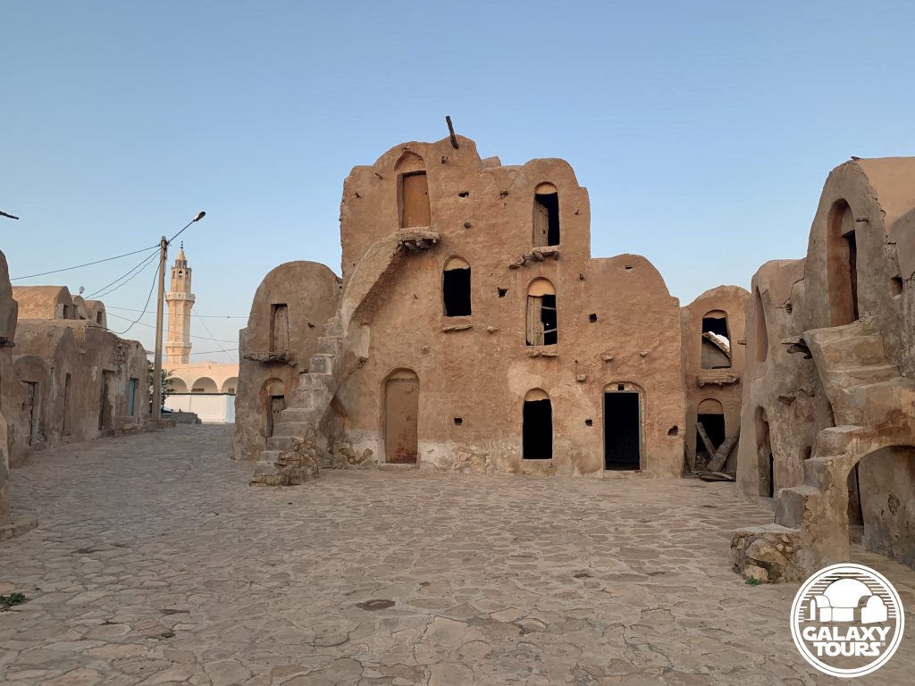
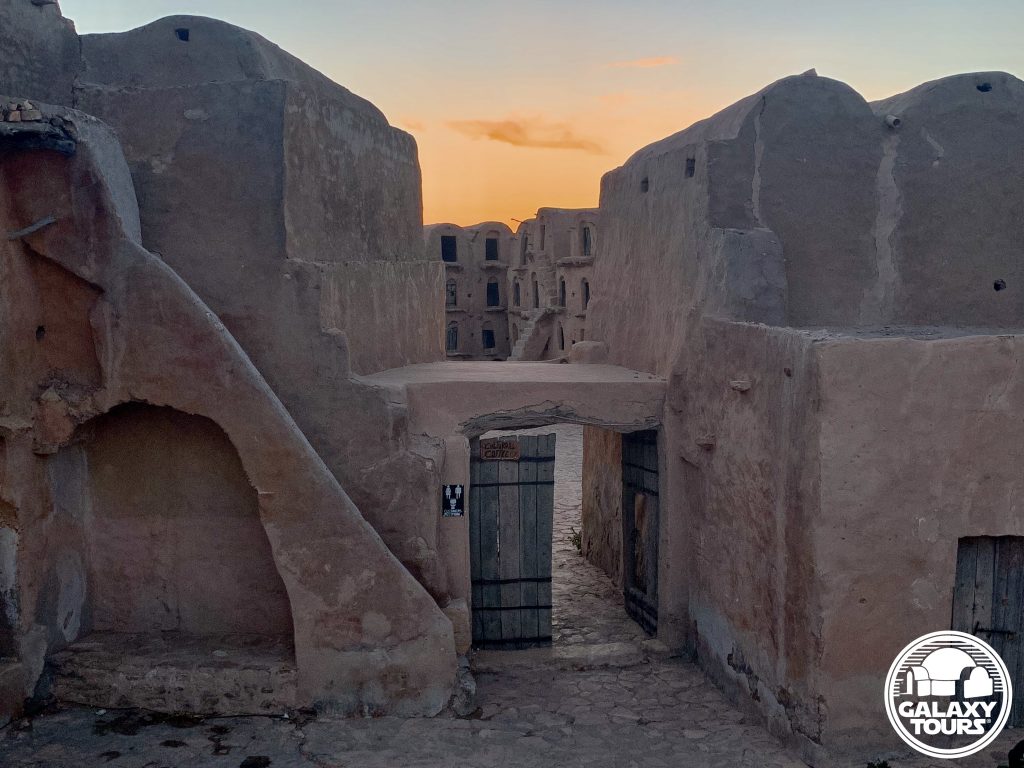
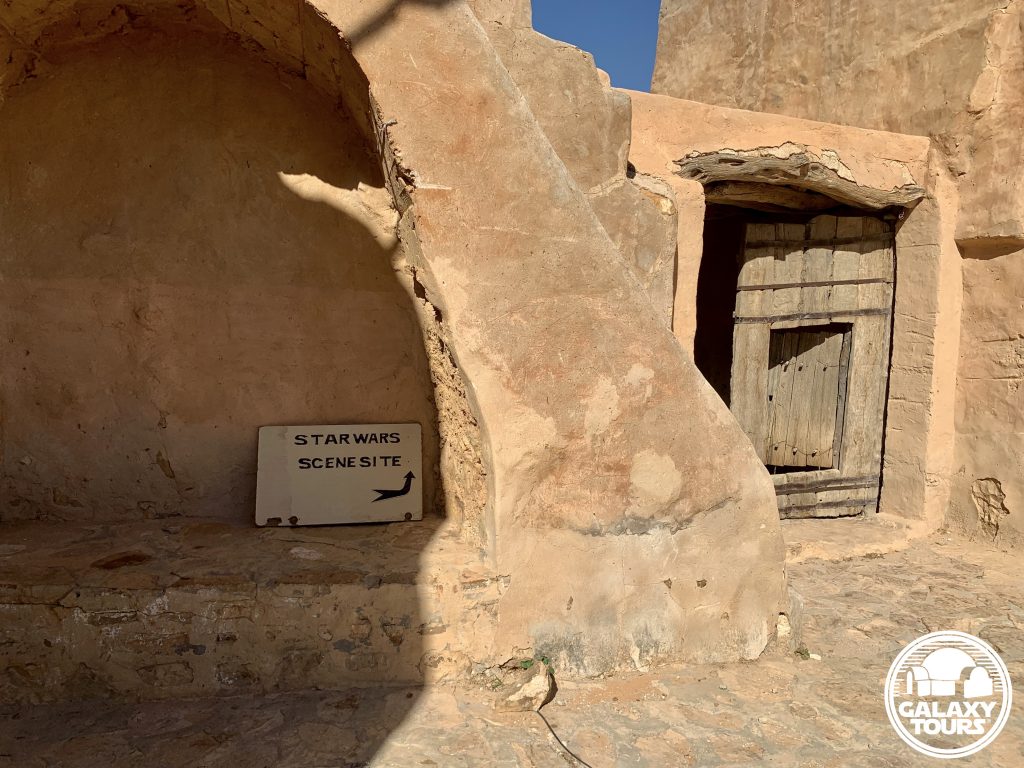
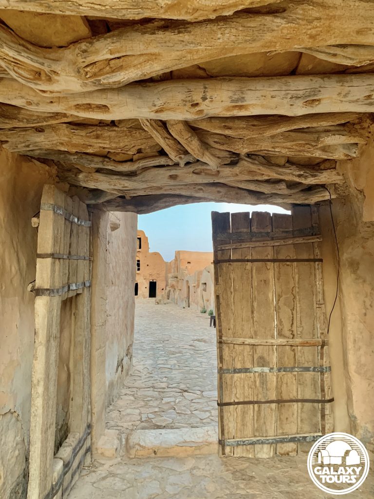
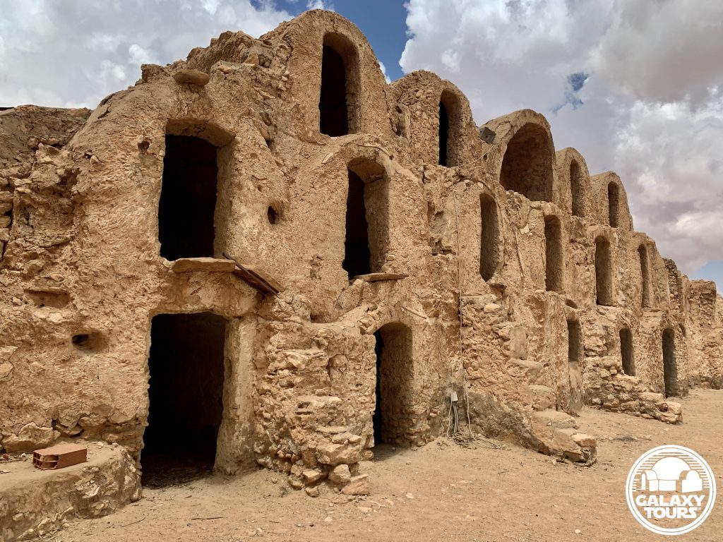
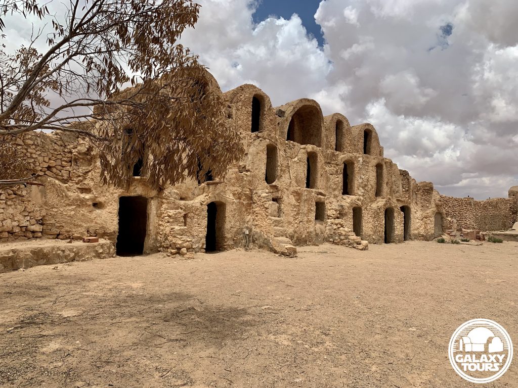
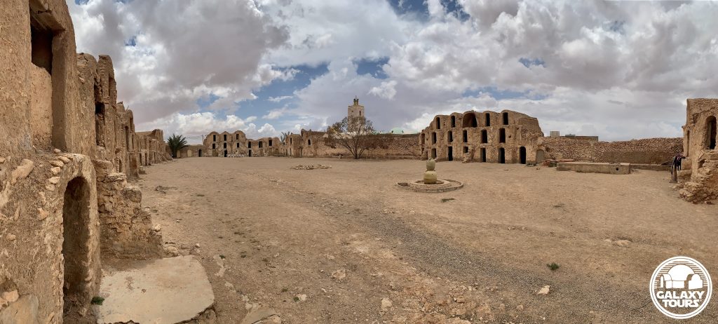
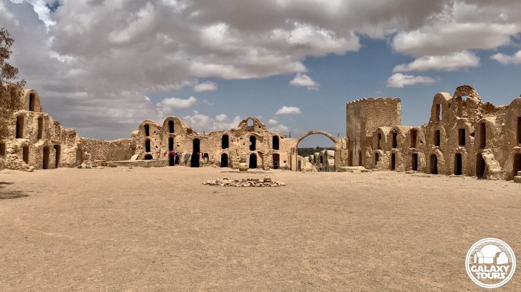
Ksar Ouled Abdallah
OVERVIEW
Site: Ksar Ouled Abdallah
GPS: 33.368891, 10.436985
Location: Metameur, Médenine Governorate, southeast Tunisia
Description: Amazigh fortified granary (18th century CE)
Star Wars recce:
Episode I – Tunisia (December 1995)
Source: Original recce photograph (Reynolds)
Star Wars scouted set concept:
Mos Espa | slave quarters
Star Wars connection discovery:
Galaxy Tours (9 December 2020)
Courtyard: The ksar boasts one of the largest courtyards among all surviving Tunisian ksour. This defining characteristic, although impressive, likely drove the decision not to film at Ksar Ouled Abdallah in preference to the more compact, visually appealing, production-friendly layout offered at nearby Ksar Ommarsia (Médenine city), the site eventually chosen for Mos Espa slave quarters street scenes.

Kala’a Guermessa
OVERVIEW
Site: Kala’a Guermessa
GPS: 32.986201, 10.251390
Location: Guermessa, Tataouine Governorate, southeast Tunisia
Description: Amazigh mountain citadel (7th century CE)
Star Wars recce:
Episode I – Tunisia (December 1995)
Source: Original recce photograph (Reynolds)
Star Wars scouted set concept:
Mos Espa spaceport | various elements
Star Wars connection discovery:
Galaxy Tours (10 February 2021)
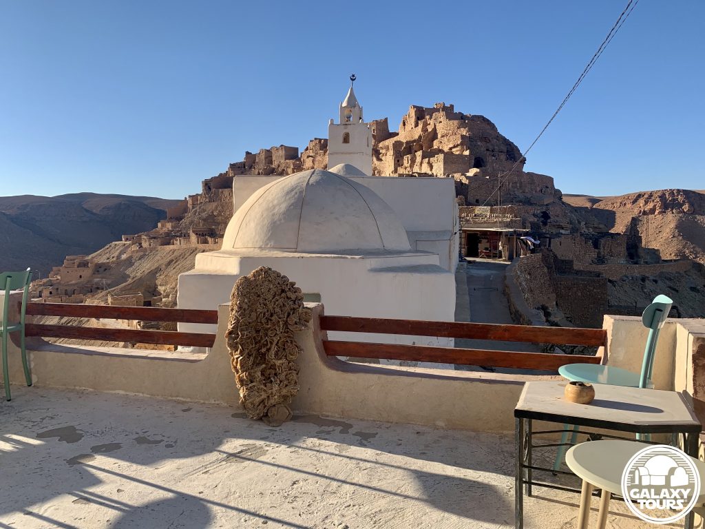
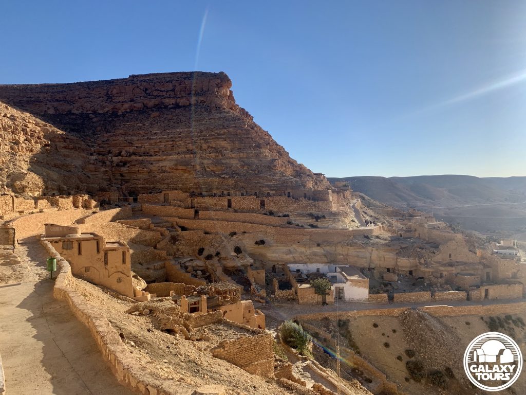
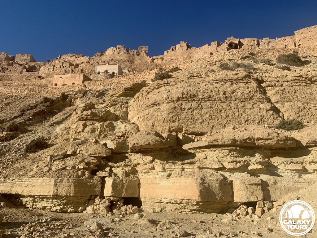
Isolation: Although arguably more impressive than Kala’a Chenini, Kala’a Guermessa receives comparatively very few visitors, creating a palpable sense of remote isolation framed by its two peaks of assorted ruins engulfing the stand-alone Sidi Hamza Marabout.
Challenges: The remote location of the site paired with the relatively steep ascent to access the ruins on both peaks likely resulted in only minimal consideration to transform Kala’a Guermessa into fictional Mos Espa.
Canon reference: The name Guermessa is associated (since 2015) with one of the three moons of fictional Tatooine. Nearby Chenini and Ghomrassen represent the names of the other two moons. All three locales “orbit” around Tataouine city.


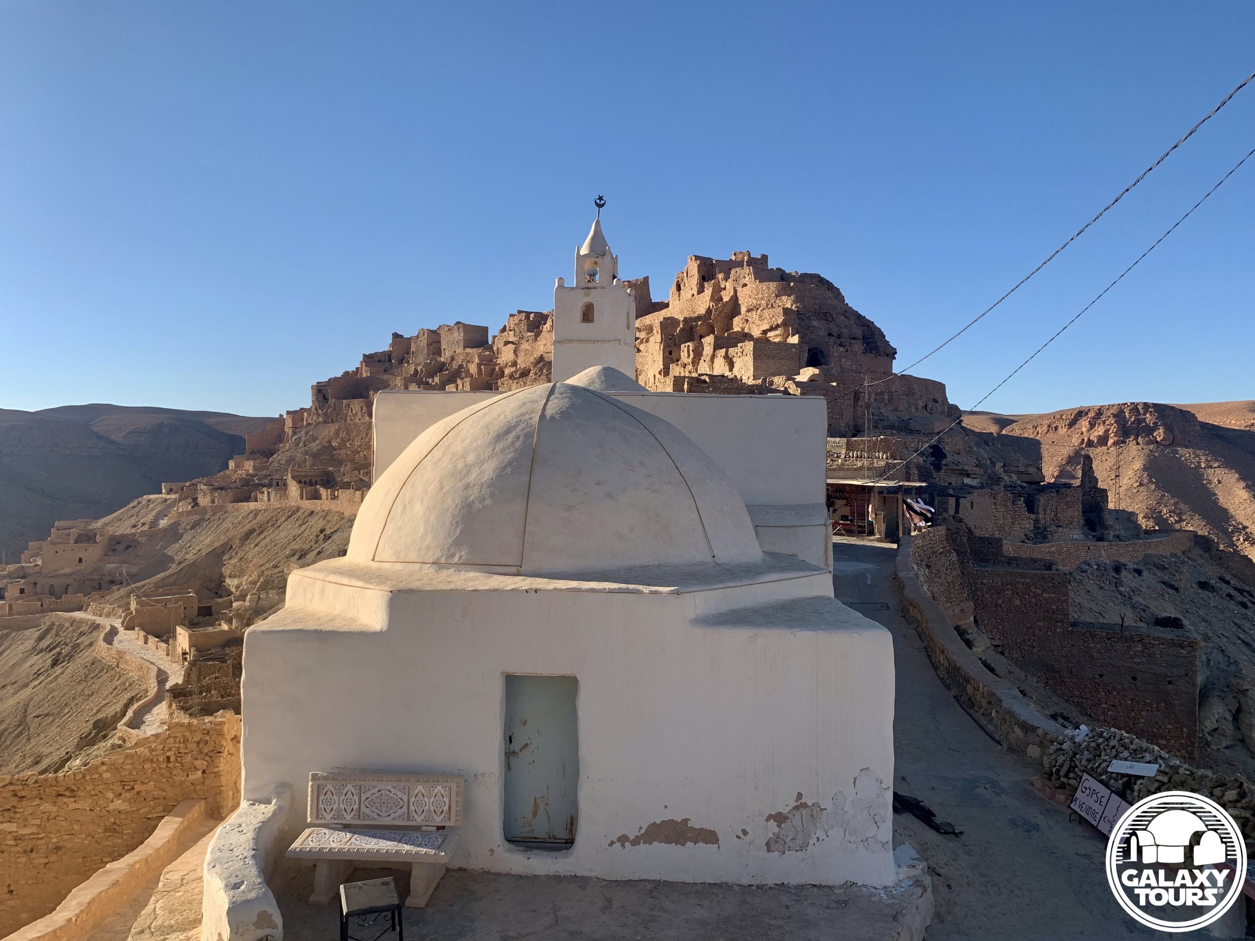
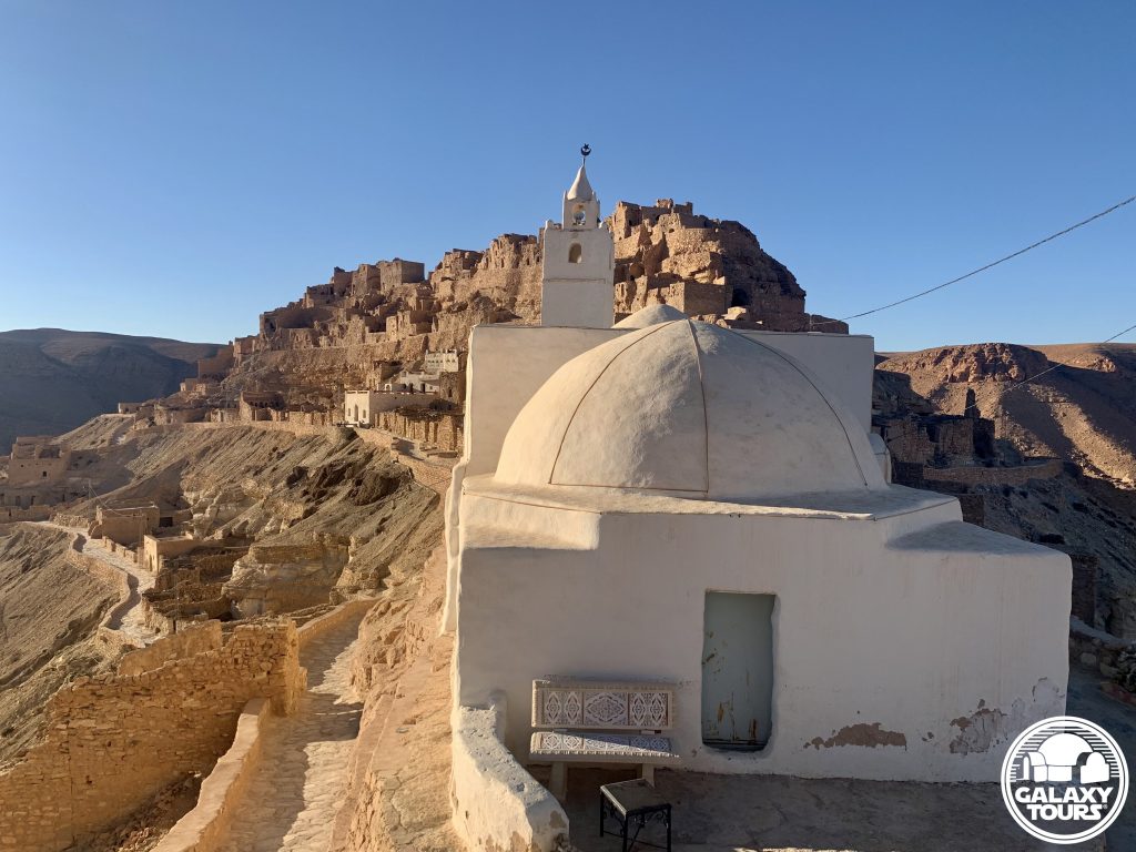
Kala’a Chenini
OVERVIEW
Site: Kala’a Chenini
GPS: 32.912024, 10.263603
Location: Chenini, Tataouine Governorate, southeast Tunisia
Description: Amazigh mountain citadel (late 12th century CE)
Star Wars recce:
Episode I – Tunisia (December 1995)
Source: Original recce sketch (Reynolds)
Star Wars scouted set concept:
Mos Espa spaceport | various elements
Star Wars connection confirmation:
Galaxy Tours (5 August 2022)
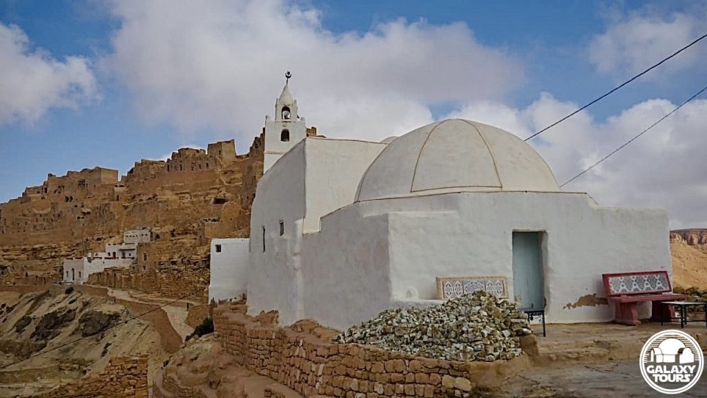
Tourist attraction: Kala’a Chenini, marked by the whitewashed Al-Farajeen Mosque as the distantly visible landmark for the bustling ancient mountain village, remains one of the most visited sites on the tourism circuit in southern Tunisia.
Challenges: The popularity of the site coupled with its remote location and the relatively steep ascent to access the ruins likely resulted in only minimal consideration to transform Kala’a Chenini into fictional Mos Espa.
Canon reference: The name Chenini is associated (since 2015) with one of the three moons of fictional Tatooine. Nearby Guermessa and Ghomrassen represent the names of the other two moons. All three locales “orbit” around Tataouine city.


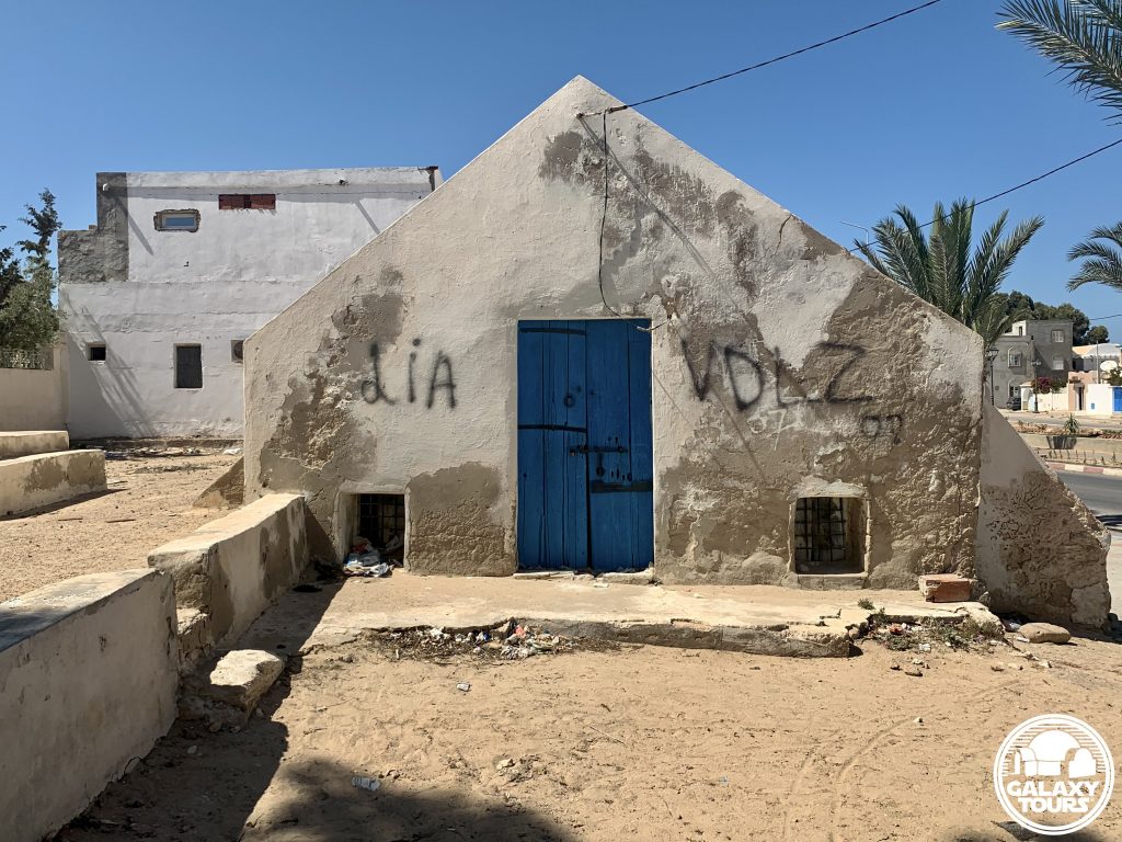
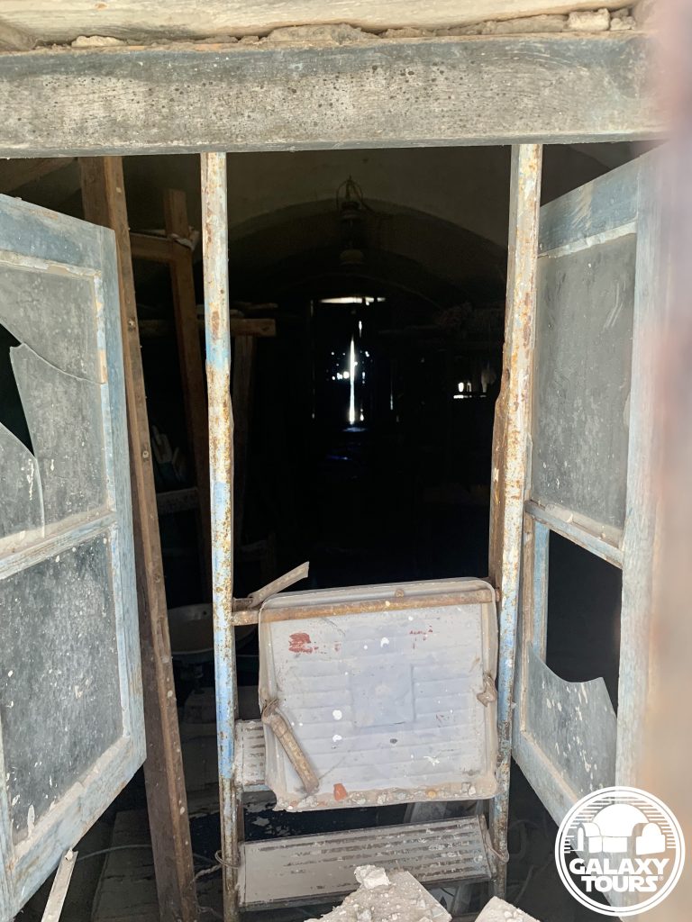
Hanout el-Aouina
OVERVIEW
Site: Hanout el-Aouina workshop
GPS: 33.882018, 10.855994
Location: Houmt Souk, Médenine Governorate, Djerba island, Tunisia
Description: Djerban wool weaving workshop (abandoned) (18th century CE)
Star Wars recce:
Episode IV – Tunisia (November 1975)
Source: Original recce photograph (Barry)
Star Wars scouted set concept:
Mos Eisley | Cantina (exterior)
Star Wars connection discovery:
Galaxy Tours (13 May 2022)
Name: Built in the 18th century CE by the Seoud family, the name Hanout el-Aouina in Tunisian Arabic means “the plum workshop,” suggesting the presence of a prominent plum tree in the immediate vicinity in former times.
Limited space: Situated in a compact area along the busy Avenue Habib Bourguiba near the Houmt Souk city center, securing adequate production space at Hanout el-Aouina would have been highly problematic, suggesting that likely only minimal consideration was given to transform the workshop into the Cantina.
Houmt Souk: Although unconfirmed, several unidentified recce photos from John Barry’s collection might possibly conclude that the Episode IV recce team also scouted various market streets inside the Houmt Souk city center in the general vicinity of Hanout el-Aouina.


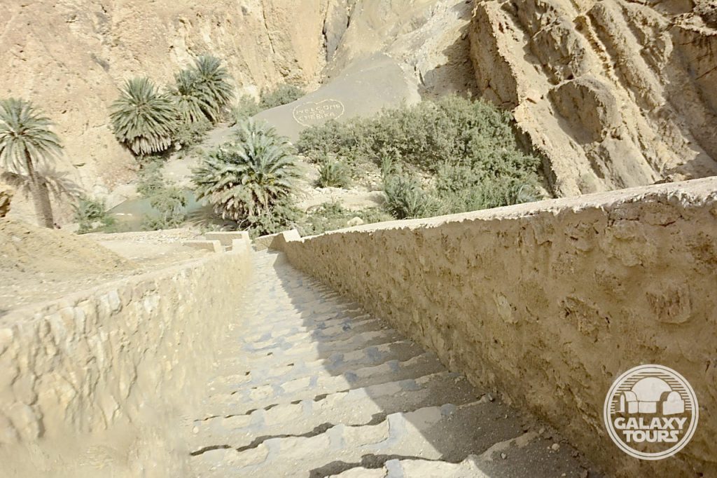
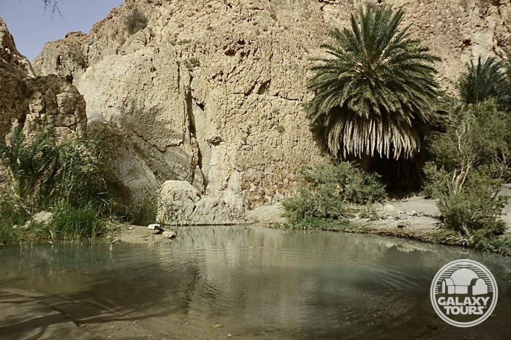
Chebika
OVERVIEW
Site: Ancient Chebika
GPS: 34.321577, 7.938975
Location: Tozeur Governorate, southwest Tunisia
Description: Ruins (Roman era)
Star Wars recce:
Episode IV – Tunisia (November 1975)
Source: Original recce sketch (Barry)
Star Wars scouted set concept:
Mos Eisley spaceport | various elements
Star Wars connection confirmation:
Galaxy Tours (8 July 2021)
Key factors: Although scouted as a potential alternative to Ajim, Chebika was likely never considered a true viable option to represent Mos Eisley for several key reasons: (1) Chebika’s remote mountainous setting seemingly presented steep logistical challenges, (2) budget constraints rendered the task of dressing an entire ruins area with set decor as highly unrealistic, and (3) Ajim proved to be more practical, economical, and accessible for production.
Screenplay setting: The rugged mountainous landscape surrounding Chebika (unlike Ajim) matched the screenplay concept for a “bluff overlooking Mos Eisley spaceport,” initially introduced in the third draft (1 August 1975).


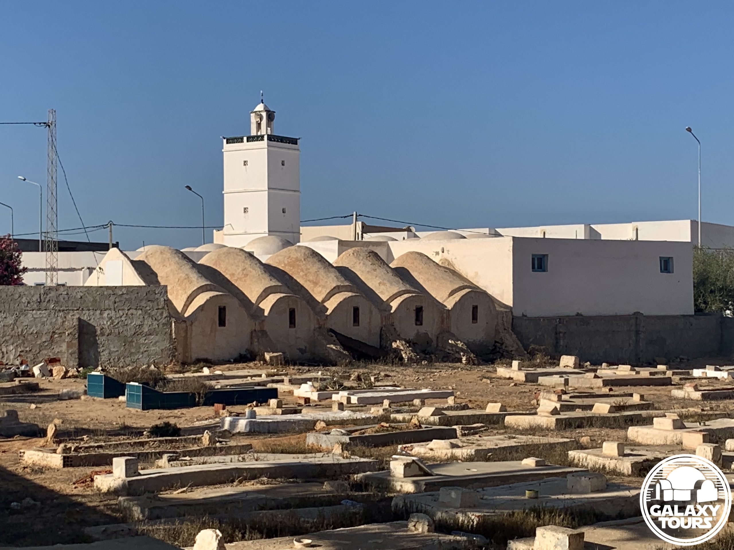
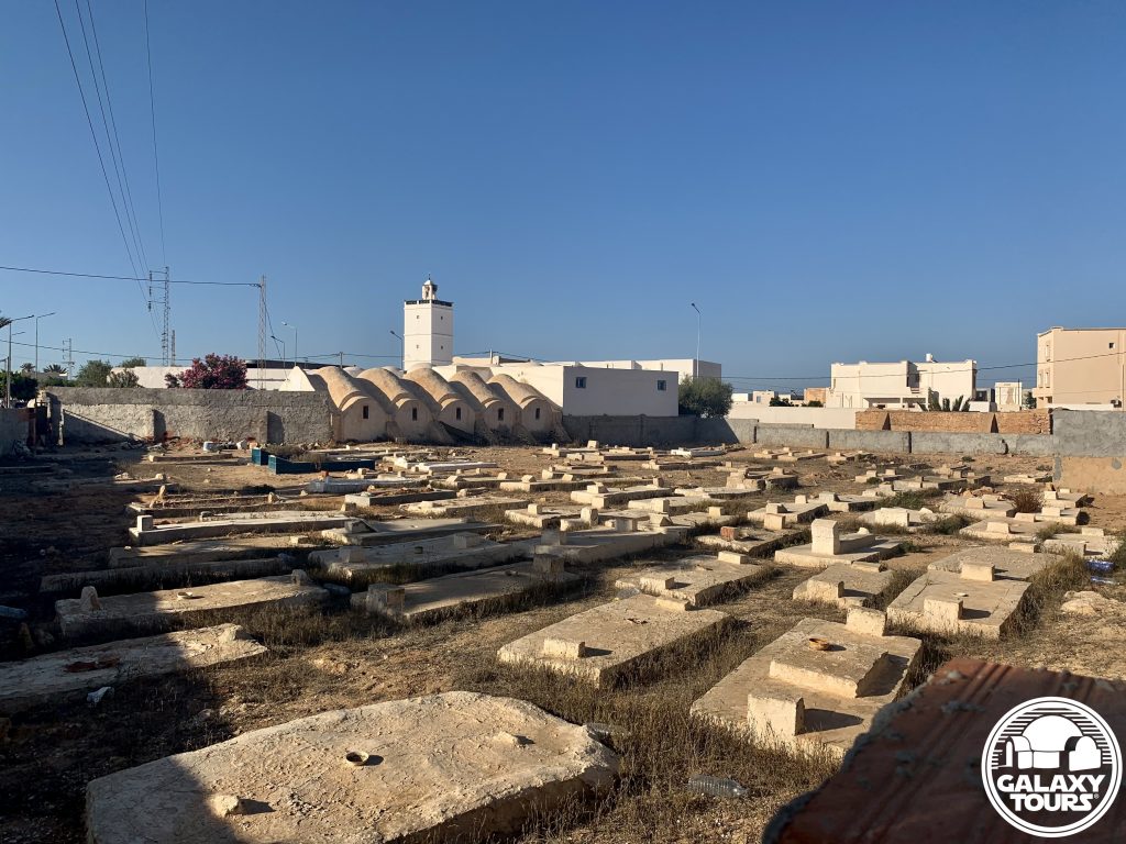
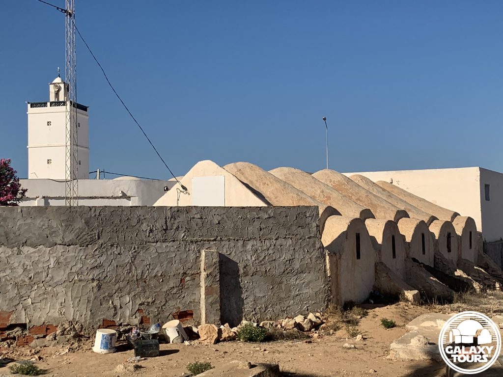
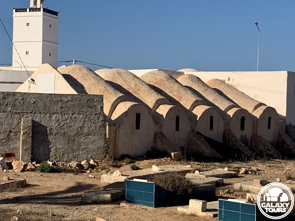
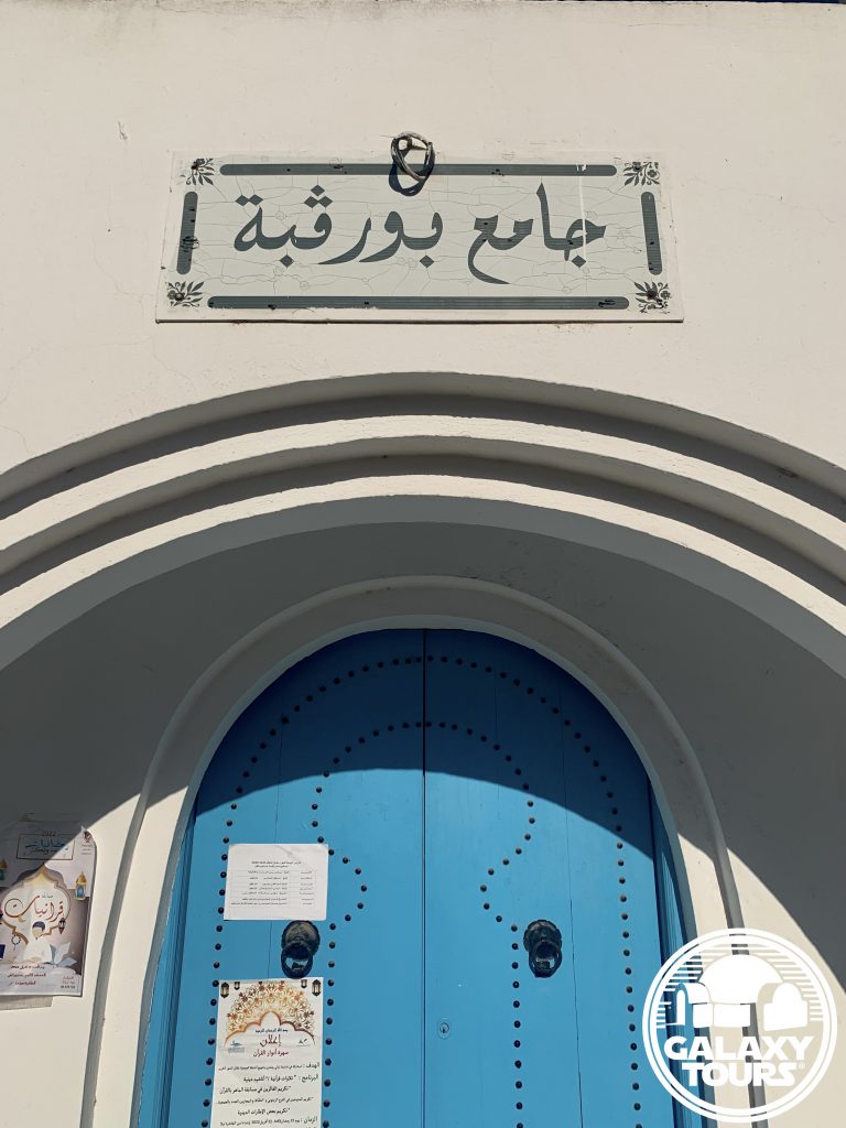
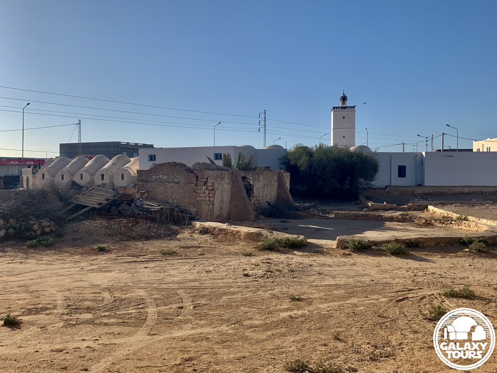
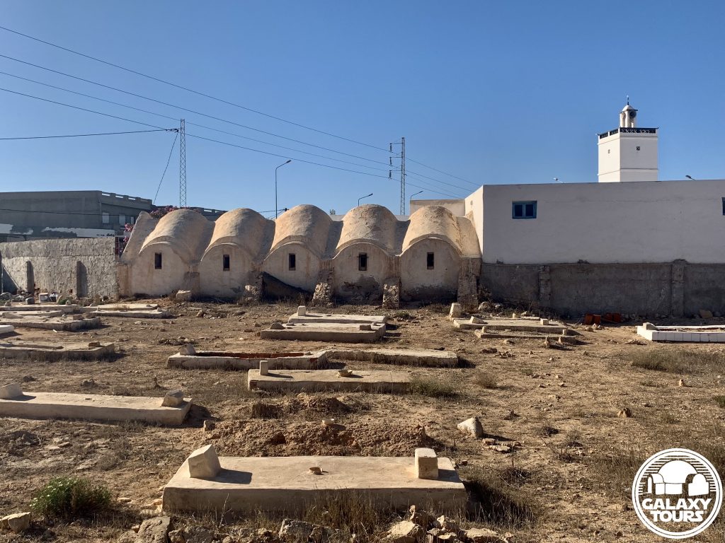
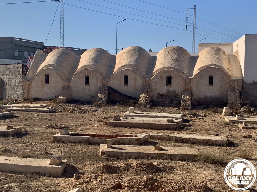
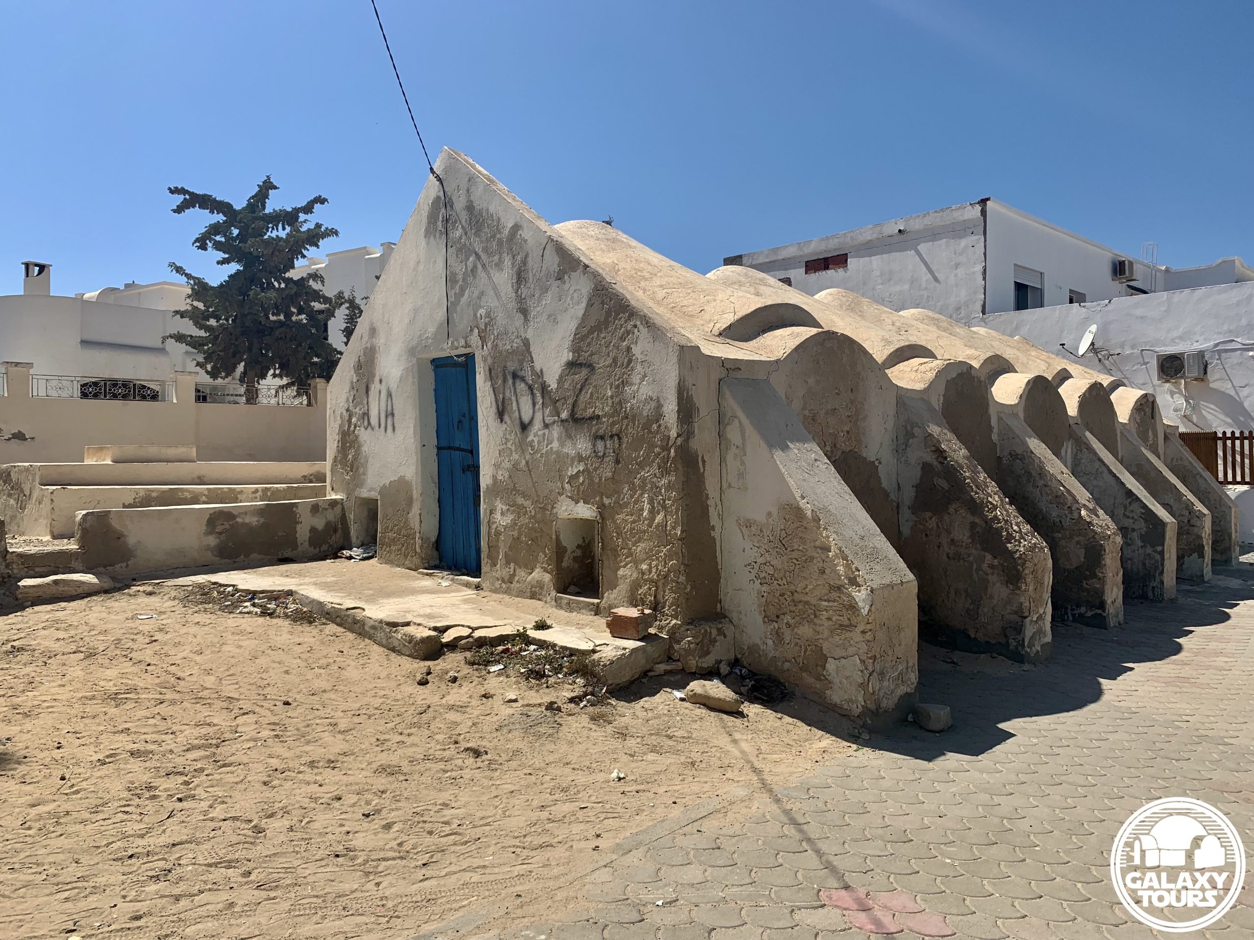
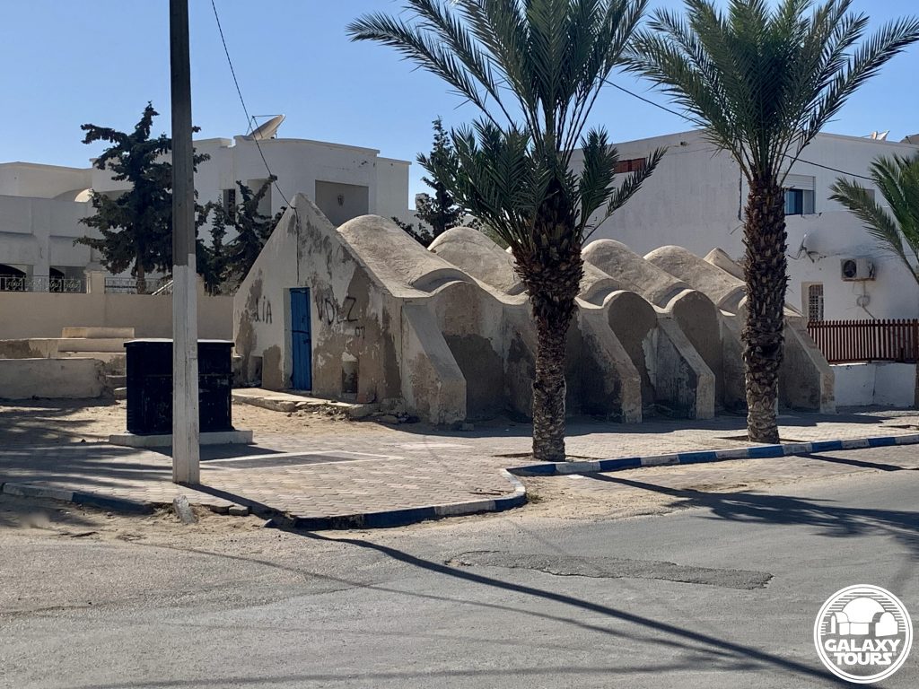
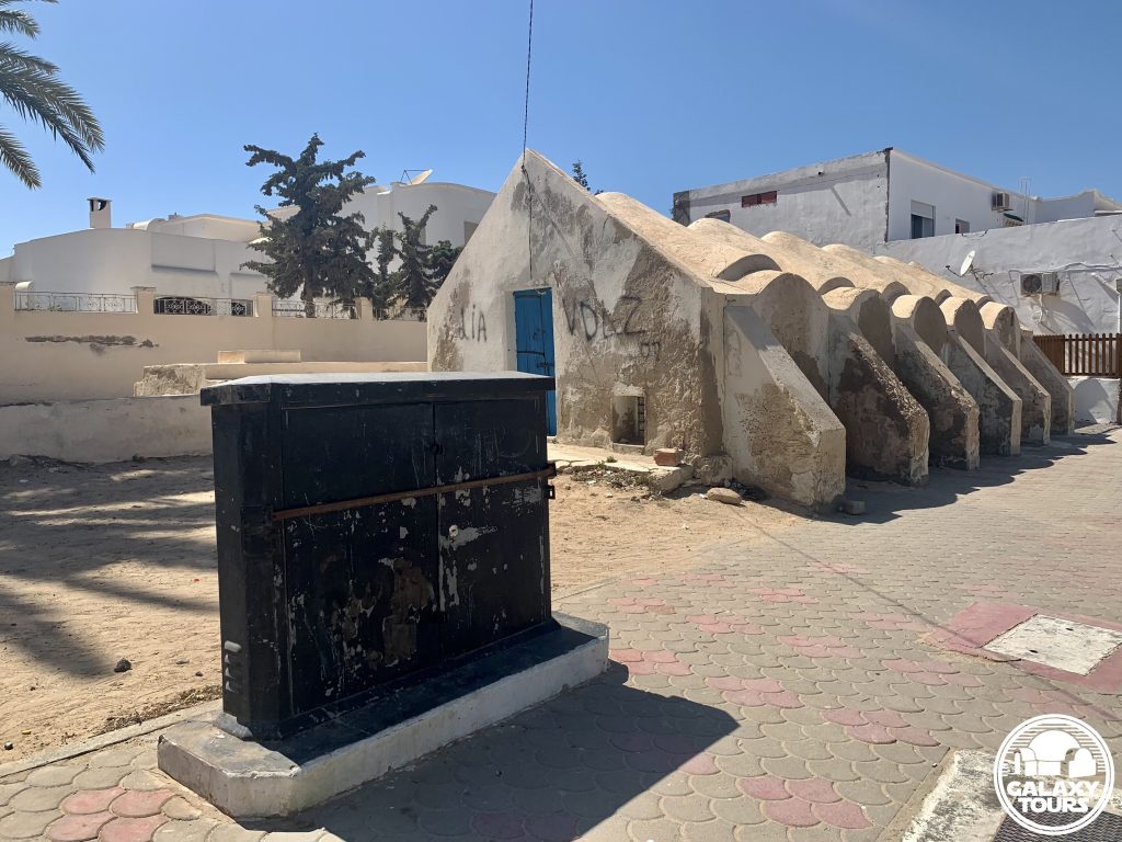
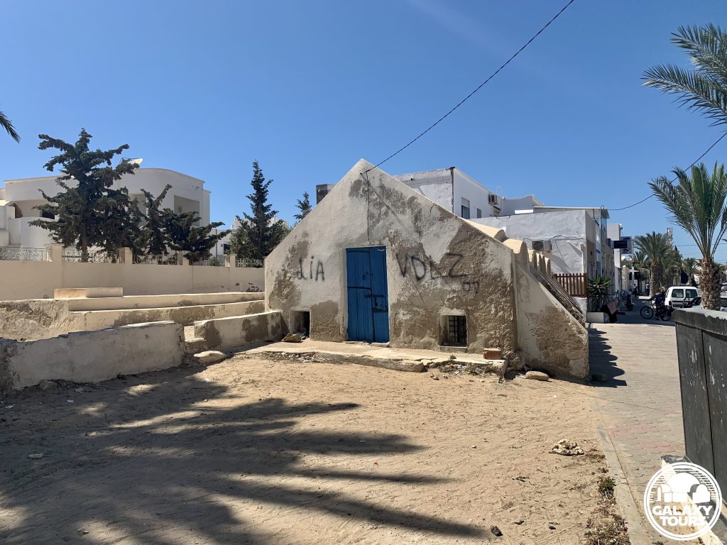
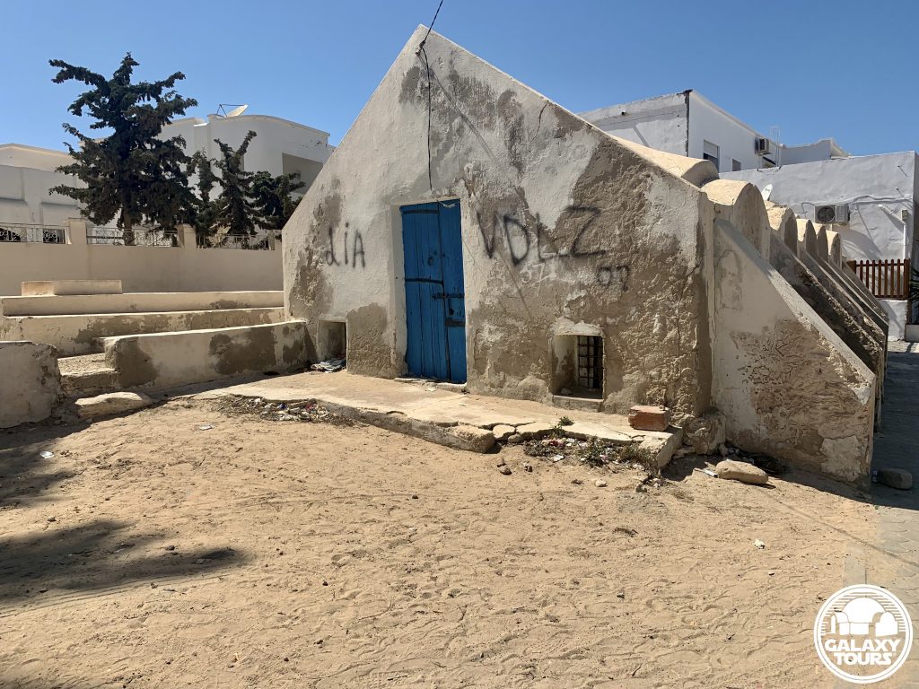
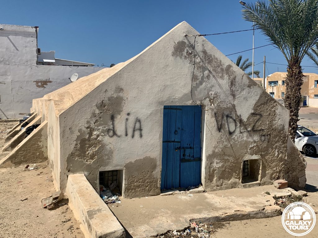
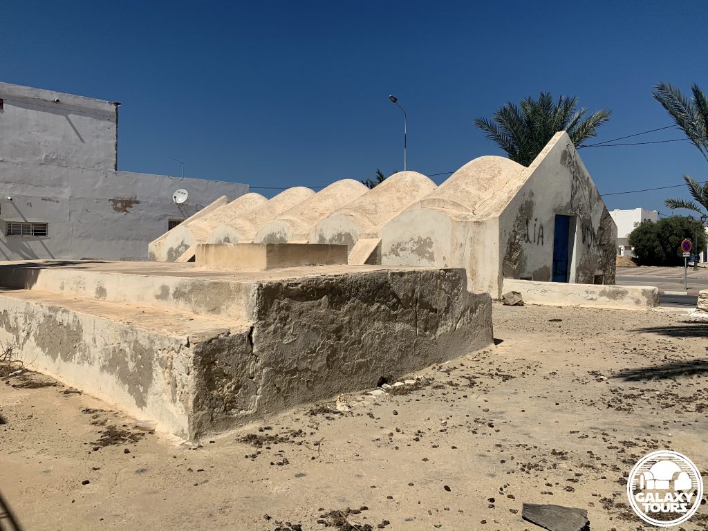
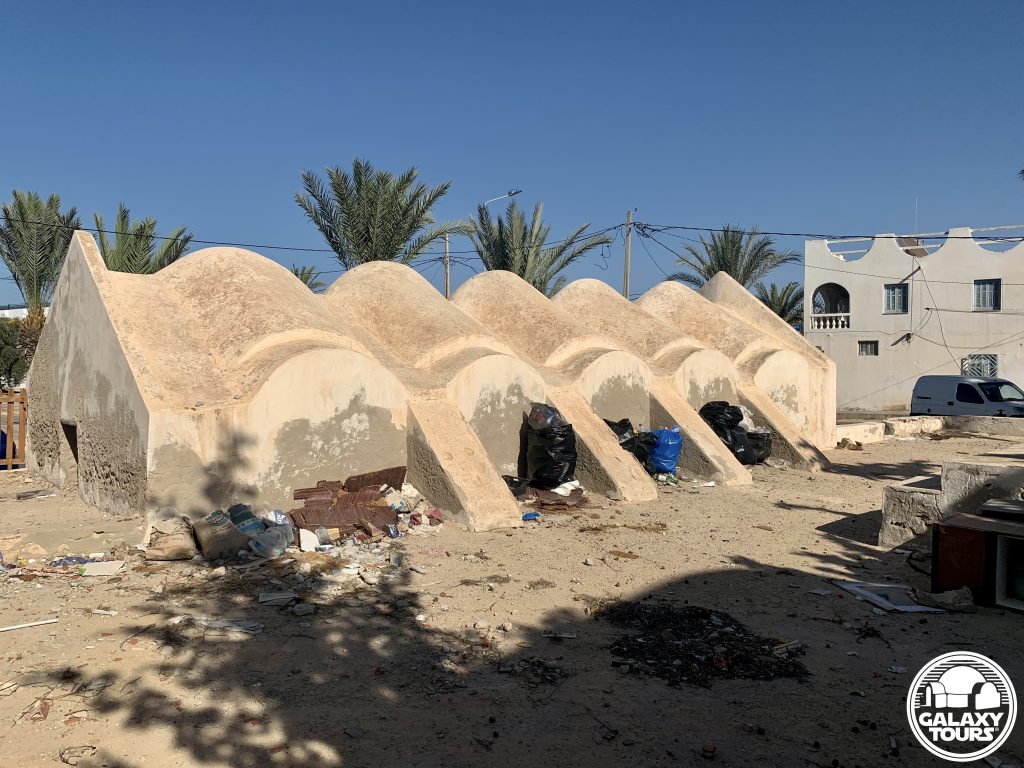
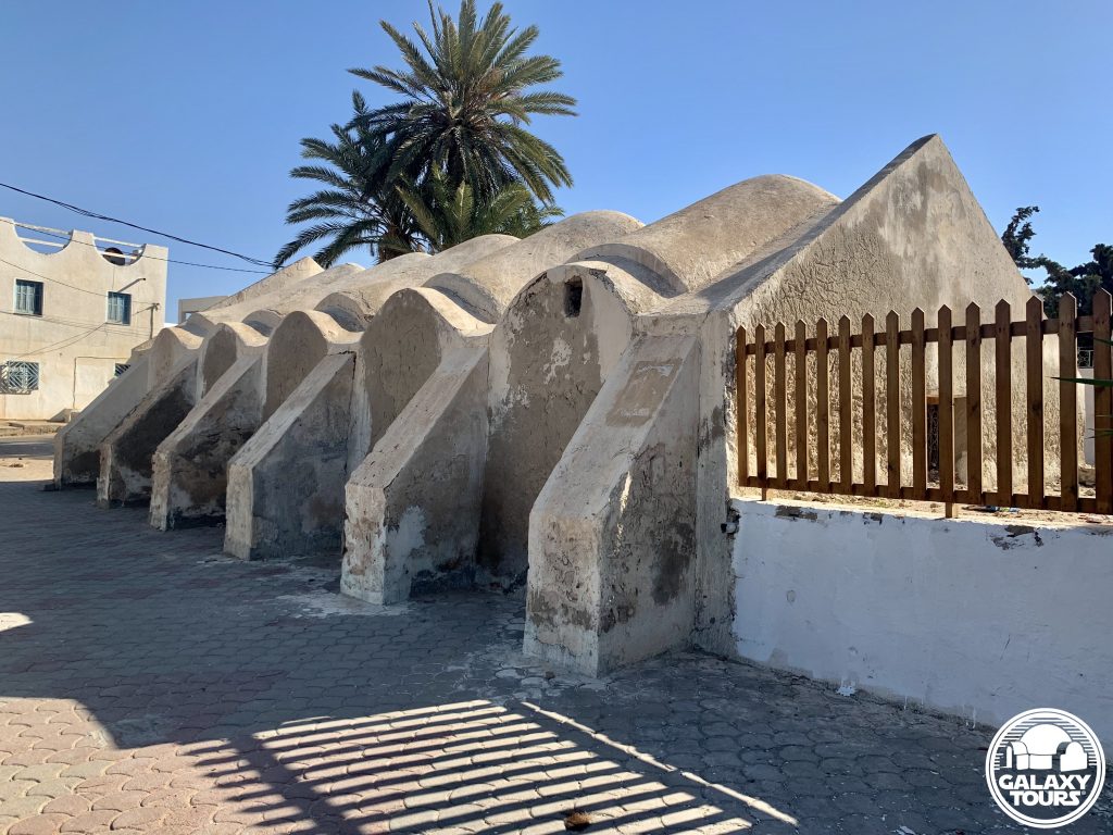
Bouregba Mosque
OVERVIEW
Site: Bouregba Mosque complex
GPS: 33.746187, 10.920452
Location: Sedouikech, Médenine Governorate, Djerba island, Tunisia
Description: Ibadi complex (late 19th century CE)
Star Wars recce:
Episode IV – Tunisia (November 1975)
Source: Original recce photograph (Barry)
Star Wars scouted set concept:
Mos Eisley | Cantina (exterior)
Star Wars connection discovery:
Galaxy Tours (13 May 2022)
Drive-by: Bouregba Mosque complex includes a mosque, wool weaving workshop, and cemetery. The focal point of the quick drive-by recce visit was certainly the weaving workshop. The close proximity of the cemetery to the workshop likely designated the site unsuitable for filming from the start.