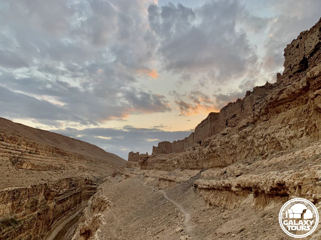
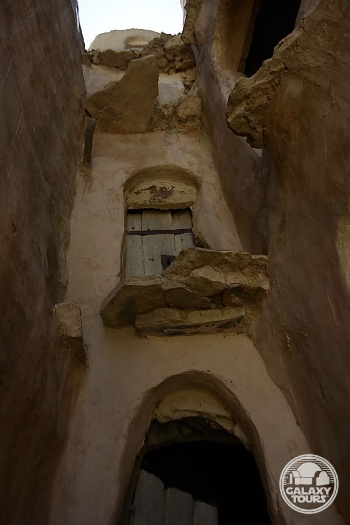
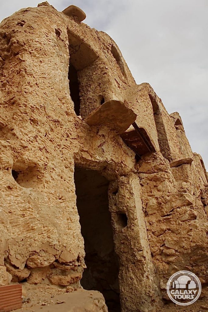
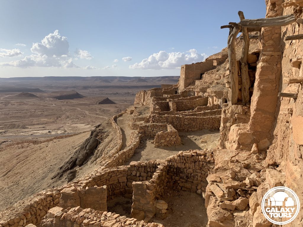
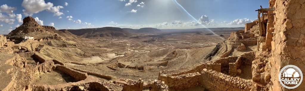
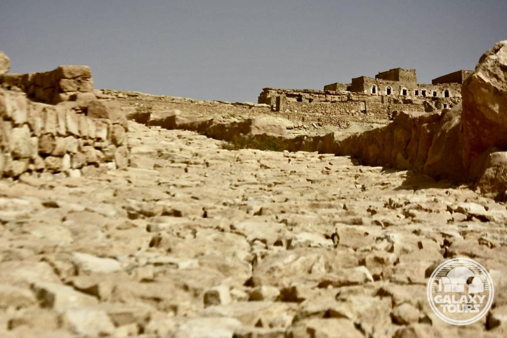
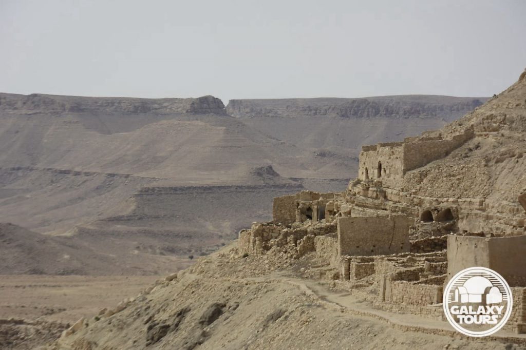
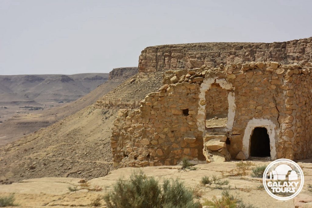
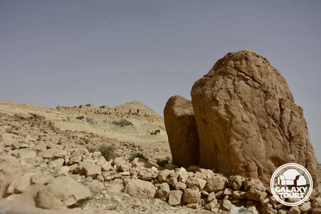
Midès
OVERVIEW
Site: Ancient Midès
GPS: 34.406692, 7.920470
Location: Tozeur Governorate, southwest Tunisia
Description: Ruins (pre-Roman era)
Star Wars recce:
Episode I – Tunisia (December 1995)
Source: Original recce photograph (Reynolds)
Star Wars scouted set concept:
Mos Espa spaceport | various elements
Star Wars connection discovery:
Galaxy Tours (22 November 2020)
Challenges: Midès’ remote mountainous setting less than 1 km from the Algerian border seemingly presented too many logistical challenges, likely resulting in only minimal consideration to transform the hillside ruins into fictional Mos Espa.
Canyon: Tunisian tourism circles frequently identify the canyon below ancient Midès as “Star Wars Canyon,” inaccurately confusing this unique landscape with Maguer Gorge (Jebel Sidi Bouhlel). This misinformation is likely tethered to the popular (but unfounded) claim that the Midès area served as inspiration for various Mos Espa podrace canyonland CGI elements.


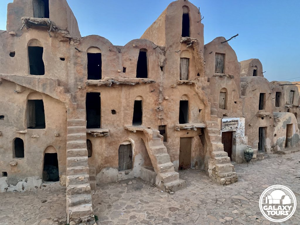
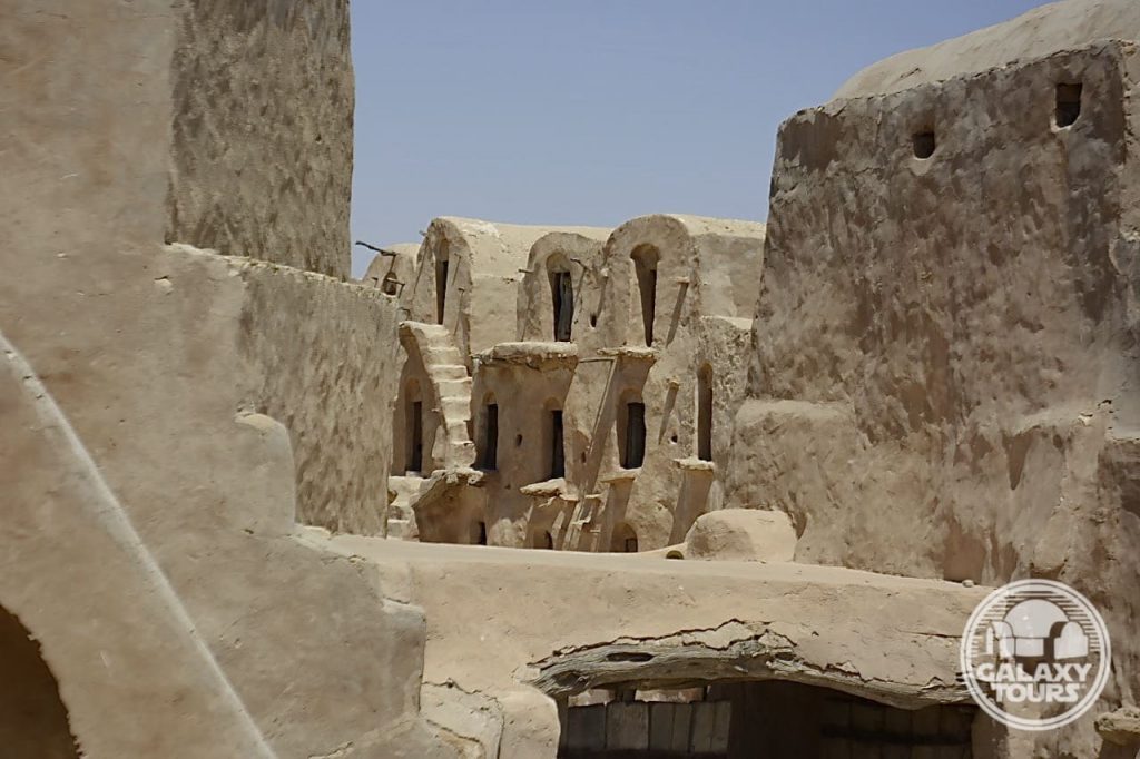
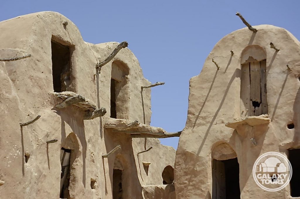
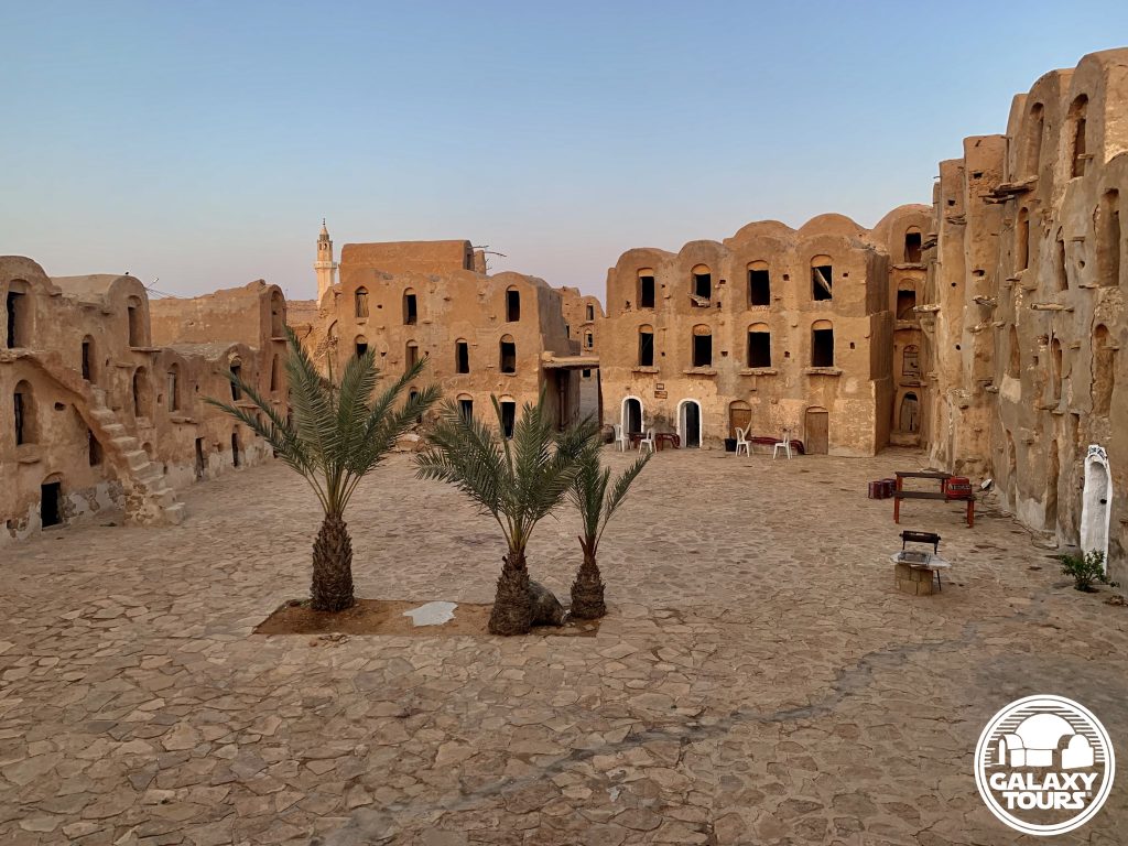
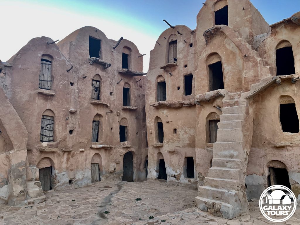
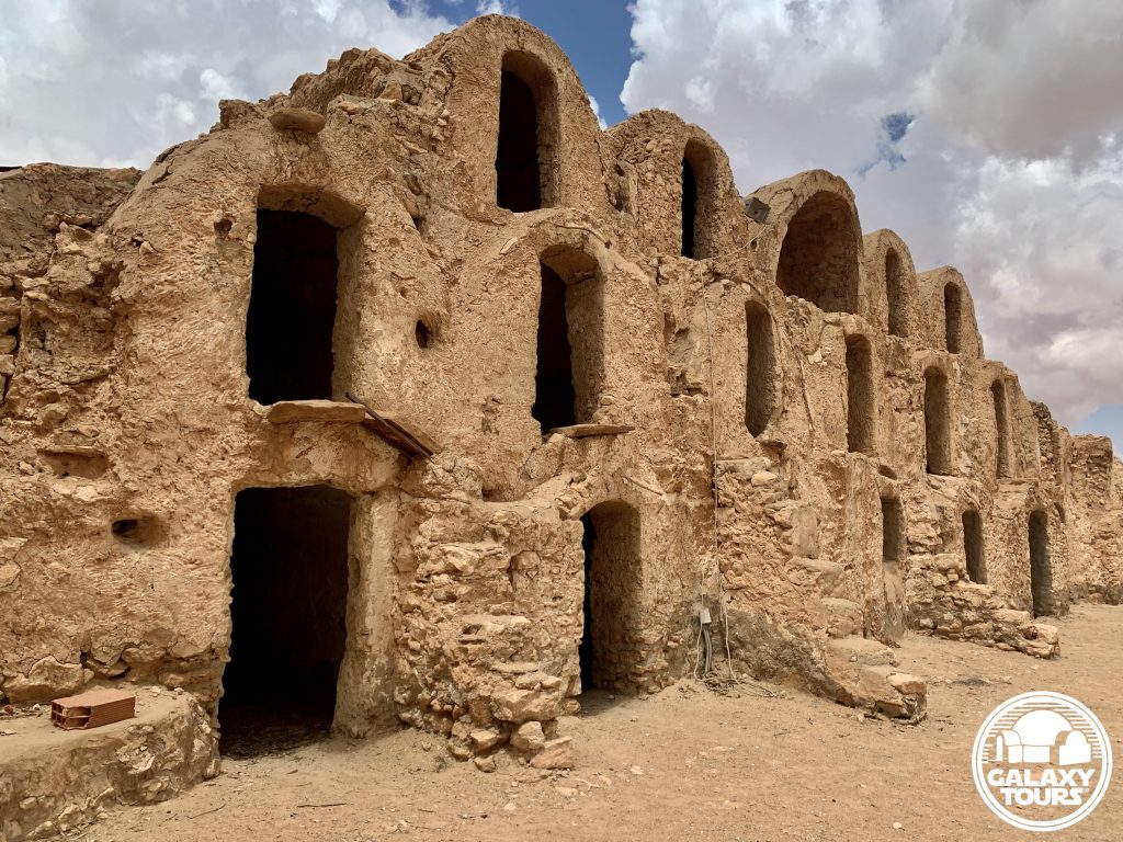
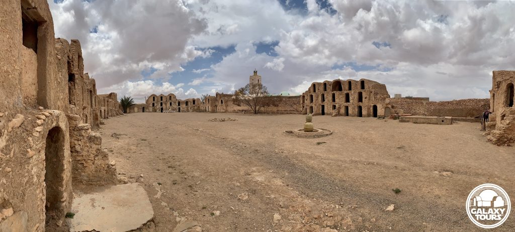
Ksar Ouled Soltane
OVERVIEW
Site: Ksar Ouled Soltane
GPS: 32.788346, 10.514549
Location: Ksar Ouled Soltane village, Tataouine Governorate, southeast Tunisia
Description: Amazigh fortified granary (late 17th century CE)
Star Wars recce:
Episode I – Tunisia (December 1995)*
Source: Correspondence with Philip Vanni (Star Wars tourism pioneer)
Star Wars scouted set concept:
Mos Espa | slave quarters
Pending: Although final confirmation is still pending, layered first- and second-hand verbal evidence suggests that Ksar Ouled Soltane—one of the most popular Tunisian ksour—was probably scouted in December 1995 or possibly during a subsequent pre-production recce in 1996. Located deep in the Tataouine region far from all major roads, the extreme remote position of the site likely resulted in only minimal consideration for Episode I production.
Correction: Despite consistently circulated misinformation dating back to 1999, Ksar Ouled Soltane is not a Star Wars film site.
*Visual confirmation pending. No recce photographs or sketches from Ksar Ouled Soltane are known to exist.

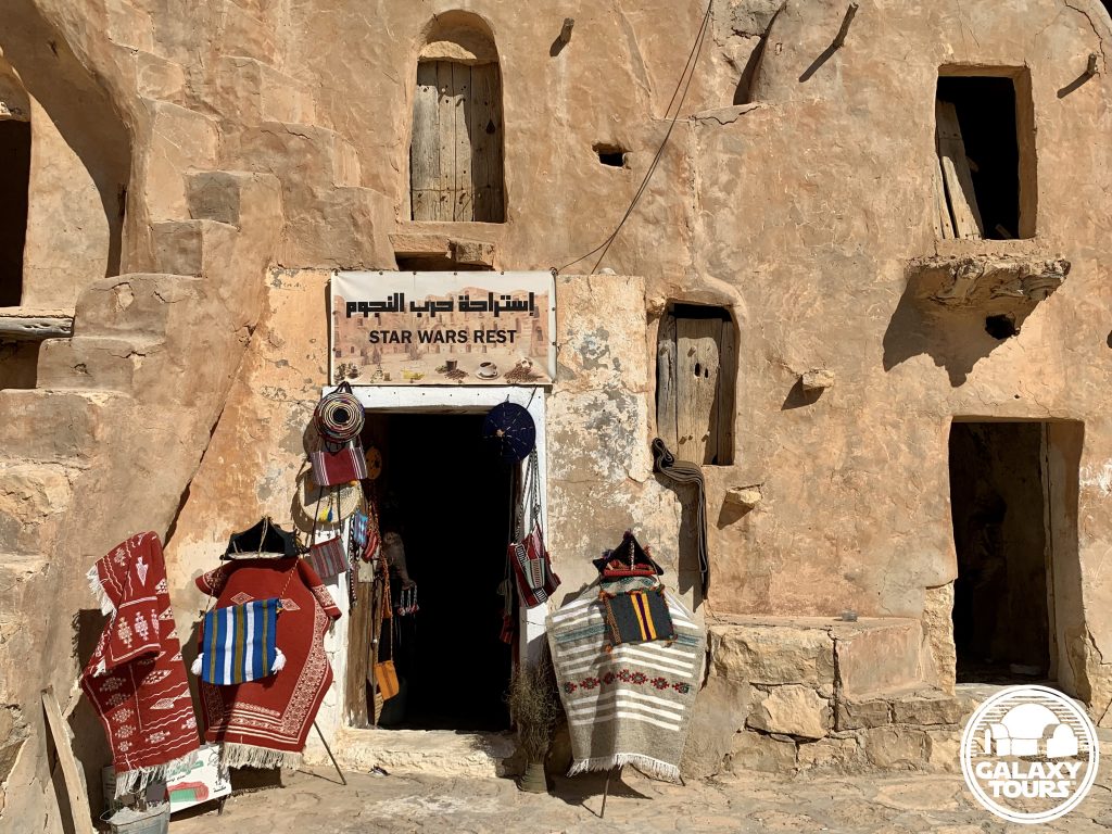
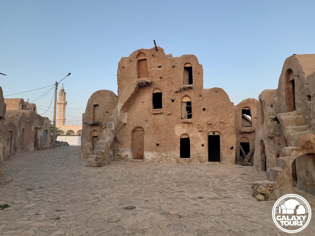
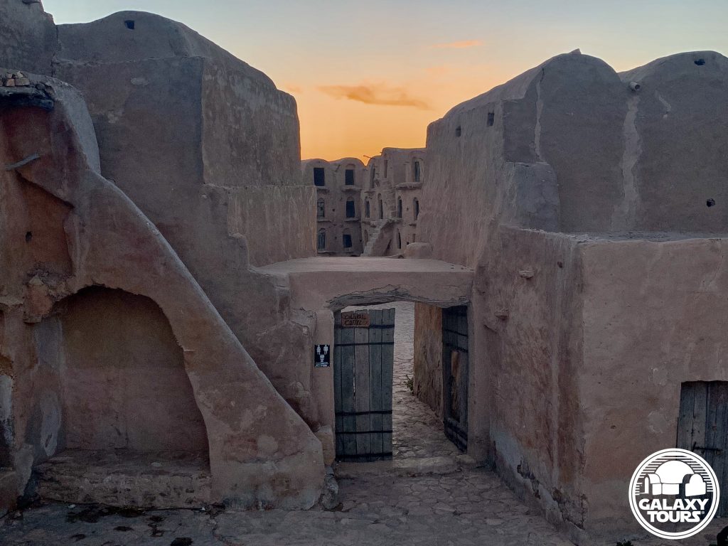
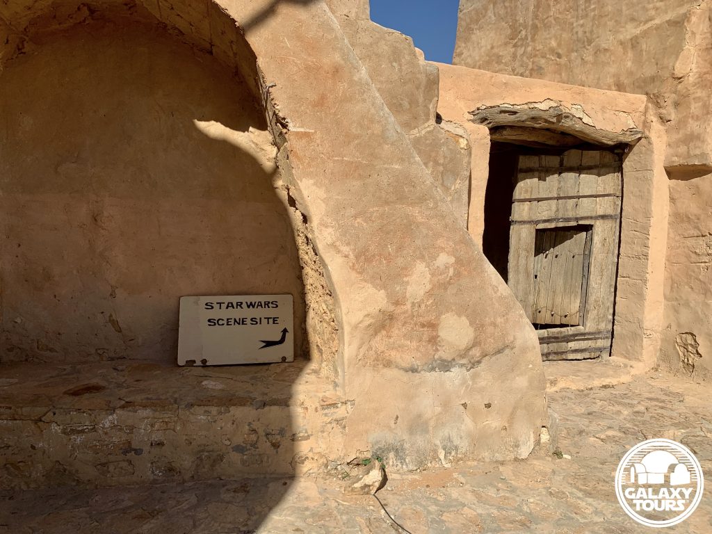
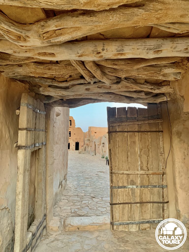
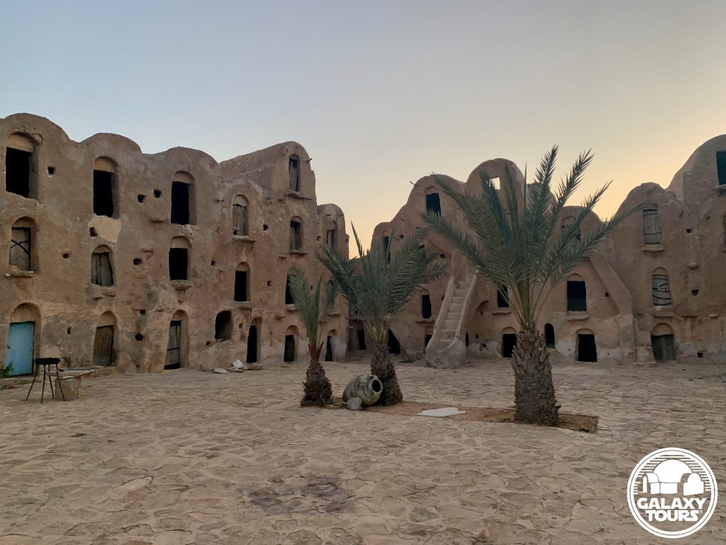
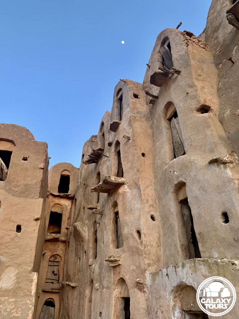
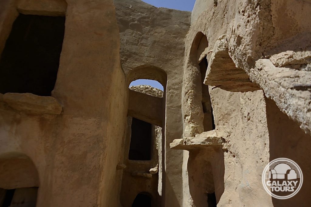

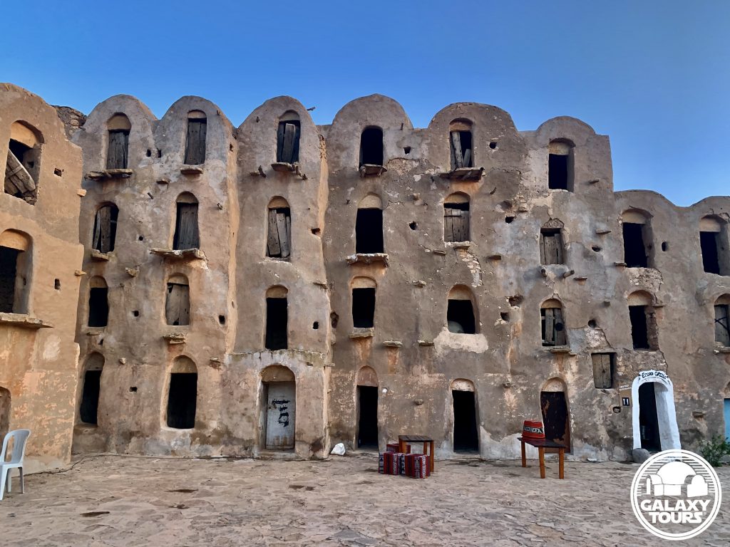


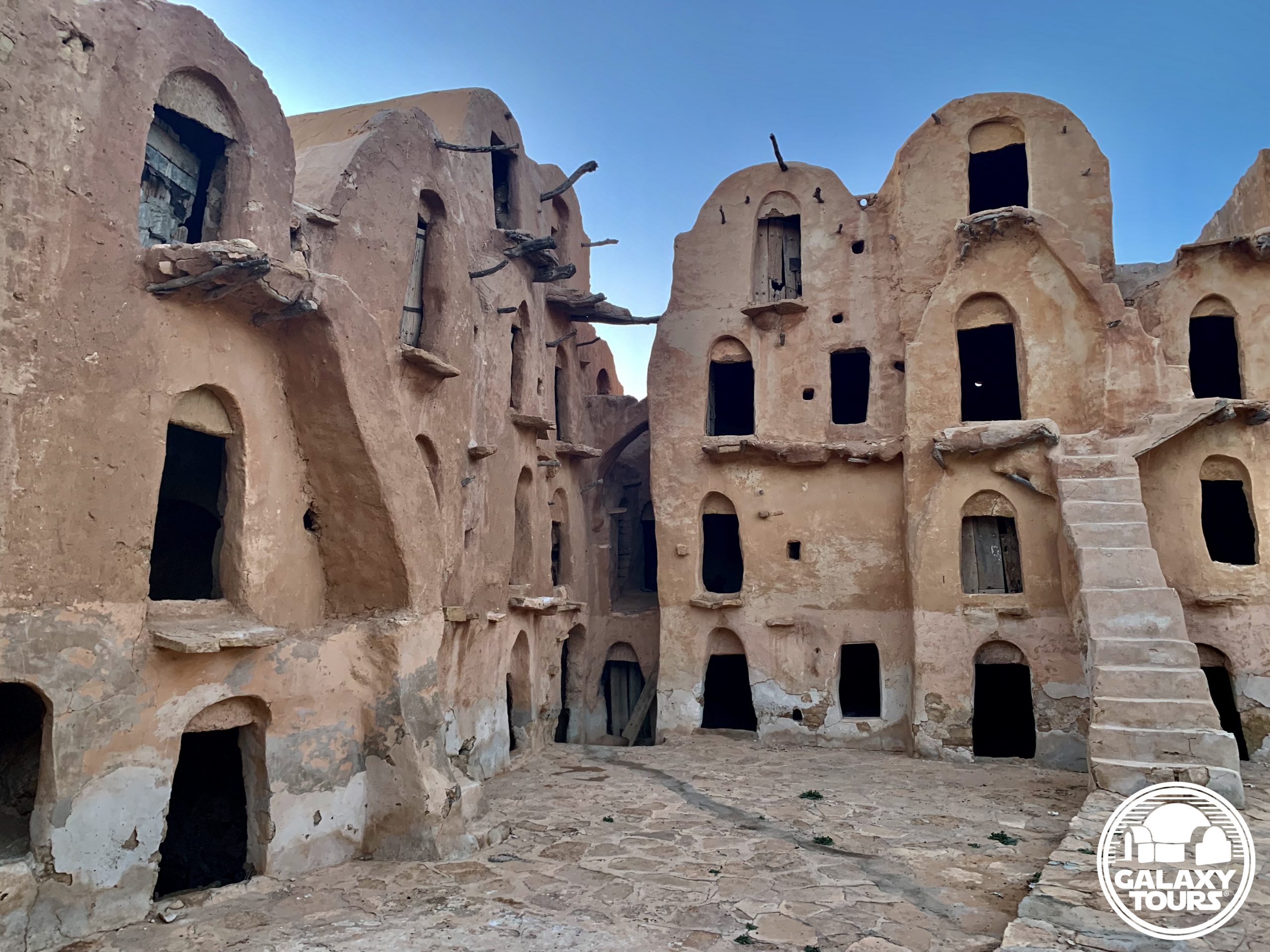
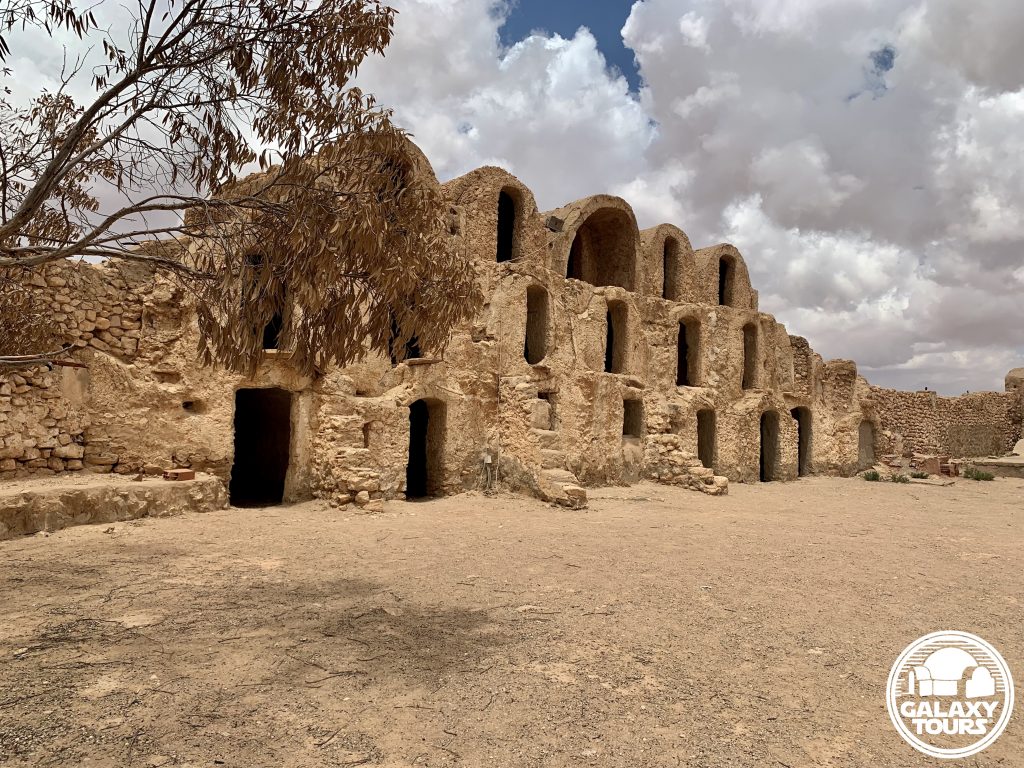
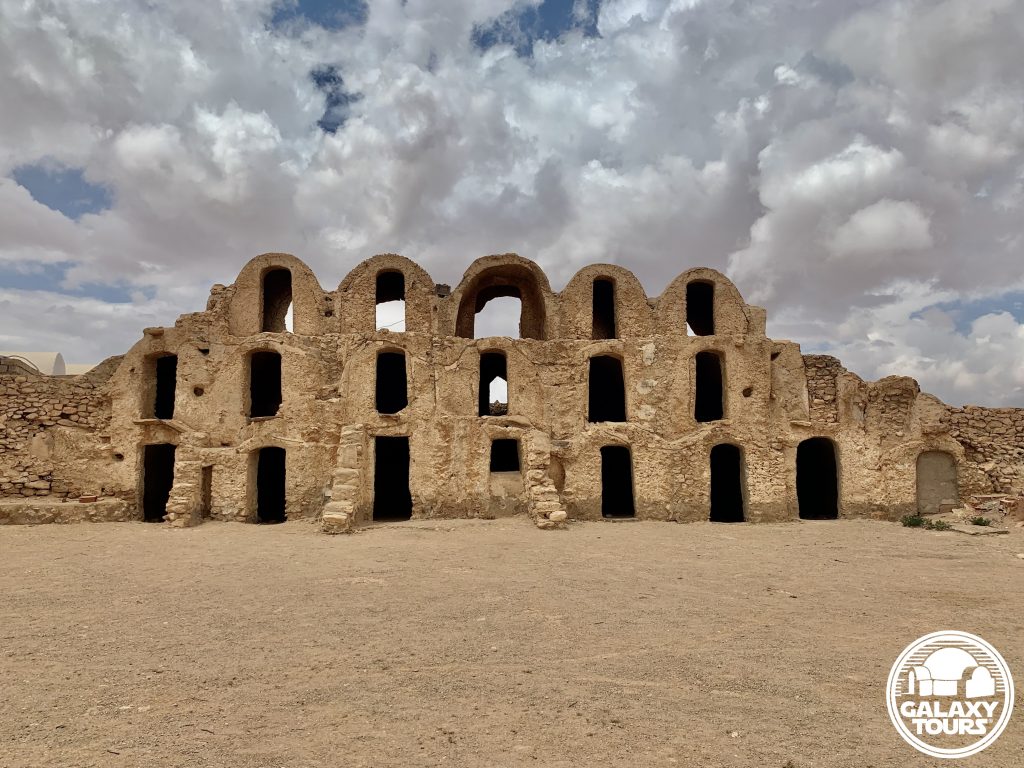
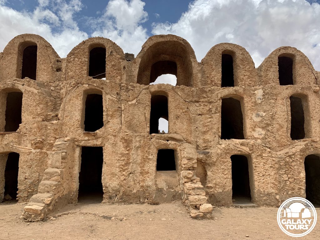
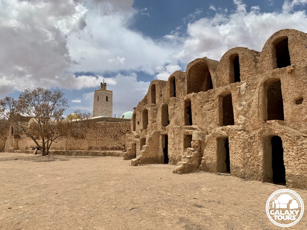
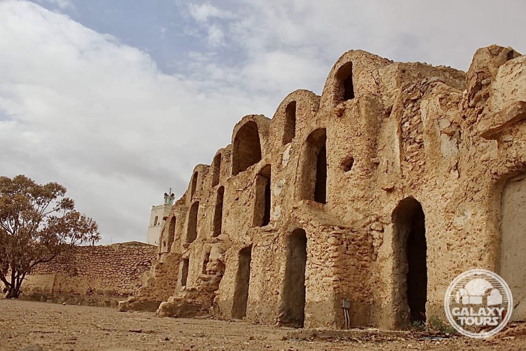
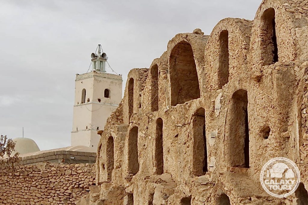
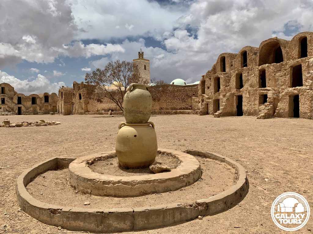
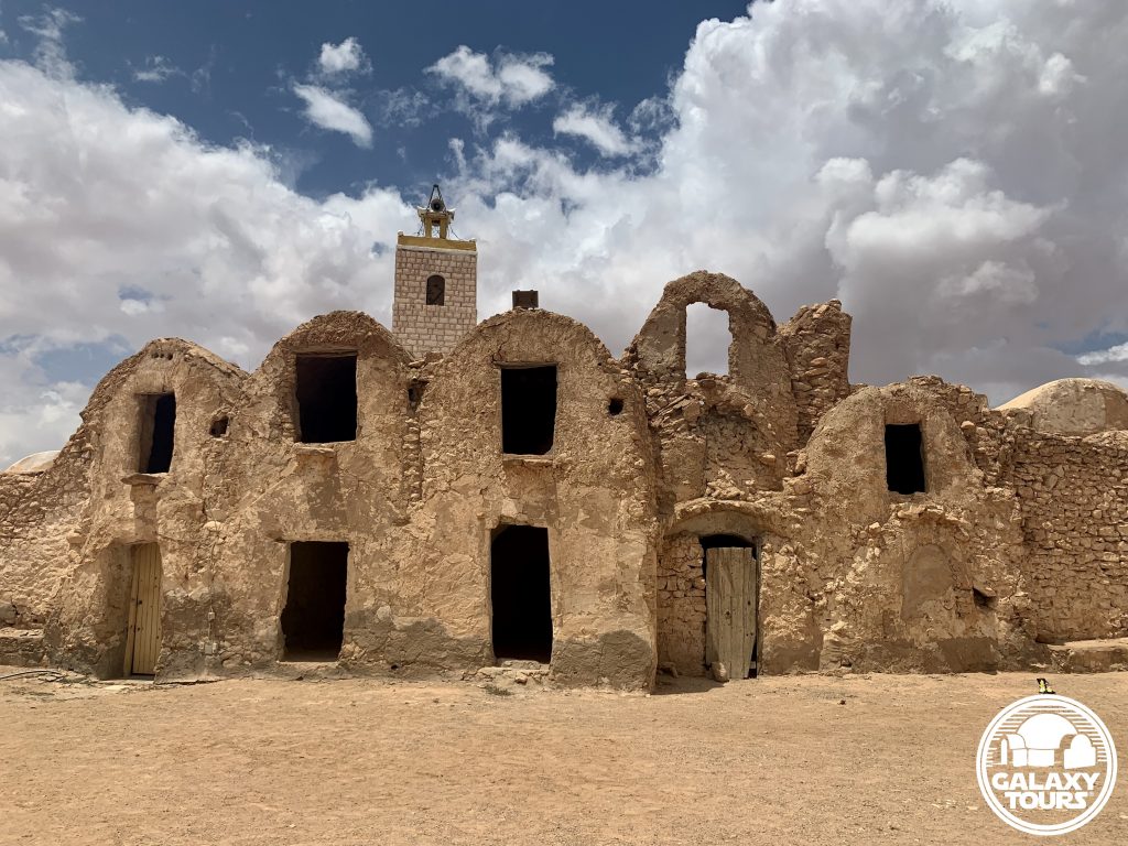
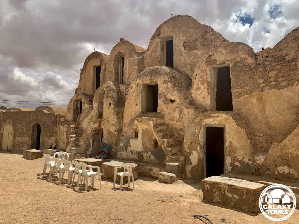
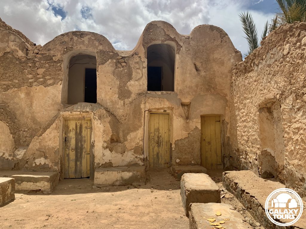
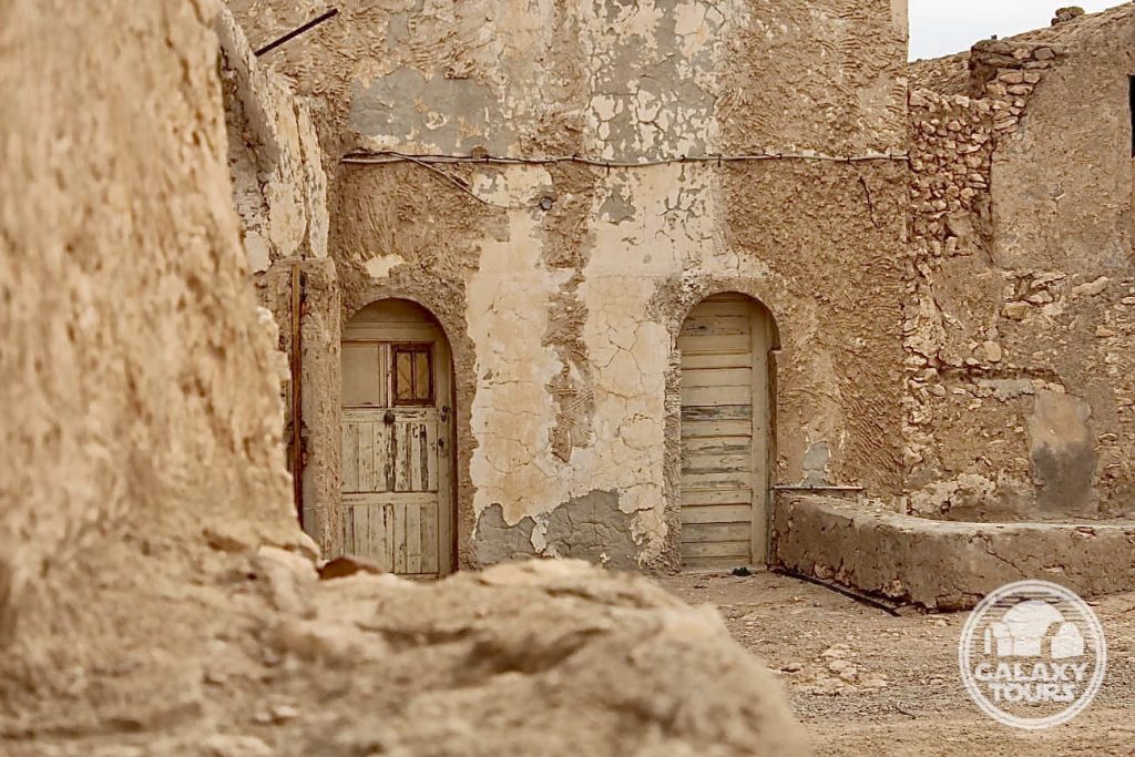
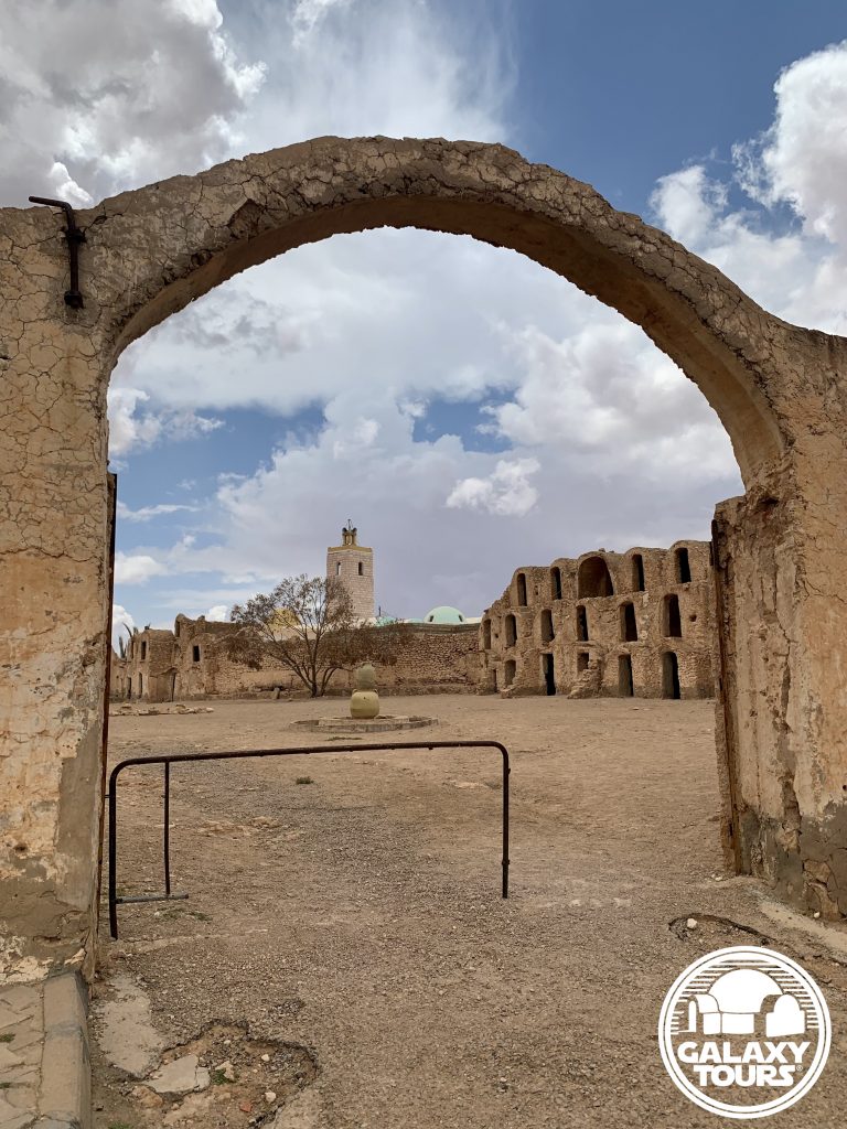
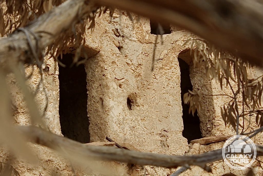
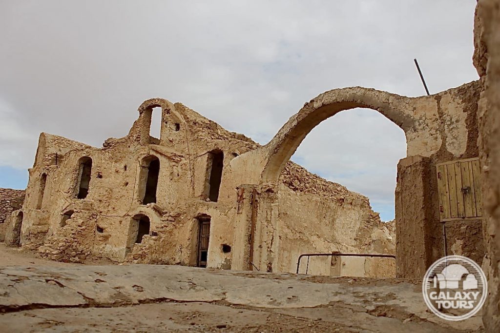
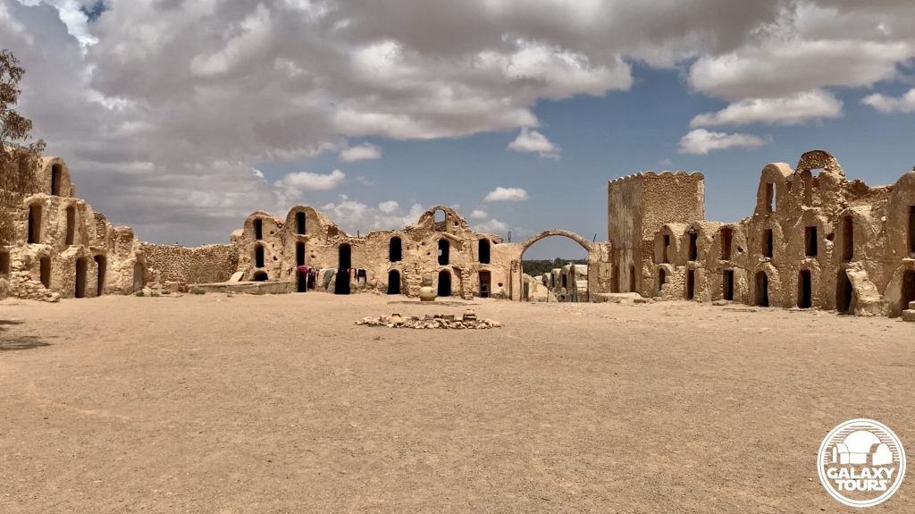
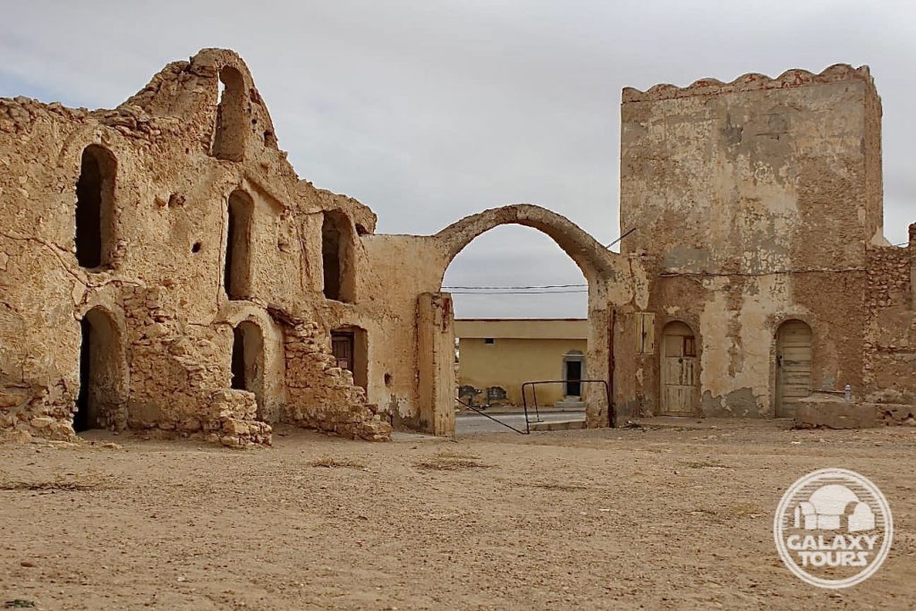
Ksar Ouled Abdallah
OVERVIEW
Site: Ksar Ouled Abdallah
GPS: 33.368891, 10.436985
Location: Metameur, Médenine Governorate, southeast Tunisia
Description: Amazigh fortified granary (18th century CE)
Star Wars recce:
Episode I – Tunisia (December 1995)
Source: Original recce photograph (Reynolds)
Star Wars scouted set concept:
Mos Espa | slave quarters
Star Wars connection discovery:
Galaxy Tours (9 December 2020)
Courtyard: The ksar boasts one of the largest courtyards among all surviving Tunisian ksour. This defining characteristic, although impressive, likely drove the decision not to film at Ksar Ouled Abdallah in preference to the more compact, visually appealing, production-friendly layout offered at nearby Ksar Ommarsia (Médenine city), the site eventually chosen for Mos Espa slave quarters street scenes.

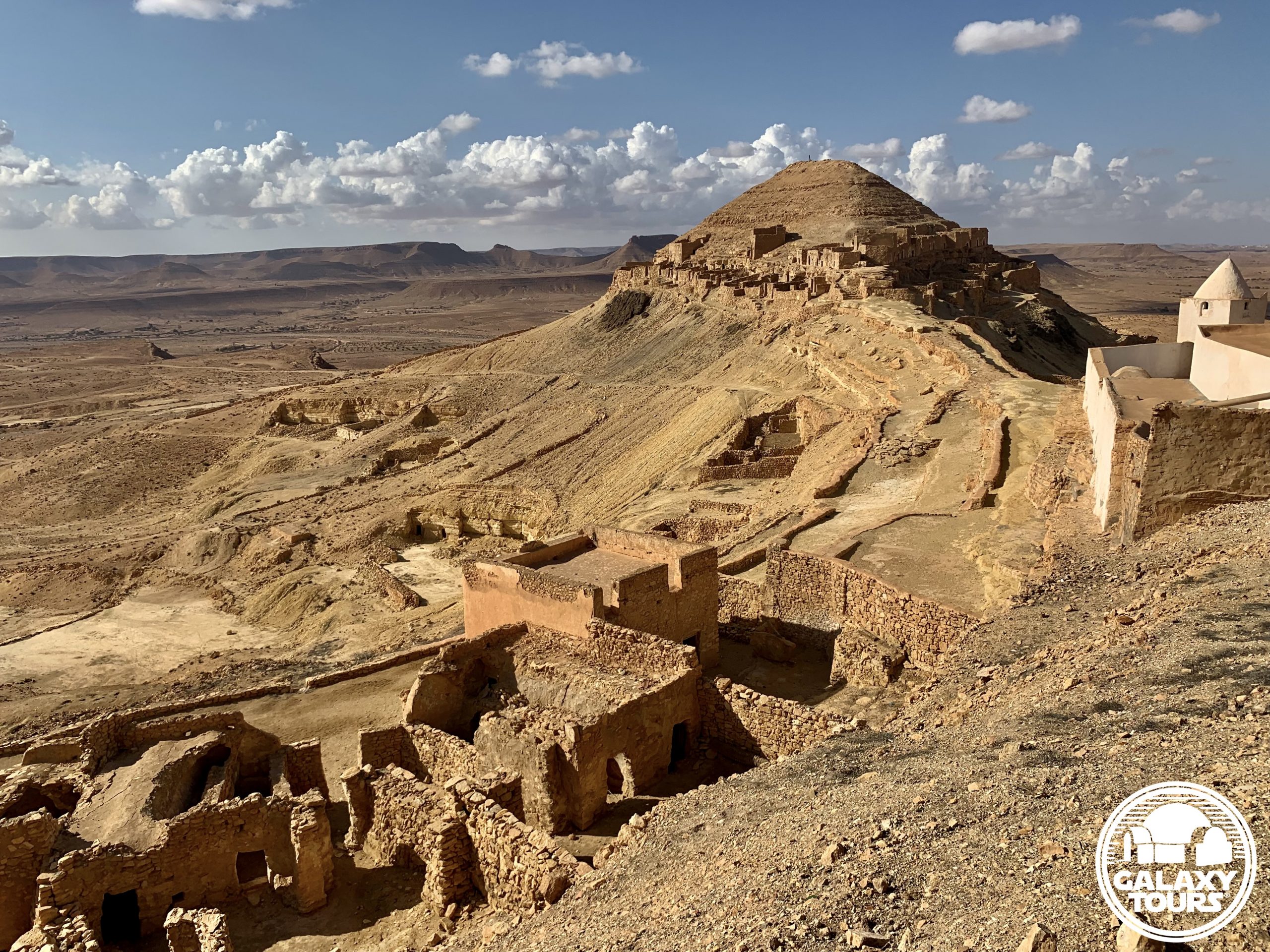
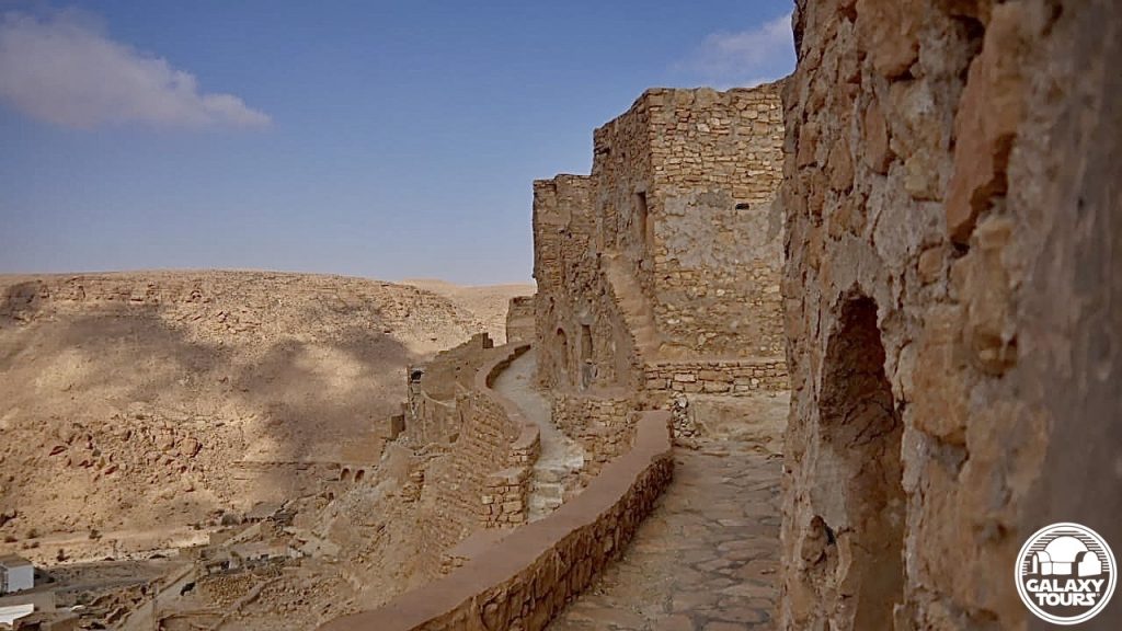
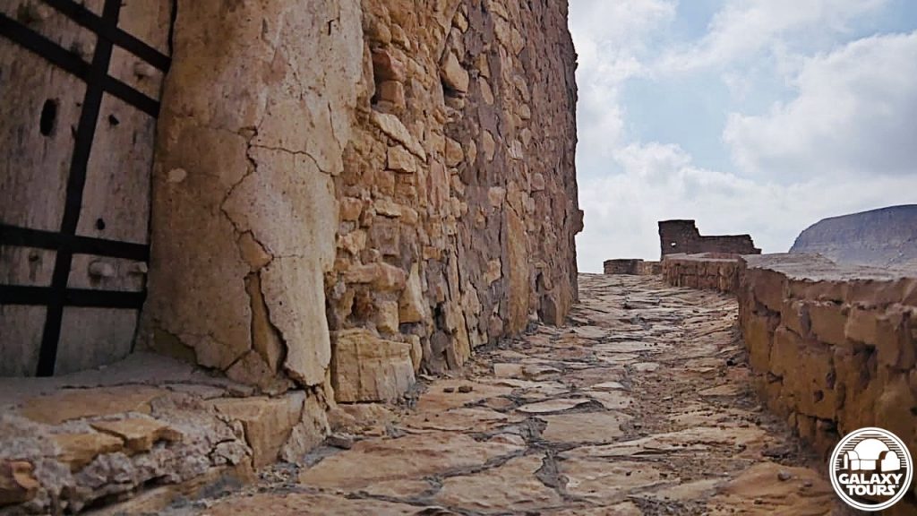
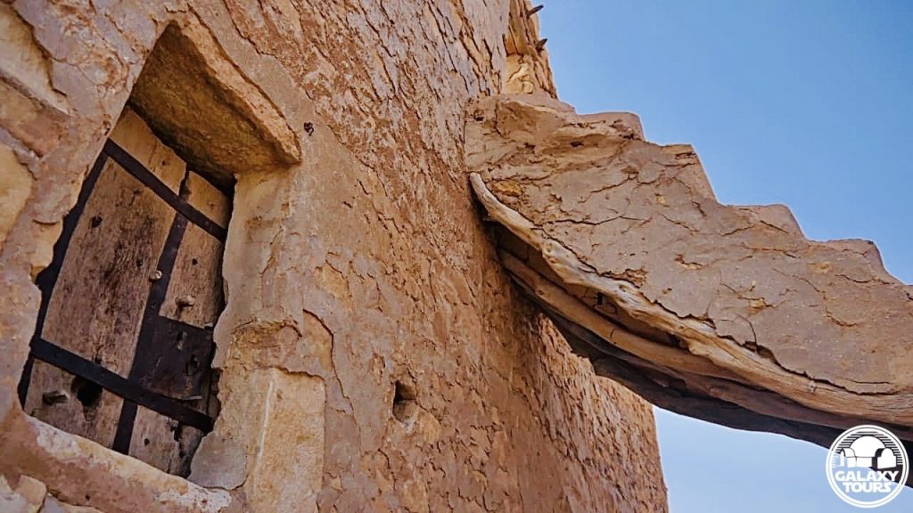
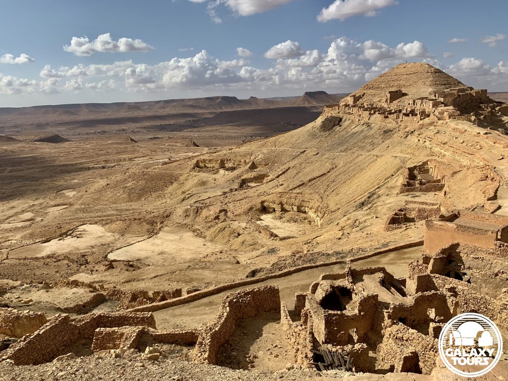
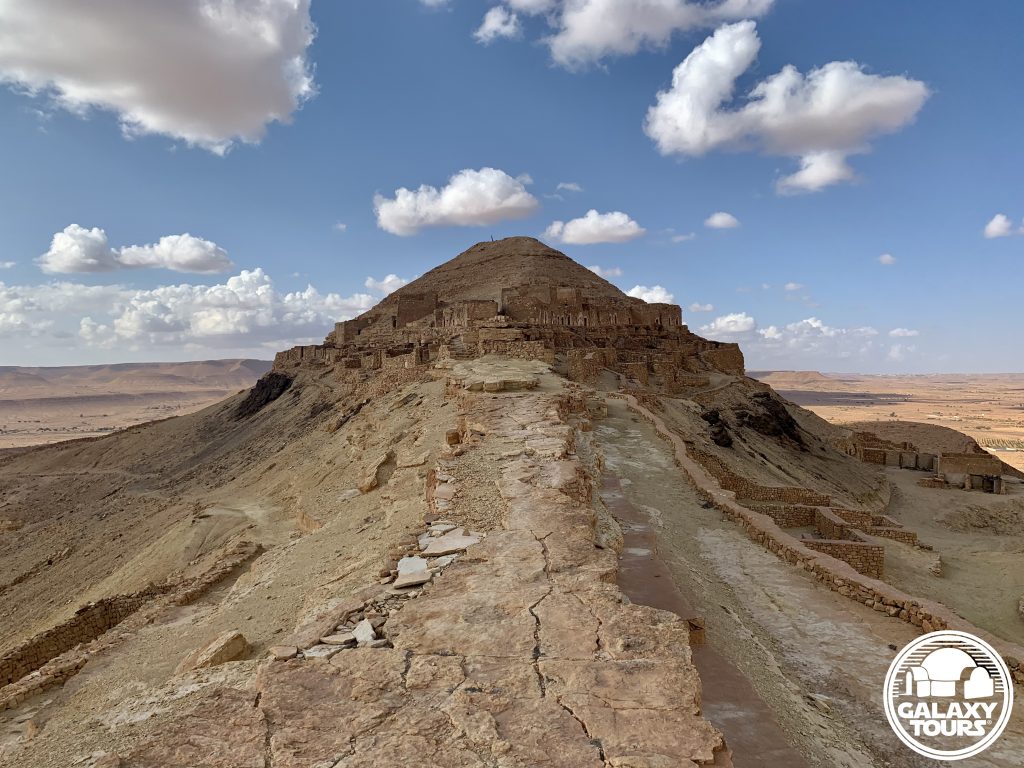
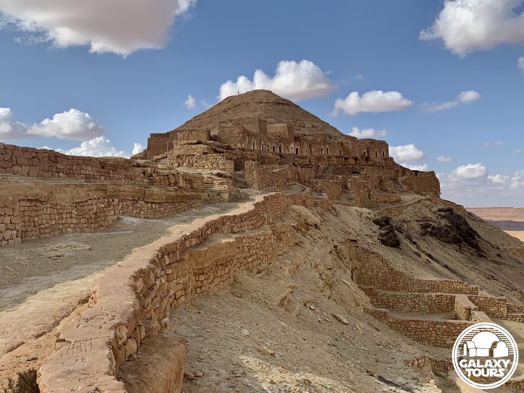
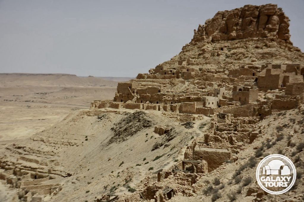
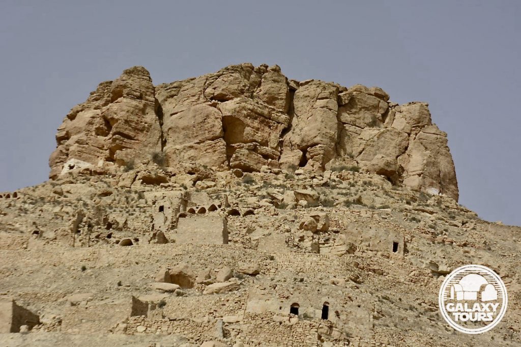
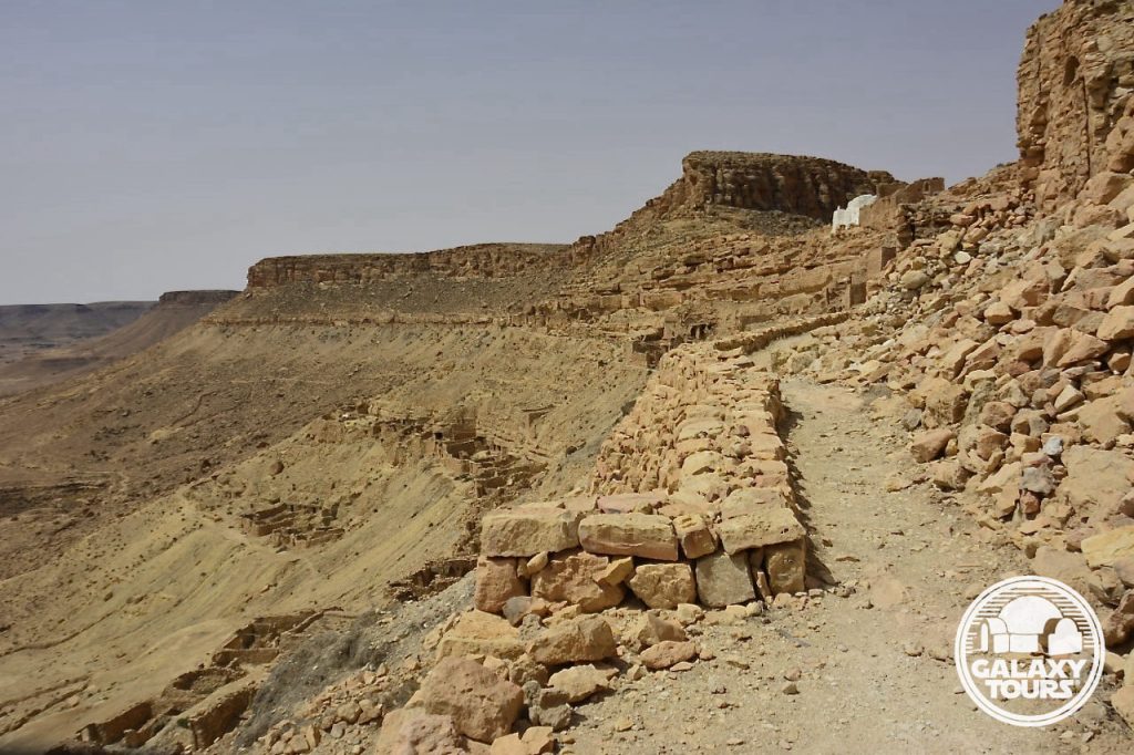
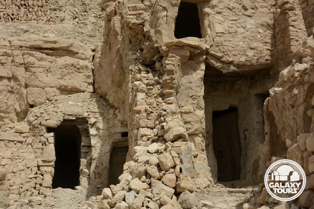
Kala’a Guermessa
OVERVIEW
Site: Kala’a Guermessa
GPS: 32.986201, 10.251390
Location: Guermessa, Tataouine Governorate, southeast Tunisia
Description: Amazigh mountain citadel (7th century CE)
Star Wars recce:
Episode I – Tunisia (December 1995)
Source: Original recce photograph (Reynolds)
Star Wars scouted set concept:
Mos Espa spaceport | various elements
Star Wars connection discovery:
Galaxy Tours (10 February 2021)
Isolation: Although arguably more impressive than Kala’a Chenini, Kala’a Guermessa receives comparatively very few visitors, creating a palpable sense of remote isolation framed by its two peaks of assorted ruins engulfing the stand-alone Sidi Hamza Marabout.
Challenges: The remote location of the site paired with the relatively steep ascent to access the ruins on both peaks likely resulted in only minimal consideration to transform Kala’a Guermessa into fictional Mos Espa.
Canon reference: The name Guermessa is associated (since 2015) with one of the three moons of fictional Tatooine. Nearby Chenini and Ghomrassen represent the names of the other two moons. All three locales “orbit” around Tataouine city.


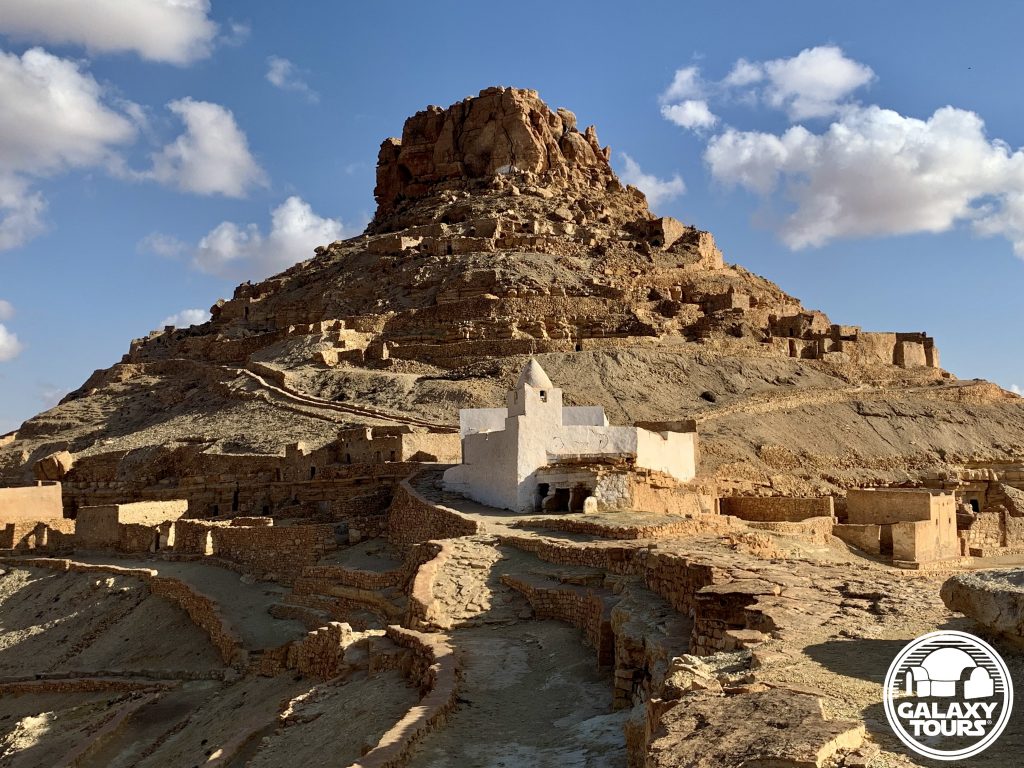
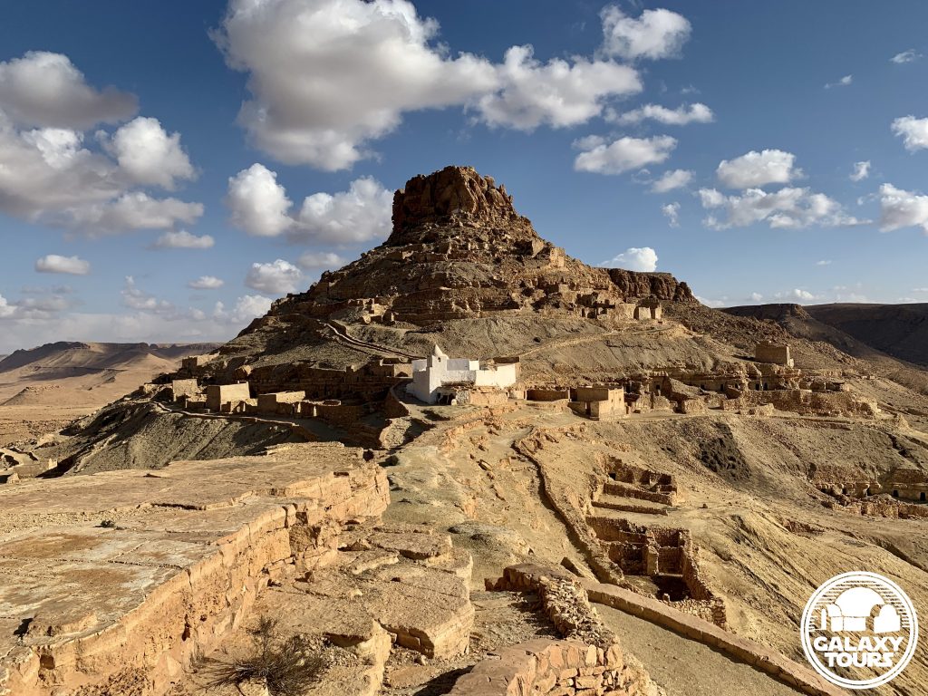

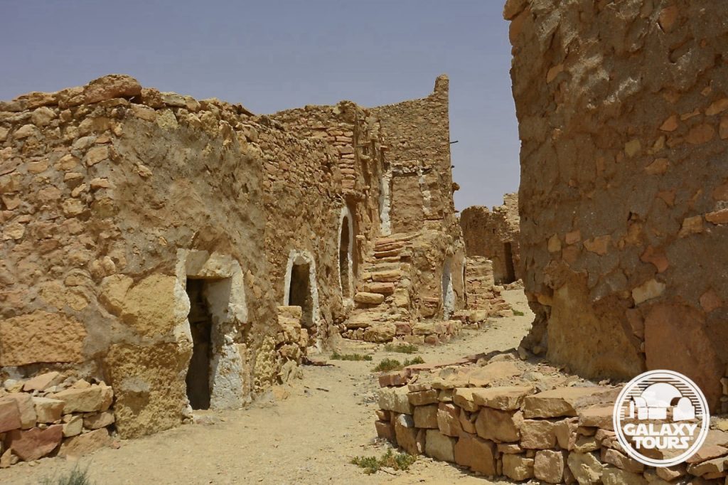
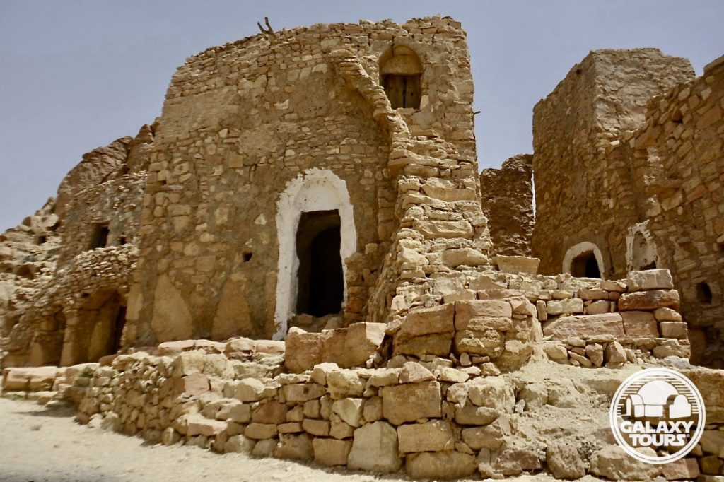
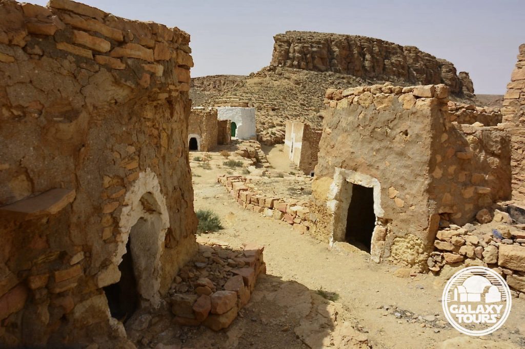
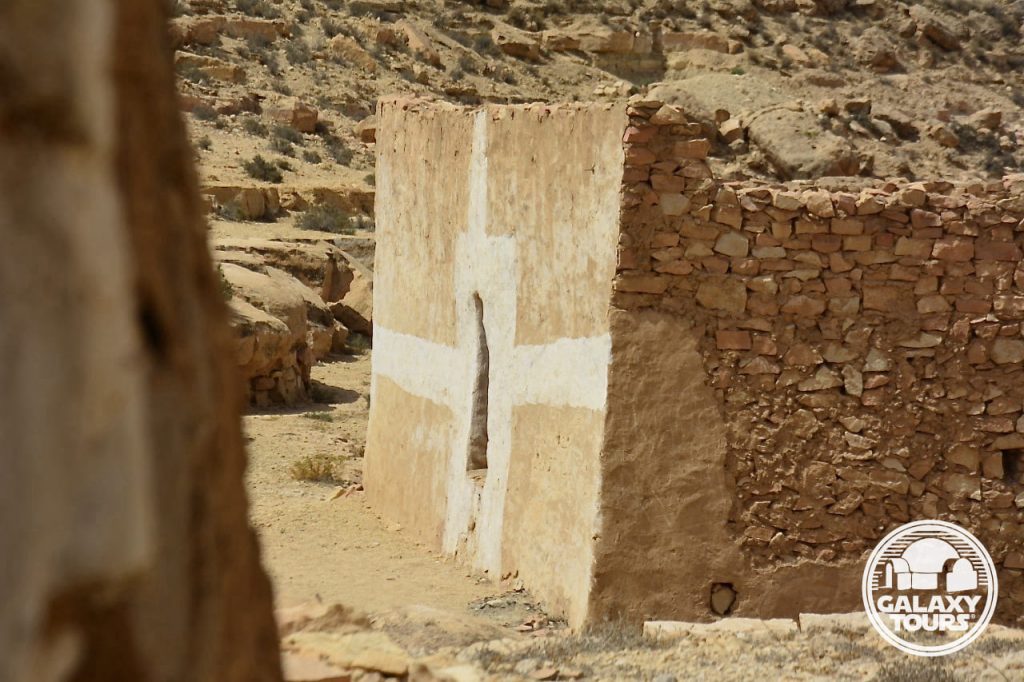
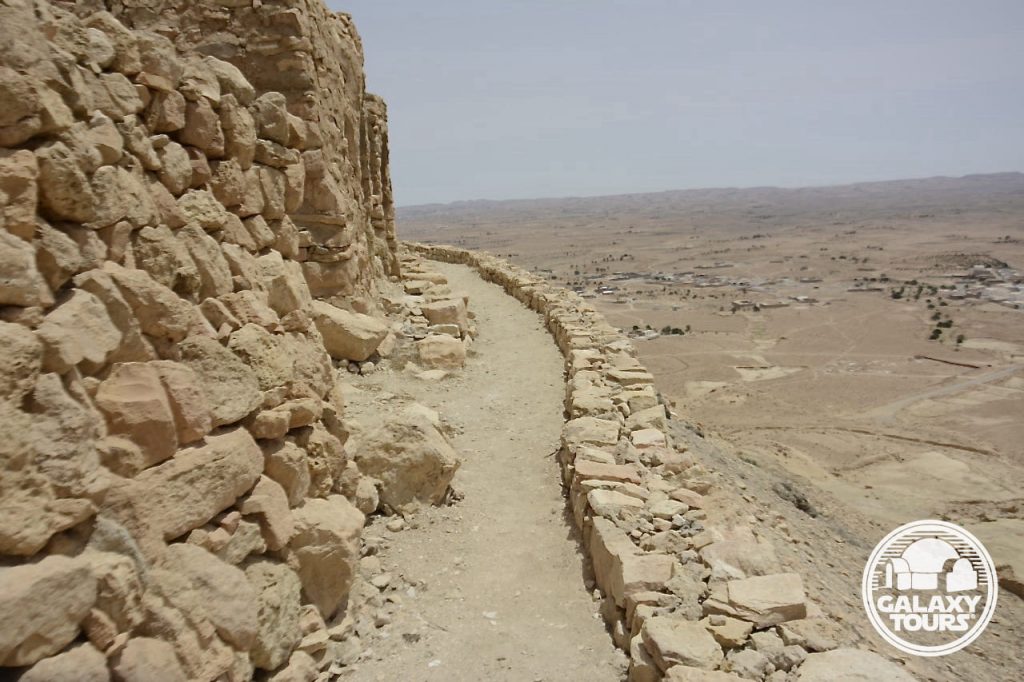
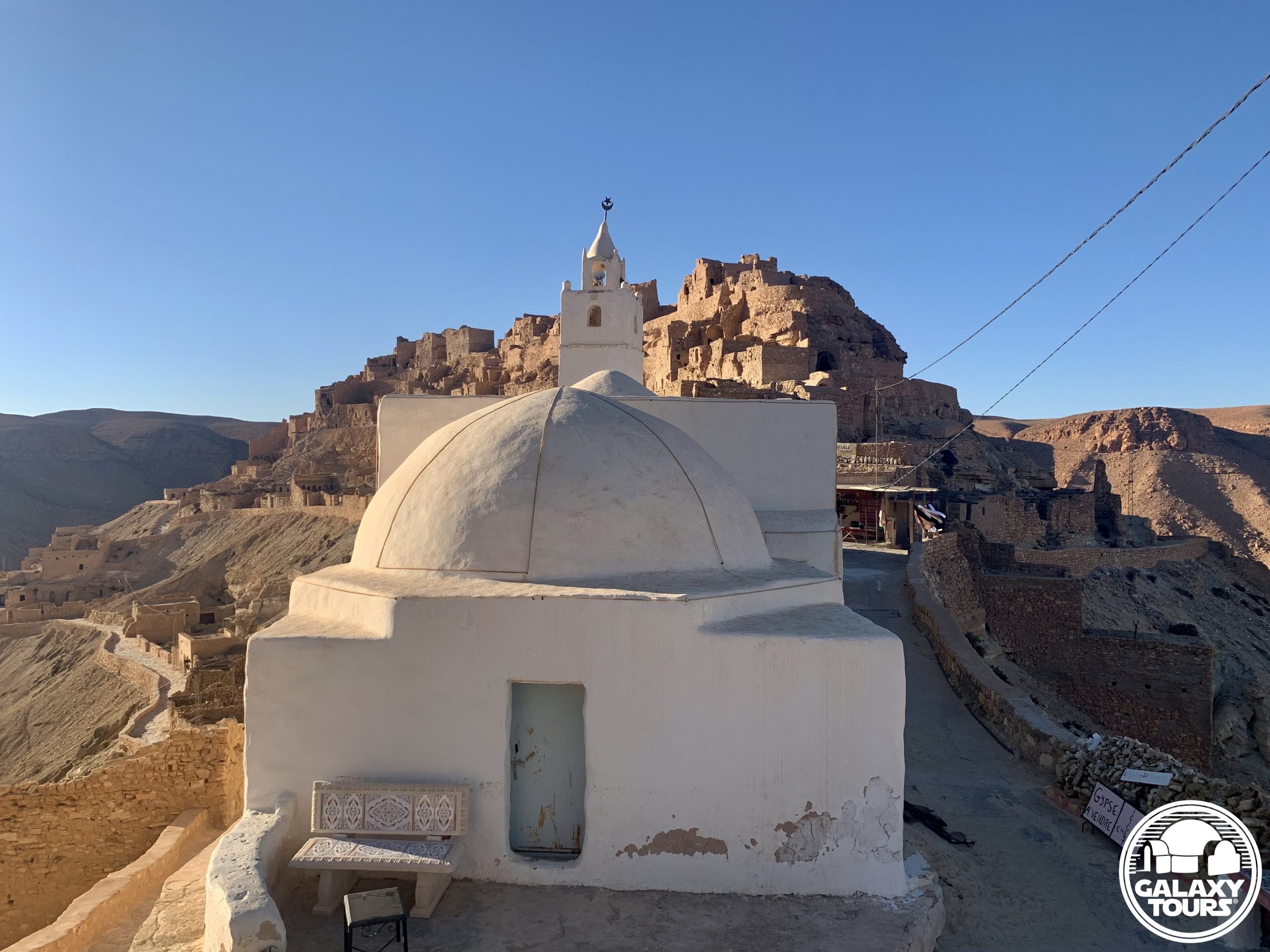
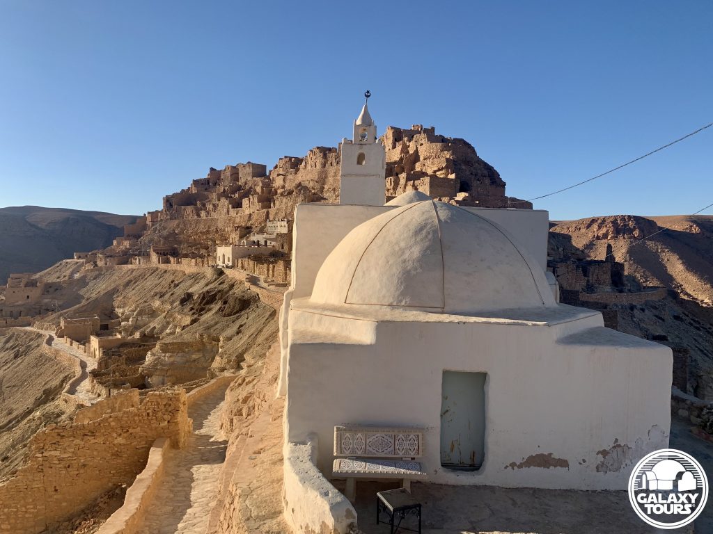
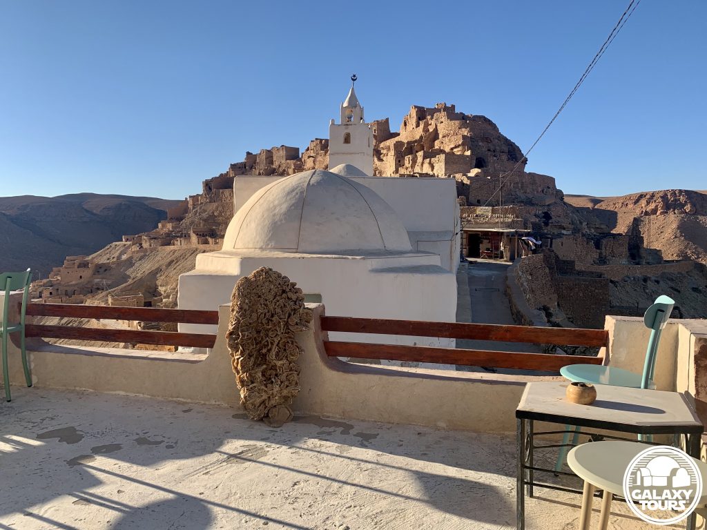
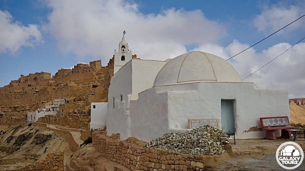
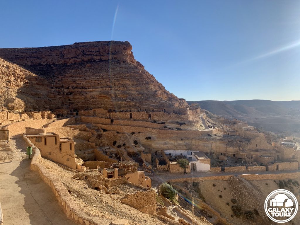
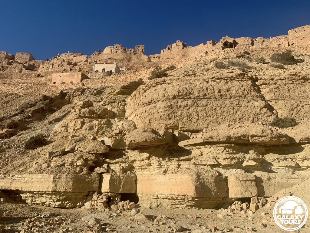
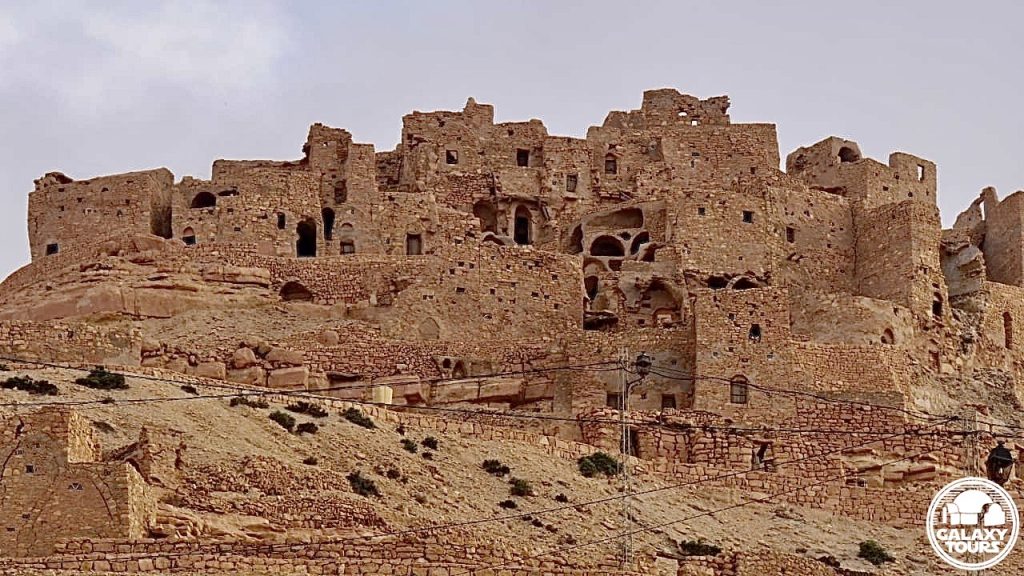
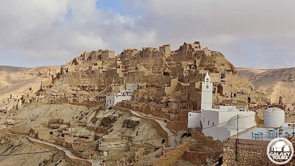
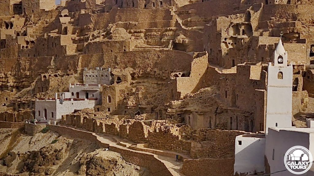
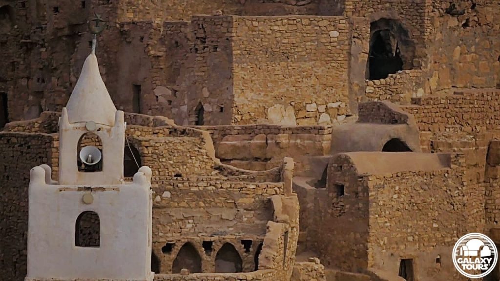
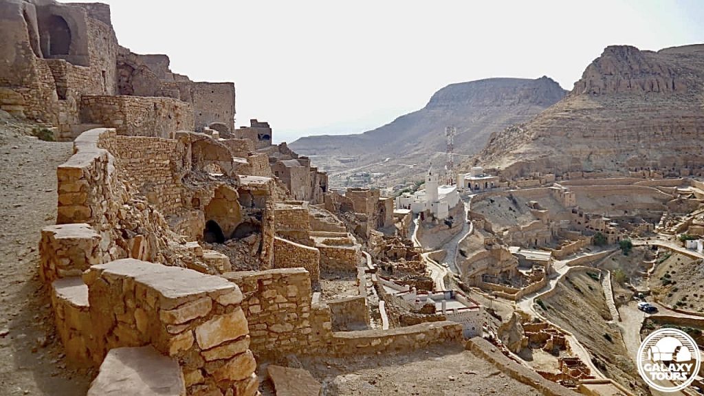
Kala’a Chenini
OVERVIEW
Site: Kala’a Chenini
GPS: 32.912024, 10.263603
Location: Chenini, Tataouine Governorate, southeast Tunisia
Description: Amazigh mountain citadel (late 12th century CE)
Star Wars recce:
Episode I – Tunisia (December 1995)
Source: Original recce sketch (Reynolds)
Star Wars scouted set concept:
Mos Espa spaceport | various elements
Star Wars connection confirmation:
Galaxy Tours (5 August 2022)
Tourist attraction: Kala’a Chenini, marked by the whitewashed Al-Farajeen Mosque as the distantly visible landmark for the bustling ancient mountain village, remains one of the most visited sites on the tourism circuit in southern Tunisia.
Challenges: The popularity of the site coupled with its remote location and the relatively steep ascent to access the ruins likely resulted in only minimal consideration to transform Kala’a Chenini into fictional Mos Espa.
Canon reference: The name Chenini is associated (since 2015) with one of the three moons of fictional Tatooine. Nearby Guermessa and Ghomrassen represent the names of the other two moons. All three locales “orbit” around Tataouine city.